WO2004034087A2 - Method and system for distributed tomographic velocity analysis using dense p-maps - Google Patents

Method and system for distributed tomographic velocity analysis using dense p-maps Download PDF

Info

Publication number
WO2004034087A2
WO2004034087A2 PCT/US2003/031478 US0331478W WO2004034087A2 WO 2004034087 A2 WO2004034087 A2 WO 2004034087A2 US 0331478 W US0331478 W US 0331478W WO 2004034087 A2 WO2004034087 A2 WO 2004034087A2
Authority
WO
WIPO (PCT)
Prior art keywords
slowness
velocity field
residual depth
velocity
seismic data
Prior art date
Application number
PCT/US2003/031478
Other languages
French (fr)
Other versions
WO2004034087A3 (en
Inventor
J. Bee Bednar
Houzhu Zhang
Chengpin Peng
Original Assignee
Core Laboratories Lp
Priority date (The priority date is an assumption and is not a legal conclusion. Google has not performed a legal analysis and makes no representation as to the accuracy of the date listed.)
Filing date
Publication date
Application filed by Core Laboratories Lp filed Critical Core Laboratories Lp
Priority to AU2003300646A priority Critical patent/AU2003300646A1/en
Publication of WO2004034087A2 publication Critical patent/WO2004034087A2/en
Publication of WO2004034087A3 publication Critical patent/WO2004034087A3/en

Links

Classifications

    • GPHYSICS
    • G01MEASURING; TESTING
    • G01VGEOPHYSICS; GRAVITATIONAL MEASUREMENTS; DETECTING MASSES OR OBJECTS; TAGS
    • G01V1/00Seismology; Seismic or acoustic prospecting or detecting
    • G01V1/28Processing seismic data, e.g. analysis, for interpretation, for correction
    • G01V1/30Analysis
    • G01V1/303Analysis for determining velocity profiles or travel times
    • GPHYSICS
    • G01MEASURING; TESTING
    • G01VGEOPHYSICS; GRAVITATIONAL MEASUREMENTS; DETECTING MASSES OR OBJECTS; TAGS
    • G01V1/00Seismology; Seismic or acoustic prospecting or detecting
    • G01V1/28Processing seismic data, e.g. analysis, for interpretation, for correction
    • GPHYSICS
    • G01MEASURING; TESTING
    • G01VGEOPHYSICS; GRAVITATIONAL MEASUREMENTS; DETECTING MASSES OR OBJECTS; TAGS
    • G01V2210/00Details of seismic processing or analysis
    • G01V2210/60Analysis
    • G01V2210/66Subsurface modeling

Definitions

  • TITLE METHOD AND SYSTEM FOR DISTRIBUTED
  • This invention relates to the field of seismic data processing and, more particularly, to creating velocity models for use in seismic data migration for determining subsurface earth structure represented by a 3-D volume of data for identifying structural and stratigraphic features in three dimensions.
  • Searching for subsurface mineral and hydrocarbon deposits comprises data acquisition, analysis, and mte ⁇ retation procedures.
  • Data acquisition involves energy sources generating signals propagating into the earth and reflecting from subsurface geologic structures.
  • the signals received are recorded by receivers on or near the surface of the earth.
  • the received signals are stored as time series (seismic traces) that consist of amplitudes of acoustic energy which vary as a function of time, receiver position, and source position and, most importantly, vary as a function of the physical properties of the structures from which the signals reflect.
  • the data are generally processed to create volumes of acoustic images from which data analysts
  • Data processing involves procedures that vary depending on the nature of the data acquired and the geological structure being investigated.
  • a typical seismic data processing effort produces images of geologic structure.
  • the final product of data processing sequence depends on the accuracy of these analysis procedures.
  • Processed seismic data are inte ⁇ reted to make maps of subsurface geologic structure to aid decisions for subsurface mineral exploration.
  • the inte ⁇ reter's task is to assess the likelihood that subsurface hydrocarbon deposits are present. The assessment will lead to an understanding of the regional subsurface geology, important main structural features, faults, synclines and anticlines.
  • Maps and models of the subsurface, both in 2D and 3D representations are developed from the seismic data inte ⁇ retations.
  • the quality and accuracy of the seismic data processing has a significant impact on the accuracy and usefulness of the inte ⁇ reted data.
  • Massively parallel processors can have multiple central processing units (CPUs) which can perform simultaneous computations. By efficient use of these CPUs, projects that took weeks or months of resource time previously can be reduced to a few days or a few hours. These advantages can be enhanced further when efficient algorithms are included in the MPP software.
  • Computational algorithms have previously been written for prior seismic analysis routines using single or just a few processors, usually using sequential computing. Sequential computing performs single procedures at any given time. Options for obtaining enhanced performance are limited when few processors are available.
  • MPP computing machines offer an obvious computation advantages.
  • the total time required to process a dataset can be reduced by dividing the work to be done among the various CPUs or CPU clusters in manner such that each CPU performs useful work while other CPUs also work in parallel.
  • Tomography is a method for finding the velocity and reflectivity distribution from a multitude of observations using combinations of source and receiver locations, or of determining the resistivity distribution from conductivity measurements using a transmitter in one well and a receiver in another well.
  • Tomography is derived from the Greek for "section drawing.” Generally space is divided into cells and the data are expressed as line integrals along raypaths through the cells.
  • Transmission tomography involves borehole-to-borehole, surface-to- borehole, or surfaceto-surface observations.
  • Reflection tomography involves surface- to-surface observations as in conventional reflection or refraction work.
  • Tomography is used to compute corrections to velocities from observed traveltime errors in seismic datasets.
  • the position of events observed on post- migration common image point gathers indicates errors that can be caused by several reasons: error in velocity, error in the depth location of reflector, or error in placing a fault.
  • the velocity will be over corrected by assuming all the observed traveltime errors originated by velocities. Over corrected velocities will force more structural errors in deeper reflectors, and errors repeat and can increase as depth increases so that a correct velocity model cannot be obtained from further iteration. If the errors caused by misplaced horizons and fault locations can be corrected, the result is a better depth image and a better correction to the velocity model.
  • the present invention provides a method and system for distributed residual tomographic velocity analysis using dense residual depth difference maps. Prestack seismic imaging is performed using an initial velocity field and inte ⁇ reted horizons. A residual depth difference is estimated referenced to fixed offset and all horizons.
  • Residual depth difference maps are computed for each offset and each horizon.
  • the residual depth difference maps are back projected to determine slowness perturbation.
  • the initial velocity model may be converted to slowness and the estimated slowness is composited therewith to produce a new slowness volume.
  • the new slowness volume is converted to a new velocity volume for performing prestack seismic imaging. This process is repeated until the slowness perturbation is negligible or reaches a predetermined threshold.
  • Figure 1 Illustrates a flow chart of incremental velocity updating.
  • Figure 2 Illustrates model partitioning and model sharing.
  • Figure 3 Illustrates the general structure of distributed tomography.
  • Figure 4A illustrates a flow chart of an embodiment of the invention.
  • Figure 4B illustrates a flow chart of another embodiment of the invention.
  • Figure 5 illustrates a computer system for carrying out an embodiment of the invention.
  • a good macro velocity model is the key to producing good depth migration results.
  • CIG Common Image Gather
  • CAIG Common Angle Image Gathers
  • 3D velocity model updating typically requires several gigabytes of memory. This is usually beyond the memory limit of a single modern computer. On PC clusters, large problems can be partitioned into small ones. Each partition can be processed independently. The final velocity is the combination of all the local models.
  • a macro velocity model is needed for depth migration.
  • the kinematic information provided by this smooth velocity is the traveltime in seismic data and depth information in depth images.
  • Depth migration and velocity estimation are coupled problems. Given a good velocity model, modern depth imaging algorithms can give satisfying results.
  • Velocity estimation or inversion has been one of the most challenging geophysical problems. There are many ways to estimate a smooth background velocity. Prestack migration is one of them.
  • Residual Tomography CIG gather-based residual tomography updates the velocity model incrementally.
  • the process is illustrated in the flow chart of Figure 1.
  • An initial velocity 101 is used to migrate 103 seismic data to get a common image gather 105.
  • a determination is made whether the CIG is flattened 107. If the CIG is not sufficiently flattened tomography 109 is performed to derive a new velocity 111 for input to the migration 103. The cycle is repeated until the CIG is sufficiently flattened 107 and the process finishes 113.
  • A is the linear operator that transforms the model m to the data space.
  • Parameter b,- is the known data.
  • Model Space Partition and Model Sharing A key problem with distributed tomography is how to partition the model.
  • the partitioning method depends on the characteristics of the model and the input depth residuals. Once partitioned, on each node, the space used by the model is relatively small compared with the space used by the ray segments. Thus, the ideal partition can be based on the density of the surface depth residual estimates. The higher the density, the smaller the model partition. This usually results in load balanced computation.
  • other simpler methods can be used. For example, if the model is much longer in inline direction than in crossline direction, we can partition the model in inline direction.
  • the partition used here is an intelligent one. The user specifies the number of partitions or the number of nodes, this number is factorized into two factors which are as close as possible. For example, 12 is factorized into 3 and 4 instead of 2 and 6. Then the larger number of these two factors is assigned to the longer direction.
  • Velocity Smoothing Smooth velocity models are critical for obtaining good depth images, especially for prestack depth migration. For distributed tomography, each node works on its own independent piece of the model. The overlapped pieces between adjacent nodes may produce different velocity estimates due to different input data on each node. To ensure the global smoothness of the velocity model, adjacent partitions need to exchange information from the overlapped areas.
  • Global smoothing across computer nodes is illustrated in Figure 3. Data is exchanged between nodes 303 for smoothing every several iterations. As illustrated in Figure 3 control parameters are read from the deck file 301, and this information is shared across the nodes. Other parameters are read and computed 305. At 307 residual slowness is solved for and then smoothing is applied. The process at 307 iterates between solving for residual slowness and applying smoothing. Slowness values are output 309 after parameters have converged sufficiently.
  • Global smoothmg is necessary during velocity updating because we want the model difference between any two nodes to be small. Global smoothing enforces model consistency between nodes and global convergence of the solution.
  • FIG. 4A illustrates a flowchart of a preferred embodiment of the method and system provided by the present invention.
  • Prestack seismic imaging is performed 401 using an initial velocity field and inte ⁇ reted horizons.
  • a residual depth difference is estimated 403 referenced to fixed offset and all horizons.
  • Residual depth difference maps (p-maps) are computed 405 for each offset and each horizon.
  • the residual depth difference maps are back projected 407 to determine slowness perturbation.
  • the initial velocity model may be converted 409 to slowness and the estimated slowness is composited therewith to produce a new slowness volume.
  • the new slowness volume is converted 411 to a new input velocity volume for performing prestack seismic imaging. This process is repeated 413 until the slowness perturbation is negligible or reaches a predetermined threshold.
  • Figure 4B illustrates an alternate embodiment of the invention where the threshold for slowness perturbation is determined prior to converting slowness to a new input velocity volume.
  • FIG. 5 illustrates a computer system comprising a central processing unit 1011, a display 1001, an input device 1021, and a plotter 1031.
  • the computer program for carrying out the invention will normally reside on a storage media (not shown) associated with the central processing unit.
  • the computer program may be transported on a CD-ROM or other storage media shown symbolically as storage medium 1041.
  • the method and system of the present invention provides results that may be displayed or plotted with commercially available visualization software and computer peripherals. Such software and computer peripherals are well known to those of ordinary skill in the art. It should be appreciated that the results of the methods of the invention can be displayed, plotted and/or stored in various formats.

Abstract

The present invention provides a method and system for distributed residual tomographic velocity analysis using dense residual depth difference maps. Prestack seismic imaging is performed using an initial velocity field and interpreted horizons. A residual depth difference is estimated referenced to fixed offset and all horizons. Residual depth difference maps are computed for each offset and each horizon. The residual depth difference maps are back projected to determine slowness perturbation. The initial velocity model may be converted to slowness and the estimated slowness is composited therewith to produce a new slowness volume. The new slowness volume is converted to a new velocity volume for performing prestack seismic imaging. This process is repeated until the slowness perturbation is negligible or reaches a predetermined threshold.

Description

TITLE: METHOD AND SYSTEM FOR DISTRIBUTED
TOMOGRAPHIC VELOCITY ANALYSIS USING DENSE P-MAPS
FIELD OF THE INVENTION
[001] This invention relates to the field of seismic data processing and, more particularly, to creating velocity models for use in seismic data migration for determining subsurface earth structure represented by a 3-D volume of data for identifying structural and stratigraphic features in three dimensions.
BACKGROUND OF THE INVENTION
[002] Searching for subsurface mineral and hydrocarbon deposits comprises data acquisition, analysis, and mteφretation procedures. Data acquisition involves energy sources generating signals propagating into the earth and reflecting from subsurface geologic structures. The signals received are recorded by receivers on or near the surface of the earth. The received signals are stored as time series (seismic traces) that consist of amplitudes of acoustic energy which vary as a function of time, receiver position, and source position and, most importantly, vary as a function of the physical properties of the structures from which the signals reflect. The data are generally processed to create volumes of acoustic images from which data analysts
(inteφreters) create maps and images of the subsurface of the earth.
[003] Data processing involves procedures that vary depending on the nature of the data acquired and the geological structure being investigated. A typical seismic data processing effort produces images of geologic structure. The final product of data processing sequence depends on the accuracy of these analysis procedures.
[004] Processed seismic data are inteφreted to make maps of subsurface geologic structure to aid decisions for subsurface mineral exploration. The inteφreter's task is to assess the likelihood that subsurface hydrocarbon deposits are present. The assessment will lead to an understanding of the regional subsurface geology, important main structural features, faults, synclines and anticlines. Maps and models of the subsurface, both in 2D and 3D representations are developed from the seismic data inteφretations. As is well known in the art, the quality and accuracy of the seismic data processing has a significant impact on the accuracy and usefulness of the inteφreted data.
[005] High quality data processing greatly simplifies data inteφretation, since resources can be focused on the geologic structure since subsurface imaging can be made less ambiguous. Unfortunately, three dimensional geophysical data processing and/or modeling frequently require large computation expenses, and practitioners are forced to simplify the data processing effort as much as possible to reduce analysis time and cost.
[006] The sheer volume of data impacts data processing considerations. Seismic survey data sets can involve hundreds of thousands of source locations, with each source location associated with many hundreds more receiver locations. Each input/output data transfer demand burdens resources independent of the computation burden. [007] There have been several different approaches to manage these computational resource burdens. These approaches relate to the manner in which the data acquisition exercise is designed and carried out, as well as to assumptions made during data processing. The use of available a priori geologic and geophysical information can facilitate the minimization of the seismic data acquisition effort. Such a minimization of resources reduces the amount of data that is acquired by reducing the acquisition effort.
[008] Minimization of the computational effort is often implemented during data processing. Compromises made during data acquisition and/or processing may lead to ambiguous and/or inaccurate images. Because little is generally known of the geologic structure being investigated, the inteφreter will not know the extent to images are erroneous.
[009] It is not uncommon for significant computer resources to be involved when large or complex data volumes are processed, often involving weeks or months of actual computer processing time. The recent availability of massively parallel processor computers offers a significant opportunity to reduce overall processing times. Massively parallel processors (MPPs) can have multiple central processing units (CPUs) which can perform simultaneous computations. By efficient use of these CPUs, projects that took weeks or months of resource time previously can be reduced to a few days or a few hours. These advantages can be enhanced further when efficient algorithms are included in the MPP software. [0010] Computational algorithms have previously been written for prior seismic analysis routines using single or just a few processors, usually using sequential computing. Sequential computing performs single procedures at any given time. Options for obtaining enhanced performance are limited when few processors are available.
[0011] MPP computing machines offer an obvious computation advantages. The total time required to process a dataset can be reduced by dividing the work to be done among the various CPUs or CPU clusters in manner such that each CPU performs useful work while other CPUs also work in parallel.
[0012] From Robert E. Sheriffs "Encyclopedic Dictionary of Exploration Geophysics" SEG Press, 2002: Tomography is a method for finding the velocity and reflectivity distribution from a multitude of observations using combinations of source and receiver locations, or of determining the resistivity distribution from conductivity measurements using a transmitter in one well and a receiver in another well. Tomography is derived from the Greek for "section drawing." Generally space is divided into cells and the data are expressed as line integrals along raypaths through the cells. Transmission tomography involves borehole-to-borehole, surface-to- borehole, or surfaceto-surface observations. Reflection tomography involves surface- to-surface observations as in conventional reflection or refraction work. In seismic tomography, slowness or velocity, and sometimes an attenuation factor, is assigned to each cell and traveltimes and amplitudes are calculated by tracing rays through the model. The results are compared with observed times and amplitudes; the model is then perturbed and the process repeated iteratively to minimize errors. Raypaths have to be recalculated after each change of assumed velocity. Diffraction tomography involves calculations assuming least-time travelpaths according to Fermat's principle rather than Snell's law bending at cell boundaries. Layer-based tomography divides the earth into layers, allowing for lateral variation of velocity within the layers, instead of subdivision into cells. Tomographic methods include the algebraic reconstruction technique, the simultaneous reconstruction technique, and Gauss Seidel methods.
[0013] Tomography is used to compute corrections to velocities from observed traveltime errors in seismic datasets. The position of events observed on post- migration common image point gathers indicates errors that can be caused by several reasons: error in velocity, error in the depth location of reflector, or error in placing a fault. In some cases the velocity will be over corrected by assuming all the observed traveltime errors originated by velocities. Over corrected velocities will force more structural errors in deeper reflectors, and errors repeat and can increase as depth increases so that a correct velocity model cannot be obtained from further iteration. If the errors caused by misplaced horizons and fault locations can be corrected, the result is a better depth image and a better correction to the velocity model.
[0014] For large datasets parallel computation methods offer significant processing time savings, and this is true for velocity analyses as well. An option for overcoming increased computational expenses is to employ efficient parallel algorithms and techniques. [0015] It would therefore be desirable to have a system and method that is able to perform tomographic velocity analyses efficiently on a parallel computer in a cost- effective manner. The present invention satisfies this need.
SUMMARY OF THE INVENTION
[0016] The present invention provides a method and system for distributed residual tomographic velocity analysis using dense residual depth difference maps. Prestack seismic imaging is performed using an initial velocity field and inteφreted horizons. A residual depth difference is estimated referenced to fixed offset and all horizons.
Residual depth difference maps (p-maps) are computed for each offset and each horizon. The residual depth difference maps are back projected to determine slowness perturbation. The initial velocity model may be converted to slowness and the estimated slowness is composited therewith to produce a new slowness volume. The new slowness volume is converted to a new velocity volume for performing prestack seismic imaging. This process is repeated until the slowness perturbation is negligible or reaches a predetermined threshold.
BRIEF DESCRIPTION OF THE DRAWINGS
[0017] The present invention and its advantages will be better understood by referring to the following detailed description and the attached drawings in which:
Figure 1: Illustrates a flow chart of incremental velocity updating. Figure 2: Illustrates model partitioning and model sharing. Figure 3: Illustrates the general structure of distributed tomography. Figure 4A: illustrates a flow chart of an embodiment of the invention. Figure 4B : illustrates a flow chart of another embodiment of the invention.
Figure 5: illustrates a computer system for carrying out an embodiment of the invention.
[0018] While the invention will be described in connection with its preferred embodiments, it will be understood that the invention is not limited thereto. On the contrary, it is intended to cover all alternatives, modifications, and equivalents which may be included within the spirit and scope of the invention, as defined by the appended claims.
DETAILED DESCRIPTION OF THE PREFERRED EMBODIMENTS
[0019] A good macro velocity model is the key to producing good depth migration results. When the velocity is correct, Common Image Gather (CIG) reflections from different offsets should be aligned at the same depth. While this disclosure explains the concepts using CIGs, the method and system of the present invention is directly applicable to Common Angle Image Gathers (CAIG) as well. When the velocity is incorrect, it can be updated using the depth error in the CIG.
[0020] 3D velocity model updating typically requires several gigabytes of memory. This is usually beyond the memory limit of a single modern computer. On PC clusters, large problems can be partitioned into small ones. Each partition can be processed independently. The final velocity is the combination of all the local models.
[0021] Distributed tomography on a PC cluster is very cost effective. It makes it possible to solve extremely large problems quickly. In addition, very large offsets can be used in the inversion process.
[0022] A macro velocity model is needed for depth migration. The kinematic information provided by this smooth velocity is the traveltime in seismic data and depth information in depth images. Depth migration and velocity estimation are coupled problems. Given a good velocity model, modern depth imaging algorithms can give satisfying results. Velocity estimation or inversion has been one of the most challenging geophysical problems. There are many ways to estimate a smooth background velocity. Prestack migration is one of them.
[0023] One approach to velocity updating is described in Bednar et al., 1999, where the depth image is sorted into CIG gathers in which at each point there is a three- parameter function: depth, offset and CDP. The principle is that reflections from one reflector at different offsets in each CDP should be mapped into one horizontal event in the depth image if there is no error in the input velocity model. For real problems, velocity models are never exact. The error in velocity usually appears as curved events in the CIGs. To determine the velocity, it is necessary to invert the depth eπor of each of these points in the CIG gathers.
[0024] Ray-tracing is use to compute the difference between the input traveltime and traveltime computed form the model. This residual is used to update the velocity model. Information of each ray segment needs to be recorded. Obviously, for typical 3D real problems, a large amount of memory must be used. It is almost impossible to solve the typical problems on a single computer node.
[0025] Herein disclosed is an implementation of 3D residual tomography on a distributed PC cluster. The full problem is divided into small pieces or partitions. Each small partition is solved on different node. The main issues in this method are model partition and consistency between overlapping pieces of the desired model.
[0026] Residual Tomography CIG gather-based residual tomography updates the velocity model incrementally. The process is illustrated in the flow chart of Figure 1. An initial velocity 101 is used to migrate 103 seismic data to get a common image gather 105. A determination is made whether the CIG is flattened 107. If the CIG is not sufficiently flattened tomography 109 is performed to derive a new velocity 111 for input to the migration 103. The cycle is repeated until the CIG is sufficiently flattened 107 and the process finishes 113.
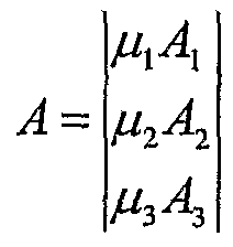
[0027] For each iteration, the following optimization problem is solved
Figure imgf000011_0001
[0028] Here, A, is the linear operator that transforms the model m to the data space. Parameter b,- is the known data. Parameter μ,- is a damping factor to ensure the smoothness and stability of the solution of the linear system below. Solving Equation 1 is equivalent to solving the following linear system
ATAm = Aτb (2) where
Figure imgf000012_0001
and
Figure imgf000012_0002
Iterative methods such as conjugate gradient (Paige and Saunders, 1982) can be used to solve this large linear system.
[0029] Distributed Tomography: Residual tomography is highly automatic. Given model and data, the process can proceed until a solution is reached. The major problem with residual tomography is that input and output models are usually so large that they can not fit into the memory of one computer node. In addition to memory resources required for the model, ray tracing, used for traveltime computation, also requires a large amount of memory. In 3D the following parameters are stored: the coordinates of the two endpoints of a ray segment and the direction vector of a ray segment. The ray tracing is done for each depth point of each offset of each CDP, for each inline and for each crossline. [0030] This is a five dimensional data space. To reduce the computation, one usually limits the number of xlines and inlines or limits the range of offsets. But too small ranges of offset or too few lines will not give reasonable or good velocity estimates. The best way is to divide the whole model into small partitions, each of which is solved in one computer or node.
[0031] The reason we can do this is that, based on the locality principle, one point in the model space only influences on the points which fall in a circle on the surface. The radius of the circle is half of the largest offset for that CDP. Thus, we only need to consider the data within that circle in the velocity inversion of that point. This is illustrated with the portioned survey 201 of Figure 2. For each simple partition 203, additional areas are padded in all the four sides in (x,y) domain as illustrated by the offset buffer zone 205 in Figure 2 that represents half the offset of a seismic gather. These padded areas 205 are to be shared by the adjacent nodes.
[0032] Model Space Partition and Model Sharing: A key problem with distributed tomography is how to partition the model. The partitioning method depends on the characteristics of the model and the input depth residuals. Once partitioned, on each node, the space used by the model is relatively small compared with the space used by the ray segments. Thus, the ideal partition can be based on the density of the surface depth residual estimates. The higher the density, the smaller the model partition. This usually results in load balanced computation. In addition to this complicated partition method, other simpler methods can be used. For example, if the model is much longer in inline direction than in crossline direction, we can partition the model in inline direction. [0033] The partition used here is an intelligent one. The user specifies the number of partitions or the number of nodes, this number is factorized into two factors which are as close as possible. For example, 12 is factorized into 3 and 4 instead of 2 and 6. Then the larger number of these two factors is assigned to the longer direction.
[0034] Simply dividing the entire model evenly and assign each piece to each node won't work well because the part of the model on one node may need data which resides on an adjacent node. In order to make sure that all the data needed for the inversion of every point in each partition are used, each piece needs to be padded before inversion. This is shown in Figure 2. Partitions after padding are illustrated 207.
[0035] Velocity Smoothing: Smooth velocity models are critical for obtaining good depth images, especially for prestack depth migration. For distributed tomography, each node works on its own independent piece of the model. The overlapped pieces between adjacent nodes may produce different velocity estimates due to different input data on each node. To ensure the global smoothness of the velocity model, adjacent partitions need to exchange information from the overlapped areas. Global smoothing across computer nodes is illustrated in Figure 3. Data is exchanged between nodes 303 for smoothing every several iterations. As illustrated in Figure 3 control parameters are read from the deck file 301, and this information is shared across the nodes. Other parameters are read and computed 305. At 307 residual slowness is solved for and then smoothing is applied. The process at 307 iterates between solving for residual slowness and applying smoothing. Slowness values are output 309 after parameters have converged sufficiently.
[0036] Global smoothmg is necessary during velocity updating because we want the model difference between any two nodes to be small. Global smoothing enforces model consistency between nodes and global convergence of the solution.
[0037] Obviously, frequent exchanging of data between nodes increases network overhead. This overhead can be reduced by applying global smoothing every several conjugate steps. In addition, the data transmission between nodes can be reduced further by choosing a proper partition.
[0038] The general flow of this proposed distributed tomography is given in Figure 3 with all the major features highlighted. Data communication is based on MPI. A Master node is responsible for distributing model and data to all other nodes. After each node finishes its computation, it sends the updated local model to the master node. The master node assembles all the pieces and writes the result on to disk.
[0039] Tomography on distributed PC clusters is an excellent way to solve large velocity updating projects with a reasonable computation time and relatively small cost. By partitioning a large model in to small pieces, a high density of input depth residuals becomes possible and thus highly accurate velocity inversions are possible. Issues associated with distributed computation need special treatment. There are areas overlapping between adjacent nodes which leads to model consistency among all the nodes. Area overlapping ensures the combination of inversion on each individual nodes is equivalent to the inversion of the entire problem on one node. Global smoothing provides an additional constraint for global convergence. Performance testing demonstrates that this strategy can reduce computation time significantly and increases throughput.
[0040] Figure 4A illustrates a flowchart of a preferred embodiment of the method and system provided by the present invention. Prestack seismic imaging is performed 401 using an initial velocity field and inteφreted horizons. A residual depth difference is estimated 403 referenced to fixed offset and all horizons. Residual depth difference maps (p-maps) are computed 405 for each offset and each horizon. The residual depth difference maps are back projected 407 to determine slowness perturbation. The initial velocity model may be converted 409 to slowness and the estimated slowness is composited therewith to produce a new slowness volume. The new slowness volume is converted 411 to a new input velocity volume for performing prestack seismic imaging. This process is repeated 413 until the slowness perturbation is negligible or reaches a predetermined threshold. Figure 4B illustrates an alternate embodiment of the invention where the threshold for slowness perturbation is determined prior to converting slowness to a new input velocity volume.
[0041] The method and system of the present invention disclosed herein may be conveniently carried out by writing a computer program to carry out the steps described herein on a work station or other conventional digital computer system of a type normally used in the industry. The generation of such a program may be performed by those of ordinary skill in the art based on the processes described herein. Figure 5 illustrates a computer system comprising a central processing unit 1011, a display 1001, an input device 1021, and a plotter 1031. The computer program for carrying out the invention will normally reside on a storage media (not shown) associated with the central processing unit. The computer program may be transported on a CD-ROM or other storage media shown symbolically as storage medium 1041.
[0042] The method and system of the present invention provides results that may be displayed or plotted with commercially available visualization software and computer peripherals. Such software and computer peripherals are well known to those of ordinary skill in the art. It should be appreciated that the results of the methods of the invention can be displayed, plotted and/or stored in various formats.
[0043] While the invention has been described and illustrated herein by reference to embodiments in relation to the drawings attached hereto, various changes and further modifications, apart from those shown or suggested herein, may be made herein by those skilled in the art, without departing from the spirit of the invention, the scope of which is expressed in the following claims.

Claims

What is claimed is:
1. A method for processing seismic data comprising: a) acquiring seismic data with an initial velocity field and an inteφreted horizon; b) performing prestack imaging on said seismic data; c) estimating a residual depth difference to compute a residual depth map for said inteφreted horizon; d) back projecting residual depth difference map to determine slowness perturbation; e) converting input velocity field to slowness to produce new slowness volume; and f) repeating steps b) through e) until slowness perturbation has reached a predetermined threshold.
2. The method of claim 1 further comprising partitioning said velocity field into partitions with padding.
3. The method of claim 1 further comprising partitioning said velocity field into partitions with a padding distance of at least half the offset of an input seismic gather.
4. A digital computer programmed to utilize seismic data traces obtained over a region of the earth's subsurface to perform a process comprising: a) acquiring seismic data with an initial velocity field and an inteφreted horizon; b) performing prestack imaging on said seismic data; c) estimating a residual depth difference to compute a residual depth map for said inteφreted horizon; d) back projecting residual depth difference map to determine slowness perturbation; e) converting input velocity field to slowness to produce new slowness volume; and f) repeating steps b) through e) until slowness perturbation has reached a predetermined threshold.
5. The digital computer of claim 4 further programmed to perform a process for partitioning said velocity field into partitions.
6. The digital computer of claim 4 further programmed to perform a process for partitioning said velocity field into partitions with a padding distance of at least half the offset of an input seismic gather.
7. A system for processing seismic data obtained over a region of the earth's subsurface comprising: a) acquiring seismic data with an initial velocity field and an inteφreted horizon; b) performing prestack imaging on said seismic data; c) estimating a residual depth difference to compute a residual depth map for said inteφreted horizon; d) back projecting residual depth difference map to determine slowness perturbation; e) converting input velocity field to slowness to produce new slowness volume; and f) repeating steps b) through e) until slowness perturbation has reached a predetermined threshold.
8. The system of claim 7 further comprising a process for partitioning said velocity field into partitions.
9. The system of claim 7 further comprising a process for partitioning said velocity field into partitions with a padding distance of at least half the offset of an input seismic gather.
PCT/US2003/031478 2002-10-04 2003-10-06 Method and system for distributed tomographic velocity analysis using dense p-maps WO2004034087A2 (en)

Priority Applications (1)

Application Number Priority Date Filing Date Title
AU2003300646A AU2003300646A1 (en) 2002-10-04 2003-10-06 Method and system for distributed tomographic velocity analysis using dense p-maps

Applications Claiming Priority (2)

Application Number Priority Date Filing Date Title
US41606802P 2002-10-04 2002-10-04
US60/416,068 2002-10-04

Publications (2)

Publication Number Publication Date
WO2004034087A2 true WO2004034087A2 (en) 2004-04-22
WO2004034087A3 WO2004034087A3 (en) 2004-06-17

Family

ID=32093810

Family Applications (1)

Application Number Title Priority Date Filing Date
PCT/US2003/031478 WO2004034087A2 (en) 2002-10-04 2003-10-06 Method and system for distributed tomographic velocity analysis using dense p-maps

Country Status (3)

Country Link
US (1) US20040162677A1 (en)
AU (1) AU2003300646A1 (en)
WO (1) WO2004034087A2 (en)

Cited By (23)

* Cited by examiner, † Cited by third party
Publication number Priority date Publication date Assignee Title
GB2413384A (en) * 2004-04-22 2005-10-26 Pgs Americas Inc Horizon-based residual depth migration velocity analysis
GB2432936A (en) * 2005-11-04 2007-06-06 Westerngeco Seismic Holdings 3D pre-stack full waveform inversion with seismic model up-dating
US7693318B1 (en) 2004-01-12 2010-04-06 Pme Ip Australia Pty Ltd Method and apparatus for reconstruction of 3D image volumes from projection images
US7778392B1 (en) 2004-11-02 2010-08-17 Pme Ip Australia Pty Ltd Method of reconstructing computed tomography (CT) volumes suitable for execution on commodity central processing units (CPUs) and graphics processors, and apparatus operating in accord with those methods (rotational X-ray on GPUs)
US8019151B2 (en) 2007-06-11 2011-09-13 Visualization Sciences Group, Inc. Methods and apparatus for image compression and decompression using graphics processing unit (GPU)
US8189002B1 (en) 2004-10-29 2012-05-29 PME IP Australia Pty, Ltd. Method and apparatus for visualizing three-dimensional and higher-dimensional image data sets
US9019287B2 (en) 2007-11-23 2015-04-28 Pme Ip Australia Pty Ltd Client-server visualization system with hybrid data processing
US9728165B1 (en) 2007-11-23 2017-08-08 PME IP Pty Ltd Multi-user/multi-GPU render server apparatus and methods
US9749245B2 (en) 2013-03-15 2017-08-29 PME IP Pty Ltd Method and system for transferring data to improve responsiveness when sending large data sets
US9860300B2 (en) 2007-08-27 2018-01-02 PME IP Pty Ltd Fast file server methods and systems
US9898855B2 (en) 2013-03-15 2018-02-20 PME IP Pty Ltd Method and system for rule based display of sets of images
US9904969B1 (en) 2007-11-23 2018-02-27 PME IP Pty Ltd Multi-user multi-GPU render server apparatus and methods
US9984478B2 (en) 2015-07-28 2018-05-29 PME IP Pty Ltd Apparatus and method for visualizing digital breast tomosynthesis and other volumetric images
US9984460B2 (en) 2007-11-23 2018-05-29 PME IP Pty Ltd Automatic image segmentation methods and analysis
US10070839B2 (en) 2013-03-15 2018-09-11 PME IP Pty Ltd Apparatus and system for rule based visualization of digital breast tomosynthesis and other volumetric images
CN109188522A (en) * 2018-10-09 2019-01-11 中国石油天然气股份有限公司 Velocity field construction method and device
US10311541B2 (en) 2007-11-23 2019-06-04 PME IP Pty Ltd Multi-user multi-GPU render server apparatus and methods
RU2710972C1 (en) * 2019-10-28 2020-01-14 Общество с ограниченной ответственностью «Сейсмотек» Multivariate tomography method of seismic survey data
US10540803B2 (en) 2013-03-15 2020-01-21 PME IP Pty Ltd Method and system for rule-based display of sets of images
US10909679B2 (en) 2017-09-24 2021-02-02 PME IP Pty Ltd Method and system for rule based display of sets of images using image content derived parameters
US11244495B2 (en) 2013-03-15 2022-02-08 PME IP Pty Ltd Method and system for rule based display of sets of images using image content derived parameters
US11599672B2 (en) 2015-07-31 2023-03-07 PME IP Pty Ltd Method and apparatus for anonymized display and data export
US11810660B2 (en) 2013-03-15 2023-11-07 PME IP Pty Ltd Method and system for rule-based anonymized display and data export

Families Citing this family (14)

* Cited by examiner, † Cited by third party
Publication number Priority date Publication date Assignee Title
US7120283B2 (en) * 2004-01-12 2006-10-10 Mercury Computer Systems, Inc. Methods and apparatus for back-projection and forward-projection
US20050270298A1 (en) * 2004-05-14 2005-12-08 Mercury Computer Systems, Inc. Daughter card approach to employing multiple graphics cards within a system
US7480206B2 (en) * 2004-09-13 2009-01-20 Chevron U.S.A. Inc. Methods for earth modeling and seismic imaging using interactive and selective updating
US7609884B1 (en) 2004-12-23 2009-10-27 Pme Ip Australia Pty Ltd Mutual information based registration of 3D-image volumes on GPU using novel accelerated methods of histogram computation
US7623732B1 (en) 2005-04-26 2009-11-24 Mercury Computer Systems, Inc. Method and apparatus for digital image filtering with discrete filter kernels using graphics hardware
EP2062071B1 (en) * 2006-09-04 2014-10-22 Geosystem S.r.l. Method for building velocity models for pre-stack depth migration via the simultaneous joint inversion of seismic, gravity and magnetotelluric data
US9429677B2 (en) 2011-10-11 2016-08-30 Saudi Arabian Oil Company High performance and grid computing with fault tolerant data distributors quality of service
US9674033B2 (en) * 2011-10-11 2017-06-06 Saudi Arabian Oil Company High performance and grid computing with liveliness and deadlines fault tolerant data distributor quality of service
US9482769B2 (en) 2011-10-11 2016-11-01 Saudi Arabian Oil Company High performance and grid computing with partitioning quality of service control
WO2013055840A2 (en) * 2011-10-11 2013-04-18 Saudi Arabian Oil Company High performance and grid computing with quality of service control
US9366771B2 (en) * 2012-07-26 2016-06-14 Chevron U.S.A. Inc. System and method for migration velocity modeling
US20140153367A1 (en) * 2012-11-30 2014-06-05 Chevron U.S.A. Inc. System and method for velocity anomaly analysis
US10444406B2 (en) * 2014-04-17 2019-10-15 Siemens Aktiengesellschaft Short term cloud coverage prediction using ground-based all sky imaging
US10067252B2 (en) 2016-07-25 2018-09-04 Chevron U.S.A. Inc. Methods and systems for identifying a clathrate deposit

Citations (1)

* Cited by examiner, † Cited by third party
Publication number Priority date Publication date Assignee Title
US6424920B1 (en) * 1999-09-17 2002-07-23 Konstantin Sergeevich Osypov Differential delay-time refraction tomography

Patent Citations (1)

* Cited by examiner, † Cited by third party
Publication number Priority date Publication date Assignee Title
US6424920B1 (en) * 1999-09-17 2002-07-23 Konstantin Sergeevich Osypov Differential delay-time refraction tomography

Cited By (64)

* Cited by examiner, † Cited by third party
Publication number Priority date Publication date Assignee Title
US7693318B1 (en) 2004-01-12 2010-04-06 Pme Ip Australia Pty Ltd Method and apparatus for reconstruction of 3D image volumes from projection images
GB2413384A (en) * 2004-04-22 2005-10-26 Pgs Americas Inc Horizon-based residual depth migration velocity analysis
GB2413384B (en) * 2004-04-22 2008-04-09 Pgs Americas Inc Horizon-based residual depth migration velocity analysis
US8189002B1 (en) 2004-10-29 2012-05-29 PME IP Australia Pty, Ltd. Method and apparatus for visualizing three-dimensional and higher-dimensional image data sets
US7778392B1 (en) 2004-11-02 2010-08-17 Pme Ip Australia Pty Ltd Method of reconstructing computed tomography (CT) volumes suitable for execution on commodity central processing units (CPUs) and graphics processors, and apparatus operating in accord with those methods (rotational X-ray on GPUs)
AU2006235820B2 (en) * 2005-11-04 2008-10-23 Westerngeco Seismic Holdings Limited 3D pre-stack full waveform inversion
GB2432936B (en) * 2005-11-04 2010-07-07 Westerngeco Seismic Holdings 3D pre-stack full waveform inversion
GB2432936A (en) * 2005-11-04 2007-06-06 Westerngeco Seismic Holdings 3D pre-stack full waveform inversion with seismic model up-dating
US8019151B2 (en) 2007-06-11 2011-09-13 Visualization Sciences Group, Inc. Methods and apparatus for image compression and decompression using graphics processing unit (GPU)
US10038739B2 (en) 2007-08-27 2018-07-31 PME IP Pty Ltd Fast file server methods and systems
US11902357B2 (en) 2007-08-27 2024-02-13 PME IP Pty Ltd Fast file server methods and systems
US11516282B2 (en) 2007-08-27 2022-11-29 PME IP Pty Ltd Fast file server methods and systems
US11075978B2 (en) 2007-08-27 2021-07-27 PME IP Pty Ltd Fast file server methods and systems
US9860300B2 (en) 2007-08-27 2018-01-02 PME IP Pty Ltd Fast file server methods and systems
US10686868B2 (en) 2007-08-27 2020-06-16 PME IP Pty Ltd Fast file server methods and systems
US10706538B2 (en) 2007-11-23 2020-07-07 PME IP Pty Ltd Automatic image segmentation methods and analysis
US10762872B2 (en) 2007-11-23 2020-09-01 PME IP Pty Ltd Client-server visualization system with hybrid data processing
US11640809B2 (en) 2007-11-23 2023-05-02 PME IP Pty Ltd Client-server visualization system with hybrid data processing
US10043482B2 (en) 2007-11-23 2018-08-07 PME IP Pty Ltd Client-server visualization system with hybrid data processing
US9984460B2 (en) 2007-11-23 2018-05-29 PME IP Pty Ltd Automatic image segmentation methods and analysis
US9728165B1 (en) 2007-11-23 2017-08-08 PME IP Pty Ltd Multi-user/multi-GPU render server apparatus and methods
US10311541B2 (en) 2007-11-23 2019-06-04 PME IP Pty Ltd Multi-user multi-GPU render server apparatus and methods
US11514572B2 (en) 2007-11-23 2022-11-29 PME IP Pty Ltd Automatic image segmentation methods and analysis
US11328381B2 (en) 2007-11-23 2022-05-10 PME IP Pty Ltd Multi-user multi-GPU render server apparatus and methods
US10380970B2 (en) 2007-11-23 2019-08-13 PME IP Pty Ltd Client-server visualization system with hybrid data processing
US11315210B2 (en) 2007-11-23 2022-04-26 PME IP Pty Ltd Multi-user multi-GPU render server apparatus and methods
US10430914B2 (en) 2007-11-23 2019-10-01 PME IP Pty Ltd Multi-user multi-GPU render server apparatus and methods
US11900608B2 (en) 2007-11-23 2024-02-13 PME IP Pty Ltd Automatic image segmentation methods and analysis
US11244650B2 (en) 2007-11-23 2022-02-08 PME IP Pty Ltd Client-server visualization system with hybrid data processing
US9019287B2 (en) 2007-11-23 2015-04-28 Pme Ip Australia Pty Ltd Client-server visualization system with hybrid data processing
US10614543B2 (en) 2007-11-23 2020-04-07 PME IP Pty Ltd Multi-user multi-GPU render server apparatus and methods
US11900501B2 (en) 2007-11-23 2024-02-13 PME IP Pty Ltd Multi-user multi-GPU render server apparatus and methods
US9904969B1 (en) 2007-11-23 2018-02-27 PME IP Pty Ltd Multi-user multi-GPU render server apparatus and methods
US10825126B2 (en) 2007-11-23 2020-11-03 PME IP Pty Ltd Multi-user multi-GPU render server apparatus and methods
US10540803B2 (en) 2013-03-15 2020-01-21 PME IP Pty Ltd Method and system for rule-based display of sets of images
US11810660B2 (en) 2013-03-15 2023-11-07 PME IP Pty Ltd Method and system for rule-based anonymized display and data export
US11763516B2 (en) 2013-03-15 2023-09-19 PME IP Pty Ltd Method and system for rule based display of sets of images using image content derived parameters
US9898855B2 (en) 2013-03-15 2018-02-20 PME IP Pty Ltd Method and system for rule based display of sets of images
US10820877B2 (en) 2013-03-15 2020-11-03 PME IP Pty Ltd Apparatus and system for rule based visualization of digital breast tomosynthesis and other volumetric images
US10832467B2 (en) 2013-03-15 2020-11-10 PME IP Pty Ltd Method and system for rule based display of sets of images using image content derived parameters
US10631812B2 (en) 2013-03-15 2020-04-28 PME IP Pty Ltd Apparatus and system for rule based visualization of digital breast tomosynthesis and other volumetric images
US11129578B2 (en) 2013-03-15 2021-09-28 PME IP Pty Ltd Method and system for rule based display of sets of images
US9749245B2 (en) 2013-03-15 2017-08-29 PME IP Pty Ltd Method and system for transferring data to improve responsiveness when sending large data sets
US11129583B2 (en) 2013-03-15 2021-09-28 PME IP Pty Ltd Apparatus and system for rule based visualization of digital breast tomosynthesis and other volumetric images
US11701064B2 (en) 2013-03-15 2023-07-18 PME IP Pty Ltd Method and system for rule based display of sets of images
US10764190B2 (en) 2013-03-15 2020-09-01 PME IP Pty Ltd Method and system for transferring data to improve responsiveness when sending large data sets
US11666298B2 (en) 2013-03-15 2023-06-06 PME IP Pty Ltd Apparatus and system for rule based visualization of digital breast tomosynthesis and other volumetric images
US11296989B2 (en) 2013-03-15 2022-04-05 PME IP Pty Ltd Method and system for transferring data to improve responsiveness when sending large data sets
US10762687B2 (en) 2013-03-15 2020-09-01 PME IP Pty Ltd Method and system for rule based display of sets of images
US10373368B2 (en) 2013-03-15 2019-08-06 PME IP Pty Ltd Method and system for rule-based display of sets of images
US10320684B2 (en) 2013-03-15 2019-06-11 PME IP Pty Ltd Method and system for transferring data to improve responsiveness when sending large data sets
US11916794B2 (en) 2013-03-15 2024-02-27 PME IP Pty Ltd Method and system fpor transferring data to improve responsiveness when sending large data sets
US10070839B2 (en) 2013-03-15 2018-09-11 PME IP Pty Ltd Apparatus and system for rule based visualization of digital breast tomosynthesis and other volumetric images
US11244495B2 (en) 2013-03-15 2022-02-08 PME IP Pty Ltd Method and system for rule based display of sets of images using image content derived parameters
US9984478B2 (en) 2015-07-28 2018-05-29 PME IP Pty Ltd Apparatus and method for visualizing digital breast tomosynthesis and other volumetric images
US11620773B2 (en) 2015-07-28 2023-04-04 PME IP Pty Ltd Apparatus and method for visualizing digital breast tomosynthesis and other volumetric images
US10395398B2 (en) 2015-07-28 2019-08-27 PME IP Pty Ltd Appartus and method for visualizing digital breast tomosynthesis and other volumetric images
US11017568B2 (en) 2015-07-28 2021-05-25 PME IP Pty Ltd Apparatus and method for visualizing digital breast tomosynthesis and other volumetric images
US11599672B2 (en) 2015-07-31 2023-03-07 PME IP Pty Ltd Method and apparatus for anonymized display and data export
US11669969B2 (en) 2017-09-24 2023-06-06 PME IP Pty Ltd Method and system for rule based display of sets of images using image content derived parameters
US10909679B2 (en) 2017-09-24 2021-02-02 PME IP Pty Ltd Method and system for rule based display of sets of images using image content derived parameters
CN109188522B (en) * 2018-10-09 2020-02-14 中国石油天然气股份有限公司 Velocity field construction method and device
CN109188522A (en) * 2018-10-09 2019-01-11 中国石油天然气股份有限公司 Velocity field construction method and device
RU2710972C1 (en) * 2019-10-28 2020-01-14 Общество с ограниченной ответственностью «Сейсмотек» Multivariate tomography method of seismic survey data

Also Published As

Publication number Publication date
AU2003300646A8 (en) 2004-05-04
WO2004034087A3 (en) 2004-06-17
AU2003300646A1 (en) 2004-05-04
US20040162677A1 (en) 2004-08-19

Similar Documents

Publication Publication Date Title
US20040162677A1 (en) Method and system for distributed tomographic velocity analysis using dense p-maps
US10310113B2 (en) Q-compensated full wavefield inversion
Sun et al. 3-D prestack Kirchhoff beam migration for depth imaging
US7095678B2 (en) Method for seismic imaging in geologically complex formations
AU692878B2 (en) Method for seismic data processing using depth slice decomposition
US5995904A (en) Method for frequency domain seismic data processing on a massively parallel computer
WO2004034088A2 (en) Method and system for limited frequency seismic imaging
EP0842482B1 (en) Method for determining seismic data traveltime fields on a massively parallel computer
US20220350042A1 (en) Method and system for super resolution least-squares reverse time migration
Ma et al. Topography-dependent eikonal traveltime tomography for upper crustal structure beneath an irregular surface
EP0846294B1 (en) Method for frequency domain seismic data processing on a massively parallel computer
Zhu et al. First-arrival tomography: Method and application
Cabrera et al. 3-D prestack depth migration: Implementation and case history
US20190204463A1 (en) Variable Aperture Estimation using Bottom-Up Ray Tracing
Taillandier et al. Refraction traveltime tomography based on adjoint state techniques
Pleshkevich et al. Parallel algorithm for one-way wave equation based migration for seismic imaging
US11573347B2 (en) Computing program product and method that interpolates wavelets coefficients and estimates spatial varying wavelets using the covariance interpolation method in the data space over a survey region having multiple well locations
Akbar Three-dimensional prestack plane-wave Kirchhoff depth migration in laterally varying media
Abatchev Development of Specialized Nonlinear Inversion Algorithms, Basis Functions, Eikonal Solvers, and Their Integration for Use in Joint Seismic and Gravitational Tomographic Inversion
Taillandier et al. 3-D refraction traveltime tomography algorithm based on adjoint state techniques
Levchenko Parallel Algorithm for One-Way Wave Equation Based Migration for Seismic Imaging
Rüger Dynamic ray tracing and its application in triangulated media
Bonomi et al. Migration of seismic data
Zhang et al. Distributed velocity updating on PC clusters
Manuel et al. The generalised exploding reflector method

Legal Events

Date Code Title Description
AK Designated states

Kind code of ref document: A2

Designated state(s): AE AG AL AM AT AU AZ BA BB BG BR BY BZ CA CH CN CO CR CU CZ DE DK DM DZ EC EE ES FI GB GD GE GH GM HR HU ID IL IN IS JP KE KG KP KR KZ LC LK LR LS LT LU LV MA MD MG MK MN MW MX MZ NO NZ OM PH PL PT RO RU SC SD SE SG SK SL TJ TM TN TR TT TZ UA UG UZ VC VN YU ZA ZM ZW

AL Designated countries for regional patents

Kind code of ref document: A2

Designated state(s): GH GM KE LS MW MZ SD SL SZ TZ UG ZM ZW AM AZ BY KG KZ MD RU TJ TM AT BE BG CH CY CZ DE DK EE ES FI FR GB GR HU IE IT LU MC NL PT RO SE SI SK TR BF BJ CF CG CI CM GA GN GQ GW ML MR NE SN TD TG

121 Ep: the epo has been informed by wipo that ep was designated in this application
DFPE Request for preliminary examination filed prior to expiration of 19th month from priority date (pct application filed before 20040101)
122 Ep: pct application non-entry in european phase
NENP Non-entry into the national phase

Ref country code: JP

WWW Wipo information: withdrawn in national office

Country of ref document: JP