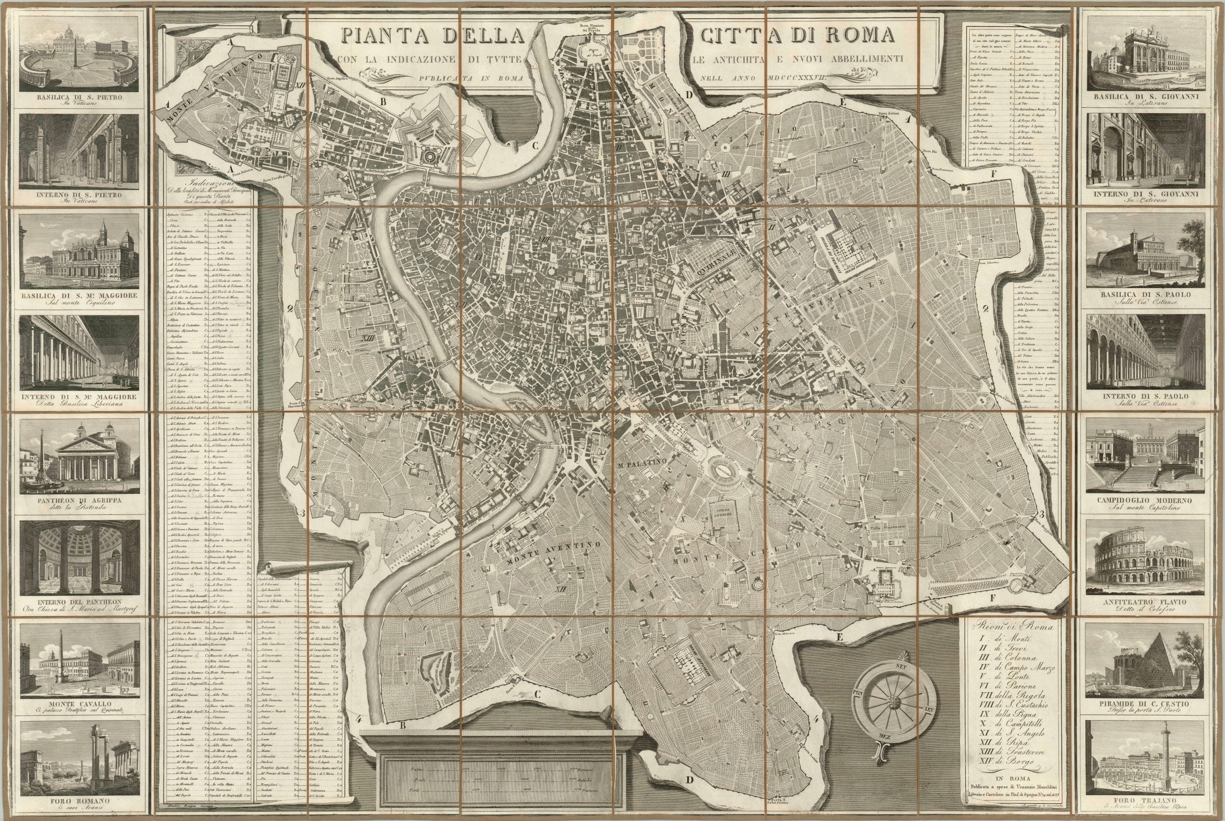
Pianta Della Citta di Roma
$1,250.00
Spectacularly detailed look at Rome in the first half of the 19th century.
Description
Designed by Pietro Ruga and published by Venanzio Monaldini from 1818 through the late 1840’s, this fantastic view of Rome shows a city that has remain largely unchanged for thousands of years. The sixteen administrative divisions, or rioni, are individually listed and indexed and have been in use since at least the 14th century. Nearly 400 individual monuments, modern and ancient, are crammed into the outer margins on either side of the map and correspond directly to coordinates on the grid surrounding the city’s walls. A previous user, perhaps an educated European traveler in the midst of the Grand Tour, has annotated several locations.
Sixteen of these monuments can be seen on full display in the views flanking either side of the map, and include some of Rome’s most popular attractions today, like the Colosseum, St. Peter’s Basilica, and the Forum. Shading in the negative areas on the sheet add depth to the image, providing an unusually attractive look for a 19th century city plan.
Map Details
Publication Date: 1837
Author: Pietro Ruga
Sheet Width (in): 44.50
Sheet Height (in): 29.50
Condition: A-
Condition Description: The case map is in excellent condition, dissected and mounted on linen with original slipcase and publisher's label. Very clean image, with some minor soiling. Old pencil marks in the index.
$1,250.00

