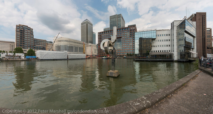
Cycling Around the Isle of Dogs: Tuesday June 24th 2014 was a nice Summer day in London. Not too hot, with a maximum in the low twenties, and with a blue sky tempered by some nice clouds and just a few light showers to cool me down. For me it was an ideal day for a bike ride and also for making some panoramic images.
It was a while since I’d been to the Isle of Dogs, and there had been quite a few changes around there in recent years, so after an early lunch I put my folding bike on the train and made my way to Limehouse.
It wasn’t really a bike ride, more just using the bike to carry me and my camera around the area, stopping on my way to make well over two hundred panoramic images in the roughly two and a half hours it took me to get to Island Gardens, opposite Greenwich for the train home. Later I worked on these images, selecting around 90 to put on-line – a higher than usual proportion. But I do rather more thinking about panoramic images and they require rather more care, particularly to get the camera absolutely level to keep the horizon straight.
I posted them in two groups, Limehouse pans and Millwall – Isle of Dogs pans. All the images were converted using the PT Gui software implementation of the Vedutismo perspective (also called Panini) made popular by Canaletto and other Italian cityscape painters in the 18th century which allows a more realistic representation of extreme angles of view – something like 147 degrees horizontally in these images. These would be impossibly stretched towards the edges in a normal rectilinear view, which only works up to around 90 degrees.
You can see any of these images larger on the links given to My London Diary at the end of this post, or by right-clicking on any of them and selecting to view them. Rather than write more about the ride here, I’ll quote from one of the posts there:
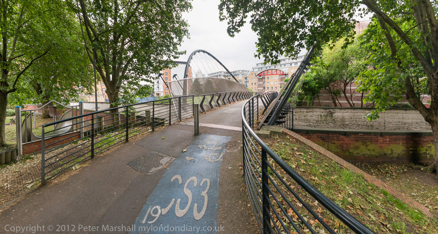
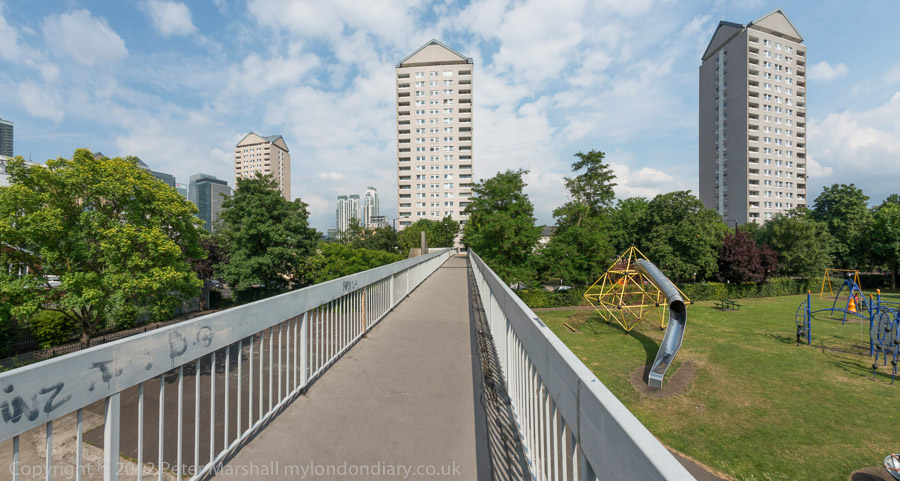
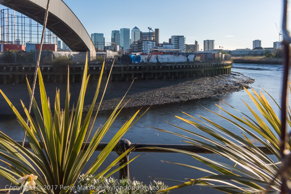
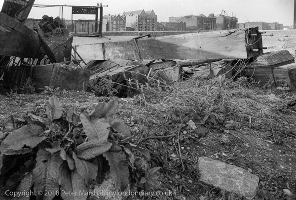
When I first walked these streets there was virtually no access to the riverside, with wharf after wharf between Westferry Rd and the river until you came to the park (Sir John McDougall Gardens.) A footbridge led from the Barkantine estate – built to replace a heavily bombed area of densely-packed small houses. South of this you again walked along the busy street until there were a few empty wharves around the south of the Isle of Dogs.
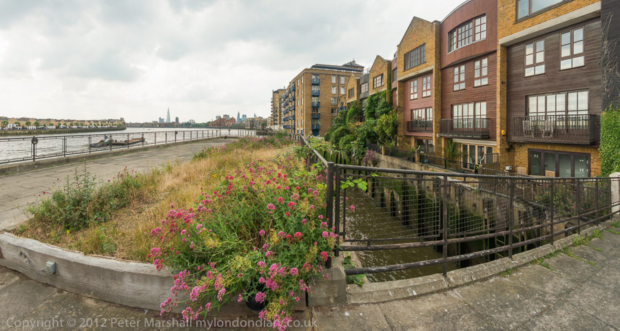
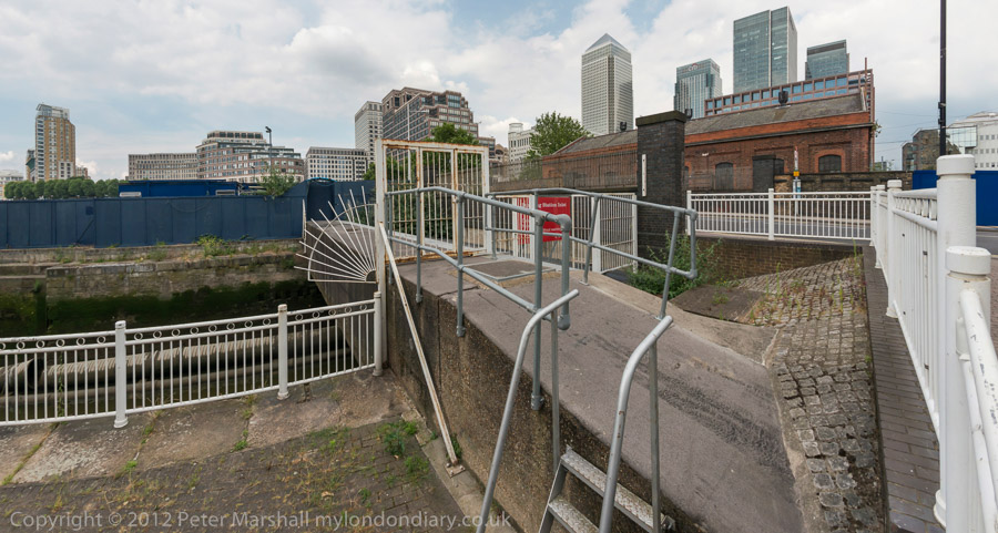
Now you can walk mainly along the riverside, with only one working area blocking the path. But there are several other places where you have to divert, including one wall dividing social housing from its wealthy neighbours. There was also a temporary diversion in one area, though it wasn’t clear why.
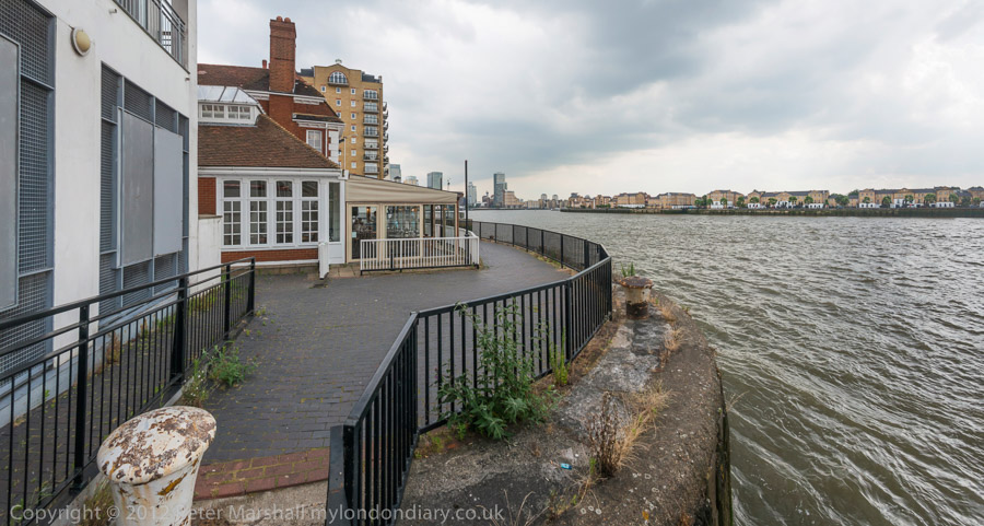
Further on are fine views across the river to Greenwich, along with further diversions from the riverside, where several earlier developments did not include riverside walks.
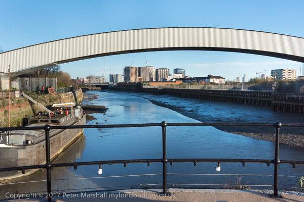
The Thames is too wide here for a panorama to work well without some foreground interest, or cropped to a very narrow strip. At the end of the ride, I did make a few pictures from Island Gardens across the river with a rather longer lens. These are in a separate post, also linked below.
Canada Water, Southwark Homes & Cody Dock: Events and pictures from Saturday 25th March 2017
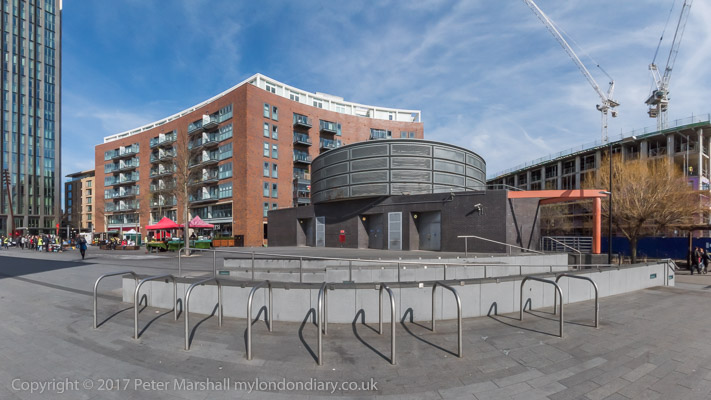
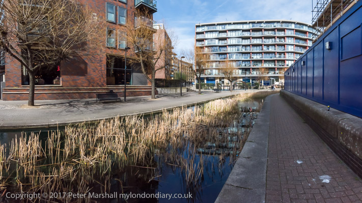
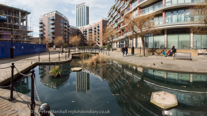
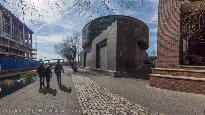
Canada Water, Southwark.
The Surrey Commercial Docks were the largest area of London’s Docklands and the only large docks on the south bank of the River Thames, built on a large marshy area at Rotherhithe, a little closer to London than the Royal Navy dockyard at Deptford.
The first dock here was dug out in 1696 and was the largest dock of that age, and could take 120 sailing ships. Later the dock became Greenland Dock, a base for the Arctic whaling trade, but in the 19th century there was a huge increase in trade with Scandanavia and the Baltic, and other docks were dug, as well as huge timber ponds which soon became its major trade.
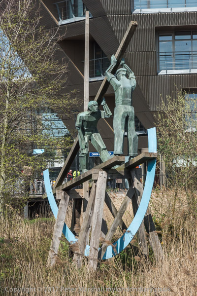
Deal Porters sculpture by Philip Bews
Surrey Docks was in full swing the in the Victorian age, with nine docks, six timber ponds and the Grand Surrey Canal. Badly damaged by bombing in the Second World War, the docks never fully recovered and were then hit by containerisation. The docks were too small to handle container ships and closed in 1970. Most of the docks were filled in and the whole area was redeveloped.
By the time the London Docklands Development Corporation was set up by the Tories in 1980 the redevelopment initially led by Southwark Council was well under way and the area was set to have a rather different character from the redevelopments on the north bank.
But the LDDC appeared as the principal objector, to the council’s statutory development plan and was backed by the Department of the Environment. Southwarks plan for the whole of the south riverside from London Bridge to Deptford was rejected for showing ‘unrealistic commitment to public housing‘ and for its ‘opposition to office and other private development’. The LDDC went ahead with selling land and buildings for speculative development.
The LDDC rubbed its hands in glee at the thought of selling riverside sites which Southwark had planned for low cost rented housing to developers of large blocks of luxury flats, and rushed to clear aging council estates and replace them with privately owned properties, policies which were strongly opposed by Southwark Council.
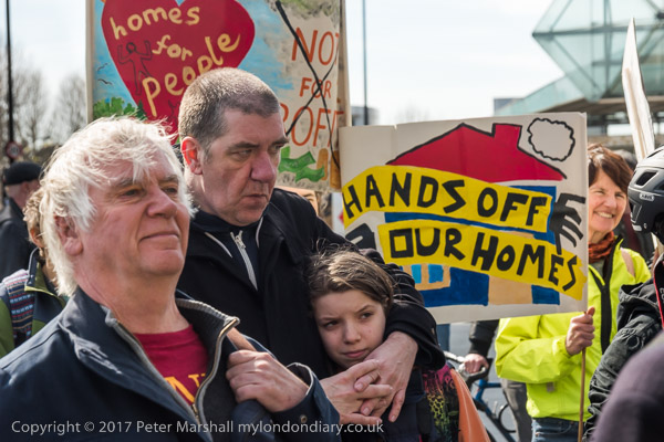
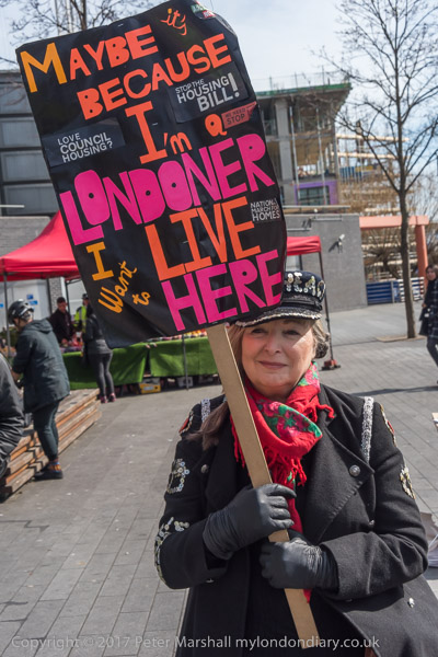
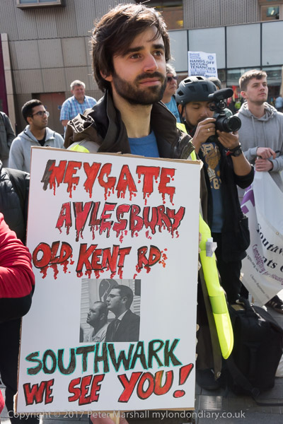
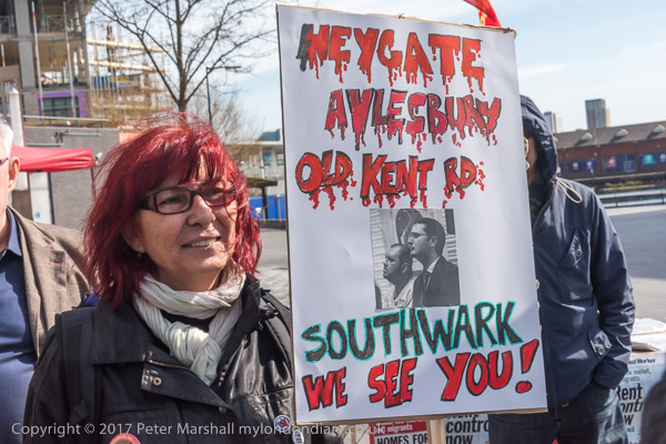
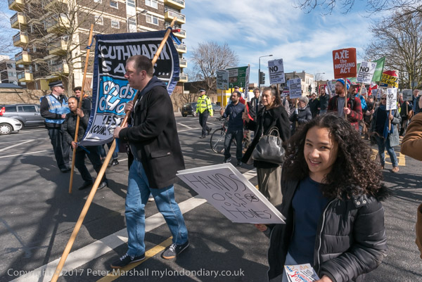
But times have changed, and I had come to Canada Water for a march where local people had come to protest against very similar policies by Southwark’s Labour council, working for and with developers to demolish estates such as the Heygate and Aylesbury, with the replacements including only a very small percentage of social housing. I’d arrived early on purpose to give me time for a short walk around before the protest began.
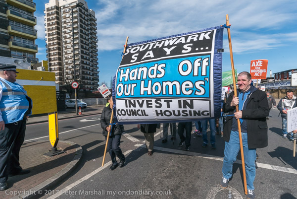
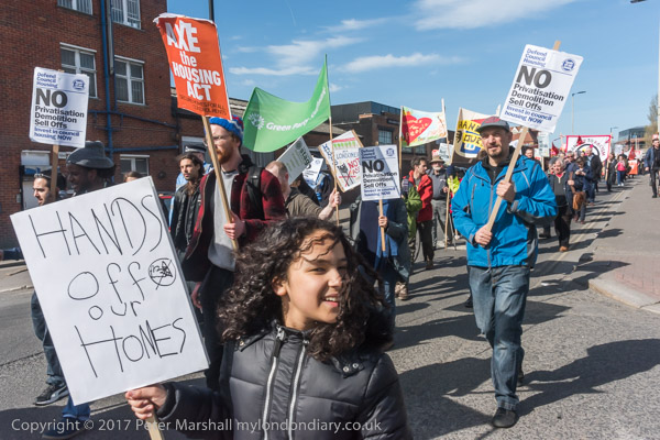
Southwark campaigners marched from Canada Water to protest at Thurlow Lodge Community Hall on the Aylesbury Estate, calling on Labour-run Southwark Council to save homes and jobs in the borough.
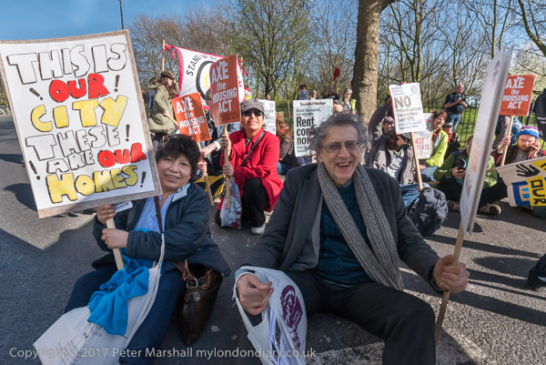
Marchers and speakers at the rally before the march included those from tenants and residents organisations, local business networks and others. They had come to oppose Southwark Council demolishing council estates for luxury home building, selling off public land to private developers and profit-oriented housing associations and forcing out small businesses through policies they say are solely concerned with realising asset values and trample on the rights and needs of local residents.
On My London Diary there is a long list of some of the groups involved, but there were others too.
One of the bigger battles, still continuing, is over the future of the Aylesbury Estate in Walworth, just south of the Heygate Estate at the Elephant and Castle, where the council lost a great deal of public money in providing a huge site with great transport links to allow a private developer to make huge profits, losing around 2000 social rent homes. Many of the new flats are empty boxes, investments for wealthy foreigner profiting from rapid increases in London property prices.
Piers Corbyn with others sitting down on Albany Road at the end of the march
Much of the Aylesbury estate has now been emptied, and some demolished. The council was found to have acted acting unfairly towards leaseholders who were being offered derisory compensation – usually less than half the market value of comparable properties in the area. Those who took the court case got improved offers, but there is little evidence of it changing its ways and trying to cheat others. Among those involved in fighting to save the Aylesbury on this march was Piers Corbyn, Jeremy’s older brother, in the news more recently over arguably less worthwhile causes, particularly in opposition to Covid restrictions.
The Aylesbury Estate had been at the centre of the Labour Party’s plans for the regeneration of council estates, the site of Tony Blair’s first big press event. But Labour’s policy was more about grabbing headlines than providing the good low-cost housing that a proper social housing policy requires. Councils such as Southwark have used it to demonise and run-down their large estates, spending large sums with PR companies to do so and working with major developers, rather than properly consulting with residents and putting the necessary cash into estate maintenance, running them down on purpose.
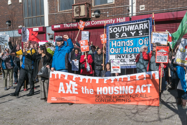
It was a long march to the Aylesbury Estate, detouring to pass several housing estates and business areas threatened by the council, and a tiring one on a warm and sunny March Day, and we were all tired by the time it ended outside Thurlow Lodge Community Hall. This had been saved earlier this year by a community occupation after Southwark Council had wanted to evict the occupants, Divine Rescue, a body with a soup kitchen offering support, training and meals to around a hundred homeless people, and runs a a food bank. Southwark wanted to sell or let the community hall to make more money.
The march organisers had planned to end the march here with Divine Rescue providing hot drinks and toilet facilities after the long walk, but Southwark Council had warned Divined Rescue that there lease would again be threatened if they had anything to do with the protest, forcing them to withdraw their offer. The hall was locked and shuttered, guarded by Southwark Council security when we arrived. It seemed a very petty piece of bullying by the council.
The protesters sat down on Albany Road blocking traffic for around 10 minutes in protest at this, then moved to the area in front of the community hall for a final rally.
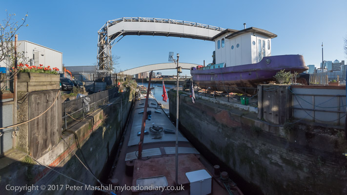
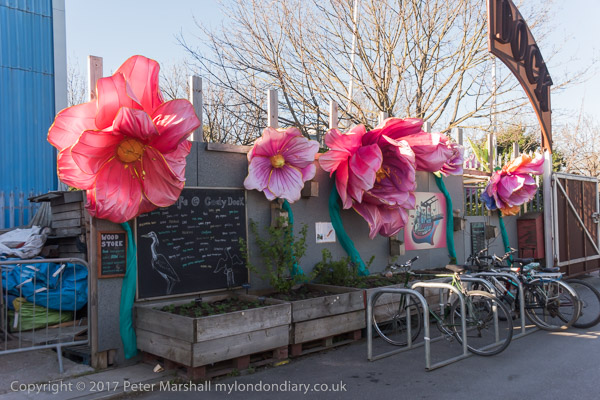
From the Aylesbury Estate I made my way to Cody Dock for the opening of my show there, ‘All Along the Lea‘, black and white photographs from the 1980s and 90s, arriving an hour or two early.
This gave me time to take a few more pictures, but also to have some food and a beer and listen to some live music and just to enjoy being there.
It was a pleasant opening with a decent crowd, with plenty of people coming to look at the pictures and talk, including the local MP. As I said and wrote, “When I took these pictures many people wondered why I was wasting time and film on such scenes, so I’m really pleased to have them appreciated now. “
I hadn’t chosen the title for the show, and it wasn’t accurate fro the pictures that were on the wall, almost all from Bow Creek. But I had photographed ‘All Along the Lea’ and my web site and the book ‘Before the Olympics‘ have pictures from the source at Leagrave to the outlets into the Thames both at Bow Creek, and, via the Limehouse Cut, at Limehouse Dock.
From Southwark Park Schools which ended the previous post on this walk, Rotherhithe New Road & Southwark Park Schools, I walked a few yards up Southwark Park Road to the corner with Banyard Road, where I photographed the taxi office (still there but changed from A-Z Star Cars to 5 Star Cars) with the pub on the opposite corner, the Southwark Park Tavern, now closed and converted to residential around 2003.
There was a pub around here, the Green Man, possibly on this site before Southwark Park opened in 1869 but I think this building probably came shortly after the park was opened, and is opposite the Carriage Drive leading into the park.
Unfortunately I haven’t yet digitised this picture, nor one of rather plain two-storey terrace on Banyard Rd or an image showing a play area in the park. I hurried through the park to the Jamaica Road gate at its north, crossing to make my way to Kings Stairs Gardens and the River Thames.
River Thames, Downstream, Rotherhithe, Southwark, 1988 88-10l-63
The two jetties visible here I think have now gone and there is certainly no line of lighters as in this picture, and there is one striking new building on the riverfront.
River Thames, Downstream, Rotherhithe, Southwark, 1988 88-10l-65
A second picture taken with a short telephoto lens from almost exactly the same place shows the central area more clearly, with new flats being built on Rotherhithe St.
Wapping, River Thames, Rotherhithe, Southwark, 198888-10l-51
Looking across the Thames downstream, with Free Trade Wharf at the extreme right and just to the left the cylinder ventilation shaft of the Rotherhithe tunnel in the King Edward Memorial Park. Both Metropolitan Wharf and New Crane Wharf are covered iwth scaffolding.
Wapping, River Thames, Rotherhithe, Southwark, 1988 88-10l-52
Part of St John’s Wharf and King Henry’s Wharves seen across the River Thames.
Wapping, River Thames, Rotherhithe, Southwark, 1988 88-10l-53
More of St John’s Wharf, including one of the earlier warehouse conversions and the Grade II listed Wapping Police Station, built 1907-10, Metropolitan Police architect John Dixon Butler. At extreme left is a part of Aberdeen Wharf built in 1843–4 by the Aberdeen Steam Navigation Company.
Wapping, River Thames, Rotherhithe, Southwark, 1988 88-10l-54
The end of Aberdeen Wharf is at the right edge of this picture, and at its left the Wapping Police Boatyard, an unnecessarily ugly building opened in 1973. The new building in the centre of the picture also seems something of an eyesore, at least at its ends.
Wapping, River Thames, Rotherhithe, Southwark, 1988 88-10l-55
Continuing up-river from the Police Boatyard are St Thomas Wharf, Pierhead Wharf, Oliver’s Wharf – the first warehouse in Wapping to be converted into luxury flats in 1972 – and Wapping Pierhead, with houses designed by Daniel Alexander in 1811 and the main entrance to London Docks.
Bermondsey, River Thames, Rotherhithe, Southwark, 1988 88-10l-41
Looking upriver on the south bank with Tower Bridge at the extreme right and Guy’s Hospital tower just left of centre. Cherry Garden Pier is at left.
Silver Jubilee, marker, EIIR, River Thames, Rotherhithe, Southwark, 1988 88-10l-43
There is still a marker for the Queen’s Silver Jubilee here but it looks far less impressive than this rugged stonework I photographed in 1988. London has also gained quite a few tall buildings, but the view along the river remains clear and you can still see the dome of St Paul’s Cathedral.
41 Rotherhithe St, now apparently 1 Fulford St at least according to Google Maps, was the offices of lighterage company Braitwaite & Dean, where their lightermen would come to collect their weekly wage. Apparently it was known locally as the Leaning Tower of Rotherhithe, though the building’s lean is more apparent from across the river than in my picture.
It was left more or less alone on this stretch of the river with just the Angel pub equally isolated a few yards upriver after Bermondsey council bought many of the buildings in 1939 to create a park, with wartime bombing continuing the demolition job. There was some temporary housing by the river when I first walked along here in the early 1980s, but that soon disappeared.
My walk in Bermondsey continued – more about it in a later post.
Rotherhithe New Road & Southwark Park Schools – October 1988
Rotherhithe New Rd Bermondsey, Southwark, 1988 88-10k-31
I’m not entirely sure whether my next pictures, taken on Rotherhithe New Road were a part of the same walk as my previous post in this series, Down the Blue, Spa Road & Old Jamaica Road 1988 or the start of my next visit to the area from roughly where that ended.
This window was somewhere not far from Raymouth Road which I probably walked down to get to Rotherhithe New Road, and I liked the design of the window with its tall thin iron supports, though it was hard so see them through the branches – which perhaps added to their attraction. I can’t find the actual location and it may well have been demolished.
Debnams Rd, Rotherhithe New Rd, Bermondsey, Southwark, 1988 88-10k-34
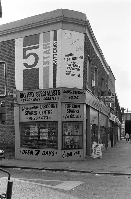
This is the corner of Debnams Road with Rotherhithe New Road and it was obviously the ‘5 Star Batteries’ painting on the first floor wall together with the other signage that made me photograph it. 203-5 is now covered with pebbledash and for some years had an advertising hoarding on this side wall, but this is now gone. The premises have changed hands several times, and in recent years have been a glazing firm, an African Food Store and now ‘Posh Hair Salon’.
Rotherhithe New Rd, Bermondsey, Southwark, 1988 88-10k-22
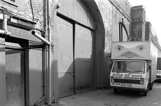
Next to the railway arches on the south side of Rotherhithe New Road in what is now called Jarrow Road I couldn’t resist this smiling lorry for ‘Wood Be Good Paint Strippers’.
Rotherhithe New Rd Bermondsey, Southwark, 1988 88-10k-23
This obviously dilapidated building was on Rotherhithe New Road close to the railway bridges and I think was demolished to build the Rotherhithe Business Estate at 214 Rotherhithe New Rd. Unfortunately I have no idea what it had been – if anyone knows please tell me in the comments.
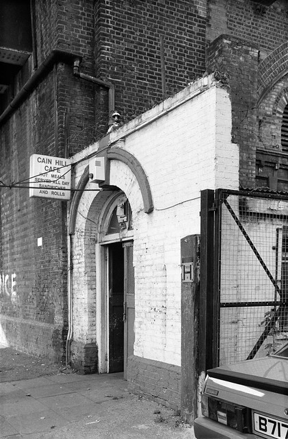
Cain Hill Cafe, Rotherhithe New Rd, Bermondsey, Southwark, 1988 88-10k-11
The Cain Hill Cafe which offered hot meals served all day, sandwiches and rolls was at the side of this railway bridge on Rotherhithe New Rd. This was demolished to give a wider entrance to the Rotherhithe Business Estate.
Southwark Park Schools, Southwark Park Rd, Bermondsey, Southwark, 1988 88-10k-12
Southwark Park Schools on Southwark Park Road, Grade II listed as an early example of a London Board School by E.R.Robson 1873-4. This frontage is a part of the original building which was extended in the 1890’s and 1910, and sensitively comprehensively redeveloped around 2010 retaining the listed buildings.
My photograph shows one of the two ‘2 sculptural reliefs which depict children learning; to each an inscription panel with the words “School Board for London” and “Southwark Park Schools“.’
From here I walked down to the River Thames, where the next post on this walk will continue.
Deptford to Rotherhithe October 1988 – the continuation and end of my photographic walk in October 1988. The previous post on this was Liquor, Motors, Furniture, Packing & Timber.
I turned around on Grinstead Road and made this picture as I returned to Evelyn Street. Directly ahead on the other side of Evelyn St was the car auction site shown in a previous post, and towering above that two of the towers on the Pepys Estate. On my right was the grim factory wall of the former galvanised iron and zinc Ida works, at the back of Neptune Wharf on the now filled-in Surrey Canal
Clare Villas, Evelyn St, Deptford, Lewisham, 1988
Clare Villas at 114-116 Evelyn Street and the neighbouring semi-detached pair Oak Villas whose doorway is at the left of the picture show us that there were then some wealthy local residents. These houses back on to Deptford Park and probably date from when this land was market gardens around the time this was bought by the London County Council in 1884. I think one of the two pairs was a little earlier than this date; Pevsner mentions both Clare Villas and Oak Villas, dating the latter to 1881.
Another picture of Clare Villas. I walked further along Evelyn Street stooping to take a couple of pictures of a large block on the corner with Bestwood Street, with six rounded columns going up between its four storeys of windows with a vaguely deco feel, I think where MacDonalds now is, which I seem to have forgotten to digitise, along with an interestingly angled four-storey building with balconies on the north side of the junction, also not digitised.
I often saw this block of two storey properties with their neatly trimmed hedges from the top floor of a bus, but this time I was on foot and stopped to make a couple of pictures, of whcih this, with its row of striped posts is more successful. Though I think it looked better from the higher viewpoint of the bus. This is a council development from the 1930s.
Scorer’s Corner has conveniently placed road signs among its wealth of text to tell us that this is the corner of Plough Way and Lower Road. The buildings on Lower Road were demolished before 2008 and the site remained empty until replaced by a rather boring development in 2015-6. This includes the site of the Dreadnought pub at right, first recorded in 1849, although its mock Tudor frontage is rather later.
The buildings along Plough Way at left are still standing, though the Prince of Wales pub, there since at least 1861 closed and became a betting shop around 2012.
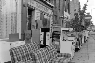
The Crystal Ball, Rotherhithe New Rd, Rotherhithe, Southwark, 198888-10i-15
The Crystal Ball frontage at 30 Rotherhithe New Road survived until around 2011 although I think the shop probably closed rather earlier. The building was then converted into residential use.
The Crystal Ball, Rotherhithe New Rd, Rotherhithe, Southwark, 1988 88-10i-16
It name ‘The Crystal Ball’ was inspired by the pub next door, the Crystal Tavern, first recorded here on the corner of Rotherhithe Old Road in 1852 but the current building, a fine example of a late Victorian pub, is dated 1895. Although it still has the pub sign (altered to read ‘Christ All Tavern’) and the Courage cockerel you can see in part at top left of this picture, it has since 1996 been home to the Christian Arise & Shine Evangelistic Association as their London Outreach Centre.
I think this walk ended here, at Surrey Quays Station, though it was then a rather longer an inconvenient journey for me by Underground back to Waterloo, requiring changes at Whitechapel from the East London Line to the District, then at Embankment onto the Northern Line one stop to Waterloo. The extension of the Jubilee Line to Stratford, opened at the start of 2000 made journeys to Rotherhithe considerably more convenient.
I think I joined the Greater London Industrial Archaelogy Society (GLIAS) in around 1979, forty years ago, but it had then been going for 10 years. I’ve not been the most active of members, particularly in recent years when I’ve been too busy with other things, but over the years I’ve been on numerous walks, several outings, attended talks and lectures and even made some tiny contributions. I still enjoy reading the newsletters and occasional publications of the group.
The various walks usually took me back to areas of London I’d already explored when taking photographs, and they often made me much better informed about buildings I had already photographed. I’ve not been on any lately as they almost always take place when I’m now working. But in previous years, the walks were often followed by the publication of small walk leaflets giving the route and pointing out the IA features.
The first of these walk leaflets was for Tower Hill to Rotherhithe and this anniversary event more or less retraced its steps, led by one of the two original authors, Prof David Perrett, now Chairman and Vice-President of GLIAS. It was a walk I’d first taken – without the aid of the leaflet – in the opposite direction back in 1983 (though I’d photographed parts of the area previously) and quite a few pictures from that are now online on my London Photographs site.
This area on Bermondsey Wall has changed considerably since then, though the riverside of Wapping seen at the top of the image still looks much the same. Of course you can’t see it from this same point, which I think is now occupied by expensive flats.
Inspired by these walk leaflets I went on to produce one of my own, a folded A4 sheet printed on thin card by my laser printer, largely as an exercise in Desktop Publishing which I was then teaching a course on.
Over the next few years I made and sold over well over 500 copies, charging I think 20p for each of them, though I never got the cash for some that were sold locally in Bermondsey (it rankled though the money was insignificant.) My best paying customer was a local historian who used them for several years for the guided walks he did on the local area. I think it is now seriously out of date, but ‘West Bermondsey – The Leather Area‘ has for a long time been available as a free download. (PDF)
The first time I put images from the area on line was in a site called ‘London’s Industrial Heritage‘, designed for me by my elder son, and you can see some pictures from this area from the links on the Southwark page.
I haven’t put many of the pictures from the walk on My London Diary, but there are a few more at GLIAS 50th anniversary walk. If you live in or around London and have any interest in industrial archaeology you would find GLIAS worth joining – and it has a very reasonable annual subscription of £14 (£17 for family membership.)
All photographs on this and my other sites, unless otherwise stated, are taken by and copyright of Peter Marshall, and are available for reproduction or can be bought as prints.
There are no adverts on this site and it receives no sponsorship, and I like to keep it that way. But it does take a considerable amount of my time and thought, and if you enjoy reading it, please share on social media. And small donations via Paypal – perhaps the cost of a beer – would be appreciated.
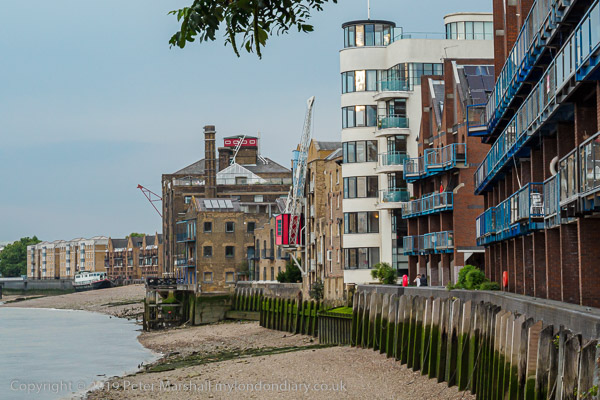
I arrived early for a private celebration of May Day with friends in a Wapping pub and took a short walk along the High St and riverside path, where I sat and ate my lunch sandwiches.
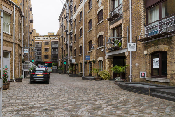
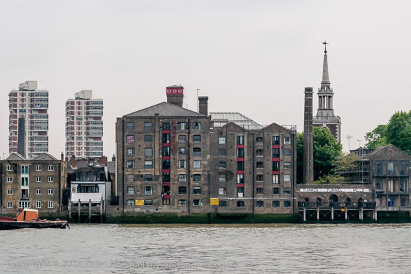
I’d made photographs here in the 1980s, and there were one or two that I’d hoped I would be able to fix the locations more precisely. It wasn’t easy as vitually everything between Wapping High Street and the river has been rebuilt with expensive riverside flats. New Crane Wharf (above) was still recognisable as here the old buildings had been converted.
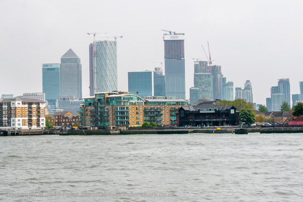
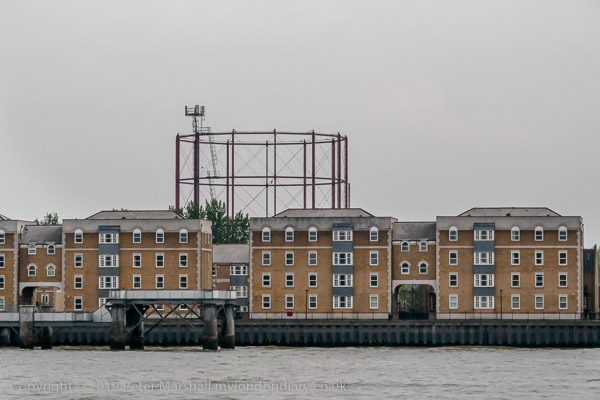
The Thames sweeps around to the south to go around the Isle of Dogs, and from Wapping you can see Canary Wharf to the North of the River and the gasholder in Rotherhithe to the south – and both appear in photographs to be across the river.
You also see rather too much very pedestrian riverside architecture like the flats above. So little new building on the river bank has any architectural merit, all about maximising profit within the planning restrictions. It’s such a shame that the LDDC didn’t have higher aspirations for its control of the redevelopment of docklands.
Relatively little of the old riverside survives here, and Tunnel Mills and the other buildings at Rotherhithe are one very welcome exception. There are parts of the north bank too where some of the better warehouses have been saved, converted into expensive flats.
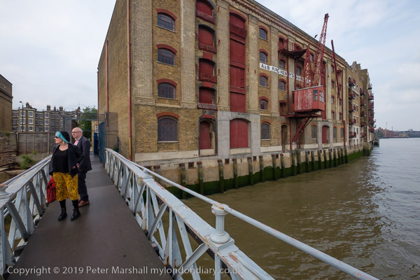
It was good also to be able to walk out onto Tunnel Pier, where I met two old friends also taking advantage of the opportunity.
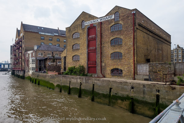
And though the Captain Kidd pub to the left of Phoenix Wharf is relatively modern, dating from the 1880s, like many Sam Smith’s pubs it is a sensitive conversion of an old building, Sun Wharf, which along with Swan Wharf (now renamed Phoenix Wharf) and St John’s F & G Wharf at left were owned or leased by W H J Alexander and Company, who as well as wharfingers dealing in a wide range of goods including coffee, dried fruit, gum and bales of Australian wool, also used these premises to repair their tugs. Swan Wharf I think is the oldest of these buildings, dating from the 1840s and possibly designed by Sidney Smirke.
All photographs on this and my other sites, unless otherwise stated, are taken by and copyright of Peter Marshall, and are available for reproduction or can be bought as prints.
There are no adverts on this site and it receives no sponsorship, and I like to keep it that way. But it does take a considerable amount of my time and thought, and if you enjoy reading it, please share on social media. And small donations via Paypal – perhaps the cost of a beer – would be appreciated.