Alcala
Philippines /
Ilocos /
Alcala /
World
/ Philippines
/ Ilocos
/ Alcala
World / Philippines / Pangasinan / Alcala
town, municipality, third-level administrative division
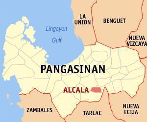
Municipality of Alcala, Province of Pangasinan
Land Area: 45.71 km²
ZIP Code: 2425
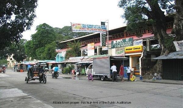
Alcala is a landlocked municipality in the province of Pangasinan in the Philippines. As of the 2010 Census, it had a population of 41,077 people.
The municipality was formerly a barrio of Bayambang called "Dangla", a vernacular term referring to a medicinal shrub which grows abundantly in the place. As a barrio, it was subdivided into several smaller units called sitios, namely: Bugyao, Bacud, Cupi, Bitulao, Guinawedan, Anulid, Cabicalan, Pindangan, Camanggaan and Sinabaan. On April 1, 1873, the early settlers submitted a petition calling for the separation of Dangla from Bayambang to constitute a separate township or "pueblo", but it took more than two years for the Spanish Authorities to take notice of the settlers demands. Finally, on September 20, 1875, a Royal Decree No. 682 was issued making the place an official municipality to be named Alcala, the name of a town in Spain where then the Governor of Pangasinan hailed from.
Alcala is politically subdivided into 21 barangays:
-Anulid
-Atainan
-Bersamin
-Canarvacanan
-Caranglaan
-Curareng
-Gualsic
-Kisikis
-Laoac
-Macayo
-Pindangan Centro
-Pindangan East
-Pindangan West
-Poblacion East
-Poblacion West
-San Juan
-San Nicolas
-San Pedro Apartado
-San Pedro Ili
-San Vicente
-Vacante
Pangasinan Webpage: www.pangasinan.org/alcala/
Land Area: 45.71 km²
ZIP Code: 2425
Alcala is a landlocked municipality in the province of Pangasinan in the Philippines. As of the 2010 Census, it had a population of 41,077 people.
The municipality was formerly a barrio of Bayambang called "Dangla", a vernacular term referring to a medicinal shrub which grows abundantly in the place. As a barrio, it was subdivided into several smaller units called sitios, namely: Bugyao, Bacud, Cupi, Bitulao, Guinawedan, Anulid, Cabicalan, Pindangan, Camanggaan and Sinabaan. On April 1, 1873, the early settlers submitted a petition calling for the separation of Dangla from Bayambang to constitute a separate township or "pueblo", but it took more than two years for the Spanish Authorities to take notice of the settlers demands. Finally, on September 20, 1875, a Royal Decree No. 682 was issued making the place an official municipality to be named Alcala, the name of a town in Spain where then the Governor of Pangasinan hailed from.
Alcala is politically subdivided into 21 barangays:
-Anulid
-Atainan
-Bersamin
-Canarvacanan
-Caranglaan
-Curareng
-Gualsic
-Kisikis
-Laoac
-Macayo
-Pindangan Centro
-Pindangan East
-Pindangan West
-Poblacion East
-Poblacion West
-San Juan
-San Nicolas
-San Pedro Apartado
-San Pedro Ili
-San Vicente
-Vacante
Pangasinan Webpage: www.pangasinan.org/alcala/
Wikipedia article: http://en.wikipedia.org/wiki/Alcala,_Pangasinan
Nearby cities:
Coordinates: 15°50'59"N 120°31'41"E
- Mangatarem 38 km
- San Jose 52 km
- Capas 56 km
- Candelaria 69 km
- Santa Cruz 71 km
- Mabini 79 km
- Botolan 80 km
- Bokod 85 km
- Kayapa 88 km
- Subic 103 km
- Canarvacanan 0.8 km
- Farmlands 0.8 km
- Pindangan Centro 2.7 km
- Olea 2.9 km
- Guinaudan 4.1 km
- gualao parti rin ng bersamin 5.1 km
- Santo Tomas Town Proper 5.8 km
- La Luna 6 km
- Purok 3 6.5 km
- Pangasinan 29 km
Comments