Caapucú (Paraguay)
Paraguay /
Paraguari /
Caapucu /
World
/ Paraguay
/ Paraguari
/ Caapucu
World / Paraguay / Paraguarí
district
Add category


Caapucú is one of the districts of the 9th department of Paraguay, Paraguarí. It is located about 141 kilometers from the capital of the country.
The Route No. 1 “Mariscal Francisco Solano López” crosses through this city.
It was founded in 1787 by Pedro Melo of Portugal and previously known as Capilla Tuvá.
Caapucú is the biggest district of the department, located in the south region of it, it is separated from the Misiones department by the Tebicuary River.
Settled between valleys and hills, it is known as the city of the Paraguayan altiplano.
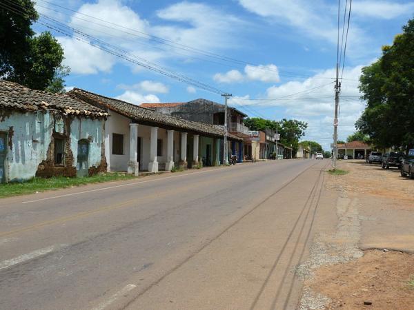
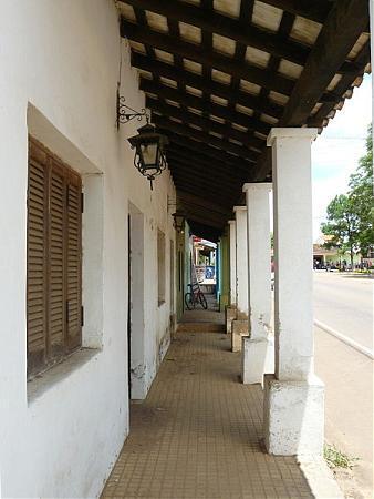
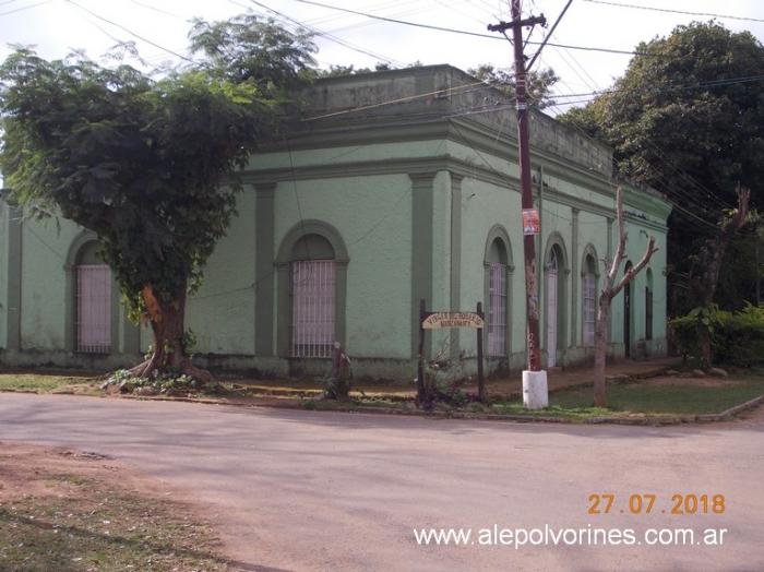
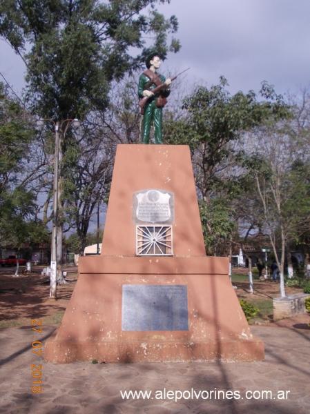
In the city are many housings from the time of the Colony, most of them built in the time around the Independence, one of them, the Stevant house, of a style very much alike a castle, has been turned into a museum that exhibits artifacts from that time.
Surface
Caapucú district has 2294 square kilometers of territorial extension, with a total population of 7822 habitants by the year 2008; its population density is 3.41 habitants per square kilometer, most of it living in the rural area.
[edit] Economy
The area that borders the Tebicuary River is a land that is victim of flooding, and is a good area for fishing.
Caapucú is an area mostly dedicated to cattle rising of cows, sheep, pigs and horses.
The agriculture activity is orientated mostly to the production for interne consumption of the population; they cultivate sweet cane, grapes, cotton and manioc. Among the main economical activities of the district are the shoe industry, the shops and workshop of craftsmanship, like wood carvings, confection of wardrove in “aó po’I”, “encaje jú” and crafts on leather.
Communications
The main paved road that crosses throughout great part of the district is the Route No. 1 “Mariscal Francisco Solano López” and is the route that connects it with the capital of the country, Asunción, and with other localities of the department.
Other roads are sand and pebbled roads and connect the districts with one another and with the capital of the department. It counts with telephonic services of Copaco and of mobile phone, besides it counts with several communication medias and journals that reach to all the districts.
How to get to Caapucú
From Asunción, Route No. 1 “Mariscal Francisco Solano López”, until reaching to the capital of Paraguarí, that is about 66 kilometers away, continues by the same route going through the cities Carapegua, San Roque González de Santa Cruz, Quiíndy, until arriving to Caapucú.
Municipality
Caapucú was founded by Pedro Melo of Portugal, on August 15, 1787, more to the north of its current location.
The city moved around 1816, during the government of José Gaspar Rodríguez de Francia, due to the shortage of water in the original location.
The current Mayor of the District is Lourdes Sanabria Britez Ugarte, member of the Liberal Party, and she’ll be in office for the period of 2006-2010.
The city counts with seven health care facilities, four sport clubs, four clean-up councils and municipal slaughterhouse.
Population
The information provided by the General Direction of Polls, Statistics and Census about the population is:
The population is mostly rural and with a slight predominance of men, occupied in farming activity. About 30% live in the urban area and 70% in the rural area.
The projections for the year 2008 are a total of 7,822 habitants, 4,020 men and 3,802 women.
Geography
The district of Caapucú is located in the West region of the Paraguarí department.
The topography of the district is characterized by hills, streams and swamps.
Limits
At North it borders on the Quiíndy and Ybycuí districts.
At South it borders on Misiones department, from which is separated by the Tebicuary River.
At East it borders on Misiones department and the Quyquyhó disrtrict.
At West it borders on Ñeembucú department.
Hydrography
Caapucú is watered by the Tebicuary River, the Negro River and the following streams:
Camalote
Guajhó
Arroyito
Paso Itá
González
Pindo
Yaguary
Itapé
Paso Pé
Capiibary
Paso Ybycuí
Guaho
Pirata
In the district there is also a lagoon called Laguna Verá.
Demography
According to information provided by the National Census and Population and Housing, from the total amount of housings, 67,19% correspond to the rural sector.
Main social and demographic indicators:
Population under the age of 15: 24.6%
Average of children per woman: 3.4 children
Percentage of illiterate people: 8.6%
Percentage of population that works in the primary productive sector: 46,2%
Percentage of population that works in the secondary productive sector: 16.5%
Percentage of population that works in the tertiary productive sector: 35.7%
Percentage of population working in farming activity: 46.0%
Percentage of housings with electric power service: 83.2%
Percentage of housings with running water: 18,9%
Population with unsatisfied basic necessities:
Percentage of population without education: 7.7%
Percentage of population without access to health care infrastructure: 33.5%
Percentage of population without appropriate housing: 27.2%
According with the information provided about the Human Development Rate, the Paraguari department has:
Basic rate of enrollment of 73.4%
Rate of literacy: 88.3%
Rate of life expectancy: 66.3 years
Value of Human Development Rate: 0.702
Schooling rate: 0.8336
Tourism
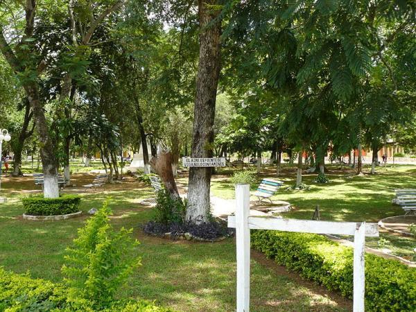
Caaupucú has very attractive touristic spots, such as the Municipal Square “Punta Arenas” located in the banks of the Tebicuary River, the touristic state “Santa Clara”, located 8 kilometers away from the city and several streams, squares and historical museums.
From Caapucú it’s possible to go to other recreational places of great beauty, such as Laguna Verá, also called Ypoa-Guazú, where people can go fishing and boating. The place also has a beautiful resort near the stream Paso Ybycuí, with installations for camping and sports.
A tour for the hills Charorá, Virgen, Yaguarete-cuá, Tarumá, Mariño, Villalba, Arayhú and Mbocayá allow the visitors to enjoy the natural landscape with a view of all the lakes.
But the main attractive of Caapucú are its beautiful beaches of white sand by the Tebicuary River, located in the city Villa Florida. This municipal resort, kept in very good conditions all the time, gives the visitors the opportunity to enjoy one of the best beaches of the country.
The foundation of the city is remembered in the month of August with a popular party, parades and sport competitions.
The folkloric festival “Che Rendá Alazán” it organized every year in the month of February and the National Festivity of the “Arriero” in October.
References
Tiempos del mundo.
Geografía del Paraguay.
Che Retá Paraguay.
Datos del la DGEEC.
ABC Color.
Ultima Hora.
EVP - Wikipedia
Enciclopedia Virtual Paraguaya - Portal
The Route No. 1 “Mariscal Francisco Solano López” crosses through this city.
It was founded in 1787 by Pedro Melo of Portugal and previously known as Capilla Tuvá.
Caapucú is the biggest district of the department, located in the south region of it, it is separated from the Misiones department by the Tebicuary River.
Settled between valleys and hills, it is known as the city of the Paraguayan altiplano.
In the city are many housings from the time of the Colony, most of them built in the time around the Independence, one of them, the Stevant house, of a style very much alike a castle, has been turned into a museum that exhibits artifacts from that time.
Surface
Caapucú district has 2294 square kilometers of territorial extension, with a total population of 7822 habitants by the year 2008; its population density is 3.41 habitants per square kilometer, most of it living in the rural area.
[edit] Economy
The area that borders the Tebicuary River is a land that is victim of flooding, and is a good area for fishing.
Caapucú is an area mostly dedicated to cattle rising of cows, sheep, pigs and horses.
The agriculture activity is orientated mostly to the production for interne consumption of the population; they cultivate sweet cane, grapes, cotton and manioc. Among the main economical activities of the district are the shoe industry, the shops and workshop of craftsmanship, like wood carvings, confection of wardrove in “aó po’I”, “encaje jú” and crafts on leather.
Communications
The main paved road that crosses throughout great part of the district is the Route No. 1 “Mariscal Francisco Solano López” and is the route that connects it with the capital of the country, Asunción, and with other localities of the department.
Other roads are sand and pebbled roads and connect the districts with one another and with the capital of the department. It counts with telephonic services of Copaco and of mobile phone, besides it counts with several communication medias and journals that reach to all the districts.
How to get to Caapucú
From Asunción, Route No. 1 “Mariscal Francisco Solano López”, until reaching to the capital of Paraguarí, that is about 66 kilometers away, continues by the same route going through the cities Carapegua, San Roque González de Santa Cruz, Quiíndy, until arriving to Caapucú.
Municipality
Caapucú was founded by Pedro Melo of Portugal, on August 15, 1787, more to the north of its current location.
The city moved around 1816, during the government of José Gaspar Rodríguez de Francia, due to the shortage of water in the original location.
The current Mayor of the District is Lourdes Sanabria Britez Ugarte, member of the Liberal Party, and she’ll be in office for the period of 2006-2010.
The city counts with seven health care facilities, four sport clubs, four clean-up councils and municipal slaughterhouse.
Population
The information provided by the General Direction of Polls, Statistics and Census about the population is:
The population is mostly rural and with a slight predominance of men, occupied in farming activity. About 30% live in the urban area and 70% in the rural area.
The projections for the year 2008 are a total of 7,822 habitants, 4,020 men and 3,802 women.
Geography
The district of Caapucú is located in the West region of the Paraguarí department.
The topography of the district is characterized by hills, streams and swamps.
Limits
At North it borders on the Quiíndy and Ybycuí districts.
At South it borders on Misiones department, from which is separated by the Tebicuary River.
At East it borders on Misiones department and the Quyquyhó disrtrict.
At West it borders on Ñeembucú department.
Hydrography
Caapucú is watered by the Tebicuary River, the Negro River and the following streams:
Camalote
Guajhó
Arroyito
Paso Itá
González
Pindo
Yaguary
Itapé
Paso Pé
Capiibary
Paso Ybycuí
Guaho
Pirata
In the district there is also a lagoon called Laguna Verá.
Demography
According to information provided by the National Census and Population and Housing, from the total amount of housings, 67,19% correspond to the rural sector.
Main social and demographic indicators:
Population under the age of 15: 24.6%
Average of children per woman: 3.4 children
Percentage of illiterate people: 8.6%
Percentage of population that works in the primary productive sector: 46,2%
Percentage of population that works in the secondary productive sector: 16.5%
Percentage of population that works in the tertiary productive sector: 35.7%
Percentage of population working in farming activity: 46.0%
Percentage of housings with electric power service: 83.2%
Percentage of housings with running water: 18,9%
Population with unsatisfied basic necessities:
Percentage of population without education: 7.7%
Percentage of population without access to health care infrastructure: 33.5%
Percentage of population without appropriate housing: 27.2%
According with the information provided about the Human Development Rate, the Paraguari department has:
Basic rate of enrollment of 73.4%
Rate of literacy: 88.3%
Rate of life expectancy: 66.3 years
Value of Human Development Rate: 0.702
Schooling rate: 0.8336
Tourism
Caaupucú has very attractive touristic spots, such as the Municipal Square “Punta Arenas” located in the banks of the Tebicuary River, the touristic state “Santa Clara”, located 8 kilometers away from the city and several streams, squares and historical museums.
From Caapucú it’s possible to go to other recreational places of great beauty, such as Laguna Verá, also called Ypoa-Guazú, where people can go fishing and boating. The place also has a beautiful resort near the stream Paso Ybycuí, with installations for camping and sports.
A tour for the hills Charorá, Virgen, Yaguarete-cuá, Tarumá, Mariño, Villalba, Arayhú and Mbocayá allow the visitors to enjoy the natural landscape with a view of all the lakes.
But the main attractive of Caapucú are its beautiful beaches of white sand by the Tebicuary River, located in the city Villa Florida. This municipal resort, kept in very good conditions all the time, gives the visitors the opportunity to enjoy one of the best beaches of the country.
The foundation of the city is remembered in the month of August with a popular party, parades and sport competitions.
The folkloric festival “Che Rendá Alazán” it organized every year in the month of February and the National Festivity of the “Arriero” in October.
References
Tiempos del mundo.
Geografía del Paraguay.
Che Retá Paraguay.
Datos del la DGEEC.
ABC Color.
Ultima Hora.
EVP - Wikipedia
Enciclopedia Virtual Paraguaya - Portal
Wikipedia article: http://en.wikipedia.org/wiki/Caapucú
Nearby cities:
Coordinates: 26°14'1"S 57°10'45"W
- Quyquyhó (Paraguay) 18 km
- Quiindy 31 km
- General José Eduvigis Díaz (Paraguay) 160 km
- plano alto 396 km
- campo bro 13 km
- Square 20 km
- Cemetery 30 km
- San Juan Batista Airport 45 km
- Club 1o de Enero 48 km
- Cemetery 49 km
- FACULTAD DE DERECHO Y FILOSOFIA 49 km
- Iturbe airport 71 km
- Propiedad de Hector Baez Samudio 78 km
- Cemetery 80 km