Gerona
Philippines /
Central Luzon /
Cardona /
World
/ Philippines
/ Central Luzon
/ Cardona
World / Philippines / Tarlac / Gerona
town, municipality, third-level administrative division
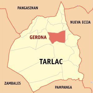
Municipality of Gerona, Province of Tarlac
Area: 128.89 km²
ZIP Code: 2302
Gerona is a municipality in the landlocked province of Tarlac in the Philippines. As of the 2010 Census, it had a population of 83,084 people.
The town is bounded on the north by Paniqui; on the east by the Pura; on the south by Tarlac City (the provincial capital); and on the west by Santa Ignacia. The town is 73 km. from San Fernando City, the regional center; 50 km from Clark Special Economic Zone in Angeles City; and 139 km north of Metro Manila.
Gerona has a land area of 141.47 square kilometers of plain and rugged agricultural land representing 4.63% of the province total area. The Tarlac River, which originates from the eastern slopes of the Zambales Mountain, cuts across the west central areas, dividing the town into two parts.
Gerona was originally named "Paontalon". Early Pangasinan settlers later named a community in the area "Barug", meaning little forest or "Pugo" in Ilocano. In 1765, the name "Barug" was officially changed to "Gerona" in honor of General Nicolas Claviera who was, at that time, the Governor General of the Philippines who hailed from Gerona, Spain.
Gerona is politically subdivided into 44 barangays:
-Abagon
-Amacalan
-Apsayan
-Ayson
-Bawa
-Buenlag
-Bularit
-Calayaan
-Carbonel
-Cardona
-Caturay
-Danzo
-Dicolor
-Don Basilio
-Luna
-Mabini
-Magaspac
-Malayep
-Matapitap
-Matayumcab
-New Salem
-Oloybuaya
-Padapada
-Parsolingan
-Pinasling (Pinasung)
-Plastado
-Poblacion 1
-Poblacion 2
-Poblacion 3
-Quezon
-Rizal
-Salapungan
-San Agustin
-San Antonio
-San Bartolome
-San Jose
-Santa Lucia
-Santiago
-Sembrano
-Singat
-Sulipa
-Tagumbao
-Tangcaran
-Villa Paz
Official Website: www.gerona.gov.ph/
Wikipedia article: http://en.wikipedia.org/wiki/Gerona,_Tarlac
Nearby cities:
Coordinates: 15°36'5"N 120°33'39"E
- Capas 39 km
- San Jose 43 km
- Mangatarem 51 km
- Botolan 67 km
- Candelaria 71 km
- Subic 80 km
- Santa Cruz 80 km
- Mabini 96 km
- Bokod 111 km
- Kayapa 114 km
- Sembrano Poultry Farm 1.4 km
- KVE Subdivision 2.8 km
- Mauplas 2.9 km
- Charoen Tarlac 3.6 km
- Mapalad 6.9 km
- Bounty Hatchery 6.9 km
- Laoang 7 km
- calayaan-mabini, gerona, tarlac 7.5 km
- Sinait 8.4 km
- San Juan de Mata 8.4 km
Comments