Welcome to Horsmonden
 Welcome to Horsmonden
 Welcome to Horsmonden
A village in the Weald of Kent
Horsmonden is a village located in the Weald of Kent. The nearest towns are Tunbridge Wells, 8 miles to the West, Maidstone, 13 miles to the North and Cranbrook, 8 miles to the East. Horsmonden is in the Borough of Tunbridge Wells.
Get directions to Horsmonden on Google Maps
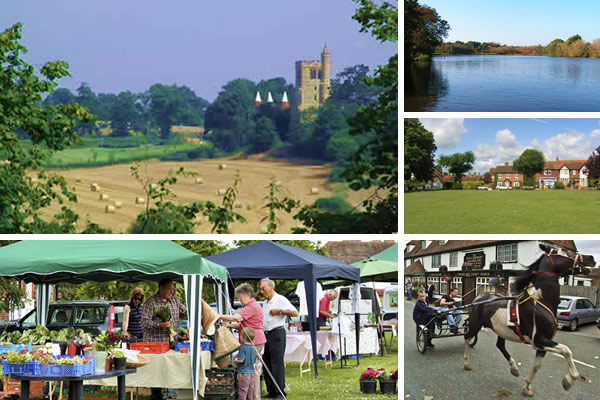
Surprisingly, Horsmonden has been the centre of Weaving Industry, the Iron and Gunfounding Industry and the Hops industry in its past! Horsmonden is also famous for its annual Gypsy Horse Fair in September.
The Parish
The Parish of Horsmonden stretches from Gaffords Bridge and August Pitts in the North, Spelmonden in the south, Shirrenden Woods in the west and the River Teise forming the eastern border. The parish comprises of the village itself, hop gardens, orchards and farmland, numerous ponds and woodlands and is about 9 square miles in total.
The Village
The village has a large green, known as The Heath, and is surrounded by the village shops and pubs. The shops are the Post Office, Heath Stores, Heath Pharmacy, Haircraft Unisex Hairdressers and Country Property Estate Agents.
Our Public House is the famous Gun and Spitroast and there is also a thriving Horsmonden Social Club both on the Green.
Other village amenities include Horsmonden Primary School, Horsmonden Kindergarten, Horsmonden Village Hall, St. Margaret's Church, Horsmonden Catholic Church, Horsmonden Methodist Church, Horsmonden Sports Ground, Horsmonden Lawn Tennis Club, amongst others.
If you want to visit Horsmonden there are various places to stay from the Gun and Spitroast, Bed and Breakfast and Holiday Cottages.
Horsmonden is in the heart of the Weald of Kent and in the High Weald Area of Outstanding Natural Beauty (AONB).
Village Life
There is plenty going on in Horsmonden, have a look at Village Life or the Village Calendar.
Local Business
Horsmonden is surprisingly diverse for business – Farming forms a large part of the local economy with several rural business centres scattered throughout the Parish being the home to many modern businesses. See a list of Horsmonden Businesses…
Local Schools
We have a primary school in the village as well as many other schools close to Horsmonden.
Public Transport
The nearest railway station to Horsmonden is Paddock Wood. Horsmonden Station closed in 1961.There are numerous bus routes serving Horsmonden giving access to Tunbridge Wells, Cranbrook, Tenterden to name a few.
Local Attractions
There are many places to visit from Horsmonden whether you are a resident or visitor, here are the main visitor attractions close to Horsmonden.
Horsmonden Village Sign
The CANNON represent the great iron foundry, which once supplied guns for the English and Dutch navies and for King Charles I’s army and later, during the English civil war, for Parliament. In 1613 two hundred men were employed in the foundry.
The TREE represents Horsmonden's great oaks and other local woods used for building, for gun carriages and for fueling John Browne’s great blast furnace.
The OASTHOUSE represents agriculture and the once thriving hop industry
The CHURCH is the 14th century parish church of St Margaret's two miles away from the main village.
Events
We have a fornightly Farmers' Market, a Nativity and Easter re-enactment and the annual Gypsy Horse Fair.
Horsmonden Gypsy Horse Fair
This takes place the second Sunday in September every year. Gypsy Horse Fair page. See a video of the 2008 Horse Fair.

Weald of Kent
Horsmonden is located in the Weald of Kent or Kentish Weald. The name Weald is derived from the Old English weald, meaning 'forest'. The adjective for 'weald' is 'wealden'.
Maps of Horsmonden
Ordnance Survey Maps cover Horsmonden. Also there are various online maps to view.