“There’s a quality of life in Maine which is this singular and unique. I think. It’s absolutely a world onto itself.” ~ Jamie Wyeth
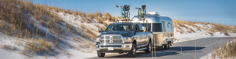
We were going home . . . home to the U.S.A., that is. After many weeks on the road and with the fall season fast approaching, we were headed into Maine, where we would be making our way, small jumps at a time, down the coast. And what a coastline it is! With all its coves, inlets, harbors and river estuaries, it has nearly 3,500 miles of tidal shoreline—more than California.
 After making the border crossing, we headed to that coastline, where we would begin our drive. Sometimes referred to as the “Sunrise Coast” because the rising sun first illuminates the land before the rest of our country, it is more commonly known as Down East Maine.
Down East is a sailing term that confuses most landlubbers. It comes from the days when schooners were used to carry cargo along the coast. The prevailing winds here blow from the southwest, pushing sailing vessels downwind, to  the east.
Merging both words together “Downeast” has been in use since the earliest sailing days, around 1820.
Billing itself as “the easternmost town in the U.S.”, Lubec, Maine was our destination. Although the town stands by that declaration, the caveat to this claim is “. . . in the contiguous U.S.” Moreover, you’ll find that West Quoddy Head Lighthouse actually stands on the easternmost point, and if you want to really get technical, it’s Sail Rock (an island just east of Quoddy Head) that is the true most eastern point.
Whatever its delineation or claim to fame, that title alone wasn’t what was bringing us here. In truth, that lighthouse was a big draw, as was the proximity to Campobello Island and its history. Actually, I was just eager to begin our long drive down the length of Maine’s coastline, anxious to explore its picturesque landscape, curious to compare it with the topography and character of Nova Scotia, and hopefully to encounter beautiful fall foliage. As soon as we cleared the border crossing, we made a  beeline for that small coastal town.
The town of Lubec isn’t the only spot that flaunts its location—the only campground in the area makes good use of its unique locale. Sunset Point RV Park might not be a big campground, but what it lacks in size (only 30 sites) is more than compensated for in location. A few miles south of Lubec, it sits directly on the shoreline of Johnson Bay, a sheltered inlet southwest of Lubec’s harbor. If you’re lucky enough (like us) to snag a shoreline site, then you can bask in the late afternoon light right from your RV.

 Settled in 1780 and now having nearly 1,500 residents, Lubec is located on a headland, with 97 miles of shoreline. Interestingly, it stands on the western side of the entrance to the Bay of Fundy, almost directly across the water from Digby, Nova Scotia, of which it has many things in common. The town offers a rugged coastal setting and pure natural beauty, combined with solitude and tranquility rarely found on other more frequented parts of the Maine coast. It’s a small hamlet of homes and fishing wharves, a few shops and restaurants, and nothing fancy. You can walk straight through its business district in no more than ten minutes.

 Some might call the town quaint, others might say it’s just plain, but surely everyone who spends any length of time here would describe Lubec as genuine. You’ll find a natural harbor on one end of town, where a small memorial to sailors and fishermen lost at sea is graced by a blooming flower garden that frames a view of Mulholland Point Light across the water.
It might be off the beaten path, but that doesn’t mean it isn’t worth your while to check it out. It has a history that no other town in our country can share—Lubec was once the beating heart of the American smoked herring industry. Today you’ll find McCurdy Smokehouse Museum dedicated to the history of the industry standing in the center of Main Street. You might not think you have an interest or care to learn about the days of herring fishing, but trust me—you won’t be bored if you stop in for a short tour.
 And, what’s more, you’ll probably be a welcomed guest of the museum’s volunteer guide waiting to give you a personal tour.
We certainly enjoyed meeting our museum guide Victor, a retired fisherman and smokehouse employee, hearing about his experiences in the herring industry.
Throughout the 19th and into the mid-20th century, the smoked herring business boomed. The fish were an inexpensive source of protein that could be preserved for weeks, which was essential in the time before refrigerators. Lubec fishermen brought in thousands of tons of Atlantic herring a year from the weirs scattered in the nearby Bay of Fundy. The silvery fish were then dumped, along with 80 pounds of salt, into water-filled tanks. They soaked there for a week before being impaled through the gills with long wooden sticks that are still in the museum.
 The fish-laden “herring sticks” were hung to dry from “herring carts” for a few hours, so that the fish wouldn’t slide off the stick. They were then hung up to 30 feet in the air from the rafters of the smokehouse, while the smoke from a perennially burning fire on the floor cured the fish. After seven to eight weeks, the herring were taken down, decapitated, skinned, gutted, deboned, split in half and packed into wooden boxes to be shipped all over the world.
The herring business did well through World War II, but the prosperous post-war period allowed Americans to trade out their iceboxes for refrigerators and freezers. The interstate highway system also ensured that fresh food could be delivered to markets faster, and medical research warned Americans against consuming too much salt. By 1975, McCurdy’s was the last smoking commercial herring smokehouse operating in the United States. In 1996, the decaying smokehouse was restored by the newly-formed Lubec Landmarks.

More of Lubec could wait. So could the surrounding coastline. Evening was coming on and from our location the sky had every look of producing a decent sunset. We headed out to the West Quoddy Head Lighthouse with high hopes for a good scenic.
It was not to be. From our clear skies there on the shores of Johnson Bay, as we drove the 5 miles east to Quoddy Head State Park we saw the heavy gray blanket of heavy fog floating above the horizon. Not a good sign. Still, we persevered on.
Sitting on a tall cliff standing guard where the Quoddy Narrows flows out into the Bay of Fundy, the 49-foot-tall lighthouse has a commanding presence even enveloped in dense fog. Since 1808, a lighthouse has stood on this location, guiding ships through this treacherous waterway. To make it more visible in snow and fog, the present lighthouse, built in 1858, is the only “candy striped” lighthouse in our country. Now is that photogenic or what?

We spent the entire next day with a return to Canada, specifically Campobello Island, to take in the Roosevelt Campobello International Park. The beautiful island, just a short drive across the FDR Memorial Bridge from Lubec, has plenty to see and photograph. While there is also a small town populated with homes of full-time as well as seasonal residents, the centerpiece is the Roosevelt “cottage” as well as remnants of a whole different lifestyle that occurred here in the latter years of the 1800 into the early 1900s.
From 1905 to 1921 FDR’s parents would summer here with their young family along with other wealthy American families who built their own “cottages” (read: mansions) here. This is where the future president visited as a baby, learned to sail as a young boy, and brought his future wife for an extended visit. He also succumbed to polio here at the age of 39. The Roosevelt Cottage, along with three others, have been renovated and are now owned by the Park commission. Originally built in 1897, the Roosevelt cottage was owned by FDR’s mother, who gifted the home to FDR and his new wife, Eleanor, and then continued to live there with the young family for many summers. The house is huge—34 rooms, with 6 bathrooms and 18 bedrooms—that have been historically decorated to the way it looked in the 1920’s when the Roosevelts lived here. To learn more about the house design, history and the daily life of the family, click here.


Map credit: WheelingIt.com
It was late afternoon by the time we had finished exploring Campobello Park, but before heading back across the bridge there was another lighthouse waiting to be bagged by us. Located on the northern tip of Campobello Island, it wasn’t a long drive and fortunately, my driver seemed up to the task.
Known as Head Harbour Light (more commonly, East Quoddy), she’s an impressive light with a unique red cross (the Cross of St. George) that’s built on a small, rocky islet off the farthest tip of Campobello Island. First lit in 1829, she’s got a 51’ tall wooden octagonal tower, a beautiful keeper’s house, oil house, and fog bell. She is the oldest surviving lighthouse in New Brunswick and is nearly unchanged since the day she was built.
There’s only one small glitch to catching more than a tiny glimpse of her . . . you must make a short, 30-minute hike crossing two rocky bridges, another bridge and several tall skinny metal ladders that scale the steep cliffs in order to see the lighthouse fully. And, take special note—this crossing must be begun and ended in the few short hours of low tide. Once those famous Fundy tides begin to roll in, you’d best be back on high ground. The high tides will soon be covering over all traces of the trail leading to the lighthouse view.

This is the best sight of the light that you can only hope to get when looking from the island’s mainland..
If the timing for the tides doesn’t work in your favor, or else you just don’t feel like attempting the hike, then you do have one other option to take . . . that is, provided you’re a skilled drone operator.

Photo credit: Chris Wall
You’ve gotta admit, the drone can get pretty darn good pictures when it comes to inacces-sible locations. Once again, Chris takes the prize for achieving beautiful compositions while doing some fancy flying through windy conditions all the while. This Head Harbour Light photo couldn’t have been any better . . . and talk about giving a feel of the location . . . all I can say is “Wow!”
We were down to our last full day around Lubec and it was about time we experienced more of Quoddy Head State Park and got back into the groove of outdoor hiking. Fortunately, we soon discovered that the park can certainly accommodate our desires.
 Established in 1962, the State of Maine purchased 532 acres of land, which included ownership of West Quoddy Head Lighthouse. Soon after, workers began hacking out nearly 5 miles of hiking trails through the diverse landscape of the park, with each trail giving access to a different feature of the area. We wasted no time at all striking out on one of those trails, which soon began paying back in big scenic dividends before we had even begun to feel the workout we’d be getting.
 The Coast Guard Trail gives fairly easy access to high cliffs looking north across the Lubec Channel and back down to the town of Lubec. The trail begins rather non-descript as it winds through a densely forested area where only mosses and ferns manage to thrive in the undergrowth.
We soon were getting a feel—a very up close and personal feel—for the natural setting of the area coastline.
Bold headland points and promontories reaching out like fingers into the ocean, forested islands and chains of tiny islets—a very dramatic view when you’re standing right out there on one of those precipices. Truly a sight that takes your breath away (or maybe gives you jitters in your stomach).

 I made sure we had enough stamina in reserve to hike what arguably was the best trail of the park—the Coastal Trail. While the terrain is much more challenging and the length quite a bit more too (4 miles round trip), the scenery is non-stop gorgeous which makes all the effort extremely worthwhile. As my hiking dictum goes “If I’m going to sweat, it better be for a good cause”, this trail definitely fit that bill.
Within the first 10 minutes you’ll be breaking out of an ordinary walk through the woods, to where big coastal views hit you smack in the face!!
 And those views never really let up . . . as you climb and wind your way past all different perspectives.


It’s all you can do to try to get it with your camera . . . but no photo can truly illustrate the magnificence of the emotional effect.
You just need to be there.


I can’t think of a better place to leave you than here at our campsite at the end of a good day.
For sure, Lubec did not disappoint.
Airstream Travelers, Melinda & Chris — With more Maine Coastline ahead.


Late afternoon light on West Quoddy Lighthouse.

I love Maine and its rocky coast. I need to get back for some smallmouth bass fishing and sitting on the rocks in the late afternoon sun. My nursing expert sadly moved to Florida. She was the reason for at least two of my recent trips to the coast of Maine north of Portland.
Considering all the places you’ve been to, that’s saying a lot about your attraction to the Maine coast. I hope I have time to send out more posts on our travels through Maine. Sadly, our trip is fast coming to an end.