Souda Bay (Chania), Crete 2022
As we were having breakfast by the large aft window in the Main Dining Room on the morning of October 26 the Zaandam sailed in through Souda Bay. On one shore we passed the ruins of an old stone fortification on the water. Located in Northwest Crete, this bay has been an important port for commercial and military ships since at least the 7th century BCE when the Minoans ruled the island. It has since been held by the Venetians and Ottomans as well as the Greeks who rule here now. There is an Allied cemetery nearby and today there is a Greek & NATO naval base.
There is a small town at the end of the bay but not much to see there. So we caught the local shuttle bus to the nearby city of Chania (pronounced with a silent C). Dating back more than 3500 years, when it was a city called Kydonia in the Minoan civilization, this is one of the oldest continuously operating towns in the world. In fact, Kydonia’s citizens are mentioned in the Odyssey. In the ensuing centuries it has been controlled by Greeks, Romans, Byzantines, Venetians, Turks, Germans and Cretans. With a population a bit over 100,000 it is a delightful city to explore, which is what we spent this day doing.
The shuttle dropped us off in a green square across from the Agora, a huge enclosed marketplace built in 1913. Unfortunately we couldn’t visit the Agora because it had been completely gutted, with only most of the outside walls still standing. We hope it is being renovated rather than demolished, but on this day there were no vendors (or much of anyone else) there.
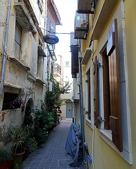
We had read about archaeological excavations not far away trying to uncover Minoan ruins (although many of them are covered by modern buildings). We didn’t find them, but we did have a chance to wander some through an atmospheric neighborhood of narrow maze-like streets that we think is called Splantzia. On one of these back streets was a tiny Greek Orthodox church.
We came out to a wide street with high retaining walls and ruined buildings on top. With think this hill is called Kastelli. We aren’t sure what to make of it (the signs are in Greek), but it might be the remains of old city walls and we understand that Minoan excavations are in progress there. As we walked along the road at the base of the walls we encountered several nice domestic gardens.
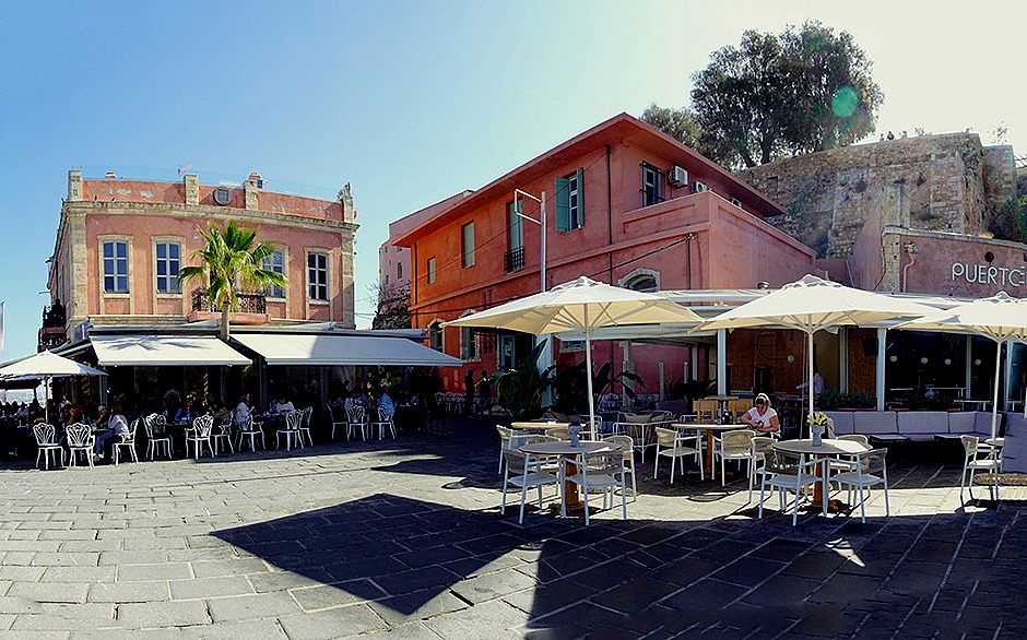
We continued walking north until we came to the center of town, which is arrayed around its old harbor. It was a beautiful day and the area almost glowed in the sunshine. The harbor is not big as harbors go and it has a narrow entrance from the sea between the lighthouse at the end of a long seawall and a fort, all of which were built by the Venetians in the 16th century. The water is remarkably clear.
Small but quite distinctive, the Mosque of the Janissaries sits near the center of the harbor promenade. Built in 1645, the year the Turks took control of the city, it is no longer used for religious purposes. It has been an art gallery but was completely closed when we were there.
Up the road a bit from the harbor is the Cathedral Trimartiti, which appears to be Greek Orthodox. It was built in 1860 on a spot where an earlier Byzantine church had been destroyed by the Turks in 1645. The cathedral sits back from the road on a nice plaza with benches and a statue we think is of an 18th century Cretan martyr who was tortured to death here.
We set off to find the Etz Hayyim Synagogue, originally built in the 15th century. There had been a Jewish community in Crete for more than 2000 years when World War II broke out. The British controlled the island at that time and were, we have read, confident of defending it because of their sea power. But the first successful paratroop invasion in history bypassed the naval defense and, after 10 days of intense fighting, the Germans took control of the island in May, 1941. Chania suffered extensive damage in the fighting.
In 1944 all but one of Chania’s 276 Jews were rounded up by the Germans and placed on a transport ship along with 500 resistance fighters, heading for Auschwitz. They escaped that gruesome fate when a British submarine torpedoed the transport, which sank with all aboard. The names of the 276 are now inscribed on a plaque near the synagogue. The synagogue deteriorated over the decades from disuse, but in the 1990’s a group of local Christians, Muslims and Jews led an effort to restore it. The synagogue reopened in 1999 and is once again the center of a local Jewish community.
The synagogue was difficult to find because it is on a dead end back street. We walked around the area in which we understood it to be (the area of the medieval Jewish ghetto) but couldn’t find it. We asked a woman who was managing a sidewalk café and she said you reach it by walking through my restaurant! We did that and behind the restaurant, invisible from the main street, we found the synagogue. A sign on the gate said it was open during business hours and to ring the bell to gain admittance. We rang it several times but nobody came to open the gate so we were unable to view the inside. But we did get a couple of pictures of the building and its green gate with a star of David.
We walked through some interesting back streets and along the waterfront to the Firkas Fortress, across from the lighthouse.
Constructed in 1629 by the Venetians to protect the harbor from raiders, the fortress was originally named Revellino del Porto. Control of the island passed to the Turks in 1645, however, and the name was changed to Firkas which means barracks, because Turkish troops were housed in it. At one time there was a chain that could be stretched from the fortress to the lighthouse to bar harbor entrance to hostile ships. Made of stone, it seems very sturdy and many cannon were installed on its high walls. The fort had great views of the harbor and lighthouse. In addition to the long barracks building on the side away from the water there were a number of what looked like skylights that covered former dungeons. A lookout tower was at the corner of the fort facing the lighthouse, but it was a difficult climb so Rick went up there alone.
After leaving the fort we had a late lunch at a waterfront restaurant nearby called Amphora. There are quite a few waterfront restaurants around the harbor, so we had a lot of choices. This one advertised that they had been recommended by Tripadvisor and Lonely Planet, so we almost passed it up as a likely tourist trap. But we were glad we didn’t because we had a delicious souvlaki lunch along with a nice view. We planned to stop for gelato at a stand we spotted that was on the way back to the shuttle stop but when we asked for the bill the waiter brought us some tasty chocolate tarts and a small flagon of dessert wine on the house. We couldn’t turn that down, but what the heck we were on vacation so we stopped for the gelato as well.
Lastly, a few miscellaneous photos that didn’t fit anywhere else. Notably, we passed a human statue of Atlas; we didn’t see him move but we know he can. He is standing in front of a building that looked like a warehouse (ergo no picture), but is actually the 500 year old Venetian Arsenal where they repaired their ships (today an office building).
So that’s pretty much all there is to tell about our delightful day in Chania. We had our gelato on the walk to the shuttle bus stop then went back to the ship, which later that evening set sail to leave the Mediterranean Sea. The last sight before retiring was a muted sunset over the port of Souda.


Wow did u eat that big ice cream cone. I take it u didn’t get lost in those narrow streets. Love all the information on where u are.
January 30, 2023 at 2:34 pm
We didn’t eat that one (too early in the morning), but we did have a large gelato cone on the way back to the shuttle bus. Not that big, but big enough, & yummy.
Rick
January 30, 2023 at 2:45 pm