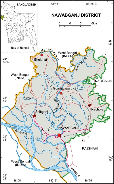
Map of Nawabganj District. | Upazilas & Thanas: |
Nawabganj District (rajshahi division) with an area of 1744.33 sq km, is bounded by West Bengal of India on the north, south and west, rajshahi and naogaon districts on the east. The district lies under barind tract and consists of diaras and charlands (sandbars develop in riverbed). Main rives are ganges, mahananda, Pagla, Moraganga and punarbhaba. Beel Bhatia, Beel Choral, Beel Hogla, Beel Singra, Sukrabari Damos, Maricha Dara, Beel Putimari, Beel Anal, Kumiradaha are the noted depressions. Annual average temperature: maximum 37.8°C, minimum 11.2°C; annual rainfall 1862 mm. | |
