Approximate Location Map
Large Map »
Latitude: 51.5821 / 51°34'55"N
Longitude: -2.577 / 2°34'37"W
OS Eastings: 360114
OS Northings: 187184
OS Grid: ST601871
Mapcode National: GBR JR.CGH5
Mapcode Global: VH882.8HZJ
Plus Code: 9C3VHCJF+R5
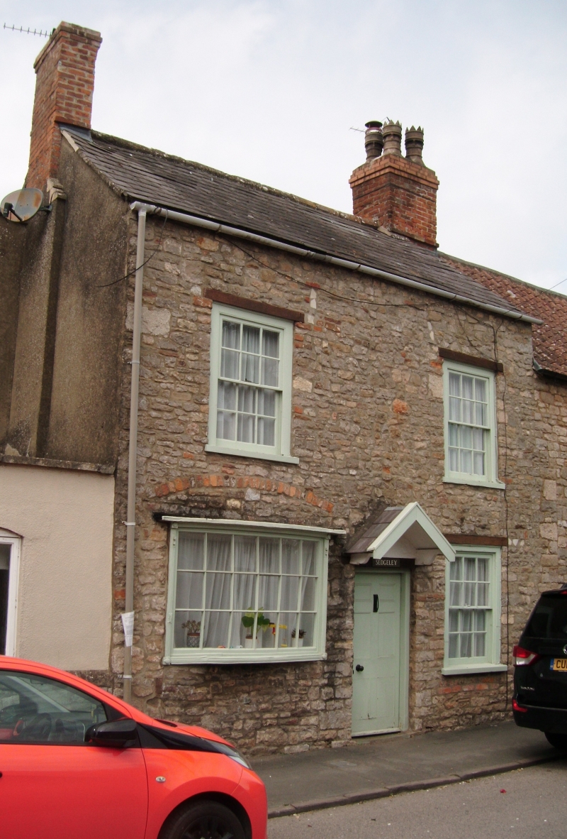
Entry Name: Sedgeley
Listing Date: 5 December 1984
Grade: II
Source: Historic England
Source ID: 1137101
English Heritage Legacy ID: 35326
ID on this website: 101137101
Location: Olveston, South Gloucestershire, BS35
County: South Gloucestershire
Civil Parish: Olveston
Built-Up Area: Olveston
Traditional County: Gloucestershire
Lieutenancy Area (Ceremonial County): Gloucestershire
Church of England Parish: Olveston
Church of England Diocese: Bristol
Tagged with: Building
ST 68 NW OLVESTON THE STREET (west side)
8/221 Sedgeley
- II
House. C18 with early C19 shop window. Rubble, slate roof with brick gable
stacks. 2 storeys, 2 windows, sashes in exposed boxes at 1st floor and ground
right, to left bow-fronted window with glazing bars, shutter fittings, reeded
jambs, central 6-panelled door with triangular hood. Interior: not inspected.
Listing NGR: ST6011487184
External links are from the relevant listing authority and, where applicable, Wikidata. Wikidata IDs may be related buildings as well as this specific building. If you want to add or update a link, you will need to do so by editing the Wikidata entry.


Other nearby listed buildings
