Category:Hankelow
Jump to navigation
Jump to search
English: Hankelow is a village and civil parish in the unitary authority of Cheshire East and the ceremonial county of Cheshire, England. It used to be a township within the township of Audlem, one mile away on the Nantwich Road. According to the 2001 Census, the parish had a population of 272.
village and civil parish in Cheshire East, Cheshire, UK  | |||||
| Upload media | |||||
| Instance of | |||||
|---|---|---|---|---|---|
| Location | Cheshire East, Cheshire, North West England, England | ||||
| Said to be the same as | Hankelow (Wikimedia duplicated page, civil parish) | ||||
 | |||||
Subcategories
This category has the following 2 subcategories, out of 2 total.
B
- Ball Farm, Cheshire (1 F)
H
- Hankelow Hall (2 F)
Media in category "Hankelow"
The following 56 files are in this category, out of 56 total.
-
 Audlem Road, Hankelow - geograph.org.uk - 2675074.jpg 640 × 480; 120 KB
-
 Bridge over River Weaver - geograph.org.uk - 438174.jpg 640 × 480; 94 KB
-
 Cardinal beetle (Pyrochroa coccinea) - geograph.org.uk - 438302.jpg 640 × 462; 41 KB
-
 Coole Pilate RWeaver.jpg 480 × 640; 131 KB
-
 Crossroads, Hankelow - geograph.org.uk - 1311035.jpg 640 × 426; 51 KB
-
 Dropping towards Hankelow Mill - geograph.org.uk - 4414351.jpg 997 × 1,200; 236 KB
-
 Field north of the A529, Corbrook - geograph.org.uk - 5004176.jpg 1,600 × 1,064; 439 KB
-
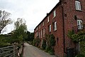
 Hall Lane, Hankelow - geograph.org.uk - 2674400.jpg 640 × 480; 129 KB
-
 Hankelow - geograph.org.uk - 3881656.jpg 3,852 × 2,625; 4.51 MB
-
 Hankelow - Manor Farm.jpg 640 × 480; 72 KB
-
 Hankelow Cottage - geograph.org.uk - 2675082.jpg 640 × 480; 130 KB
-
 Hankelow Court - geograph.org.uk - 1311003.jpg 640 × 426; 86 KB
-
 Hankelow Green - geograph.org.uk - 1311019.jpg 640 × 426; 57 KB
-
 Hankelow Green - geograph.org.uk - 1311032.jpg 640 × 426; 72 KB
-
 Hankelow Manor - geograph.org.uk - 1311010.jpg 3,456 × 2,304; 3.22 MB
-
 Hankelow Methodist Church - geograph.org.uk - 2675067.jpg 640 × 480; 118 KB
-
 Hankelow Mill - geograph.org.uk - 1311050.jpg 640 × 426; 59 KB
-
 Hankelow Mill, Audlem - geograph.org.uk - 6175930.jpg 889 × 653; 159 KB
-
 Hankelow.jpg 1,024 × 768; 448 KB
-

-
 Manor Farm, Hankelow.jpg 3,535 × 2,424; 1.89 MB
-
 Mill Pond - geograph.org.uk - 438220.jpg 640 × 480; 133 KB
-
 Monk's Lane, Hankelow - geograph.org.uk - 5002818.jpg 1,600 × 899; 275 KB
-

-

-

-
 Ornamental cones - geograph.org.uk - 1310988.jpg 640 × 426; 70 KB
-
 Park View - Hankelow - geograph.org.uk - 3881864.jpg 4,334 × 2,253; 3.72 MB
-

-
 River Weaver and Hankelow Mill - geograph.org.uk - 1311048.jpg 426 × 640; 59 KB
-
 Road to Hankelow Mill - geograph.org.uk - 1749126.jpg 3,296 × 2,472; 1.96 MB
-
 Side valley dropping to the lane to Hankelow Mill - geograph.org.uk - 5003857.jpg 1,600 × 1,064; 605 KB
-
 Sluice at Hankelow Mill - geograph.org.uk - 1311045.jpg 640 × 426; 78 KB
-
 Stile on South Cheshire Way - geograph.org.uk - 438206.jpg 640 × 480; 117 KB
-
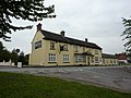
 Syhlet Lodge (formerly the White Lion PH) - geograph.org.uk - 1311027.jpg 3,456 × 2,304; 2.62 MB
-
 The Green, Hankelow - geograph.org.uk - 5001454.jpg 1,600 × 899; 305 KB
-
 The White Lion - Hankelow - geograph.org.uk - 3881660.jpg 2,529 × 2,779; 3.19 MB
-
 The White Lion in Hankelow - geograph.org.uk - 183752.jpg 640 × 480; 92 KB
-
 The White Lion, Hankelow - geograph.org.uk - 5001456.jpg 1,600 × 899; 240 KB
-
 View towards the mill - geograph.org.uk - 438215.jpg 640 × 480; 62 KB
-
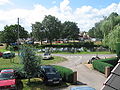
 Village stocks and pond - geograph.org.uk - 1311041.jpg 640 × 426; 75 KB
-
 Watermill - geograph.org.uk - 3902.jpg 640 × 480; 86 KB
-
 Cows near River Weaver - geograph.org.uk - 438224.jpg 640 × 480; 90 KB
-
 Farm Machinery By South Cheshire Way - geograph.org.uk - 438411.jpg 480 × 640; 122 KB
-
 Field and edge of Rookery Wood - geograph.org.uk - 438188.jpg 640 × 480; 74 KB
-
 Fields near Burrows Bridge - geograph.org.uk - 126272.jpg 640 × 480; 58 KB
-
 Footpath From Bennett's Bridge - geograph.org.uk - 438272.jpg 640 × 480; 53 KB
-

-
 Footpath Through Field - geograph.org.uk - 438283.jpg 640 × 480; 75 KB
-
 Road from the Mill to the A529 - geograph.org.uk - 438309.jpg 640 × 480; 113 KB
-
 Rubble at Manor Farm - geograph.org.uk - 438159.jpg 640 × 480; 98 KB
-
 Start of Footpath of A529 - geograph.org.uk - 438211.jpg 480 × 640; 109 KB
-
 Stream near Mill Plantation - geograph.org.uk - 438294.jpg 640 × 480; 112 KB
-
 Under the bridge - geograph.org.uk - 438400.jpg 640 × 480; 81 KB
-
 View over Brine Pit - geograph.org.uk - 438178.jpg 640 × 480; 60 KB
-
 Village Green - geograph.org.uk - 3901.jpg 640 × 480; 65 KB


_-_geograph.org.uk_-_438302.jpg)


_-_geograph.org.uk_-_1311027.jpg)


