Category:Staverton, Northamptonshire
Jump to navigation
Jump to search
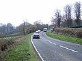
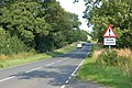
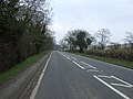
English: Staverton is a village in the southwest of Northamptonshire, England. It is 2.3 miles west of Daventry, 7.9 miles east of Southam and 15.3 miles east of Royal Leamington Spa. It straddles the A425 road from Daventry to Leamington.
village and civil parish in Northamptonshire, United Kingdom  | |||||
| Upload media | |||||
| Instance of | |||||
|---|---|---|---|---|---|
| Location | West Northamptonshire, Northamptonshire, East Midlands, England | ||||
| Population |
| ||||
| Area |
| ||||
| Said to be the same as | Staverton (Wikimedia duplicated page, civil parish) | ||||
 | |||||
Subcategories
This category has only the following subcategory.
Media in category "Staverton, Northamptonshire"
The following 145 files are in this category, out of 145 total.
-
 A425 heading east into Staverton - geograph.org.uk - 3906936.jpg 640 × 480; 72 KB
-
 A425 looking up the hill to Staverton - geograph.org.uk - 1416312.jpg 640 × 426; 136 KB
-
 A425 towards Daventry - geograph.org.uk - 3906929.jpg 640 × 480; 68 KB
-
 A425 towards Daventry - geograph.org.uk - 3907312.jpg 640 × 480; 73 KB
-
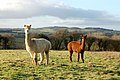 Alpacas at Staverton Hall - geograph.org.uk - 1634363.jpg 640 × 426; 82 KB
-

-
 Barn on a hillside near Berry Fields - geograph.org.uk - 1635857.jpg 640 × 426; 78 KB
-

-
 Bates Farm from the Jurassic Way - geograph.org.uk - 2212804.jpg 4,000 × 3,000; 2.86 MB
-
 Below the hill north of Staverton - geograph.org.uk - 1634361.jpg 640 × 426; 71 KB
-

-
 Biomass crop west of Staverton - geograph.org.uk - 1498992.jpg 640 × 426; 111 KB
-

-
 Close to Berry Fields - geograph.org.uk - 5234790.jpg 480 × 640; 78 KB
-

-
 Cottages in Staverton - geograph.org.uk - 6221435.jpg 1,024 × 680; 240 KB
-

-
 Daventry Road - geograph.org.uk - 5233755.jpg 640 × 480; 50 KB
-
 Daventry Road, Staverton - geograph.org.uk - 3294948.jpg 1,280 × 856; 412 KB
-
 Daventry Road, Staverton - geograph.org.uk - 3907306.jpg 640 × 480; 63 KB
-
 Daventry to Leamington Road at Staverton Hill 23rd April 2008 (1).JPG 2,560 × 1,920; 1.24 MB
-

-
 Entering Staverton - geograph.org.uk - 3906941.jpg 640 × 480; 93 KB
-

-
 Entrance to Upper farm, Newbold Grounds - geograph.org.uk - 1416209.jpg 640 × 433; 115 KB
-

-
 Farm track near Vine Tree Farm - geograph.org.uk - 3907296.jpg 640 × 480; 68 KB
-
 Farmland north of the A425 - geograph.org.uk - 3906927.jpg 640 × 480; 60 KB
-
 Farmland south of Staverton - geograph.org.uk - 1634167.jpg 640 × 426; 87 KB
-
 Farmland south of Staverton - geograph.org.uk - 3907291.jpg 640 × 480; 43 KB
-
 Felled tree north of Staverton - geograph.org.uk - 1634359.jpg 640 × 426; 105 KB
-
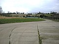
 Football pitches - Staverton - geograph.org.uk - 3297142.jpg 1,280 × 856; 340 KB
-

-

-
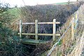
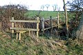
 Footbridge over brook north of Staverton - geograph.org.uk - 1634967.jpg 473 × 600; 128 KB
-

-

-

-

-
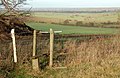
 Footpath to Flecknoe, Staverton - geograph.org.uk - 1634195.jpg 640 × 426; 95 KB
-

-
-
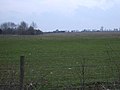
 Grazing west of Staverton - geograph.org.uk - 3906935.jpg 640 × 480; 57 KB
-

-
 Greenacres, Hellidon Road, Staverton - geograph.org.uk - 1634141.jpg 640 × 426; 76 KB
-
 Harvest time near Staverton Lodge - geograph.org.uk - 4640276.jpg 4,320 × 3,240; 5.39 MB
-

-
 Hellidon Road south of Staverton - geograph.org.uk - 1634154.jpg 640 × 426; 114 KB
-

-
 House on Church Street, Staverton - geograph.org.uk - 3907303.jpg 640 × 480; 59 KB
-
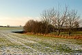
 Lingering snow north of Staverton - geograph.org.uk - 1634947.jpg 600 × 399; 43 KB
-

-

-

-

-

-
 Looking north from Staverton Hall - geograph.org.uk - 1634193.jpg 640 × 426; 73 KB
-

-

-

-

-
-
 Manor Road - geograph.org.uk - 5233543.jpg 640 × 480; 64 KB
-
 Manor Road, Staverton - geograph.org.uk - 3301303.jpg 1,280 × 852; 308 KB
-

-

-
 Oakham Lane, Staverton - geograph.org.uk - 3299795.jpg 1,280 × 857; 325 KB
-

-

-
 Phonebox in Staverton - geograph.org.uk - 1634196.jpg 444 × 600; 80 KB
-

-
-

-
-

-

-
 Remains of a window - geograph.org.uk - 6221338.jpg 1,024 × 680; 298 KB
-
 Road heading south from Staverton - geograph.org.uk - 3907294.jpg 640 × 480; 85 KB
-
 Ruin beside the Jurassic Way - geograph.org.uk - 2197288.jpg 4,000 × 3,000; 2.9 MB
-
 Seat on the Jurassic Way - geograph.org.uk - 2197331.jpg 4,000 × 3,000; 2.86 MB
-
 Sheep feeding south of Staverton - geograph.org.uk - 1634159.jpg 640 × 418; 58 KB
-

-
 Staverton - geograph.org.uk - 68134.jpg 640 × 480; 92 KB
-
 Staverton 10 - panoramio.jpg 2,448 × 3,264; 1.79 MB
-
 Staverton 22,04,2007.JPG 2,560 × 1,920; 479 KB
-
 Staverton 7 - panoramio.jpg 3,264 × 2,448; 2.64 MB
-
 Staverton 8 - panoramio.jpg 3,264 × 2,448; 2.77 MB
-
 Staverton 9 - panoramio.jpg 3,264 × 2,448; 2.53 MB
-
 Staverton Acres - geograph.org.uk - 1192682.jpg 480 × 640; 97 KB
-
 Staverton Crossroads - geograph.org.uk - 1182753.jpg 640 × 480; 54 KB
-
 Staverton crossroads - geograph.org.uk - 1634184.jpg 640 × 415; 86 KB
-
 Staverton Farm - geograph.org.uk - 4514373.jpg 1,024 × 768; 127 KB
-
 Staverton Farmland - geograph.org.uk - 2648932.jpg 640 × 424; 40 KB
-
 Staverton Hall and barns - geograph.org.uk - 1634203.jpg 640 × 410; 77 KB
-
 Staverton Hall Farm barns - geograph.org.uk - 1634364.jpg 640 × 429; 102 KB
-
 Staverton Hall frontage - geograph.org.uk - 1634362.jpg 640 × 423; 56 KB
-
 Staverton Lodge - geograph.org.uk - 2648247.jpg 640 × 480; 113 KB
-
 Staverton Lodge - geograph.org.uk - 2649629.jpg 640 × 480; 124 KB
-
 Staverton Northamptonshire.png 674 × 705; 13 KB
-
 Staverton Parish Church 22,04,2007.JPG 2,560 × 1,920; 1.1 MB
-
 Staverton village 22,04,2007 (3).JPG 2,560 × 1,920; 1.13 MB
-
 Staverton Village Green - geograph.org.uk - 1181605.jpg 640 × 480; 59 KB
-
 Staverton Village Green - geograph.org.uk - 1192673.jpg 640 × 480; 109 KB
-
 Staverton village, The Countryman Pub 22,04,2007 (5).JPG 2,560 × 1,920; 1.1 MB
-
 Staverton Water Treatment Works - geograph.org.uk - 1182742.jpg 640 × 480; 51 KB
-
 Staverton, Northants - View N along Manor Rd - geograph.org.uk - 4288683.jpg 1,024 × 768; 168 KB
-
 Staverton-Glebe Lane - geograph.org.uk - 1182702.jpg 640 × 550; 76 KB
-
 Staverton-The Woodlands - geograph.org.uk - 1192677.jpg 640 × 480; 136 KB
-
 Staverton-Well Lane - geograph.org.uk - 1182716.jpg 480 × 640; 124 KB
-

-
 Stile beside Hellidon Road, Staverton - geograph.org.uk - 1634144.jpg 547 × 640; 137 KB
-
 Stile north of Staverton Hall Farm - geograph.org.uk - 1634199.jpg 536 × 640; 169 KB
-
-
 Stile opposite The Countryman, Staverton - geograph.org.uk - 1634183.jpg 640 × 424; 116 KB
-
 The Countryman pub, Staverton - geograph.org.uk - 3906943.jpg 640 × 480; 55 KB
-

-
 The Countryman, Staverton - geograph.org.uk - 3298603.jpg 1,280 × 856; 345 KB
-
 The Green. Staverton - geograph.org.uk - 802878.jpg 640 × 480; 105 KB
-
 The tower of Staverton church - geograph.org.uk - 6221331.jpg 680 × 1,024; 260 KB
-
 The Woodlands, Staverton - geograph.org.uk - 1634202.jpg 640 × 426; 121 KB
-

-
 Track to sewage works - geograph.org.uk - 3906938.jpg 640 × 480; 90 KB
-

-

-

-
-
 Tree north of Staverton Hall - geograph.org.uk - 1634190.jpg 577 × 640; 160 KB
-
 Trees north of Staverton Hall - geograph.org.uk - 1634366.jpg 640 × 426; 120 KB
-

-
 Undulating farmland near Staverton - geograph.org.uk - 1634957.jpg 640 × 426; 89 KB
-
 Unused byre north of Staverton - geograph.org.uk - 1634941.jpg 640 × 426; 86 KB
-
 Village Green, Staverton - geograph.org.uk - 2197338.jpg 4,000 × 3,000; 2.88 MB
-

-

-

-
 Barns by the A425 west of Staverton - geograph.org.uk - 1416316.jpg 640 × 409; 87 KB
-
 Curious cattle west of Staverton - geograph.org.uk - 1416317.jpg 640 × 447; 111 KB
-
 Staverton - geograph.org.uk - 119545.jpg 640 × 480; 196 KB
-
 Staverton - geograph.org.uk - 120323.jpg 480 × 640; 63 KB
-
 Staverton - geograph.org.uk - 67818.jpg 640 × 480; 136 KB
-
 Staverton - geograph.org.uk - 68132.jpg 640 × 480; 128 KB
-
 Staverton - geograph.org.uk - 68136.jpg 640 × 480; 81 KB
-
 Staverton - geograph.org.uk - 68138.jpg 640 × 480; 140 KB
-
 Staverton Fields - geograph.org.uk - 119554.jpg 640 × 480; 106 KB
-


.JPG)
_and_Staverton_Hill_(skyline)_-_geograph.org.uk_-_1415966.jpg)


_-_geograph.org.uk_-_1634969.jpg)
_-_geograph.org.uk_-_1634973.jpg)


_-_geograph.org.uk_-_1635851.jpg)
_-_geograph.org.uk_-_1635853.jpg)
_-_geograph.org.uk_-_1635856.jpg)
_-_geograph.org.uk_-_1634919.jpg)
_-_geograph.org.uk_-_1634923.jpg)


.JPG)


.JPG)


