File:Islas del Atlántico Sur department.svg
Jump to navigation
Jump to search

Size of this PNG preview of this SVG file: 384 × 599 pixels. Other resolutions: 154 × 240 pixels | 307 × 480 pixels | 492 × 768 pixels | 656 × 1,024 pixels | 1,312 × 2,048 pixels | 1,037 × 1,618 pixels.
Original file (SVG file, nominally 1,037 × 1,618 pixels, file size: 239 KB)
Captions
Captions
Add a one-line explanation of what this file represents
Summary[edit]
| Description |
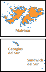
Español: Mapa del departamento de Islas del Atlántico Sur.
Los territorios que abarca el departamento son administrados por el Reino Unido pero reclamados por Argentina. |
| Date | |
| Source |
This file was derived from: |
| Author |
|
Licensing[edit]

|
Permission is granted to copy, distribute and/or modify this document under the terms of the GNU Free Documentation License, Version 1.2 or any later version published by the Free Software Foundation; with no Invariant Sections, no Front-Cover Texts, and no Back-Cover Texts. A copy of the license is included in the section entitled GNU Free Documentation License. |
If this file is eligible for relicensing, it may also be used under the Creative Commons Attribution-ShareAlike 3.0 license. The relicensing status of this image has not yet been reviewed. You can help.
|
File history
Click on a date/time to view the file as it appeared at that time.
| Date/Time | Thumbnail | Dimensions | User | Comment | |
|---|---|---|---|---|---|
| current | 03:45, 2 January 2018 | | 1,037 × 1,618 (239 KB) | Janitoalevic (talk | contribs) | texto |
| 03:44, 2 January 2018 |  | 1,037 × 1,618 (180 KB) | Janitoalevic (talk | contribs) | . | |
| 03:33, 2 January 2018 |  | 1,037 × 1,618 (176 KB) | Janitoalevic (talk | contribs) | . | |
| 03:30, 2 January 2018 |  | 1,100 × 1,720 (179 KB) | Janitoalevic (talk | contribs) | User created page with UploadWizard |
You cannot overwrite this file.
File usage on Commons
The following page uses this file:
File usage on other wikis
The following other wikis use this file:
- Usage on ast.wikipedia.org
- Usage on es.wikipedia.org
- Usage on eu.wikipedia.org
- Usage on fr.wikipedia.org
- Usage on it.wikipedia.org
- Usage on nn.wikipedia.org
- Usage on no.wikipedia.org
- Usage on pt.wikipedia.org
- Usage on ru.wikipedia.org
- Usage on sv.wikipedia.org