
About Cross River State
History
Cross River State is one of the 36 states of the Federal Republic of Nigeria. The political evolution of Cross River State started during the colonial era, when Calabar and Ogoja served as the administrative headquarters of Calabar and Ogoja Provinces respectively. On the 27th of May, 1967, the two provinces, excluding the Igbo-speaking areas, were carved out of the then Eastern Region of Nigeria by the General Gowon military administration to form the South Eastern State. When the nineteen states structure came into effect in 1987 the South Eastern State was renamed Cross River State. The present Cross River State come into being on 23rd of September, 1987, when the then military administration again restructured the country from its nineteen states structure to twenty-one, Akwa Ibom State was carved out from the old Cross River State.
Geographical Location
Cross River State is located within the tropical rain forest belt of Nigeria. It lies between latitude 4o 28’ and 6o 55’ North of the Equator and longitude 7o 50’ and 9o 28’ East of the Greenwich meridian. It shares common boundaries with Republic of Cameroon in the east, Benue State in the north, Ebonyi and Abia States in the west, Akwa Ibom State in the southwest and the Atlantic Ocean in the south. It has a total landmass of about 23,000 km2. Arising from its location, the state enjoys a tropical climate with the Obudu Plateau at an altitude of 1,595.79 metres above sea level enjoying a temperate climate. The state records heavy rainfall during the wet season (April – November). At least five distinct ecological zones are represented in the state ranging from mangrove and swamp forests towards the coast, tropical rain forests further inland, and savannah woodlands in the northern parts of the state. The highlands of Obudu Plateau offer montane type vegetation. The favourable climate of tropical, humid, dry and wet seasons gives rise to rich agricultural lands, thus encouraging both perennial and annual crop cultivation.
Cross River State is home to the Cross River gorilla (Gorilla gorilla diehli), recognised as a distinct and critically endangered subspecies by the Primate Specialist Group (PSG) of the IUCN Species Survival Commission (SSC) in February 2000. It is considered the rarest and most endangered subspecies of gorillas. They are also the western-most gorillas in the world. With an estimated total population of 250 individuals, the Cross River gorilla is rarer than the Mountain gorilla of the Virunga’s in East Africa. Eighty five (85) tree species belonging to 68 genera and 26 families considered endangered by the Forestry Research Institute of Nigeria are found in the forests of Cross River State. The State, with its underlying crystalline basement rocks is rich, in oil in its coastal regions and other identified mineral resources such as limestone, quartz, natural gas, clay, salt, tin, granite, basalt, lead/zinc, manganese, gypsum, barite’s, uranium and mica, some of which are yet to be exploited.
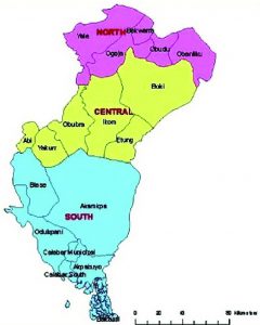
Land Area and Population
Cross River State has a total land area of 23,000 km2. The population of the State in 2021 is estimated at 4,000,000 giving a population density of 174 persons per km2. The gender distribution of the population is approximately 50/50.
Climate and Vegetation
Cross River State has a tropical humid climate with distinct wet and dry seasons occurring in April – November, and December – March respectively.
The vegetation of the State ranges from the mangrove forests moving inland and the Savannah woodland in the Northern fringe of the State. The high lands of the Obudu Plateau have a unique type of vegetation with a temperate climate that makes the Plateau a tourist haven. The varied ecological zones of the State makes it rich in agriculture products. A variety of crops like rubber, cocoa, cashew, castor seeds, yam, cocoyam, cassava, maize, melon, pineapple, plantain, banana, groundnut, and assorted vegetables, etc. are produced in the State.
People and Culture
Cross River State has a current estimated population of about 4.0 million, with Calabar as its capital. It is referred to as a miniature Nigeria because of its diversity in ethnic composition as well as its natural heritage both of which have the potential of greatly enhancing the tourism industry in the State and country at large. The people are noted for their warmth and hospitality, arguably rated unequalled in Nigeria. In spite of the numerous dialectical groups that exists in the state, there are three dominant language groups. These are Efik, Bekwarra and Ejagham. Nevertheless, all the language groups have a common linguistic root that is traceable to one ancestry. This perhaps explains why striking similarities cold be discerned from their music, dance, drumming and other artistic forms.
Cross River State is mainly an agricultural state. About 75% of its people engage in subsistence agriculture. It is now common knowledge that the State’s food quality and varieties are legendary. The food quality ranks amongst the best African dishes with examples of delicacies such as Edikang Ikong, Afang, Ekpang Nkukwo, Afia Eferre, Beniseed soup, Eruru soup, Melon cakes, snails, bushmeat and plantain. Traditional festivals relating to farming activities abound in the State. These festivals, which are observed annually to celebrate the usually rich harvest season, offer occasions for the reunion of families, friends and well-wishers from afar and near. The festivals are usually spiced with alluring and captivating dances, which express the intrinsic values of the people. This vast array of dances and idioms that surround them aptly form the basis of both culture and tourism for which Cross River State is renown.
The above content is mostly sourced from “CR-SEEDS, Cross River State Economic Empowerment and Development Strategy 2005 – 2007, State Planning Commission Calabar, Cross River State”