 Route Editor

| Guide | ♦ | 172 Triplogs | 3 Topics |
details | drive | permit | forecast | route |
stats |
photos | triplogs | topics | location |
| 1.2k | 172 | 3 |
Great! by Abe  History Col. Bob Groom (Kentucky 1824-1899) came to Arizona in 1862. Although he lived principally by prospecting and mining, Groom was also a surveyor who surveyed the townsite of Prescott. He was a member of the first Arizona Territorial Legislature. An increasing number of residents settled in the Groom Creek area, but few chose to remain year-round because of the severity of the winters. However, by 1901 there were enough families at the location of the present Groom Creek settlement to warrant establishing a post office. The name selected was Oakdale because of the situation of the community in a grove of oaks. Officially the name lasted about six weeks, at which time it was changed to Groom Creek. The townsite for Groom Creek City was recorded in Prescott in 1903.
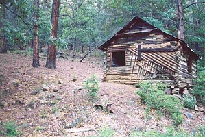
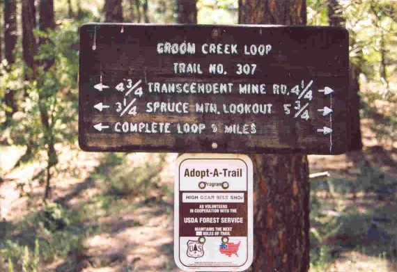
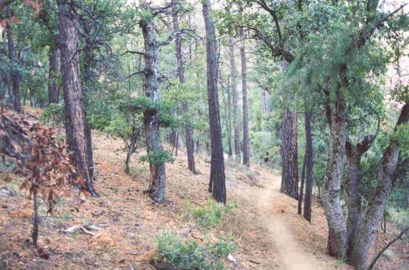
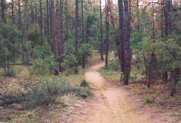
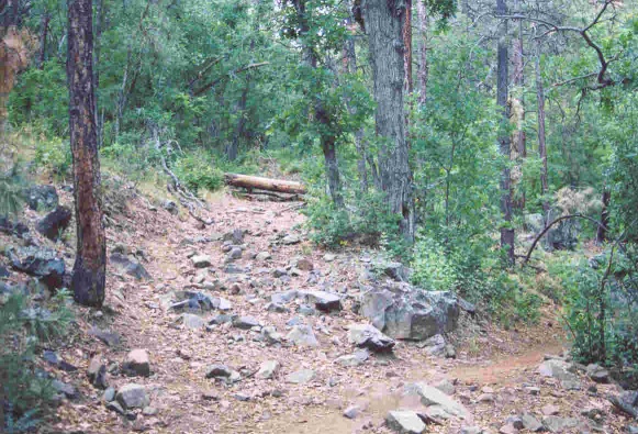
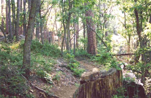
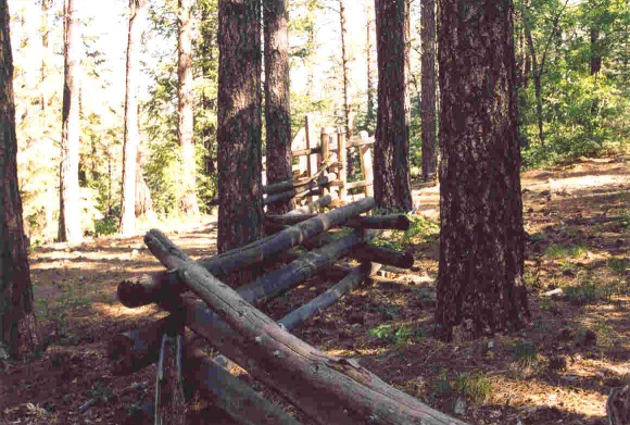
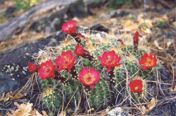
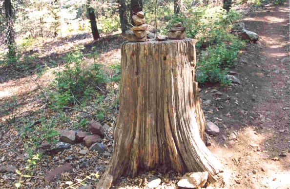
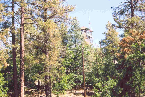
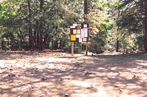
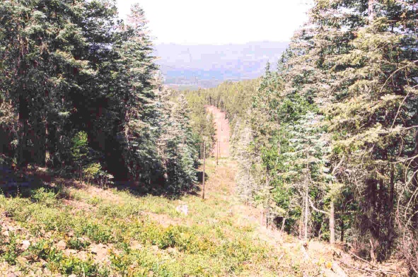
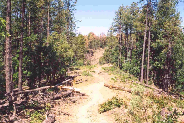
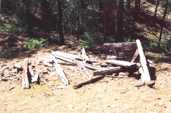
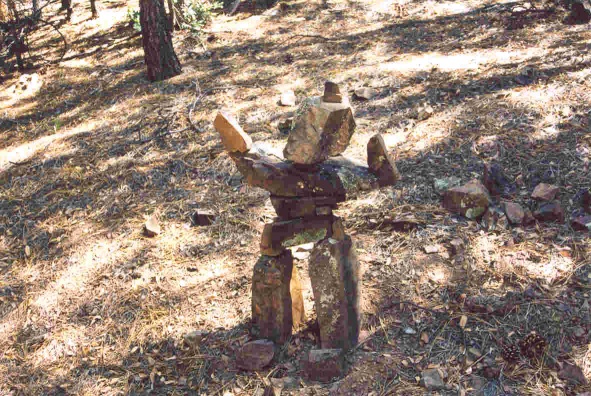
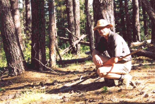
Hike The trailhead was empty when I arrived around 5:30 in the morning. The sun had not broken over the eastern horizon, splashing us with a new day: it does not matter anyhow, at 7696 feet, Spruce Mountain would block the early morning sunshine a little longer. The only hint would be the bright glow of sunlight in the top of the trees and on distant mountains to the west. The air was chilled when I stepped out of my Jeep. Refreshing to feel. Not a soul was in sight; I was alone here. The only sounds were my own as I made ready for the hike and a dog barking at something, anything, real or unreal from a nearby residence. Ready, I launched past the trailhead sign and began my hike. Many folks prefer to hike the loop in a clockwise direction or turning left at the sign. I rather go counter-clockwise to the right of the sign. The trail to the lookout tower is longer then, but by my way of thinking, by the time I get up there, most of the trail is done, and then it is downhill all the way. Most of the trail is well marked and easy to follow. However, near the trailhead, the trail is a bit butchered by dirt roads, old roads, and old trails crisscrossing around the area. It is easy to get sidetracked, as I found out later. The trail begins its climb to the top gradually. I hardly notice the rise. I was taking in the feel of the cool air on my body, the shadows of the forest, the smell of nature, and the singing of the birds. Delightful really. Until I heard something crashing through the brush away from me! I stopped and looked deep through the woods and shadows to see if I could catch any movement. The loud thrashing ceased, so I looked and listened more intently; until, yes, movements down the trail about 75 yards. It was a doe, and she stopped to look my way like she was studying me as I admired her. She strolled away through the trees. I surveyed the surroundings to see if I could spot any more deer following her, especially a buck, to no avail. An hour into the hike, the trail turns to the right and an old road appears to go straight. I took the road to visit Coles' cabin. I do not know anything about the cabin and the Coles, other than a warning painted above the gaping window, "KEEP OUT THE COLES". I imagine a miner built the cabin. I have never looked hard for a dump, a rich source to determine who may have lived here. The only thing I have found beyond the cabin is what appears to be a corral built from native pine. We press on, leaving the cabin and returning to the trail. From time to time, the trail appears lush and green, giving the impression we are not in a drought. It is easy for me while walking to let my mind wander, daydream about having a cabin out in the middle of nowhere, ponder about the world's problems, and conclude I cannot solve it, nor anyone else. To fantasies about meeting a wild, beautiful, intelligent woman on the trail who appreciates hiking as much as I do. And on occasions, I try to compose haiku's in my mind: friend is the breeze of nature caressing my face After a couple of hours, my walk comes to the junction of Isabella Trail #377. I stopped to take a break. From this point, the trek is enjoyable. When I resume my walk, I pass a forest service helo pad sign to my left. I enjoy my solitude and thoughts alone. I passed a fence, somewhat upset that somebody left the horse gate opened, so I shut it. My pace quickens as I knew I was getting closer to my objective and a late breakfast. But not so fast that I did not stop to admire the colorful blooms of a cactus or even wonder about a pile of rocks on top of a tree stump. What the heck is the purpose of that? A cairn to mark a well-used trail, or was someone making a statement? Who knows, except the person who placed them there? I was getting close. I passed a hiker going the other way talking on his cell phone, another fence, a small brick building, a large propane tank next to it, and a small tower with an antenna array. The opening appeared, and I spotted the lookout tower in front of me. It was open for business because I noted the windows opened and an American flag fluttering in the breeze. Today I decided not to visit. On my right was forest road 52A and the small picnic area. On my left, Trail #307 continues. The first matter to attend to before I continue, my late breakfast. I picked a picnic table under the shade of the pines, settled down, and devoured my well-deserved treat of peanut butter and jelly sandwich, yogurt in a tube, and apple sauce. Washing it all down with water. After my appetite was slated and I rested for a few: I saddled up and moved out. I was only on the trail for a few moments when I stopped short in surprise. My God, there is a wide swath cutting into the forest parallel to the small power line. It was as if a large lawnmower was placed on earth and cut down the side of the mountain through the forest, leaving the poles carrying the power up the mountain alone! Clean, sterile, bare. I stood staring down the gash in disbelieve, fascinated, and sadden: I now understood the severity of our drought and the natural cancerous blight of the bark beetle. The swath was not here last year when I hiked the trail. I now felt exposed as I walked down the mountain, the cut crisscrossing the trail every once in a while. At one point, I caught the view to the west and spied the blackened remains of the forest from last year's Indian Fire. The walk back was quick. I passed several hikers, a couple riding horses, and a mountain biker coming up the trail. I found the biker interesting as I yield for him because he was struggling uphill: it seems for every ten cranks on the pedal, he moved only a foot! Thinking about it, I calculated he would have cranked the pedal 171,600 from the start of the trail to the lookout tower! Marching on down the trail I spotted the remains of a collapsed cabin in a draw. Not much remains to tell the story. Near the trailhead on the right of the trail, I spotted the neatest thing I have ever seen. Rock Art! A human-made sculpture using the rocks around. Is it a man? Or, is it a woman? Maybe neither. Maybe it is a statement about humanity sharing and understanding the forest or the world. Or a wisecracking kid seeing a pile of rocks and seeing what he could do with them. Never mind, only the artist knows his reason. Not long after passing the rock art, I ran into a well-maintained dirt road. Do not do what I did and keep going; long story. Hook a right on the road, and the trailhead will be off to the left. And when I finally arrived, the trailhead was cram-packed! In closing, I love this trail, and aside from the swathin forest, which surprised me, I enjoy the feel of this trail in the morning. I think it makes an excellent conditioning trail for long hauls on other trails. And I have hiked it before climbs up Humphrey Peaks and down the Grand Canyon. A fantastic way to inventory a person's physical condition. Check out the Official Route and Triplogs. Gate Policy: If a gate is closed upon arrival, leave it closed after you go through. If it is open, leave it open. Leaving a closed gate open may put cattle in danger. Closing an open gate may cut them off from water. Please be respectful, leave gates as found. The exception is signage on the gate directing you otherwise. Leave No Trace and +Add a Triplog after your hike to support this local community.
| |||||||||||||||||||||||||||||||||||||||||||||||||||||||||||||||||||||||||||||||||||||||||||||||||||||||||||||||||||||||||||||||||||||||||||||||||||||||||||||||||||||||||||||||||||||||||||||||||||||||


