Kumysh
Kumysh is a village in Karachay-Cherkessia, North Caucasus and has about 5,190 residents. Kumysh is situated nearby to the hamlets Белая Гора and Belaya Gora.- Type: Village with 5,190 residents
- Description: human settlement in Karachayevsky District, Karachay-Cherkess Republic, Russia
- Address: Карачаевский район
Notable Places in the Area
Zelenchuk hydroelectric power plant
Power station
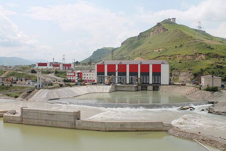
Photo: Сайга20К, CC BY-SA 4.0.
Zelenchuk hydroelectric power plant is a power station.
Localities in the Area
Khumar
Village
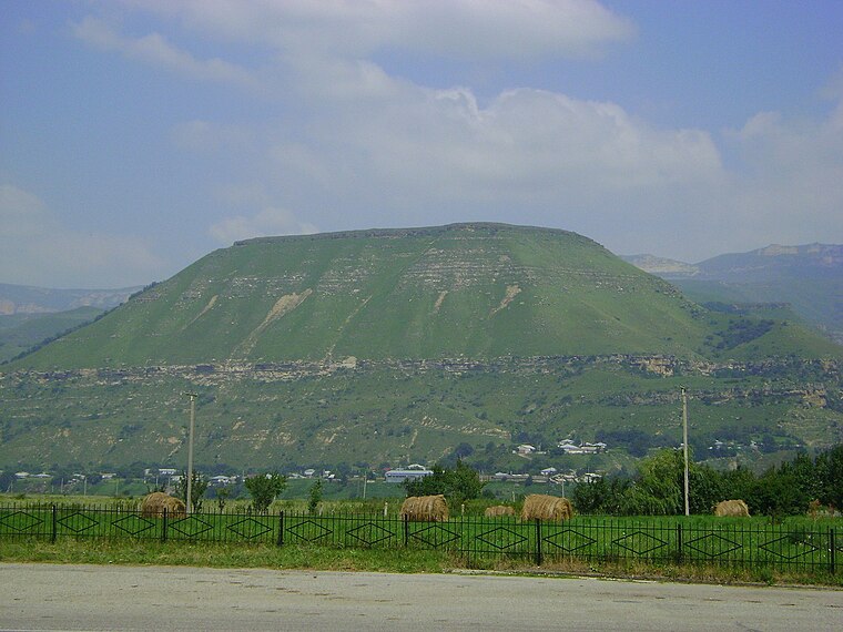
Photo: Achames, CC BY-SA 4.0.
Khumarinskoye gorodishche or Khumar is a ruined medieval fortress on the top of Mount Kalezh above the Kuban Gorge in the Greater Caucasus, near Khumara village, Karachaevsky district, Karachay–Cherkessia, Russia. Khumar is situated 3 km southeast of Kumysh.
Pravokubansky
Village

Photo: Сайга20К, CC BY-SA 4.0.
Pravokubansky is an urban locality in Karachayevsky District of the Karachay-Cherkess Republic, Russia. Pravokubansky is situated 3 km north of Kumysh.
Ordzhonikidzevsky
Village

Photo: LukaszKatlewa, CC BY-SA 3.0.
Ordzhonikidzevsky is an urban locality under the administrative jurisdiction of the town of republic significance of Karachayevsk in the Karachay-Cherkess Republic, Russia. Ordzhonikidzevsky is situated 4 km south of Kumysh.
Kumysh
- Categories: aul, administrative territorial entity of Russia, human settlement and locality
- Location: Karachay-Cherkessia, North Caucasus, Southern Russia, Russia, Eastern Europe, Europe
- View on OpenStreetMap
Latitude
43.88075° or 43° 52' 51" northLongitude
41.89736° or 41° 53' 51" eastPopulation
5,190Elevation
788 metres (2,585 feet)Open Location Code
8HM3VVJW+8WOpenStreetMap ID
node 642937207OpenStreetMap Feature
place=villageGeoNames ID
539218Wikidata ID
Q4247053Kumysh Satellite Map
© OpenStreetMap, Mapbox and Maxar
Also Known As
- Armenian: Կումիշ (Կարաչայ-Չերքեզիա)
- Armenian: Կումիշ
- Cebuano: Kumysh
- Chechen: Кумыш
- German: Kumysch
- Norwegian: Kumysj
- Ossetian: Хъуымис
- Russian: Кумыш (Карачаево-Черкесия)
- Russian: Кумыш (аул)
- Russian: Кумыш
- Podgornoye
Other Places Named Kumysh
Localities in the Area
- КумышVillage
- Белая ГораHamlet
- Belaya GoraHamlet
- Сары-ТюзVillage
- Sary-TyuzVillage, 2½ km north
Landmarks in the Area
- Музей защитников перевалов КавказаMuseum, 2½ km south
- Khumara HillfortArchaeological site, 2½ km southeast
- Нижний бассейн Зеленчукской ГЭСReservoir, 2½ km northwest
- Остатки сторожевой башни3 km north
- Грот и обзорный видScenic viewpoint, 3½ km west
Popular Destinations in North Caucasus
Discover Chechnya, North Ossetia, Kabardino-Balkaria and Ingushetia.
Escape to a Random Place
Discover other destinations in the world.
About Mapcarta. Thanks to Mapbox for providing amazing maps. Data © OpenStreetMap contributors and available under the Open Database License. Text is available under the CC BY-SA 4.0 license, excluding photos, directions and the map. Photo: Webster, CC BY-SA 2.5.