Vartej
Vartej is a census town in Bhavnagar district in the Indian state of Gujarat. Vartej has about 10,300 residents.Localities in the Area
Bhavnagar
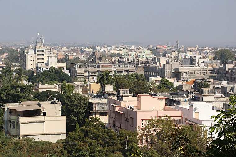
Photo: Bgag, CC BY-SA 3.0.
Bhavnagar is a city in the Saurashtran peninsula of Gujarat, India, known as an industrial hub excelling in salt and jewellery production, and is associated with Mahatma Gandhi, who went to university here.
Vartej
- Type: Village with 10,300 residents
- Description: human settlement in Bhavnagar Taluka, Bhavnagar district, Gujarat, India
- Categories: human settlement and locality
- Location: Bhavnagar, Gujarat, Western India, India, South Asia, Asia
- View on OpenStreetMap
Latitude
21.73974° or 21° 44' 23" northLongitude
72.06449° or 72° 3' 52" eastPopulation
10,300Elevation
31 metres (102 feet)Open Location Code
7JHJP3Q7+VQOpenStreetMap ID
node 1562249973OpenStreetMap Feature
place=villageGeoNames ID
1253381Wikidata ID
Q2738371Vartej Satellite Map
© OpenStreetMap, Mapbox and Maxar
Also Known As
- Bishnupriya: বারতেজ
- Cebuano: Vartej
- Chinese: Vartej
- Chinese: 瓦尔泰杰
- Chinese: 瓦爾泰傑
- Dutch: Vartej
- French: Vartej
- Gujarati: વરતેજ
- Hindi: वरतेज
- Indonesian: Vartej
- Italian: Vartej
- Malay: Vartej
- Min Nan Chinese: Vartej
- Nepali: वारतेज
- Newari: वारतेज
- Persian: ورتج
- Portuguese: Vartej
- Swedish: Vartej
- Vietnamese: Vartej
Other Places Named Vartej
Localities in the Area
- RajaparaVillage, 7 km west
- SihorTown, 11 km west
- BudhelVillage, 11 km southeast
- Bhavnagar PortSuburb, 17 km east
- SongadhTown, 18 km west
Landmarks in the Area
- Vartej railway stationRailway station
- Bhikada RiverRiver
- Shree Swaminarayan Main Temple BhavnagarHindu temple, 3 km northeast
- Sadbhavana Trust HospitalHospital, 4 km east
- Government HospitalHospital, 4 km north
Popular Destinations in Gujarat
Discover Ahmedabad, Dadra and Nagar Haveli, Surat and Vadodara.
Escape to a Random Place
Discover other destinations in the world.
About Mapcarta. Thanks to Mapbox for providing amazing maps. Data © OpenStreetMap contributors and available under the Open Database License. Text is available under the CC BY-SA 4.0 license, excluding photos, directions and the map. Description text is based on the Wikipdia page Vartej. Photo: Bgag, CC BY-SA 3.0.