Savatan
Savatan is a residence in Lavey-Morcles, Aigle District, Vaud. Savatan is situated nearby to the village Lavey-les-Bains and the bunker Fort de Dailly.Notable Places in the Area
St-Maurice railway station
Railway station
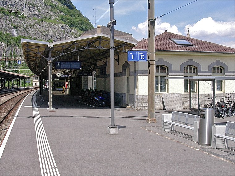
Photo: Albins, CC BY-SA 3.0.
St-Maurice railway station is a railway station in the municipality of Saint-Maurice, in the Swiss canton of Valais. St-Maurice railway station is situated 1½ km northwest of Savatan.
Fort de Dailly
Bunker

Photo: Sylenius, CC BY-SA 4.0.
The Fort de Dailly is the largest component of Fortress Saint-Maurice, which is in turn one of the three principal fortified regions of the National Redoubt of Switzerland. Fort de Dailly is situated 780 metres east of Savatan.
Fort du Scex
Castle
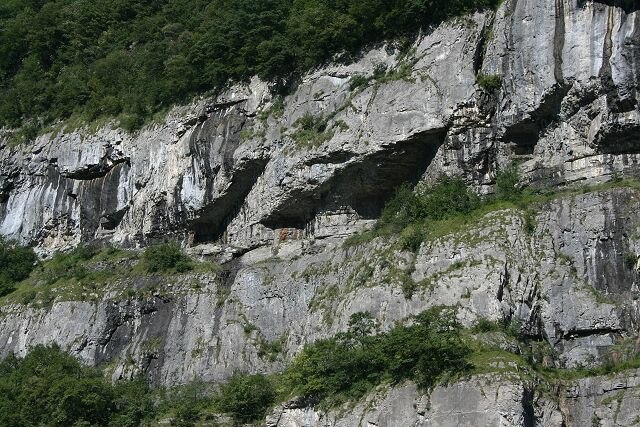
Photo: Wikimedia, CC BY-SA 3.0.
The Fort du Scex is a component of Fortress Saint-Maurice, which is in turn one of the three principal fortified regions of the National Redoubt of Switzerland. Fort du Scex is situated 2 km west of Savatan.
Localities in the Area
Lavey-les-Bains
Village
Lavey-les-Bains is a village in the district of Aigle in the canton of Vaud, Switzerland.
Lavey-Village
Village
Lavey-Village is a village in the district of Aigle in the canton of Vaud, Switzerland.
Morcles
Village
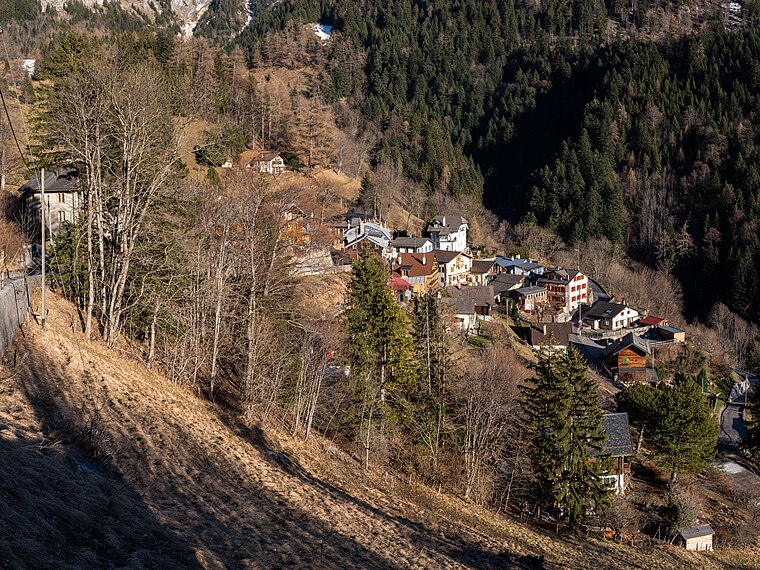
Photo: Espandero, CC BY-SA 4.0.
Morcles is a village and former municipality in the district of Aigle in the canton of Vaud, Switzerland.
Savatan
- Type: Residence
- Categories: locality, residential building and building
- Location: Lavey-Morcles, Aigle District, Vaud, Western Switzerland, Switzerland, Central Europe, Europe
- View on OpenStreetMap
Latitude
46.20947° or 46° 12' 34" northLongitude
7.01955° or 7° 1' 10" eastElevation
726 metres (2,382 feet)Open Location Code
8FR96259+QROpenStreetMap ID
node 3954362378OpenStreetMap Feature
place=isolated_dwellingGeoNames ID
2658776Savatan Satellite Map
© OpenStreetMap, Mapbox and Maxar
Localities in the Area
- DaillyLocality
- Les TerreauxNeighborhood
- VérolliezHamlet
- Saint-Maurice
- Les CaillettesLocality
Places in the Area
- Académie de PoliceBuilding
- Lavey, Front BastionnéBus stop, 410 metres west
- BEBECOGas station, 440 metres west
Escape to a Random Place
Discover other destinations in the world.
About Mapcarta. Thanks to Mapbox for providing amazing maps. Data © OpenStreetMap contributors and available under the Open Database License. Text is available under the CC BY-SA 4.0 license, excluding photos, directions and the map. Photo: Annickjaquillard, CC BY-SA 4.0.