El Pedregal
El Pedregal is a village in Rangel Municipality, Mérida and has an elevation of 3,260 metres. El Pedregal is situated nearby to the village La Mucuchache and the neighborhood San Isidro.Notable Places in the Area
Kettle Mucubají
Lake
Kettle Mucubají is a glacial lake located in Sierra Nevada National Park, in the Mérida State of Venezuela. Kettle Mucubají is situated 4 km northeast of El Pedregal.
Localities in the Area
Apartaderos
Town
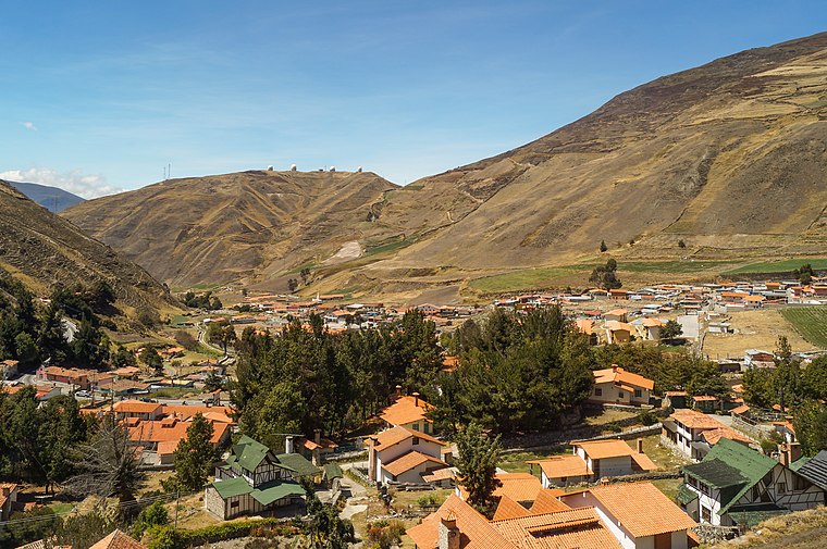
Photo: Rjcastillo, CC BY-SA 3.0.
Apartaderos is a small Andean town in Mérida State, Venezuela.
Mucuchíes
Town

Photo: Venex, CC BY-SA 3.0.
Mucuchíes is a town in the Rangel Municipality of Mérida State, Venezuela. Mucuchíes is situated 7 km southwest of El Pedregal.
El Pedregal
- Type: Village
- Category: locality
- Location: Rangel Municipality, Mérida, Andes, Venezuela, South America
- View on OpenStreetMap
Latitude
8.78031° or 8° 46' 49" northLongitude
-70.86041° or 70° 51' 38" westElevation
3,260 metres (10,696 feet)Open Location Code
67WFQ4JQ+4ROpenStreetMap ID
node 9046464696OpenStreetMap Feature
place=villageGeoNames ID
3642155El Pedregal Satellite Map
© OpenStreetMap, Mapbox and Maxar
Other Places Named El Pedregal
Localities in the Area
- La MucuchacheVillage
- San IsidroNeighborhood
- Llano AbajoHamlet
- Llano del HatoHamlet
- San Rafael de MucuchíesTown
Landmarks in the Area
- Cúpula Doble AstrógrafoObservatory
- Cúpula StockObservatory
- Museo de Astronomia a Ciencias Espaciales (MACE)Museum
- Cúpula RefractorObservatory
- Comando de la Guardia Nacional - OANPolice station
Popular Destinations in Mérida
Discover Mérida, Santo Domingo and El Vigía.
Escape to a Random Place
Discover other destinations in the world.
About Mapcarta. Thanks to Mapbox for providing amazing maps. Data © OpenStreetMap contributors and available under the Open Database License. Text is available under the CC BY-SA 4.0 license, excluding photos, directions and the map. Photo: Wikimedia, CC0.