Bois d'Enghien
Bois d'Enghien is a forest in Écaussinnes, Arrondissement of Soignies, Wallonia. Bois d'Enghien is situated close to the hamlet Baraque de Planches and the locality Belle Tête.Notable Places in the Area
Braine-le-Comte railway station
Railway station

Photo: Volapuk, CC BY-SA 3.0.
Braine-le-Comte railway station is a railway station in Braine-le-Comte, Hainaut, Belgium.
Écaussinnes railway station
Railway stop

Photo: Smiley.toerist, CC BY-SA 4.0.
Écaussinnes railway station is a railway stop.
Marche-lez-Écaussinnes railway station
Railway stop
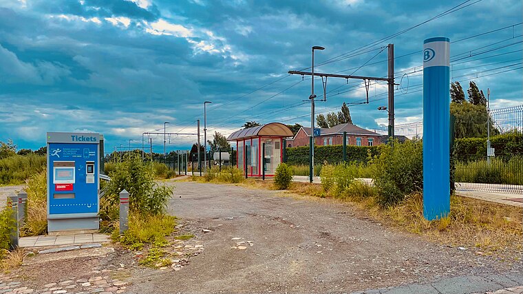
Photo: Japplemedia, CC BY-SA 4.0.
Marche-lez-Écaussinnes railway station is a railway stop.
Localities in the Area
Braine-le-Comte
Town

Photo: Jean-Pol GRANDMONT, CC BY 2.5.
Braine-le-Comte is a city and municipality of Wallonia located in the province of Hainaut, Belgium.
Arrondissement of Soignies
Town

Photo: Jean-Pol GRANDMONT, CC BY 3.0.
Soignies is a municipality of Wallonia located in the province of Hainaut, Belgium.
Naast
Village

Photo: Jean-Pol GRANDMONT, CC BY 2.5.
Naast is a village of Wallonia and a district of the municipality of Soignies, located in the province of Hainaut, Belgium, known by the wellspring of the river Zenne.Its population continued to increase throughout the nineteenth century.
Bois d'Enghien
- Type: Forest
- Location: Écaussinnes, Arrondissement of Soignies, Hainaut, Wallonia, Belgium, Benelux, Europe
- View on OpenStreetMap
Latitude
50.5761° or 50° 34' 34" northLongitude
4.1406° or 4° 8' 26" eastOpen Location Code
9F26H4GR+C6OpenStreetMap ID
way 28386499OpenStreetMap Feature
landuse=forestBois d'Enghien Satellite Map
© OpenStreetMap, Mapbox and Maxar
Other Places Named Bois d'Enghien
Localities in the Area
- Baraque de PlanchesHamlet
- Belle TêteLocality
- Bel-Air 2Neighborhood
- Barrière d'ÉcaussinnesHamlet
Landmarks in the Area
- Prairie aux sculpturesGrassland
- Ruines
- ND des Sept DouleursChurch
- Piste hippiqueBeach
- ParcGrassland
Popular Destinations in Hainaut
Discover Charleroi, Mons, Tournai and La Louvière.
Escape to a Random Place
Discover other forests in the world.
About Mapcarta. Thanks to Mapbox for providing amazing maps. Data © OpenStreetMap contributors and available under the Open Database License. Text is available under the CC BY-SA 4.0 license, excluding photos, directions and the map. Photo: Jean-Pol GRANDMONT, CC BY-SA 3.0.