MyTopo
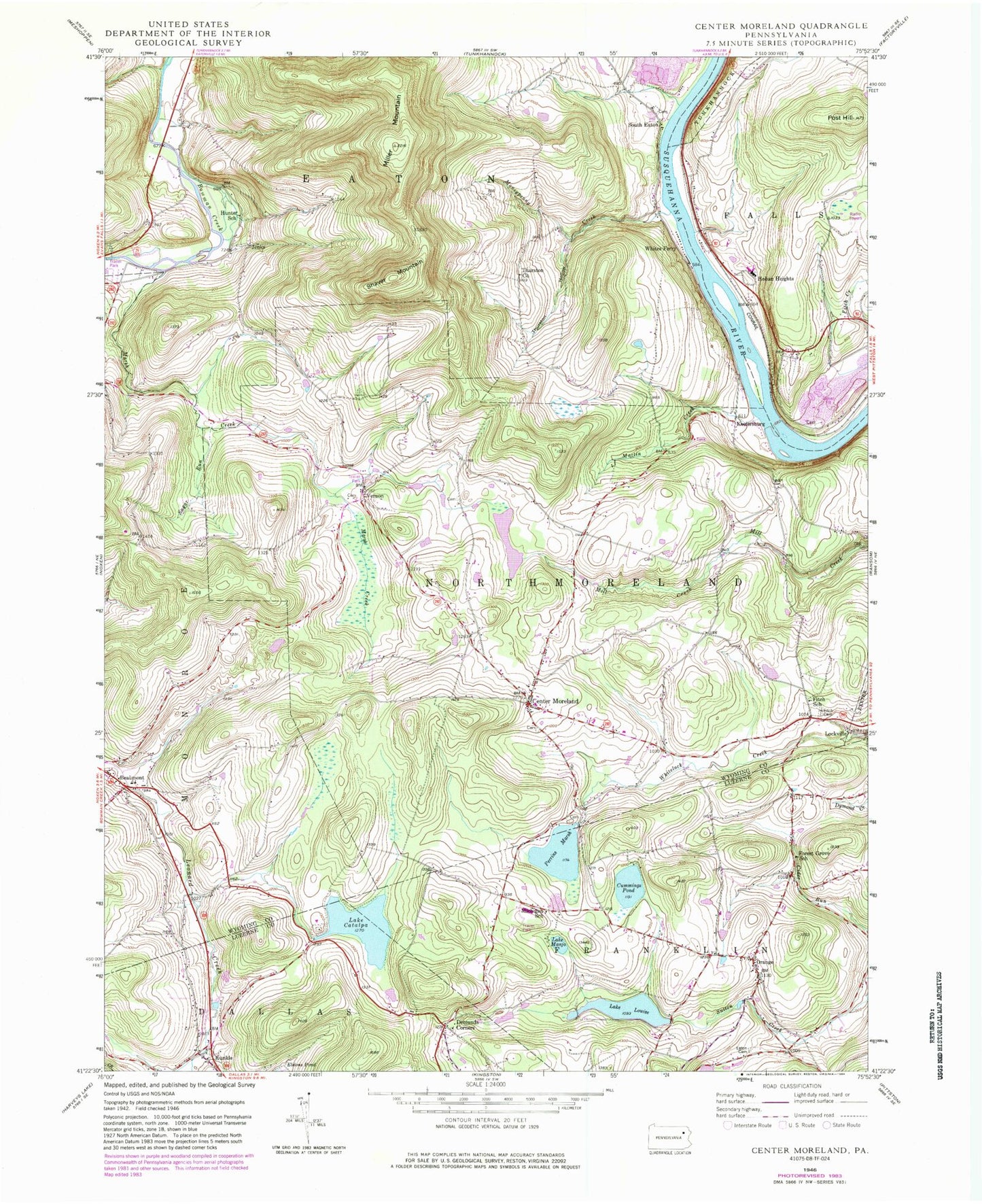
Classic USGS Center Moreland Pennsylvania 7.5'x7.5' Topo Map
Couldn't load pickup availability
Historical USGS topographic quad map of Center Moreland in the state of Pennsylvania. Typical map scale is 1:24,000, but may vary for certain years, if available. Print size: 24" x 27"
This quadrangle is in the following counties: Luzerne, Wyoming.
The map contains contour lines, roads, rivers, towns, and lakes. Printed on high-quality waterproof paper with UV fade-resistant inks, and shipped rolled.
Contains the following named places: Lake Louise Dam, Lake Manjo Dam, Lake Catalpa Dam, Perrins Marsh Dam, Hirsh Dam, Beaumont, Lake Catalpa, Center Moreland, Cummings Pond, Demunds Corners, Eaton Cemetery, Fitch Cemetery, Fitch School, Forest Grove School, Hunter School, Kunkle, Lockville, Lake Louise, Lake Manjo, Marsh Creek, Martin Creek, Michigan School, Miller Mountain, Moneypenny Creek, Orange, Perrins Marsh, Post Hill, Shaver Mountain, South Eaton, Sugar Run, Thurston Church, Thurston Hollow, Vernon, Whites Ferry, WARM-AM (Scranton), Mill City (historical), Hoban Heights, Jenks, Keelersburg, Twin Oaks Golf Course, Finchs Corners, Thurston, Township of Franklin, Township of Northmoreland, Kunkle Fire Company Station 122, Franklin Township Volunteer Fire Company Station 135, Northmoreland Township Volunteer Fire Company, Franklin Northmoreland Township Ambulance Station 535, Orange Methodist Church Cemetery