
MyTopo
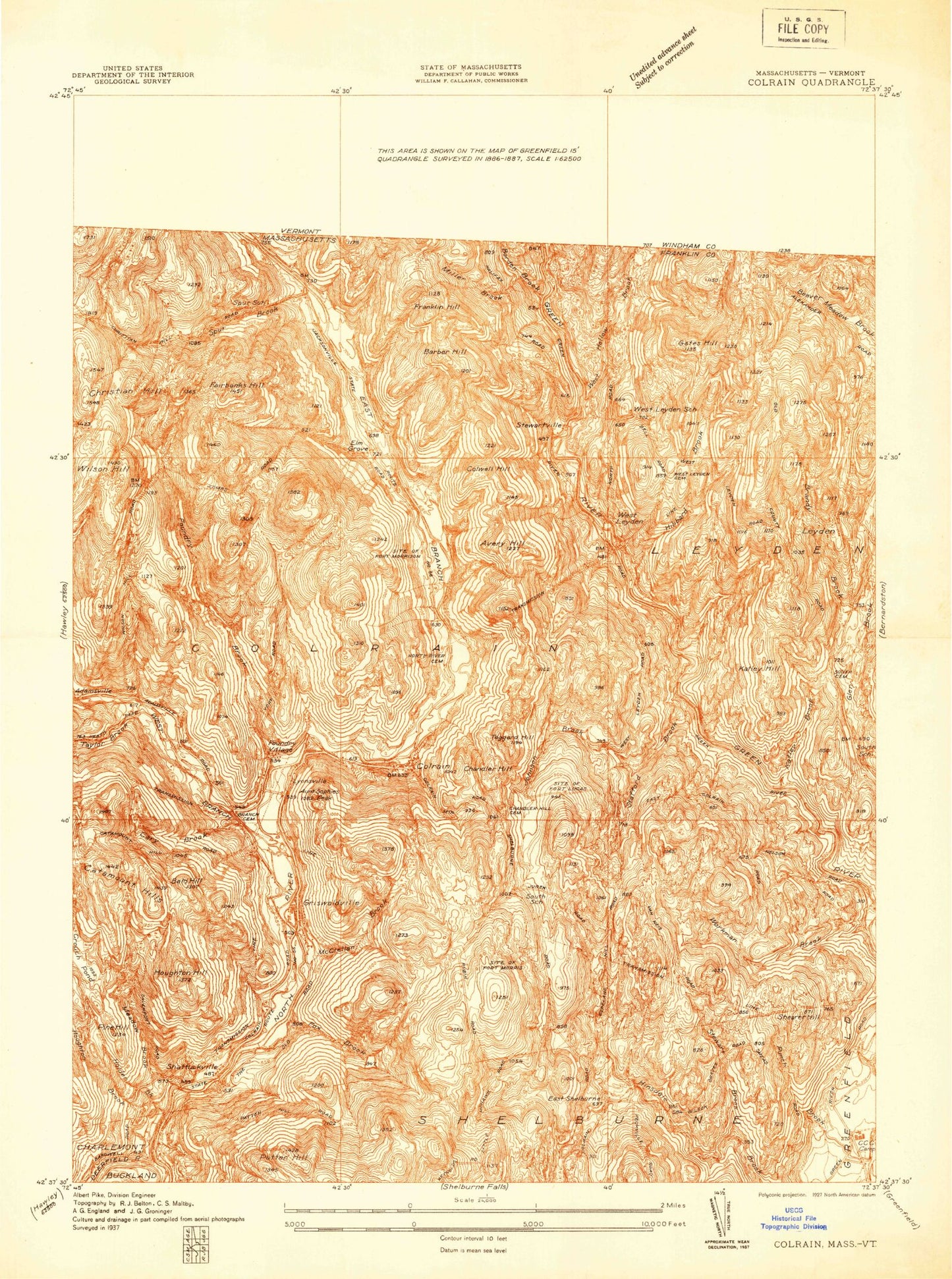
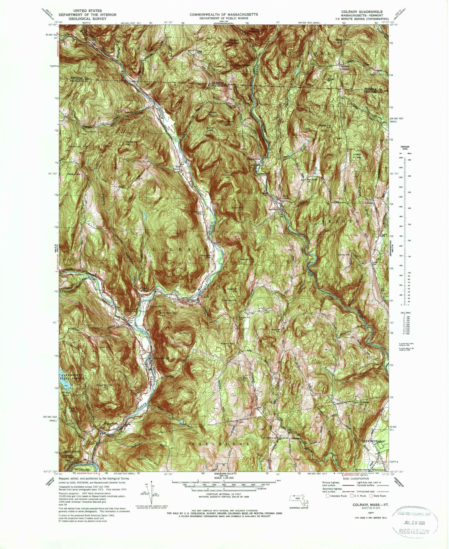
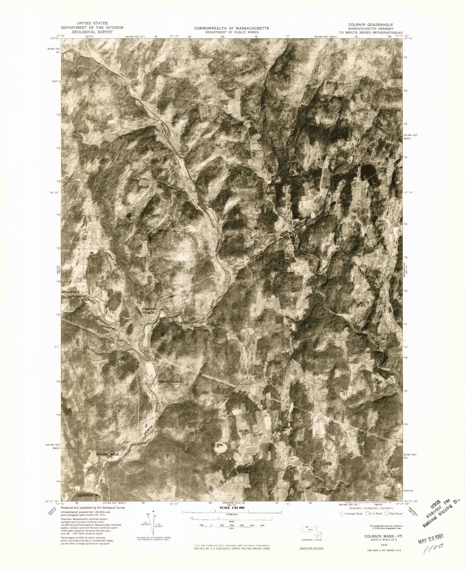
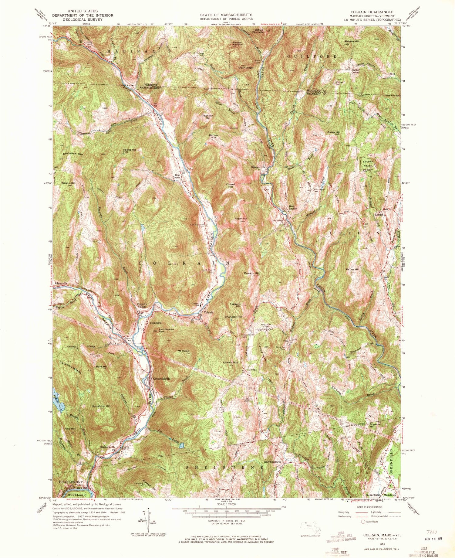
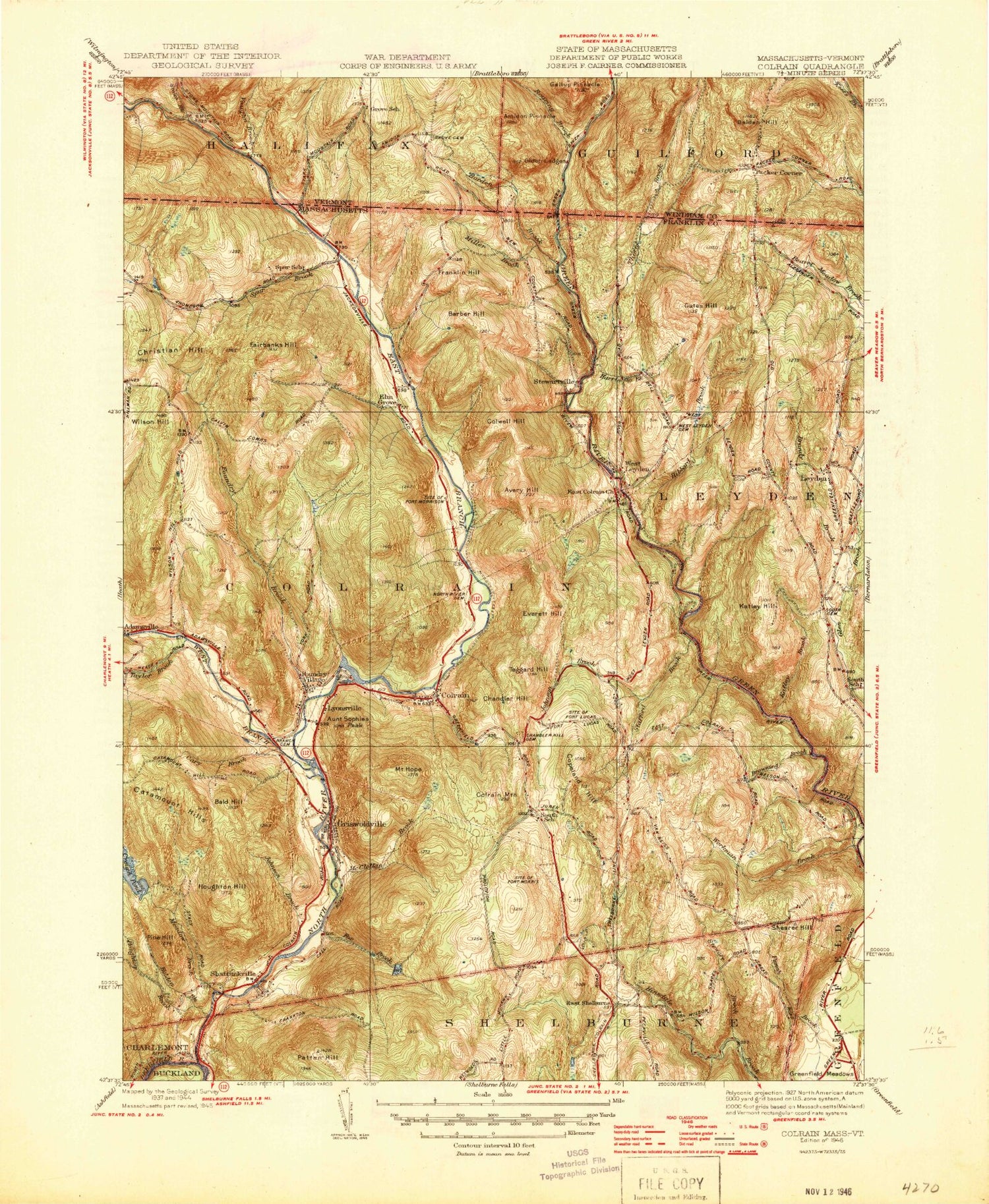
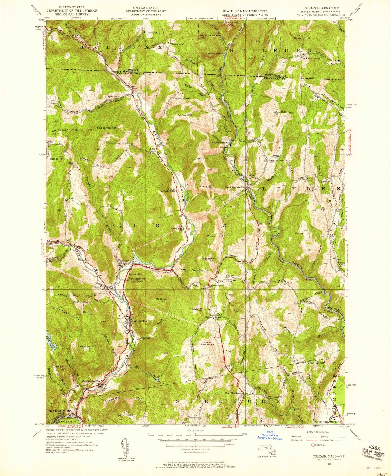
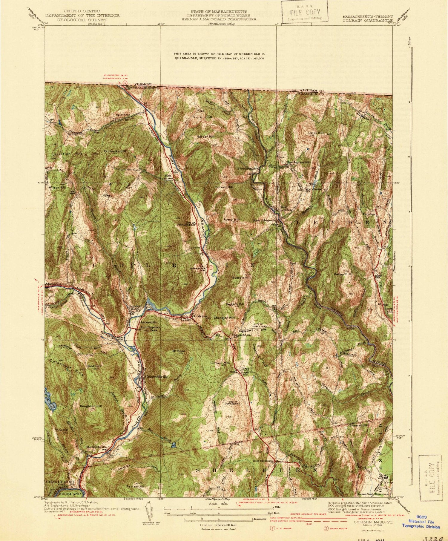
Classic USGS Colrain Massachusetts 7.5'x7.5' Topo Map
Couldn't load pickup availability
Historical USGS topographic quad map of Colrain in the states of Massachusetts, Vermont. Typical map scale is 1:24,000, but may vary for certain years, if available. Print size: 24" x 27"
This quadrangle is in the following counties: Franklin, Windham.
The map contains contour lines, roads, rivers, towns, and lakes. Printed on high-quality waterproof paper with UV fade-resistant inks, and shipped rolled.
Contains the following named places: Colrain Central School, Leyden State Forest, Brick School Cemetery, West Leyden Cemetery, East Colrain Church, South Cemetery, Leyden School, Chandler Hill Cemetery, Arthur Smith Covered Bridge, Branch Cemetery, North River Cemetery, Shelburne Falls Fire District Dam, Shelburne Falls Fire District Reservoir, McLeod Pond Dam, North River Reservoir, Kendall Company Number 1 Dam, Taylor Brook, Fort Morrison, Fort Lucas, Fort Morris, Adamsville, Aunt Sophies Peak, Avery Hill, Bald Hill, Barber Hill, Borden Brook, Brandy Brook, Browning Brook, Cary Brook, Catamount Hills, Chandler Hill, Colrain, Colrain Mountain, Colwell Hill, Copeland Hill, East Shelburne, Elm Grove, Everett Hill, Fairbanks Hill, Foundry Brook, Foundry Village, Fox Brook, Franklin Hill, Gates Hill, Griswoldville, Harris Brook, Hibbard Brook, Holden Brook, Mount Hope, Houghton Brook, Houghton Hill, Johnson Brook, Johnson Brook, Katley Brook, Katley Hill, Leyden, Fort Lucas (historical), Lyonsville, McClellan Brook, McLeod Pond, Meadow Brook, Miller Brook, Fort Morris (historical), Fort Morrison (historical), North River, Patten Hill, Pine Hill, Shattuckville, Shearer Hill, Spur Brook, Stafford Brook, Stewart Brook, Stewartville, Taggard Hill, Thorne Brook, West Branch North River, West Leyden, Wilson Hill, Workman Brook, Town of Colrain, Town of Leyden, Spencer Mountain, East Branch North River, Colrain Post Office, Leyden United Methodist Church, Pine Hill Orchards, Colrain Fire Department, Leyden Fire Department, Colrain Police Department, Leyden Police Department, Amidon Pinnacle, Belden Hill, Billings Cemetery, Gallup Pinnacle, Grove Cemetery, Olden Ledges, Packer Corner, Roaring Brook, Stark Cemetery, Stowe Brook, Thorne Brook, Vaughn Brook, Groll Cemetery, Henry Cemetery, Colrain Central School, Leyden State Forest, Brick School Cemetery, West Leyden Cemetery, East Colrain Church, South Cemetery, Leyden School, Chandler Hill Cemetery, Arthur Smith Covered Bridge, Branch Cemetery, North River Cemetery, Shelburne Falls Fire District Dam, Shelburne Falls Fire District Reservoir, McLeod Pond Dam, North River Reservoir, Kendall Company Number 1 Dam, Taylor Brook, Fort Morrison, Fort Lucas, Fort Morris, Adamsville, Aunt Sophies Peak, Avery Hill, Bald Hill, Barber Hill, Borden Brook, Brandy Brook, Browning Brook, Cary Brook, Catamount Hills, Chandler Hill, Colrain, Colrain Mountain, Colwell Hill, Copeland Hill, East Shelburne, Elm Grove, Everett Hill, Fairbanks Hill, Foundry Brook, Foundry Village, Fox Brook, Franklin Hill, Gates Hill, Griswoldville, Harris Brook, Hibbard Brook, Holden Brook, Mount Hope, Houghton Brook, Houghton Hill, Johnson Brook, Johnson Brook, Katley Brook, Katley Hill, Leyden, Fort Lucas (historical), Lyonsville, McClellan Brook, McLeod Pond, Meadow Brook, Miller Brook, Fort Morris (historical), Fort Morrison (historical), North River, Patten Hill, Pine Hill, Shattuckville, Shearer Hill, Spur Brook, Stafford Brook, Stewart Brook, Stewartville, Taggard Hill, Thorne Brook, West Branch North River, West Leyden, Wilson Hill, Workman Brook, Town of Colrain, Town of Leyden, Spencer Mountain, East Branch North River, Colrain Post Office, Leyden United Methodist Church, Pine Hill Orchards, Colrain Fire Department, Leyden Fire Department, Colrain Police Department, Leyden Police Department, Amidon Pinnacle, Belden Hill, Billings Cemetery, Gallup Pinnacle, Grove Cemetery, Olden Ledges, Packer Corner, Roaring Brook, Stark Cemetery, Stowe Brook, Thorne Brook, Vaughn Brook, Groll Cemetery, Henry Cemetery, Colrain Central School, Leyden State Forest, Brick School Cemetery, West Leyden Cemetery, East Colrain Church, South Cemetery, Leyden School, Chandler Hill Cemetery, Arthur Smith Covered Bridge, Branch Cemetery, North River Cemetery, Shelburne Falls Fire District Dam, Shelburne Falls Fire District Reservoir, McLeod Pond Dam, North River Reservoir, Kendall Company Number 1 Dam, Taylor Brook, Fort Morrison, Fort Lucas, Fort Morris, Adamsville, Aunt Sophies Peak, Avery Hill, Bald Hill, Barber Hill, Borden Brook, Brandy Brook, Browning Brook