MyTopo
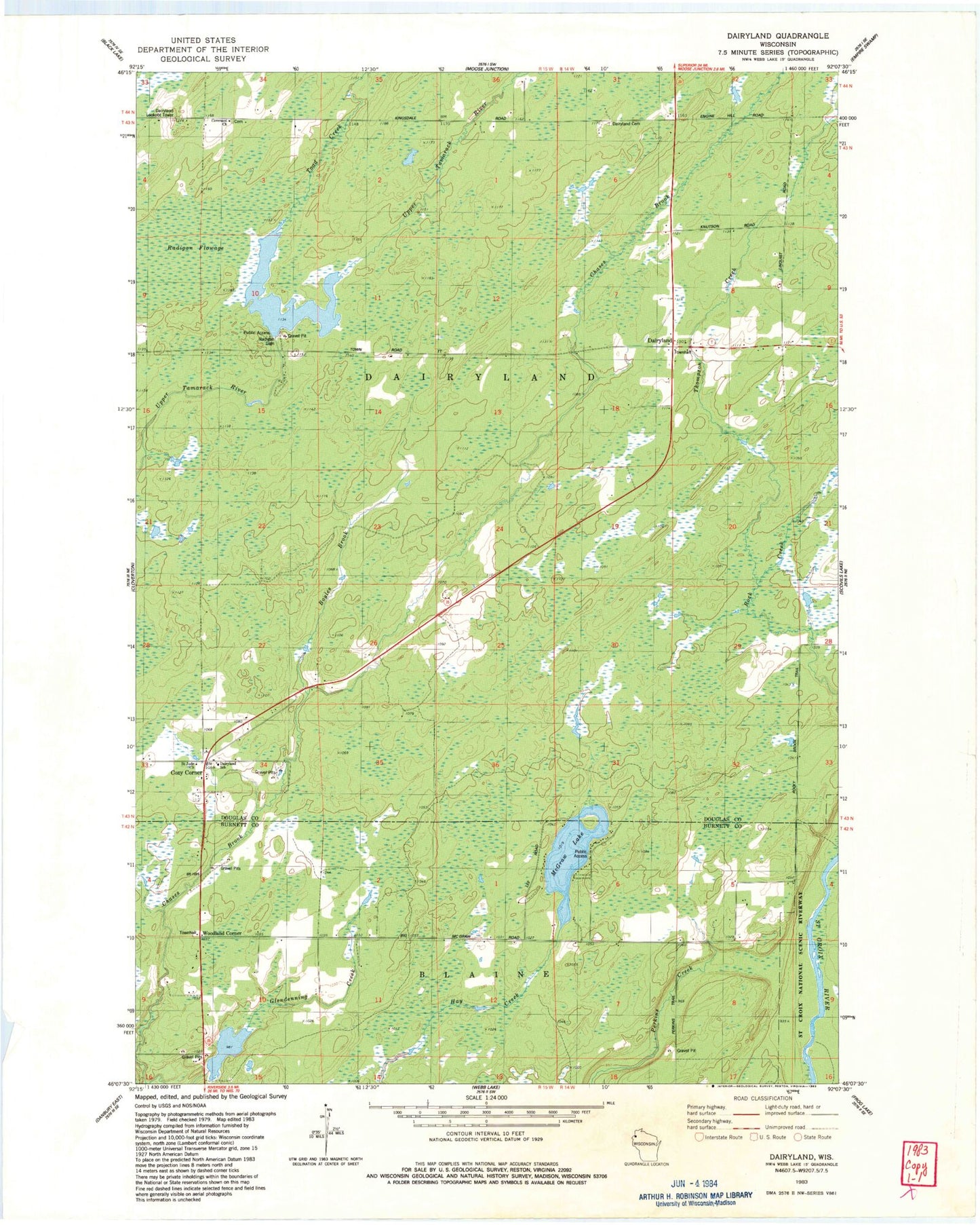
Classic USGS Dairyland Wisconsin 7.5'x7.5' Topo Map
Couldn't load pickup availability
Historical USGS topographic quad map of Dairyland in the state of Wisconsin. Map scale may vary for some years, but is generally around 1:24,000. Print size is approximately 24" x 27"
This quadrangle is in the following counties: Burnett, Douglas.
The map contains contour lines, roads, rivers, towns, and lakes. Printed on high-quality waterproof paper with UV fade-resistant inks, and shipped rolled.
Contains the following named places: 2 Reservoir, Blaine Townhall, Boyles Brook, Carpenter School, Covenant Church, Cozy Corner, Dairyland, Dairyland Cemetery, Dairyland Lookout Tower, Dairyland School, Dairyland Townhall, Dairyland Volunteer Fire and Rescue Station 1, Dairyland Volunteer Fire and Rescue Station 2, Gomulak and Profitt 3WR253 Dam, McGraw Lake, Radigan 2WP1947 Dam, Radigan Dam, Radigan Flowage, Radigan Flowage 41, Rock Creek, Saint Jude Church, Toad Creek, Town of Dairyland, Woodland Church, Woodland Corner