MyTopo
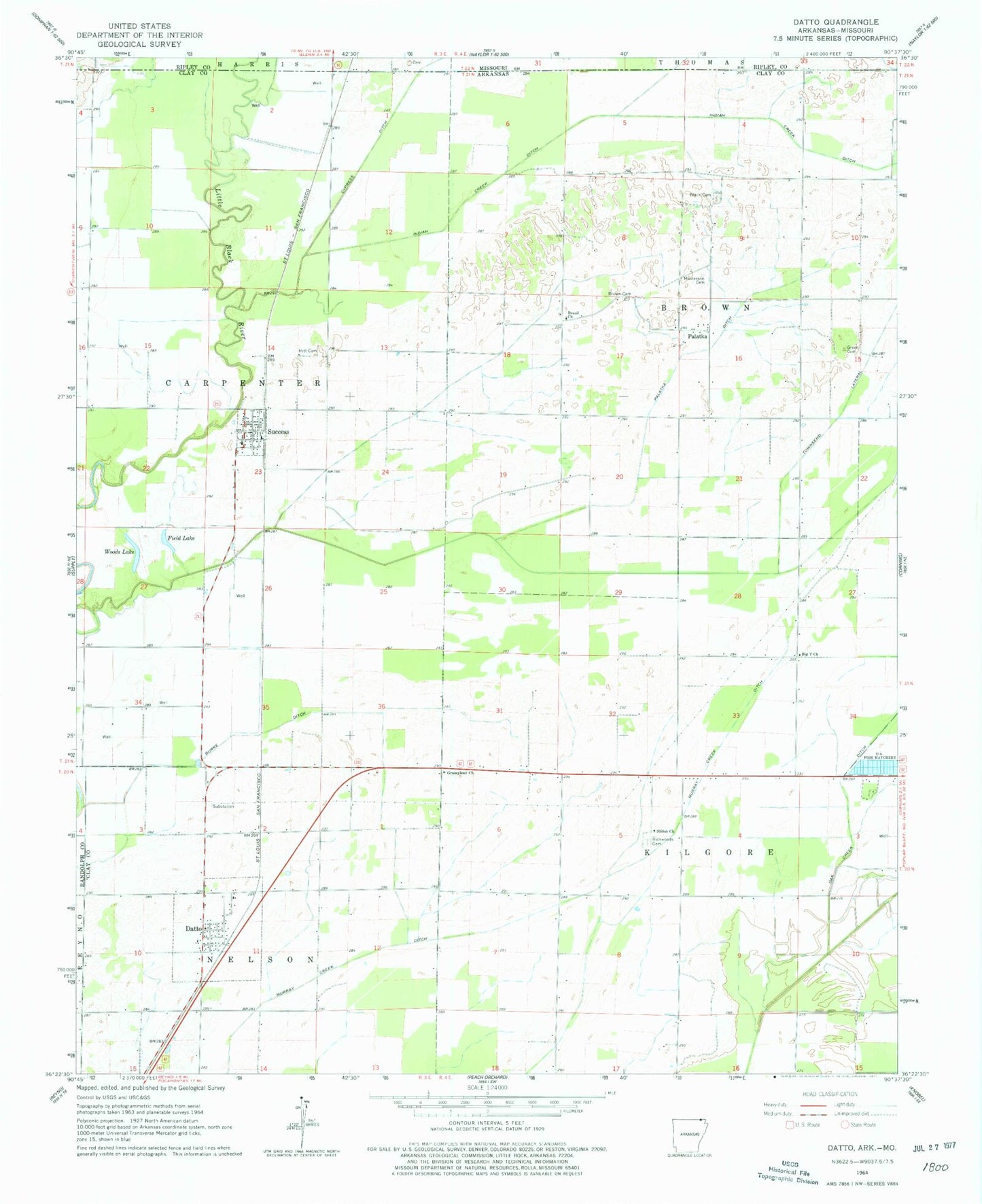
Classic USGS Datto Arkansas 7.5'x7.5' Topo Map
Couldn't load pickup availability
Historical USGS topographic quad map of Datto in the state of Arkansas. Map scale may vary for some years, but is generally around 1:24,000. Print size is approximately 24" x 27"
This quadrangle is in the following counties: Clay, Randolph, Ripley.
The map contains contour lines, roads, rivers, towns, and lakes. Printed on high-quality waterproof paper with UV fade-resistant inks, and shipped rolled.
Contains the following named places: Big T Church, Black Cemetery, Brazil Church, Brazil School, Brown Cemetery, Burke Ditch, Corning Municipal Airport, Cypress Ditch, Datto, Datto Post Office, Field Lake, Grassylead Church, Green Cemetery, Hitt Cemetery, Indian Creek Ditch, Masterson Cemetery, Murray Creek Ditch, Oak Creek Ditch, Palatka, Palatka Ditch, Pittman, Richard School, Richwoods Cemetery, Shiloh Church, Success, Success Post Office, Success Volunteer Fire Department, Town of Datto, Town of Success, Townsend Lateral, Township of Brown, Township of Brown-Carpenter, Township of Carpenter, Twin Oaks, Woods Lake, ZIP Codes: 72424, 72470