MyTopo
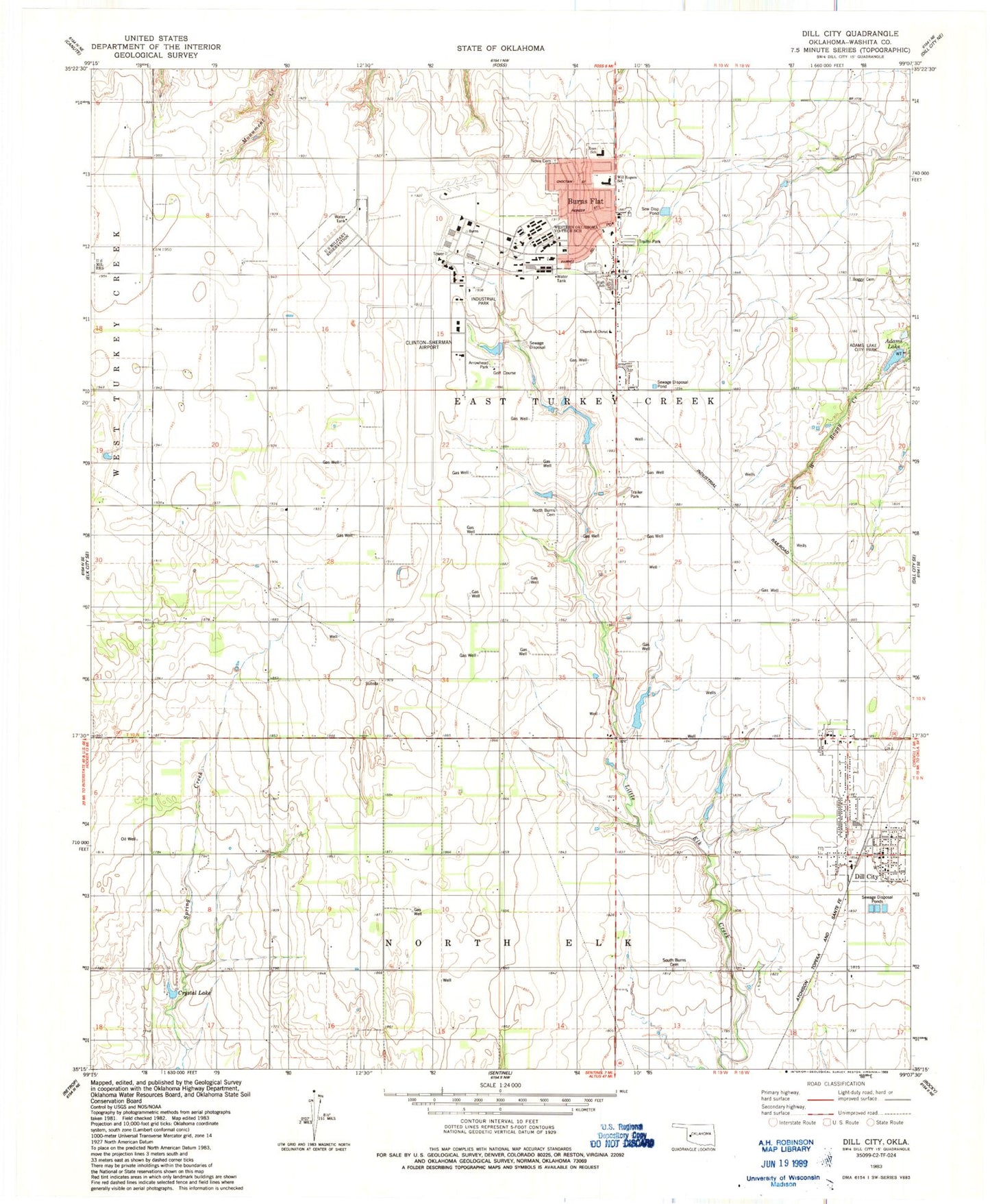
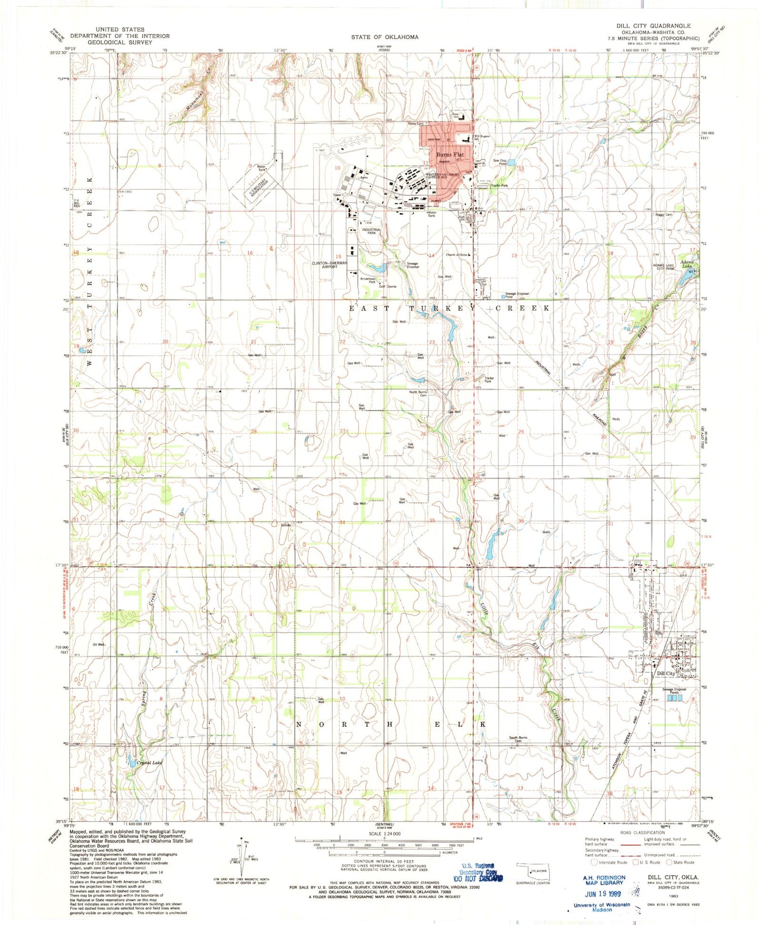
Classic USGS Dill City Oklahoma 7.5'x7.5' Topo Map
Couldn't load pickup availability
Historical USGS topographic quad map of Dill City in the state of Oklahoma. Map scale may vary for some years, but is generally around 1:24,000. Print size is approximately 24" x 27"
This quadrangle is in the following counties: Washita.
The map contains contour lines, roads, rivers, towns, and lakes. Printed on high-quality waterproof paper with UV fade-resistant inks, and shipped rolled.
Contains the following named places: Adams Lake, Adams Lake City Park, Arrowhead Park, Boggy Cemetery, Burns Flat, Burns Flat - Dill City Secondary School, Burns Flat Police Department, Burns Flat Post Office, Burns Flat Volunteer Fire Department and Emergency Medical Services, Clinton Sherman Volunteer Fire Department, Clinton-Sherman Airport, Clinton-Sherman Industrial Park, Clinton-Sherman Reservoir Dam, Clinton-Sherman Reservoir Reservoir, Cordell Reservoir, Cordell Reservoir Dam, Crystal Lake, Dill City, Dill City Post Office, Dill City Volunteer Fire Department, Lynn Airfield, Naval Air Station Clinton, North Burns Cemetery, Novis Cemetery, Oknoname 149030 Dam, Oknoname 149030 Reservoir, Oknoname 149032 Dam, Oknoname 149032 Reservoir, Ross School, South Burns Cemetery, Town of Burns Flat, Town of Dill City, Western Technology Center, Will Rogers Elementary School, ZIP Codes: 73624, 73641