
MyTopo
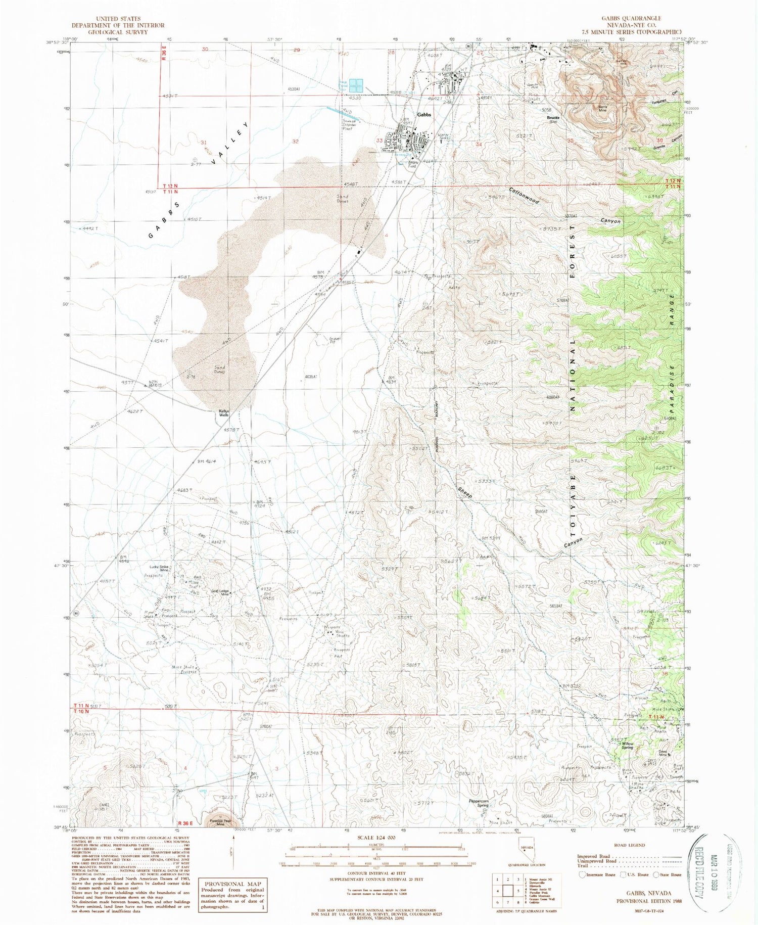
Classic USGS Gabbs Nevada 7.5'x7.5' Topo Map
Couldn't load pickup availability
Historical USGS topographic quad map of Gabbs in the state of Nevada. Map scale may vary for some years, but is generally around 1:24,000. Print size is approximately 24" x 27"
This quadrangle is in the following counties: Nye.
The map contains contour lines, roads, rivers, towns, and lakes. Printed on high-quality waterproof paper with UV fade-resistant inks, and shipped rolled.
Contains the following named places: Basic, Brucite, Brucite Mine, City of Gabbs, Cottontail Mine, Cottonwood Canyon, Davis Mine, Derringer Spring, Fairplay Mining District, Gabbs, Gabbs Census Designated Place, Gabbs City Hall, Gabbs Elementary School, Gabbs High School, Gabbs Middle School, Gabbs Post Office, Gabbs Township, Gabbs Volunteer Fire Department, Gold Ledge Mine, Gold Trace Mine, Granite Canyon, Kellys Wells, Lucky Strike Mine, Peppercorn Spring, Sheep Canyon, Sierra Mine, Sullivan Mine, Tungsten Canyon, Willow Spring


