MyTopo
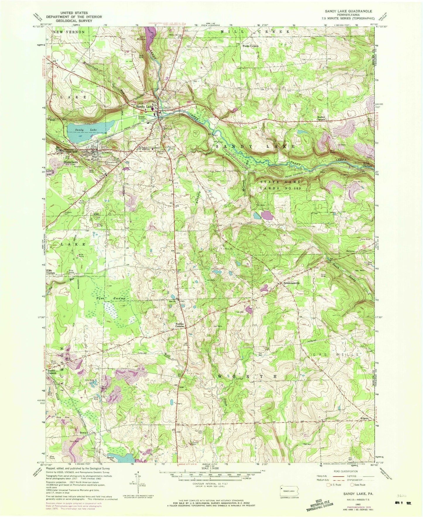
Classic USGS Sandy Lake Pennsylvania 7.5'x7.5' Topo Map
Couldn't load pickup availability
Historical USGS topographic quad map of Sandy Lake in the state of Pennsylvania. Map scale may vary for some years, but is generally around 1:24,000. Print size is approximately 24" x 27"
This quadrangle is in the following counties: Mercer.
The map contains contour lines, roads, rivers, towns, and lakes. Printed on high-quality waterproof paper with UV fade-resistant inks, and shipped rolled.
Contains the following named places: Arab School, Booher Corners, Borough of Sandy Lake, Borough of Stoneboro, Bowie, Butchery Creek, Carmichael School, Carroll Cemetery, Currier School, Fairview Cemetery, Fiddlers Green, Giebner School, Hendersonville, Hendersonville Cemetery, Hodge School, Kilgore, Lake Wilhelm Dam, Lakeview Consolidated High School, Lytle School, McConnell Run, McCutcheon Run, Oak Hill Cemetery, Pa-474 Dam, Pa-474 Reservoir, Perrine Corners, Pine Swamp, Porter School, Reeds Furnace, Rocky Springs Cemetery, Saint John School, Saint Paul School, Sandy Lake, Sandy Lake Borough Police Department, Sandy Lake Post Office, Sandy Lake Volunteer Fire Department Station 84, Sawmill Run, State Game Lands Number 130, Stoneboro, Stoneboro Police Department, Stoneboro Post Office, Stoneboro Volunteer Fire Department Station 76, Township of Sandy Lake, Township of Worth, Wades Corners, Wesleyan Campground, Yankee Hill Cemetery, Yankee Hill School, Zion Church, ZIP Codes: 16133, 16153