MyTopo
Bradleyville Missouri US Topo Map
Couldn't load pickup availability
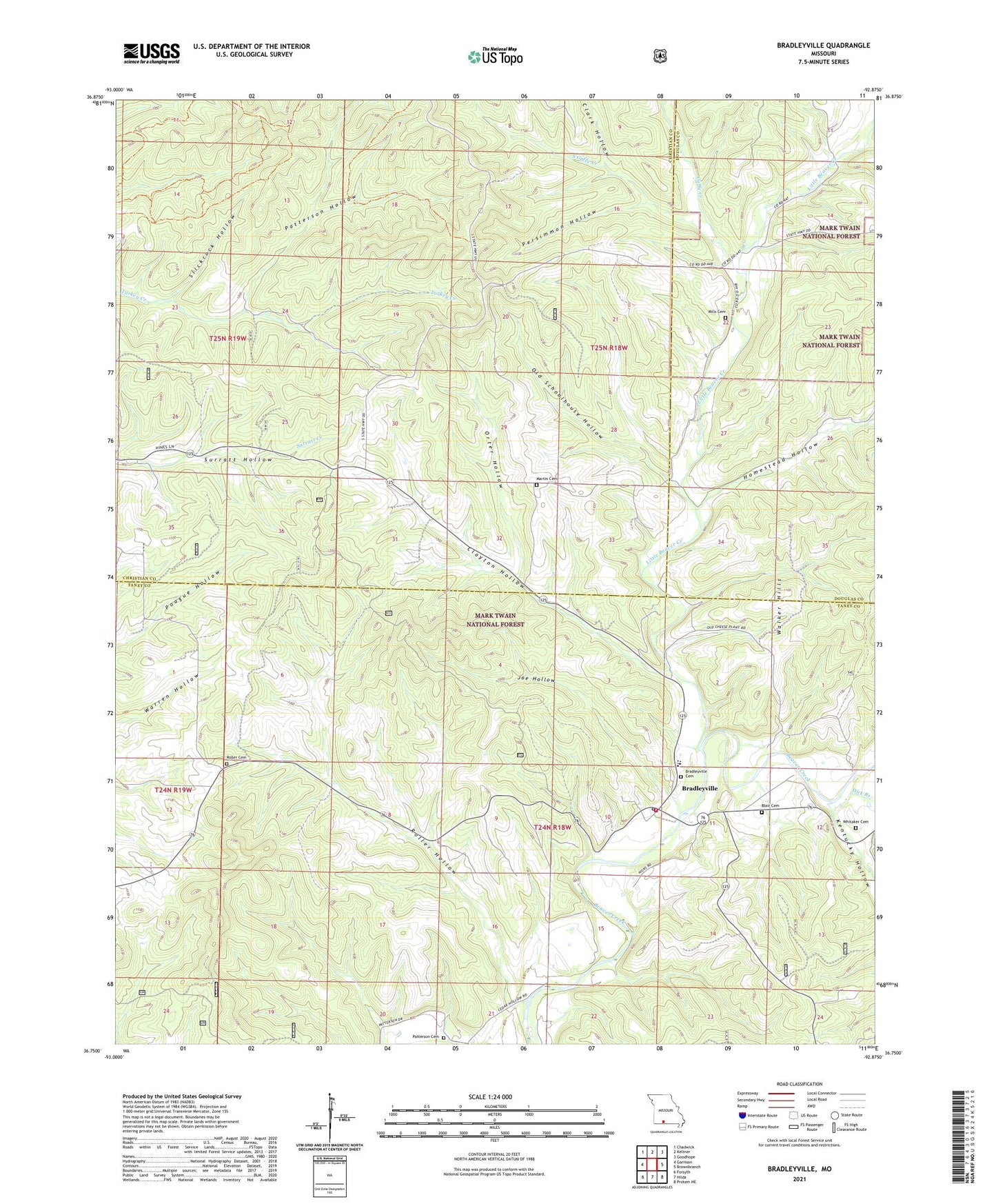
2021 topographic map quadrangle Bradleyville in the state of Missouri. Scale: 1:24000. Based on the newly updated USGS 7.5' US Topo map series, this map is in the following counties: Taney, Christian, Douglas. The map contains contour data, water features, and other items you are used to seeing on USGS maps, but also has updated roads and other features. This is the next generation of topographic maps. Printed on high-quality waterproof paper with UV fade-resistant inks.
Quads adjacent to this one:
West: Garrison
Northwest: Chadwick
North: Keltner
Northeast: Goodhope
East: Brownbranch
Southeast: Protem NE
South: Hilda
Southwest: Forsyth
Contains the following named places: Ada, Ava Ranger District, Blair Cemetery, Bradleyville, Bradleyville Post Office, Bradleyville Rural Volunteer Fire Department, Clark Hollow, Clayton Hollow, Dick Branch, Green Valley Church, Green Valley School, Guffy Creek, Homestead Hollow, Homestead School, Joe Hollow, Kentucky Hollow, Little Beaver Creek, Martin Cemetery, Mills Cemetery, Oak Ridge School, Old Schoolhouse Hollow, Orter Hollow, Patterson Cemetery, Patterson Hollow, Persimmon Hollow, Roller Cemetery, Roller Hollow, Roller Hollow School, Seneca School, Slickrock Hollow, South Guffy Creek, Surratt School, Swan Lookout, Township of Buchanan, Township of Seneca, Union Hill School, Village of Bradleyville, Wayside Post Office, Whitaker Cemetery, Witty, ZIP Code: 65614