OldMapDownloads
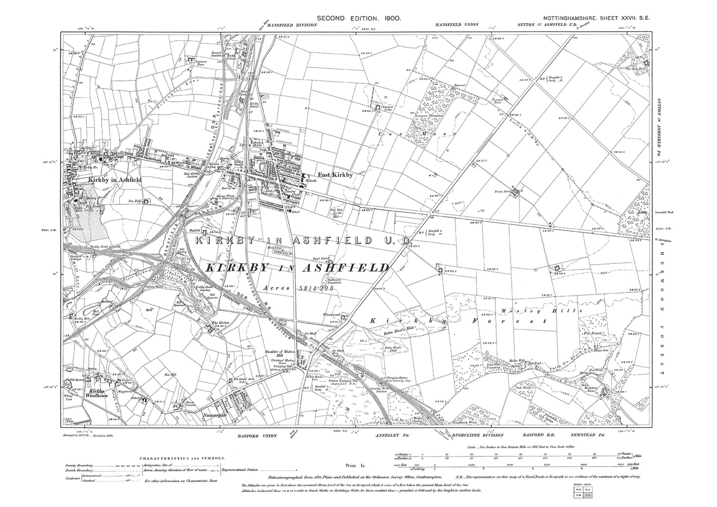
Kirkby in Ashfield, East Kirkby, old map Nottinghamshire 1900: 27SE
Kirkby in Ashfield, East Kirkby, old map Nottinghamshire 1900: 27SE
Couldn't load pickup availability
This digital download is a high-quality 300 dpi JPG image (7016 x 4961 pixels) of a 1:10560 scale (6 inches to the mile) Ordnance Survey map.
It's sized to A2 dimensions* making it perfect for viewing on your PC or laptop using image software such as Photoshop or Gimp, or utilities such as Windows Photo or Windows Paint. Can be sized and printed at home if required, or use an online or local printing service for large formats.
*59.4 cm x 42 cm
The map gives a detailed view of an area measuring 2 x 3 miles. It shows (where present) buildings, roads, railways, mines, quarries, wells, water pumps, springs, benchmarks, allotments, sports grounds, factories, mills and many other features. It also includes contours and spot heights, which provide information about the elevation of the terrain.