Elite Wall Decor
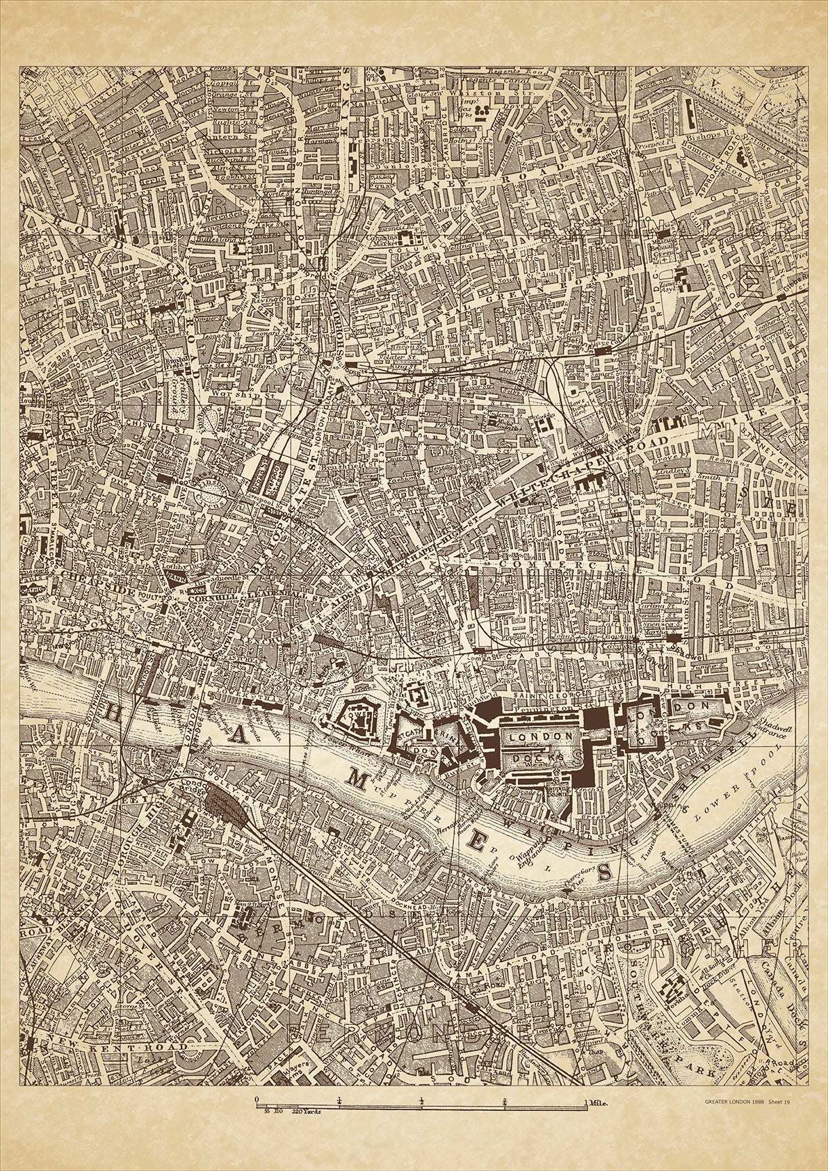
Greater London in 1888 Series - showing City, Whitechapel, Bethnal Green, Bermondsey, Rotherhithe, Cheapside, Shoreditch, Wapping, Shadwell - sheet 19
Greater London in 1888 Series - showing City, Whitechapel, Bethnal Green, Bermondsey, Rotherhithe, Cheapside, Shoreditch, Wapping, Shadwell - sheet 19
Couldn't load pickup availability
This digital download is a high-quality 300dpi JPG image of a London street atlas map dated 1888. It is enlarged, and sized to print if required at A2 dimensions (59.4 cm x 42 cm), or simply view it in close up on your computer screen using for instance Windows Photo or similar.
These maps are sharp and clear. All railway lines and stations are shown and named.
In 1888, the City of London, Whitechapel, and Bethnal Green were densely populated areas in the East End of London, with a mix of working-class and impoverished residents. These areas were marked by extreme poverty, social inequality, and high levels of crime and violence.
The City of London, located in the heart of the capital, was the financial and commercial center of the city. The area was home to many important institutions and landmarks, including the Bank of England, the Royal Exchange, and St. Paul's Cathedral. The City was primarily a middle- and upper-class area, with many residents employed in the financial and commercial sectors.
Whitechapel and Bethnal Green, located to the east of the City, were known for their large immigrant populations, many of whom were living in extreme poverty. The areas were marked by overcrowded tenements, poor sanitation, and high levels of crime and violence. Notable landmarks in Whitechapel included the Royal London Hospital and the Whitechapel Bell Foundry, which had been in operation since the 16th century. In Bethnal Green, the Victoria and Albert Museum of Childhood, which had opened in 1872, was a notable landmark.
In 1888, these areas were also impacted by the infamous Jack the Ripper murders, which occurred primarily in Whitechapel and had ripple effects throughout the city. The murders highlighted the poverty, crime, and social inequality that existed in many parts of Victorian London.
Today, visitors to the City, Whitechapel, and Bethnal Green can still see many historic landmarks and buildings from this era. These areas have also undergone significant changes and development in the years since 1888, and are now vibrant and diverse parts of modern-day London.
Whether you're a history buff, a cartography enthusiast, or simply looking for a unique piece of decor for your home or office, this map is sure to delight. It's a piece of history that you can own and enjoy for years to come.