|
Description:
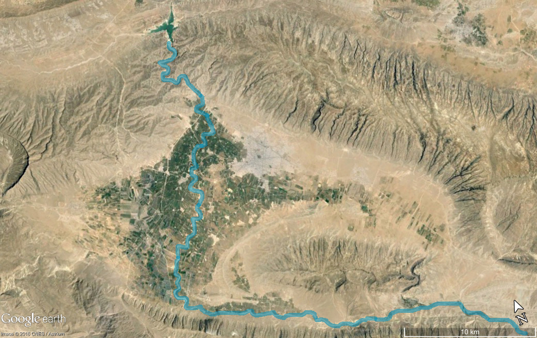
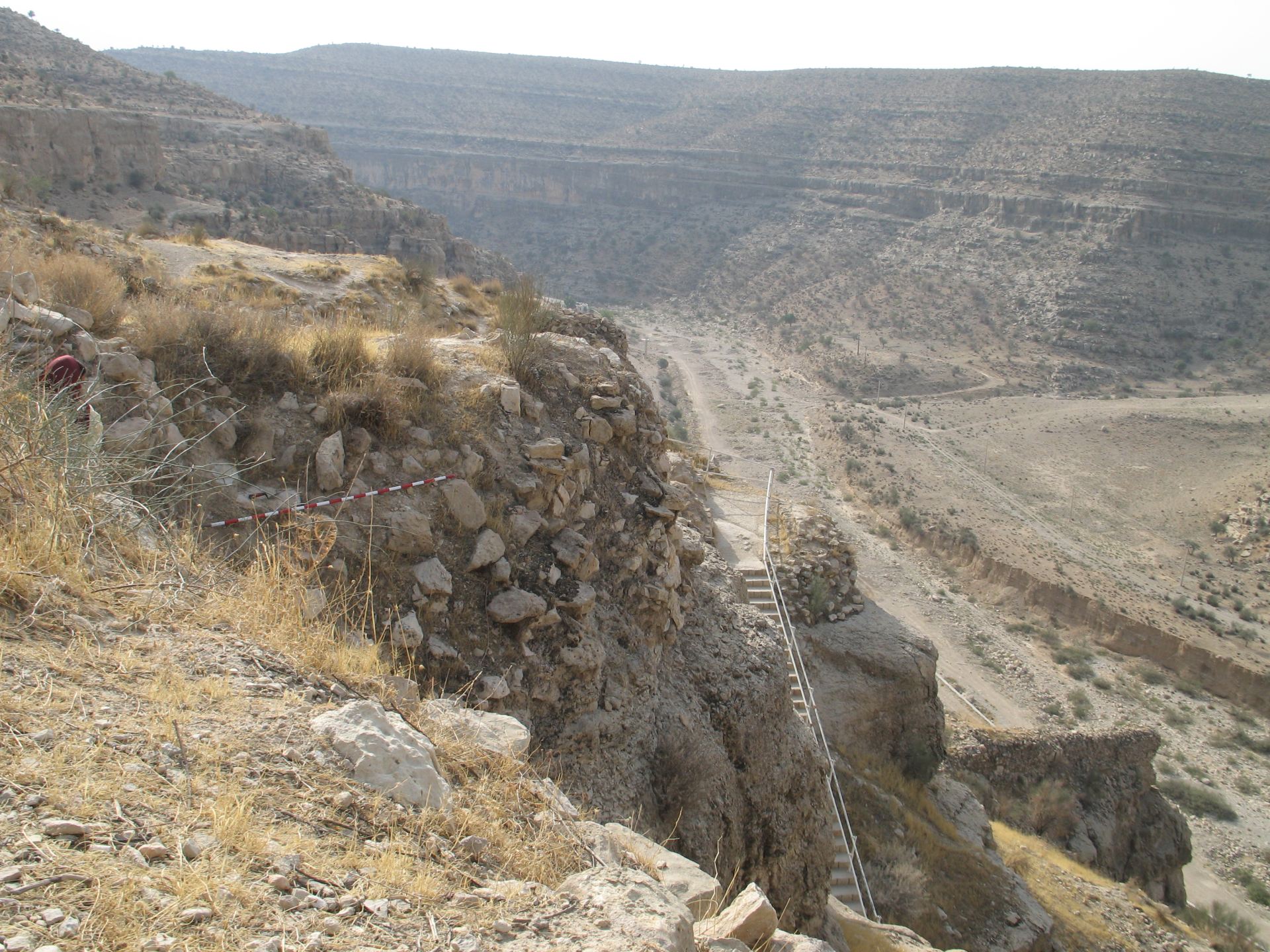
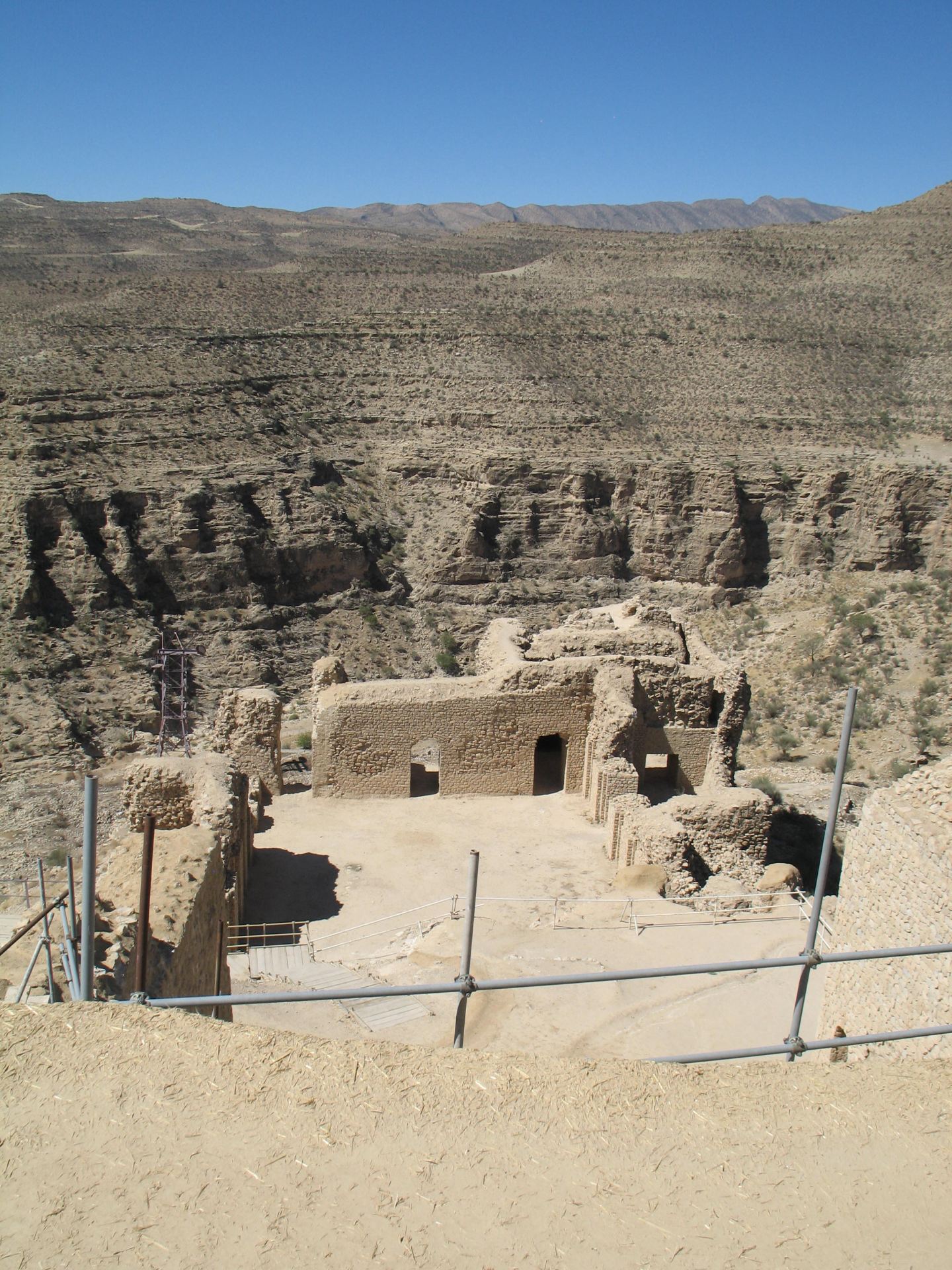
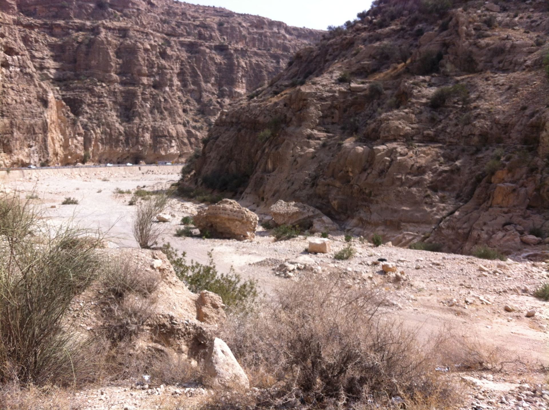
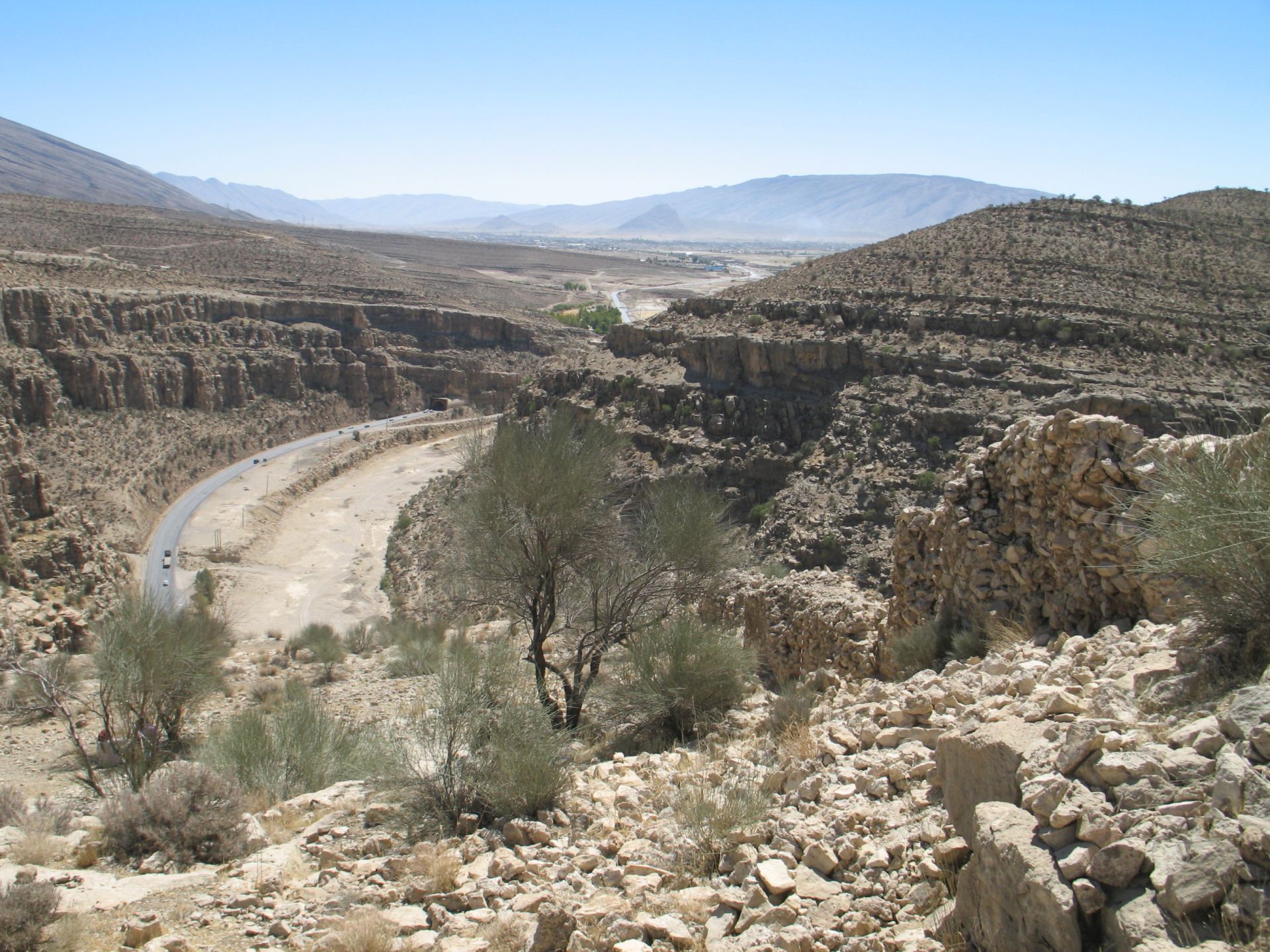
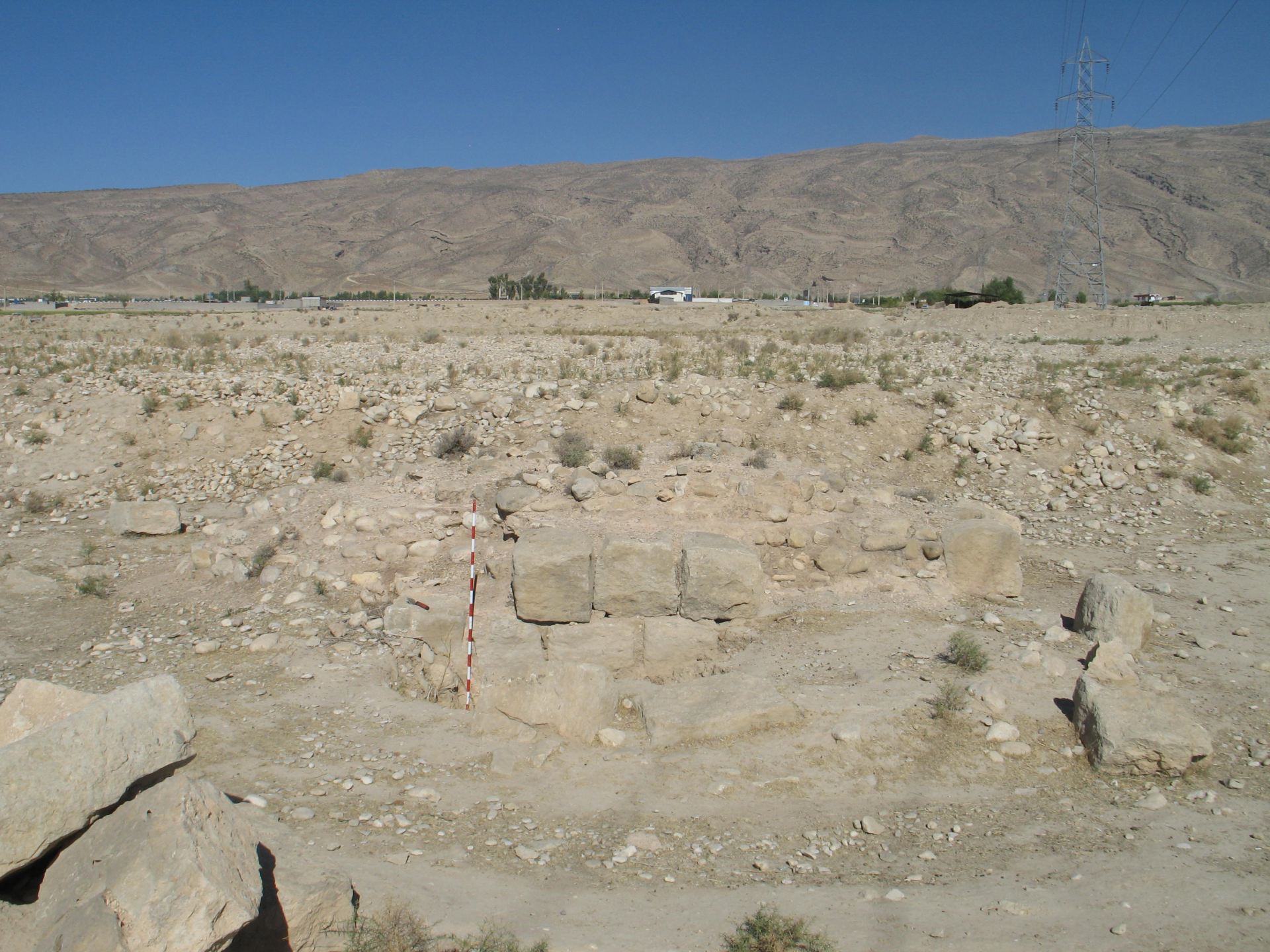
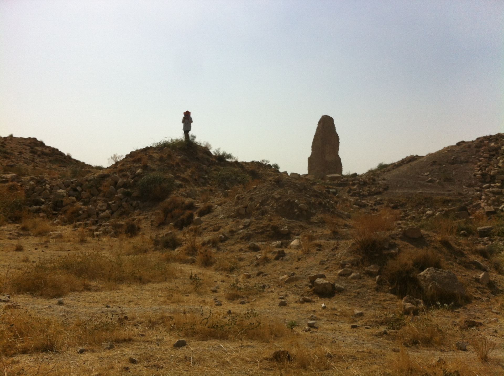
The most breathtakingly view of the ancient city of Ardašīr-Xwarrah is from above, upon some elevated point. Known also as Gur or Firuzabad, this perfectly rounded city is situated in an alluvial plan created by the river Konayfeqan or Boraza and surrounded by a high mountainous area of the Zagros, which it is locally called Kūh-e Padana. The only northern accessible road to the plain is through a gorge made by the river in the impressive ochre limestone cliffs. (Figs.1; 2) Following the serpentine gorge for five kilometres, on the rocky ridge of an eastern spur of the Kūh-e Tang-āb, a traveller would run across the fortress of Qala-ye Dokhtar and its walls built over terraces. Its position overlooking the northern route led the scholars believing that it had been built by Ardašīr I (224-240 CE) in preparation for his revolt against the Arsacid Ardavan, possibly to protect the plain and the newly founded city. The fortress’ defensive role lasted until Farrukhān, the ispahbad of Tabaristan, escaped from the Buyid dynasty (c. 934-1062 CE) by taking shelter in it. (Figs. 3; 4; 5)
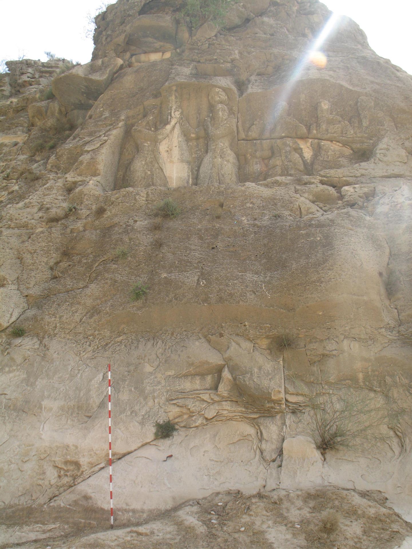
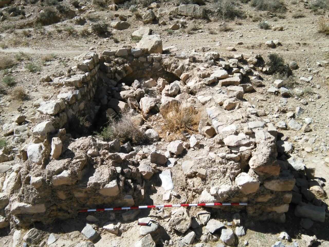
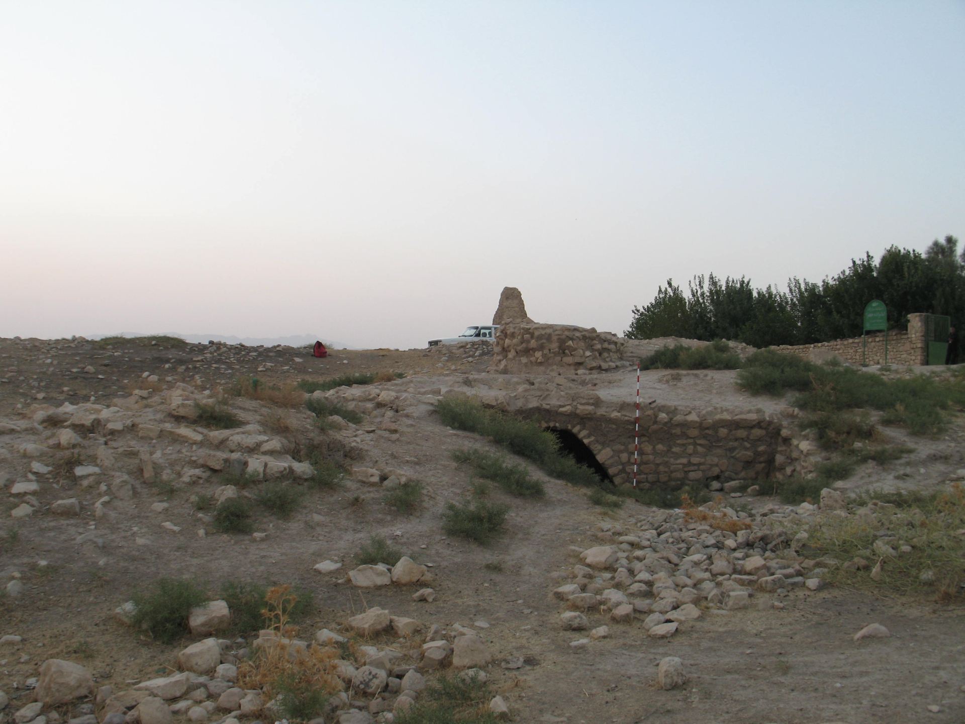
On the western slope of the Kūh-e Padana, there are two larger-than-life rock reliefs. The first one depicts Ardašīr’s investiture, while the second one represents an equestrian duel, with Ardašīr and Ardavan as main characters. Close by the first relief, an inscription by Mihr Narseh celebrates the construction of a bridge. Today only some ruined masonry of two recognisable piers remain. Along the gorge there are also the remains of a road partly carved into the rock called ‘the Road of the Kings’ and a structure, locally known as caravanserais. (Figs. 6; 7; 8; 9; 10; 11; 12; 13)
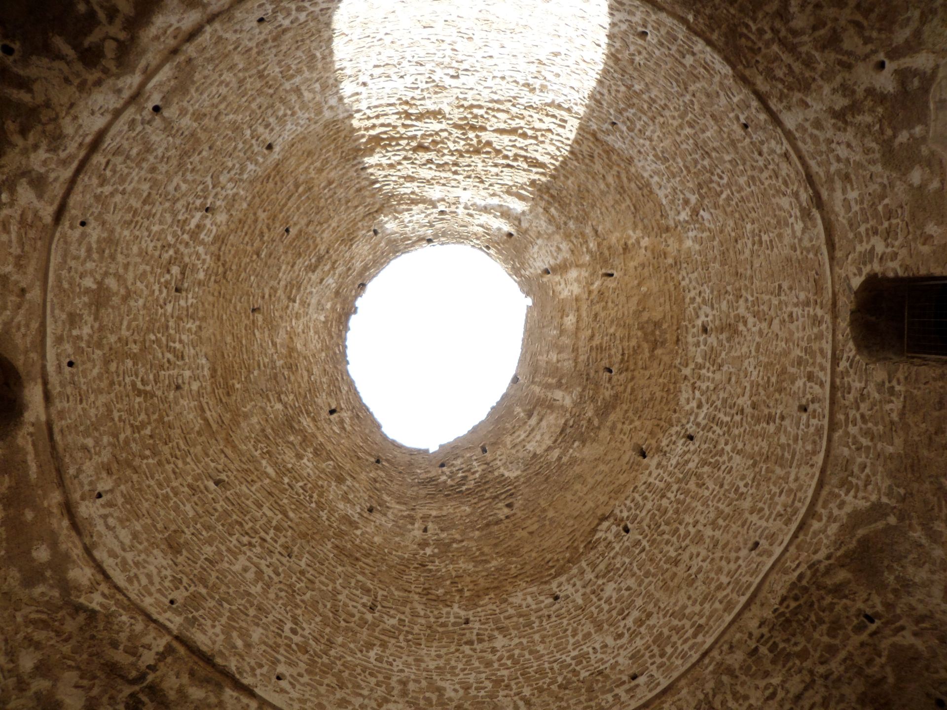
Heading south to the plain, a traveller faces the so-called Atashqadeh. As the name suggests, this structure was once thought to be a fire-temple; however, scholars recently identified it as a residential building – specifically, as Ardašīr’s palace after he became Shahanshah. Its architecture is more akin to other residential palaces than religious structures, usually identified by presenting a chahar-taq. It was partly excavated by Huff in the 70s and has been lately restored. (Figs.14; 15; 16; 17; 18; 19)
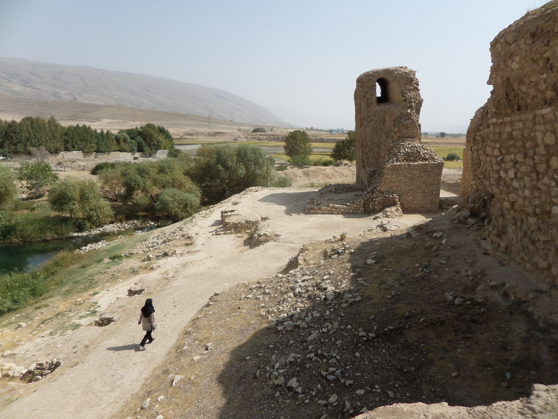
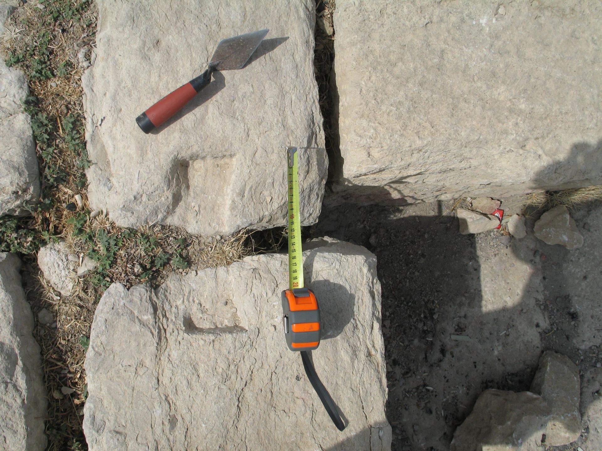
To access the city, the ancient traveller would probably have to cross one of two bridges, one controlling the east and the other one the west. Presently, what remains of them are piers made of regularly shaped limestone as the external face, enclosing a pebble-made core. The masonry is held together by hydraulic mortar, called saruj. The huge squared stones, connected through dovetail clamps and consisting of the foundation’s external face, are also preserved. Modern travellers need no bridges as today the river is more of a rivulet. (Figs. 20; 21)
Our traveller would eventually come across the city, whose name Ardašīr -Xwarrah is given to us by many historiographic sources. Its importance was reinforced by the fact that it was one of the five kūra – i.e., districts, of Fars during Sasanian times. The change from the name “Gur” to “Firuzabad” was due to the Buyid Adud, who unsurprisingly did not like people saying ‘the king has gone to gur’ – i.e., grave. The site and its structures had been visited and described by many amateurs and professional archaeologists.
The 1.95-kilometres diameter of the city is surrounded by two mudbrick walls, the main and the inner one, and a 35 metres-wide ditch. This perfectly circular shape had led scholars to interpret this city as an ideological symbol of the sovereign as centre of the state. Sources mention four gates from which was possible accessing the city: Bāb Mihr at the east, Bāb Bahrām at the west, Bāb Hormuz at the north, and Bāb Ardašīr at the south. They are not clearly recognisable today, and the main access is from south. (Figs. 22; 23)
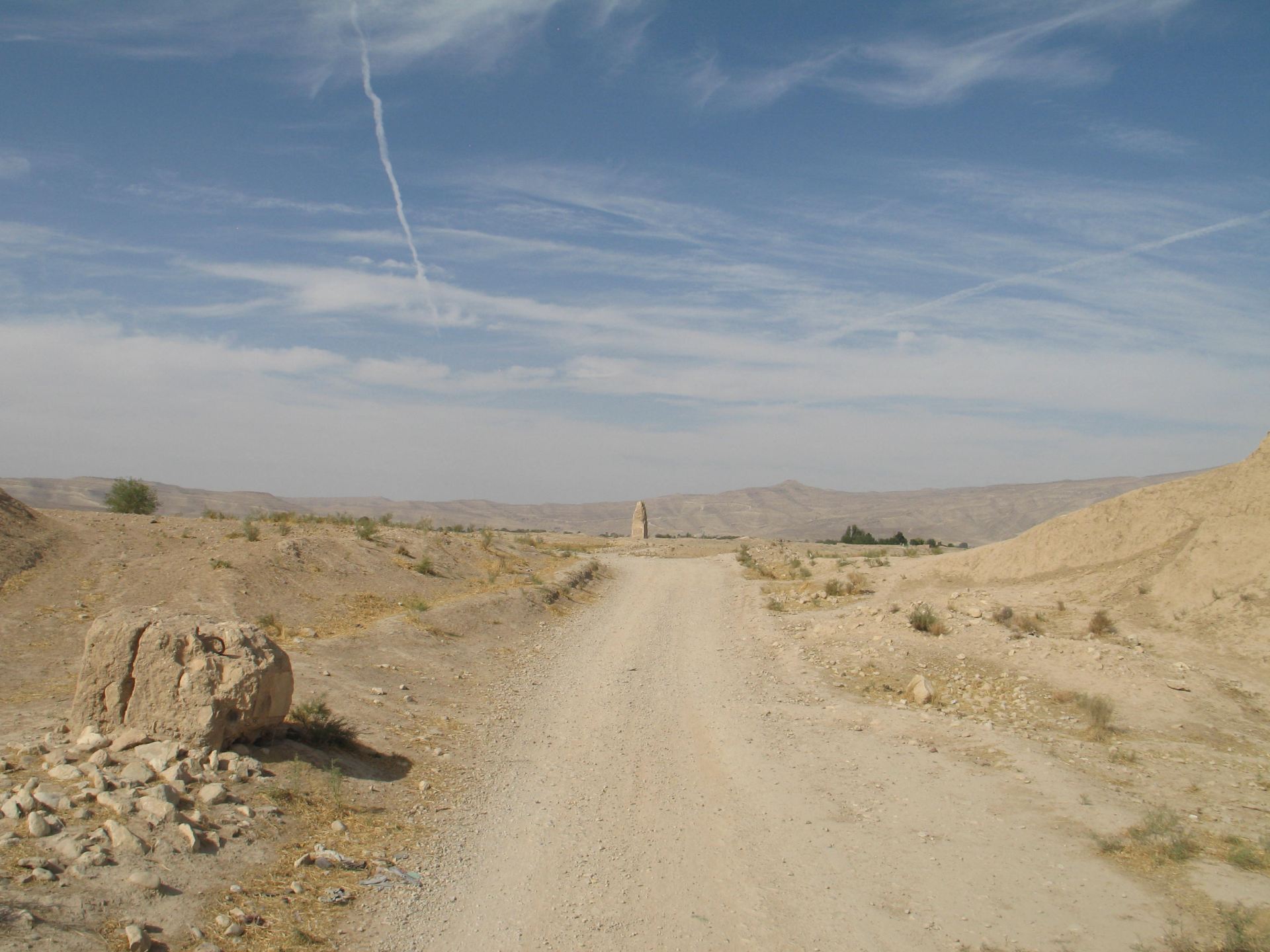
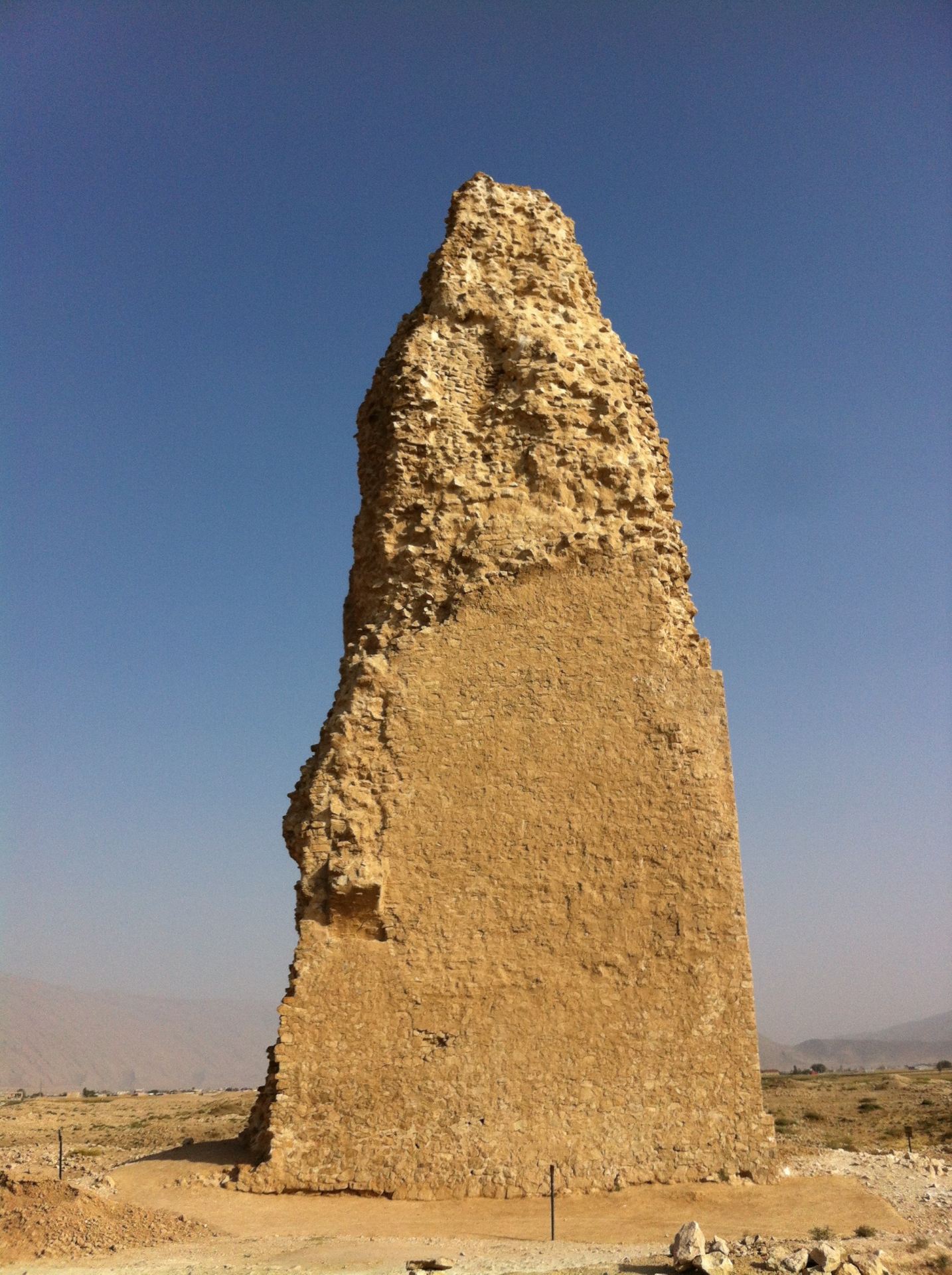
The so-known Tirbal is right in the middle of the site, well-visible from everywhere. It was firstly identified as a fire-tower with a spiraliform external stairway, and then as part of a palace or government building symbolising the divine kingship. However, a more pragmatic function is not excluded. The view from the 30-meters-high tower would have allowed for both the construction of such a perfect layout of the walls, and also communications with Qala-ye Dokhtar in case of attack. A quadrangular structure built in irregularly-shaped mortar-bound limestone is all that remains of it. (Figs. 24; 25)
The traveller would be impressed by the close remains of a dressed-limestone platform, known as Takht-e Neshin. It had also been identified as a fire-temple because of the particular architectural unit of chahar-taq, connected to religious buildings. Some of the limestone blocks, accurately carved, present marks of the dove-tail clamps. Others feature some identifying marks, probably used to indicate the correct placement of the stones during the construction. Nearby is a depression, identified as a cistern connected to the temple because water and fire were worshipped by Zoroastrians. Some preserved northern walls in irregularly shaped saruj-bound limestone seem to confirm the presence of water. (Figs. 26-9)
During the Arab-Muslim conquest, Eṣṭaxr and Ardašīr-Xwarrah were the last cities of Fārs to fall under the attacks of the general ʿAbd Allāh ibn ʿāmir. Nonetheless, its importance did not fade immediately as its strategic location along the road connecting Shīrāz to the port of Sīrāf meant that all commercial goods from the Indies had to pass through here. In this regard, it is key to mention Paul Gotch’s on-site surveys in the 60s, during which he collected huge quantities of celadon. Some of these sherds are now in the British Museum. (Fig. 30)
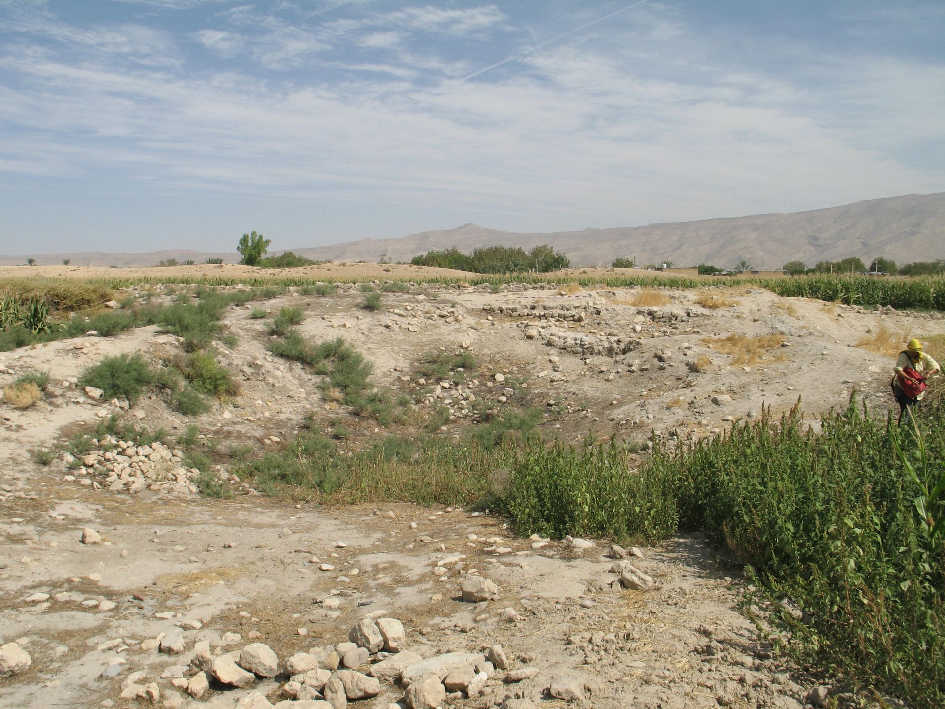
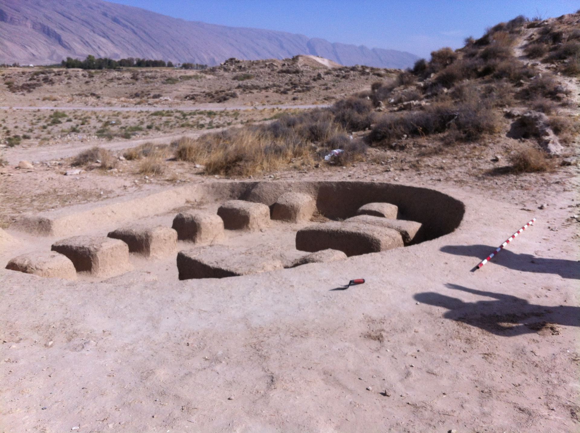
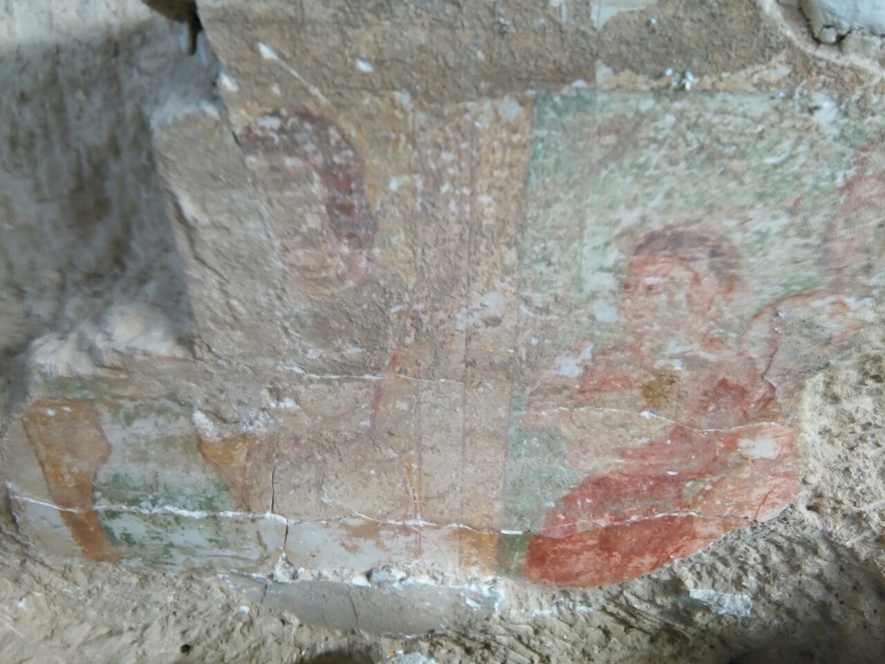
Walking through the site, it is impossible not to notice that a vast mound of rubble and intensive cultivation does not allow an easy identification of archaeological evidence. However, a lasting inhabitation within the walls after the conquest is confirmed by the so-known Deh-Shahr mentioned by Stein, and by three Imamzadeh. Although no chronology is attested, among the recognisable evidence there are also a mill and two recently excavated features, one identified as a kiln and a room with a fresco. (Figs.) The inaccessibility of Firuzabad lasted until the last century as it was the main residence of the Qashqai chiefs, independent and famous nomads of Fars. However, its unique charm and architectural features keep it an object of study and a stunning travel destination
Entry by Domiziana Rossi
Originally Published: August 15, 2021
|
| Bibliography: |
- al-Balādhurī. Kitāb futūḥ al-boldān. Translated as The Origins of the Islamic State by Philip Khuri Hitti. New York: Longmans, Green &Co, 1916.
- ibn al-Balḵī. Fārsnāma. Translated as ‘Description of the Province of Fars, in Persia, at the beginning of the twelfth century A.D. translated from the MS of Ibn al-Balkhi, in the British Museum’ by Guy Le Strange, in Journal of the Royal Asiatic Society of Great Britain and Ireland. 1912.
- Barthold, Vasilii Vladimirovich. An Historical Geography of Iran. Translated by Svat Soucek, with preface by Clifford Edmund Bosworth. Princeton (N.J.): University Press, 1984.
- Beck, Lois. The Qashqai’i of Iran. New Haven, CT: Yale University Press, 1986.
- Bartolucci, Matteo. Il Complesso con Pitture al Centro della città di Shahr-e Gur (Firuzabad, Fars, Iran): Uno Studio Archeologico e Storico-Artistico. Ph.D. Thesis, Alma Mater Studiorum University of Bologna, Bologna, Italy, 2020. (PDF)
- Boucharlat, Remi. “La période achéménide en Iran. Données archéologiques”, In: L’archéologie de l’empire achéménide: nouvelles recherches: actes du colloque organisé au Collège de France par le ‘Réseau international d’études et de recherches achéménides’, edited by Pierre Briant, 1–50. Paris: Collège de France, 2003.
- Callieri, Pierfrancesco. “Some Remarks on the Use of Dressed Stone Masonry in the Architecture of Sasanian Iran,” In: Papers in Honour of Massoud Azarnoush, edited by Hamid Fahimi and Karim Alizadeh, 153-63. Tehran: Iran Negar, 2012.
- Callieri, Pierfrancesco. Architecture et représentations dans l’Iran sassanide. Paris: Cahiers de Studia Iranica 50, 2014.
- Canepa, Matthew P. “Technologies of Memory in Early Sasanian Iran: Achaemenid Sites and Sasanian Identity”. American Journal of Archaeology 114 (2010): 563–96.
- Curzon, George. Persia and the Persian Question. London: Frank Cass and Co. Ltd, 1966.
- Daryaee, Touraj. ”Sasanians and their Ancestor,” In: Proceedings of the 5th Conference of the Societas Iranologica Europœa, Ancient and Middle Iranian Studies, edited by Antonio Panaino and Andrea Piras, 387–93. Milano: Mimesis, 2006.
- Daryaee, Touraj. Ardašīr and the Sasanian’s Rise to Power, Anabasis. Studia Classica et Orientalia 1: (2010) 236–255.Dieulafoy, Jane. La Perse, la Chaldée, et la Susiane … Relation de voyage contenant 336 gravures sur bois d’après les photographies de l’auteur et deux cartes. [With a portrait.]. Paris: Hachette, 1887.
- Du Mans, Raphael. Estat de la Perse en 1660. Paris: E. Leroux, 1890.
ibn al-Faqīh. Kitāb aḵbār al-boldān. Translated as Abrégé du Livre des Pays by Henri Masse. Damas: Institut Français de Damas, 1973.
- Flandin, Eugène and Coste, Pascal. Voyage en Perse de MM. Eugène Flandin, peintre, et Pascal Coste, architecte, vols. 1 and 2, Parigi: Gide et Jules Baudry, 1860.
- Frye, Richard N. “History and Sasanian Inscriptions,” In: Atti del Convegno Internazionale sul tema: la Persia nel Medioevo, edited by Enrico Cerulli, Alessandro Bausani, Francesco Gabrieli, et alii,, 215–23. Rome: Accademia Nazionale dei Lincei, 1971.
Ghirshman, Roman. “Firuzabad.” Bulletin de l’Institute Français de l’Archéologie Orientale 46 (1947): 1–28.
- Grabowski, Maciej. “Ardašīr’s struggle against the Parthians. Towards a reinterpretation of the Fīrūzābād I Relief.” Iranica Antiqua 46 (2011): 207- 33.
- Gyselen, Rika. La géographie administrative de l’empire sassanide. Paris: Res Orientales, 1989.
- Harper, Prudence O. “Art in Irān v. Sasanian art”. Encyclopædia Iranica 2, Fasc. 6 (1986): 585–94.
- Ḥamza al-Iṣfahānī, Sinī Mulūk ‘Arḍwʾ al-Anbīyā. Translated as Hamza Ispahanensis Annalium by Joseph Gottwaldt. Lipsiae: Sumtibus Editoris. 1844.
- ibn Ḥawqal. Kitāb al Masalek al Memalek. Translated as The Oriental Geography of Ebn Haukal, an Arabian traveller of the tenth century by sir William Ouseley. London: Wilson & co., 1800.
- Henning, Walter B. “The inscription of Firuzabad.” Asia Major 4 (1954): 98-102.
- Herrmann, Georgina. “The Rock Reliefs of Sasanian Iran,” In: Mesopotamia and Iran in the Parthian and Sasanian Periods: Rejection and Revival c. 238 BC-AD 642. Proceedings of a seminar in memory of Vladimir G. Lukonin, edited by John Curtis, 35-45. London: Published for the Trustees of the British Museum by British Museum Press, 2000.
- Herzfeld, Ernst. “Reisebericht.” Z.D.M.G. 80 (1926): 225-84.
- Hoffmann, Marion-Isabell. “Sasanidische Palastarchitektur. Forschung, Grundlagen, Funktion.” PhD thesis, LMU Munich, 2008.
- Huart, Clément. Farruḵhān, The Encyclopaedia of Islam 2 (1991): 809.
- Hudūd al-ʽĀlam. Translated by Minorsky, Vladimir Fedorovich as The Regions of the World: a Persian Geography, 372 aH/982 a.D, London: Luzac & co., 1937.
- Huff, Dietrich. “Qala-ye Dukhtar bei Firuzabad. Ein Beitrag zur sassanidischen Palastarchitektur.” Archäologische Mitteilungen aus Irān 4 (1971): 127–71.
- Huff, Dietrich. “Der Takht-i Nishin in Firuzabad. Mass-Systeme sasanidischer Bauwerke.” Archäologischer Anzeiger (1972): 517-540.
- Huff, Dietrich. “An Archaeological Survey in the Area of Firuzabad,” In: Proceedings of the IInd Annual Symposium on Archaeological Research in Iran: 29th October-1st November 1973, edited by Firouz Bagherzadeh, 155–179. Tehran: Irānian Centre for Archaeological Research, 1974.
- Huff, Dietrich. “Firuzabad. Qal’a-ye Dukhtar.” Iran Journal of the British Institute of Persian Studies 25 (1977): 172.
- Huff, Dietrich. “Firuzabad. Qal’a-ye Dukhtar.” Iran Journal of the British Institute of Persian Studies 26 (1978): 191-2.
- Huff, Dietrich. “Firuzabad. Palast Ardashirs I.” Iran Journal of the British Institute of Persian Studies 27 (1979): 149-50.
- Huff, Dietrich. “Architecture, Sasanian Period.” Encyclopædia Iranica 2, Fasc. 3 (1986): 329-34.
- Huff, Dietrich. “Čahārṭāq.” Encyclopædia Iranica 4, Fasc. 6 (1990): 634-42.
- Huff, Dietrich. “Fīrūzābād.” Encyclopædia Iranica 9, Fasc. 6 (1999): 633-6.
- Huff, Dietrich. “Qal’a-ye Dokhtar.” Encyclopædia Iranica, online edition, available at http://www.iranicaonline.org/articles/qala-ye-doktar (Last Updated: September 12, 2006).
- Huff, Dietrich. “Formation and Ideology of the Sasanian State in the context of Archaeological Evidence” In: The Idea of Iran 3, edited by Vesta Sarkosh Curtis and Sarah Stewart, 31–59. London: Tauris, 2010
- Huff, Dietrich. “Das Plansystem von Ardašīr-Xwarrah: Agrarkolonisatorisches Großprojekt und gebautes Staatsmodell eines von Gott gegebenen Königtums.” Raumkonzeptionen in antiken Religionen: Beitr, edited by Kianoosh Rezania, 153-210. Wiesbaden: Harrassowitz Verlag, 2014.
- Idrīsī. Kitāb nuzhat al-mushtaq fiʾḵtiraq al-ʾafaq. Translated by Pierre Amédéd Jaubert as Géographie d’Edrisi vol. 1. Recueil de voyages et de mémoires publie par la Société de Géographie. Paris: Impr. Royale, 1836.
- al-Iṣṭaḵrī. Kitāb masālik al-mamālik. Translated by Paul Schwarz as Iran im Mittelalter nach den arabischen Geographen 2. Leipzig: O. Harrassowitz, 1910.
- Kaim, Barbara. “Investiture or Mithra. Towards a new interpretation of so-called Investiture Scenes in Parthian and Sasanian Art.” Iranica Antiqua 44 (2009): 403-15.
- Kārnāmag-ī Ardaxšēr-ī Pābagān. Translated by Frantz Grenet as Le geste d’Ardashir fils de Pabag, Die: Èd. A Die, 2003.
- Lambton, Ann Katharine S. “Fārs.” Encyclopædia Iranica 9 (1999): 337–73.
- Lockhart, Lawrence. “Fārs.” The Encyclopaedia of Islam 2 (1991a): 925-6.
- Lockhart, Lawrence. “Fīrūzābād.” The Encyclopaedia of Islam 2 (1991ab): 925-6.
- Lukonin, Vladimir. Iran v III veke. Novye materialy i opyt istoričeskoj rekonstrukcii. Moscow: Otokar Keršovani, 1979.
- Maresca, Giulio. “I ponti di epoca sasanide in Iran nel contesto dei contatti culturali tra la Persia e Roma,” In: Mantua Humanistic Studies vol. VII edited by Edoardo Scarpanti, 245-73. Mantova: Mantova Universitas Studiorum, 2019.
- al-Maqdisī. Aḥsan al-taqāsīm fī maʿrefat al-aqālīm. Translated by Basil Anthony Collins as The best divisions for knowledge of the regions. Reading: Garnet Publishing Limited, 1994.
- al-Masʽūdī. Murū ad-dahab wa-ma’ādin al-awāhir. Translated by Charles Barbier de Meynard and Pavet de Courteille as Les Prairies d’or, 8 vols. Paris: Imprimerie Impériale, 1863.
- Miri, Negin. Sasanian Pārs. Historical Geography and Administrative Organization (Sasanika series 4). Costa Mesa (Ca): Mazda Publishers, 2012.
- al-Mustawfī. Nuzhat al-Qulūb. Translated by Guy Le Strange as The geographical part of the Nuzhat al- Qulūb. London: Luzac & Co., 1919.
- Nagel, Tilman. “Buyids.” Encyclopædia Iranica 6 (1990): 578–86.
- Oberling, Pierre. “Qašqāʼi Tribal Confederacy.” Encyclopædia Iranica, online edition, available at http://www.iranicaonline.org/articles/qasqai-tribal-confederacy-i. (Last Updated: July 20, 2003)
- Olbrycht, Marek J. “Dynastic Connections in the Arsacid Empire and the Origins of the House of Sāsān,” In: The Parthian and Early Sasanian Empire: Adaptation and Expansion, edited by Vesta Sarkosh Curtis, Elizabeth Pendleton, Touraj Daryaee and Micheal Alram, 23–5. Oxford: Oxbow, 2016.
- Ouseley, William. Travels in various countries of the East, more particularly Persia : a work wherein the author has described, as far as his own observations extended, the state of those countries in 1810, 1811, and 1812 ; and has endeavoured to illustrate many subjects of antiquarian research, history, geography, philology and miscellaneous literature, with extracts from rare and valuable oriental manuscripts, 3 vols. London: Rodwell and Martin, 1823.
- Reuther, Oscar. “Sassanian Architecture,” In: A survey of Persian Art. From Prehistoric Times to the Present 1, edited by Arthur Upham Pope, 493-ff. London, Oxford: Oxford University Press, 1938.
- Rossi, Domiziana. “La città storica di Ardashir-Xwarrah presso Firuzabad (Fars, Iran). Fonti e territorio.” MA thesis, Università La Sapienza, Rome, 2016.
- Rossi, Domiziana. “A Road to Fīrūzābād.” Ex NOVO Journal of Archaeology 3 (2018): 79-99.
- Šahrestānīhā ī Ērānšahr. Translated by Touraj Daryaee. Costa Resa, California: Mazda Publishers, 2002.
- Shenkar, Micheal. Intangible Spirits and Graven Images: The Iconography of Deities in the Pre-Islamic Iranian World. Leiden, Boston: Brill, 2014.
- Shayegan, Rahim M. Arsacids and Sasanians. Political Ideology in Post-Hellenistic and Late Antique Persia, Cambridge: Cambridge University Press, 2011.
- Shepherd, Dorothy. “Sasanian Art,” In: The Cambridge History of Iran 3(2), edited By Ehsan Yarshater, 1055-112. Cambdrige: Cambridge University Press, 1983.
- Simpson, St John. “Sasanian Cities: Archaeological Perspectives on the Urban Economy and Built Environment of an Empire,” In: Sasanian Persia. Between Rome and the Steppes of Eurasia, edited by Eberhard W. Sauer, 21-50. Edinburgh: Edinburgh University Press, 2017. Simpson forthcoming
- Stein, Aurel. “An Archaeological Tour in Ancient Persis.” Iraq 3, no. 2 (1936): 111–230.
- Stein, Aurel. “An Archaeological Journey in Western Iran.” The Geographical Journal 92, no. 4 (1938): 313–42.
- Vanden Berghe, Louis. Reliefs rupestres de l’Iran ancien. Bruxelles: Musees Royaux d’Art et d’Histoire, 1983.
- Vanden Berghe, Louis. “Les scènes d’investiture sur les reliefs rupestres de l’Irān ancien: évolution et signification,” In: Orientalia Iosephi Tucci memoriae dicata III, edited by Gherardo Gnoli, Lionello Lanciotti, 1511-31. Rome: Istituto italiano per il Medio ed Estremo Oriente, 1988.
- Whitcomb, Donald. “Trade and tradition in medieval southern Iran.” PhD Thesis, University of Chicago, Department of Anthropology, 1979.
- Whitcomb, Donald. “Archaeological surveys in the highlands behind Siraf,” In: Proceedings of the International Congress of Siraf Port, November 14 – 16, 2005, Bushehr – Iran. Bushehr Branch of Irānology Foundation & Bushehr University of Medical Sciences: Bushehr 2005: 94–104.
- Whitehouse, David and Williamson, Andrew. “Sasanian Maritime Trade.” Iran 11 (1973): 29-49.
- Widengren, Geo. 1971. “The Establishment of the Sasanian dynasty in the Light of New Evidence,” In: Atti del Convegno Internazionale sul tema: la Persia nel Medioevo, edited by Enrico Cerulli, Alessandro Bausani, Francesco Gabrieli, et alii, 711–82. Rome: Accademia Nazionale dei Lincei, 1971.
- Wiesehöfer, Josef. “Ardashir I.” Encyclopædia Irānica 2 (1987): 371–76.
- Wiesehöfer, Josef. The Ancient Persia from 550 BC to 650 AD. London: I.B. Tauris ,2002.
- Yāqūt. Mu’gham al-buldān. Translated by Charles Barbier De Meynard as Dictionnaire Géographique, Historique et Littéraire de la Perse et des Contrées Adjacentes. Paris: A l’Imprimerie Impériale. 1861.
|