World War 2 Open Museum and Lingayen Gulf Landing Shrine in Lingayen, Pangasinan
Lingayen, the capital town of Pangasinan, is one of the historical places in the Philippines but it seems underappreciated. There are events which happened during World War 2 which proves Lingayen, particularly Lingayen Gulf, historical.
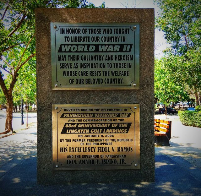
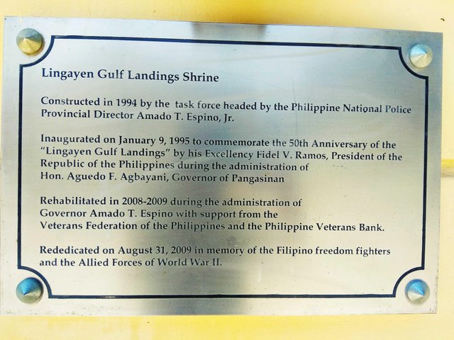
At the compund of the Provincial Capitol lies different structures including the World War 2 Museum and the Lingayen Gulf Landing Shrine which were inaugurated in 1995 and was rehabilateted during the period of 2008-2009 to commemorate and pay tribute to the war veterans of Pangasinan. It also commemorates the role of Americans in fighting against Japanese to defend Philippines during second World War.
World War 2 Open Museum
Some weapons and aircrafts used by the Americans during World War 2 are exhibited in the open museum grounds of Capitol Complex.
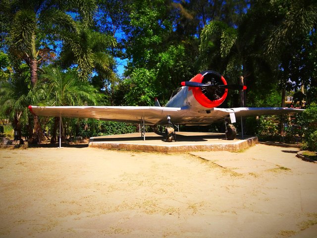
A military plane used by the American during the war. It was remained in this area for a long time and stood the test of time despite the bad weathers. It doesn't look old, but it doesn't look modern either.
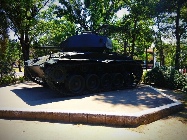
Amphinian tank which one of those which landed during the Lingayen Gulf Landing on January 9, 1945.
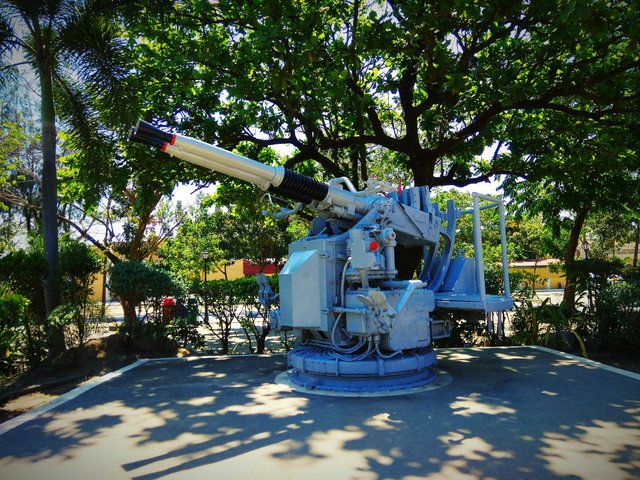
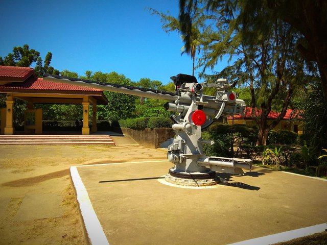
These weapons were used to fight against the Japanese, either by air or land.
Lingayen Gulf Landing Shrine
The landing of the Americans in Lingayen Gulf took place on January 9, 1945, during the height and close to the end of World War 2. The famous line the American General Douglas McArthur left in Leyte which is "I Shall Return" was fulfilled during his landing with American troops in Lingayen.
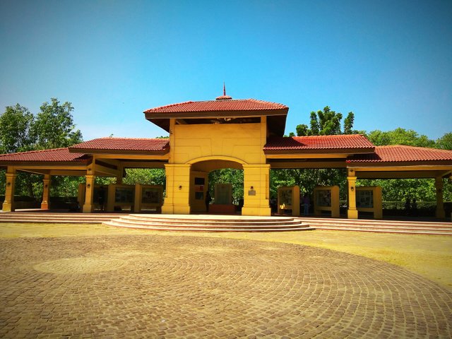
This is the structure where the events during World War 2 in Pangasinan and nearby provinces are documented. Let's look and learn from the history as we enter the shrine.
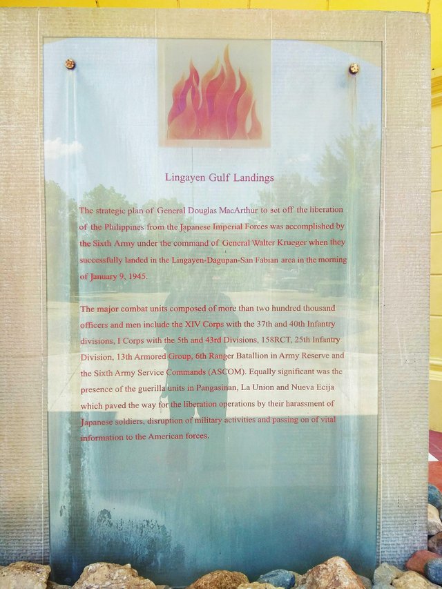
Located at the center of the shrine, it explains how the landing happened, and the extent of American troops landed to help free the country from the Japanese forces and colonization.
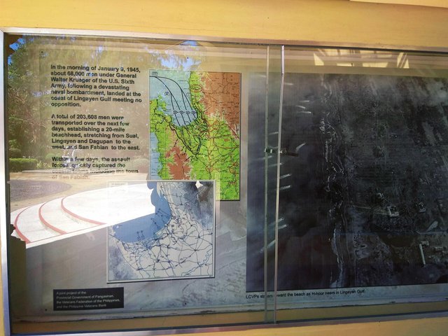
It was documented here the strategic plan and the maps how the landing came about. The Americans landed at the coastlines of Lingayen Gulf from different towns of of the province. The aerial view was also shown here the events during the landing.
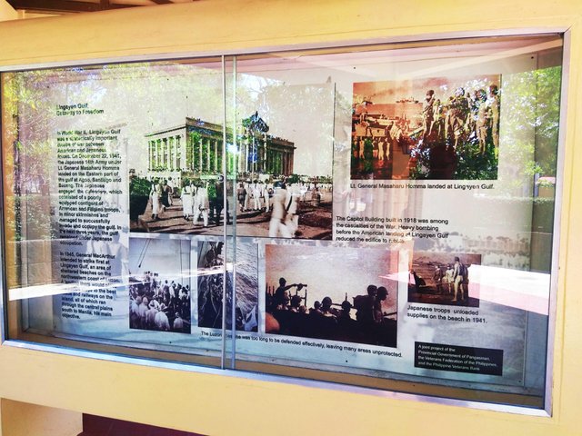
The pictures shown here were the events during World War 2, right in this area where the shrine was located. The Japanese troops also landed in Lingayen Gulf.
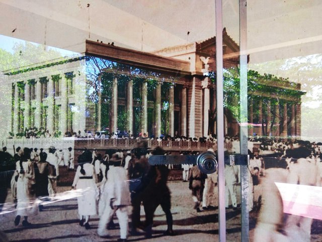
This is the Provincial Capitol Building during World War 2. It was built in 1918, but was heavily damaged during the war. This is how the Provincial Capitol Building looks now at the photo below.
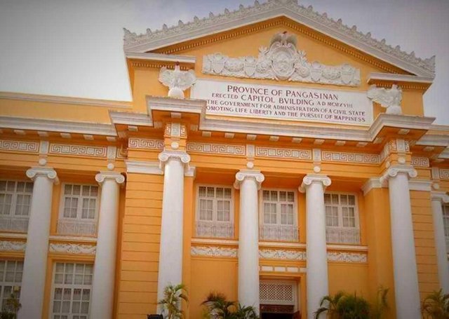
This is still the original building, and it was indicated it was built in MCMXVII, the Roman Numeral form 1918.
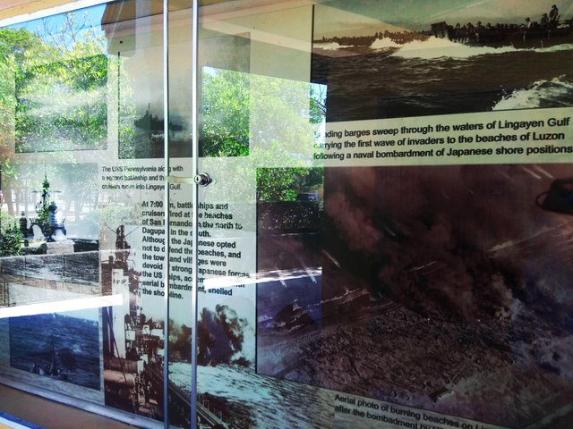
The shores of the beach was heavily struck by bombs during the war. Japanese positions were invaded as the American barges comes in through the waters of Lingayen Gulf.
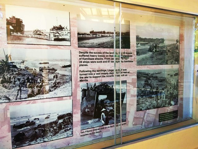
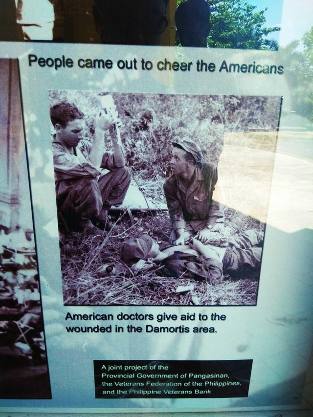
The American soldiers are no supernatural. Despite their strength, they suffered from Japanese attacks
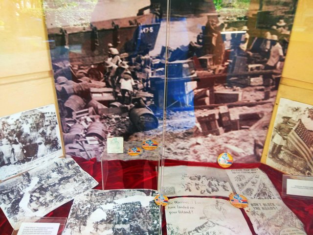
The area though became a depot for supplies.
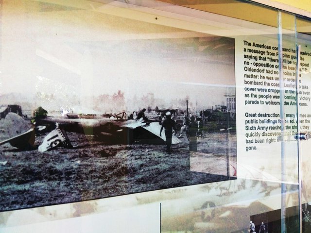
Lots of destruction happened in the area, from the weapons and planes to the public buildings nearby.
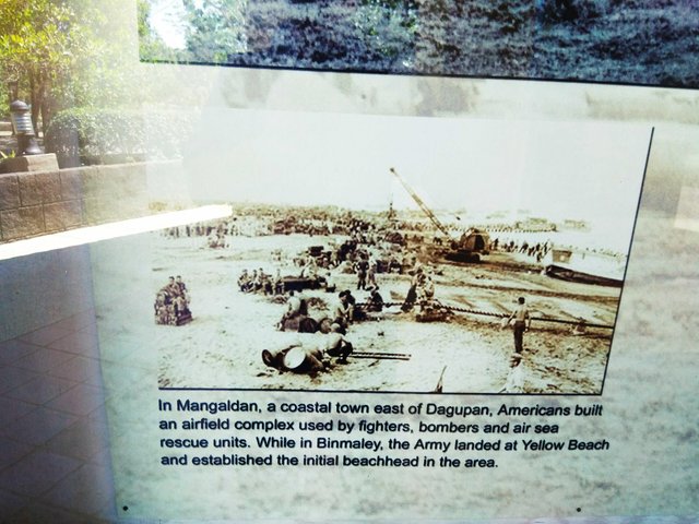
Pictured here is the coast of Mangaldan where Americans built an aircraft complex. It's an indication of growing power of Americans against Japanese soldiers.
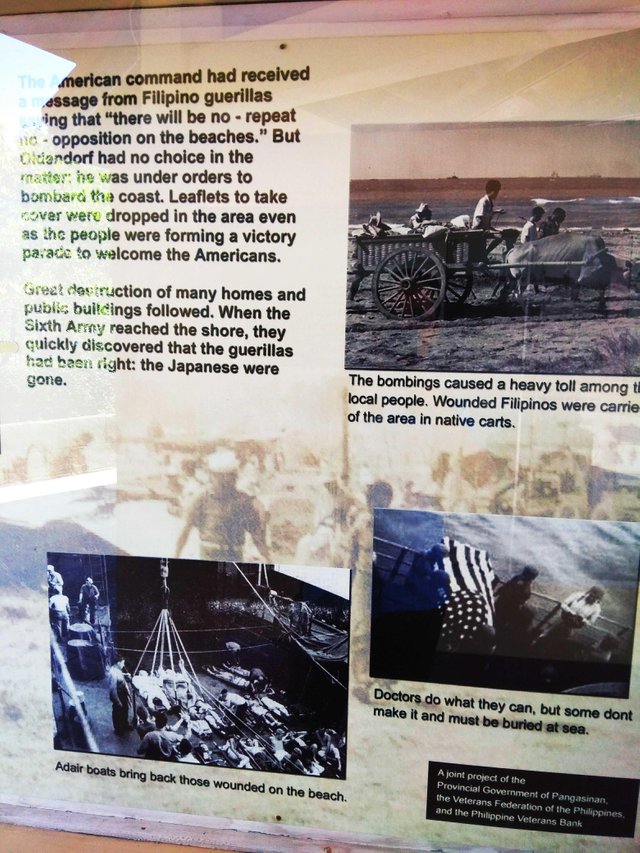
The war affected a lot of locals which killed tons of civilians, as well as soldiers. Some American soldiers who died during the war were buried in the sea.
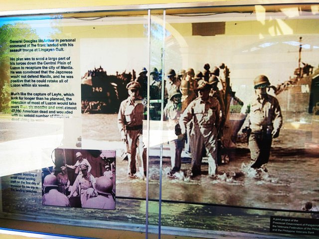
This is the historical landing of the American troops led by General Douglas McArthur. As he promised to return when he left Leyte, he fulfilled that promise upon landing in Lingayen Gulf.
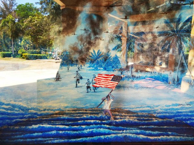
This is an oil canvass depicting the Filipino man holding and waving the American flag as he runs through the waters signifying support for the Americans.
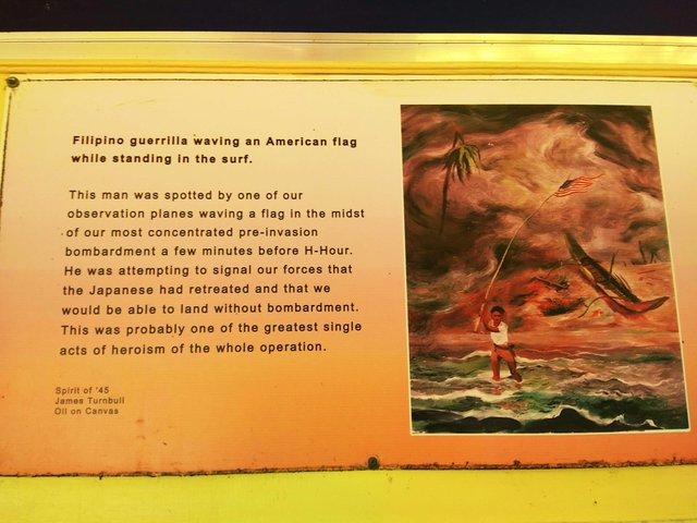
Another oil canvass by James Turnbull showing the man waving the American flag as a signal for the American soldiers.
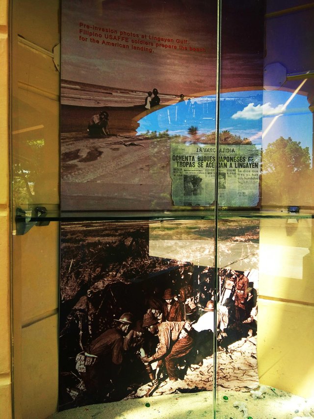
Photos before the landing in Lingayen Gulf showing the Americans preparing the area. The newspaper displayed is in Spanish. The country has been under colony for more than 3 decades, thus the language remaiitalicns being used then.
The events during the war and newspapers which are seemingly photocopied. You can see soem badges, but I am not sure what are they for.
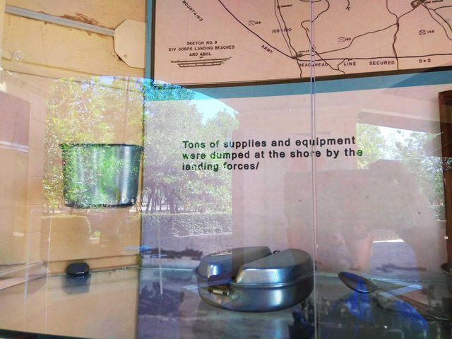
These are equipments left by the troops. They don't actually look old. They never got rusted. They're still shiny.
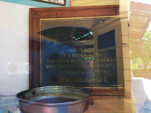
I am not sure about Australian's presence in the country during the second World War. I can't remember they're being mentioned in our History classes. But this plaque was given in 1995.
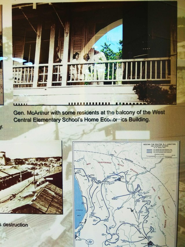
West Central Elementary School is historic. I never thought it is, that it already exists during the war. It was located in Dagupan City, and it still looks similar now.
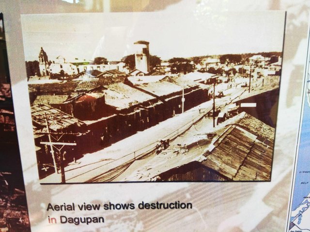
Huge destruction happened in Dagupan City. Meanwhile, that church and tower still exists that same area.
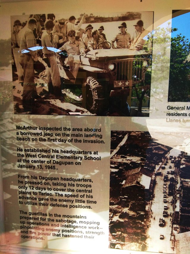
General McArthur went on to inspect the area. In another photo is an aerial view of Dagupan City.
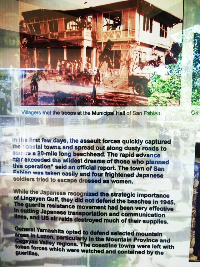
The Municipal Hall of San Fabian stand there but it seems damaged. It was taken over by the American forces.
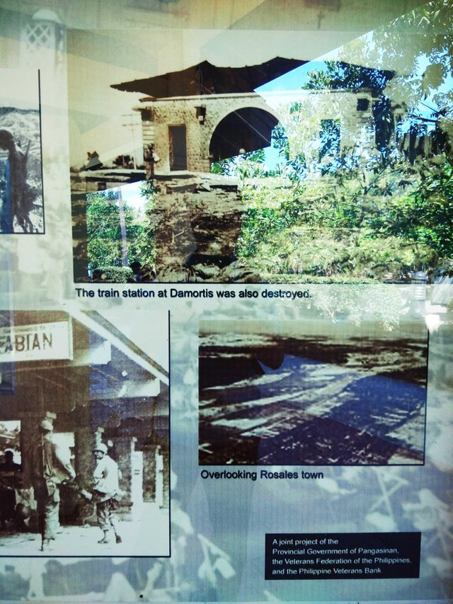
The train station in Damortis, which is at the boundary of Pangasinan and La Union was severely damaged. There's the aerieal view of the town of Rosales.
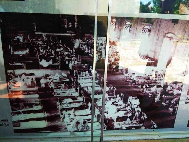
This is actually a church which was converted to a hospital where wounded people, particularly the soldiers wete brought and treated.
American doctors' lives is at risk. They are rescuing wounded soldiers.
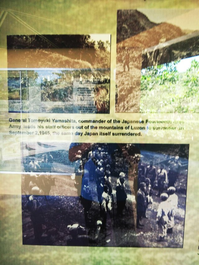
It seems the war is ending. The Japanese surrendered the same day the event in the picture happened.
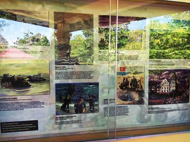
Oil canvasses by James Turnbull depicting the events during the war and the scenarios in Lingayen Gulf.
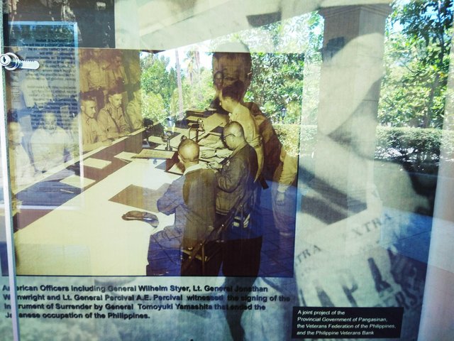
The war has ended, and the pact was signed. The Japanese occupation in the country had finally ended, which led to the grant of independency of the Philippines.
The shrine and the project was made possible by the Provincial Government of Pangasinan, the Veterans Federation of the Philippines, and the Philippine Veterans Bank to commemorate the World War 2 and the Lingayen Gulf Landing.
Photos are mine.
Medium used: Xiaomi Redmi Note 4.
Please support @surpassinggoogle as a witness by voting him at https://steemit.com/~witnesses and type in "steemgigs" at the first search box.
You can also give him witness voting decisions on your behalf, visit https://steemit.com/~witnesses again and type in "surpassinggoogle" in the second box as a proxy.
Please support his project as well, which is @teardrops Smart Media Token.
Join the Steemit School organized by @dobartim on Discord.


So many historical things in one place. Wow. Thanks for sharing. I have heard that Phillipine suffered a lot during WW2
Thank you for sharing our country history. your post simply took me there as if i was viewing it up close. thank you for the wonderful post. keep steeming. done upvoting it.
Thanks for sharing! Nice photos! :)