Oasis, Nevada Overview
Oasis, Nevada includes 11,473 nearby mines. Oasis is a census-designated place located in eastern Elko County Nevada (USA) at the junction of State Route 233 and Interstate 80 approximately 40 miles (64 km) west of the Nevada border with the state of Utah. Built along the Central Pacific Railroad (now Union Pacific Railroad) the tracks run along the north side of town.
Quick Facts
- Oasis, Nevada has a population of 29 (based on numbers from 2010).
- Located in Elko County, Nevada.
- Oasis, Nevada sits 1,790 meters (5,872.7 feet) above sea level feet above sea level.
Mines Summary
in Oasis, Nevada
- 49 Total
- 27 Occurrences
- 1 Prospects
- 1 Plants
- 20 Producers
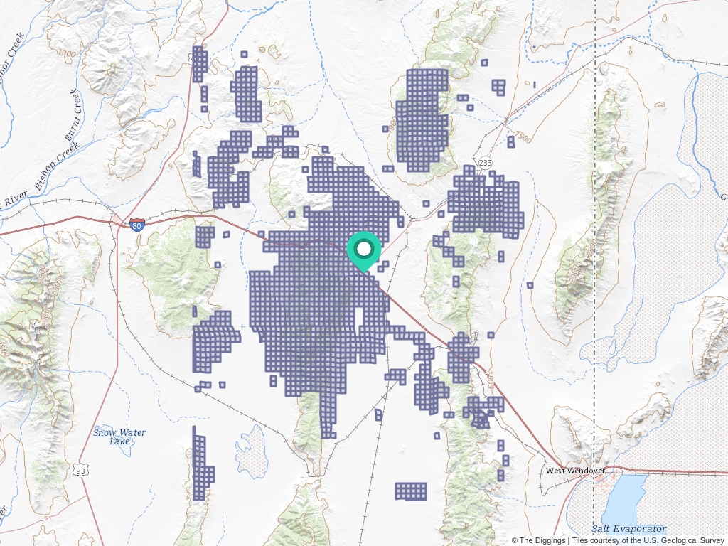
Oasis, Nevada Mine Locations
Click to open an interactive map.
© The Diggings™
Mining Claim News From The Diggings™
Learn more about the Bureau of Land Management, Public Land Survey System, and mining claims.
-

Understanding Claim Ownership
We receive lots of emails from people who find their name or a relative’s name on our site and want to know if this means they have some right to the land listed under that name.
-
Understanding BLM Administrative Areas
Whether it is filing a mine or researching one, the administering BLM office is going to be the definitive source.
-
Understanding Location Data
Mine handled by the Bureau of Land Management are not mapped by latitude and longitude, instead, these mines harken back to the Public Land Survey System.
-
Understanding Townships
A “township” can refer to two different things. Both are part of the PLSS measurement system but have different uses.