At the end of the last post, we drove along the Carretera Austral from Villa O’Higgins to Cochrane. Next, we wanted to explore the surroundings of Cochrane.

(Editor’s note: we currently have 5 months of delay between real life and our blog posts. We were in Cochrane in February)
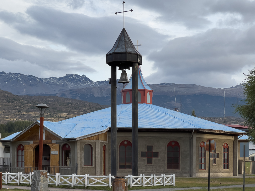
Cochrane
Cochrane is one of the larger villages along the Carretera Austral, but it’s still small with only 3,000 inhabitants.

At the viewpoint above Cochrane, we were pleasantly surprised to see the red Sprinter van of Tjorven and Claus (CuTe-Round-the-World) again. We had already met a couple of times in Tierra del Fuego.


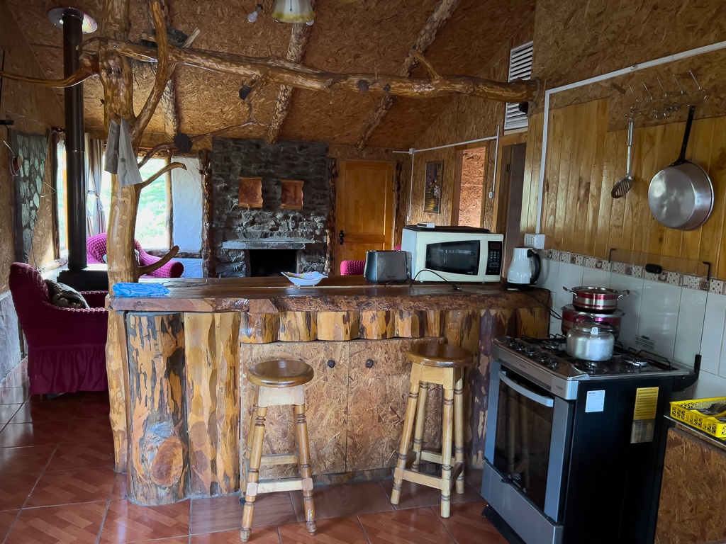
After a quick chat, we left the viewpoint to find some accommodation in Cochrane. We rented a nice wooden cabin and stayed there for the next four nights.

Ventisquero Calluqueo
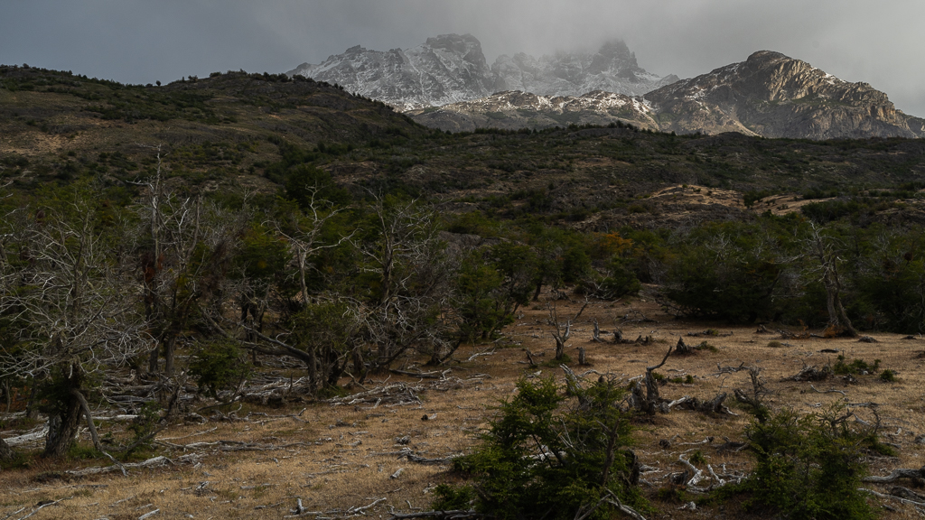
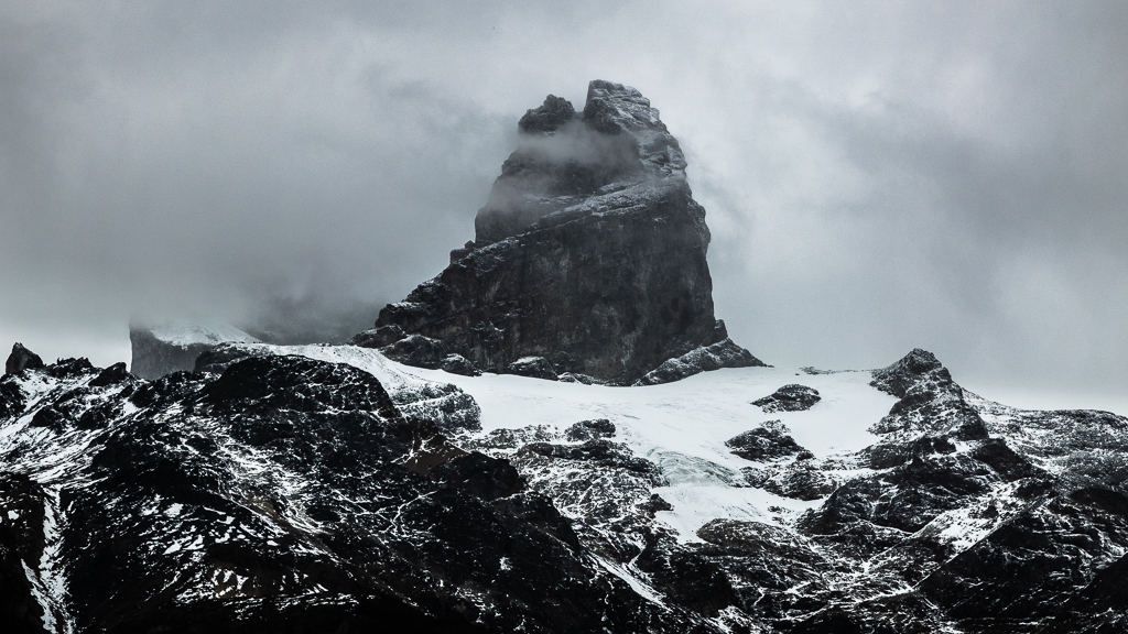
On the next day, we explored the two gravel tracks X-903 and X-901 southeast of Cochrane (see map at the top of this post). The X-903 leads to the Lago Brown and offers some spectacular views of the Cerro San Lorenzo mountain range.


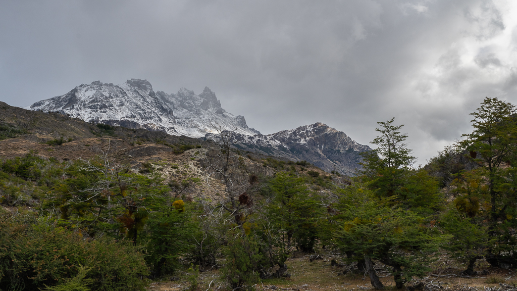

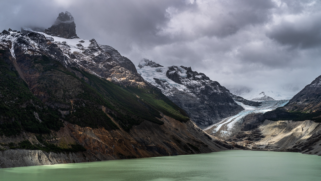
The X-901 leads to the Laguna Calluqueo and the Ventisquero Calluqueo glacier. Although the track is in a much better condition compared to my previous trip in 2019 you still have to cross some not confidence-inspiring wooden suspension bridges to reach the glacier.
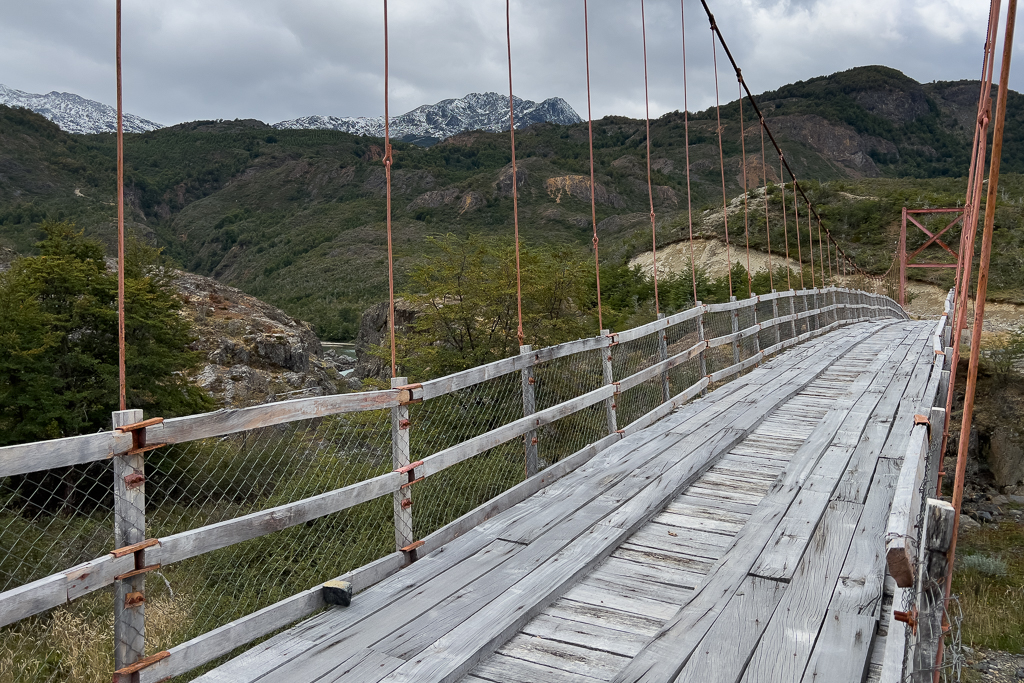
Halfway to the glacier, the road passes a nice little canyon. Of course, we had to stop there for some long exposure landscape photos.
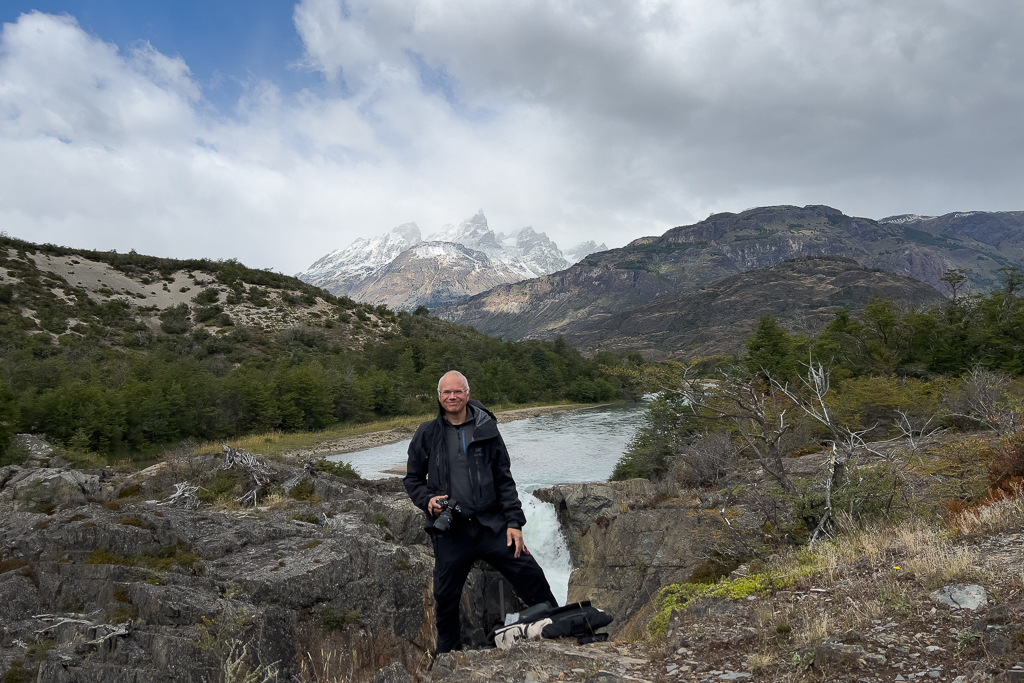


Soon after, we reached the Fin del Camino at the Laguna Calluqueo.

The landscape there is very wild with spectacular mountains, a glacier with blue ice, and a beautiful lake. It’s definitely worth the side trip from Cochrane.
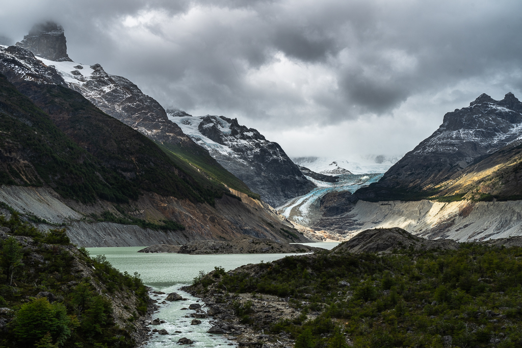

A flight with my drone revealed some hidden lakes with stunningly intense colors just below the glacier.

Lago Cochrane and Parque Nacional Patagonia – Sector Tamango
On the next day, we went to the Sector Tamango of the Parque Nacional Patagonia (formerly known as Reserva Nacional Tamango). This national park is located at Lago Cochrane.
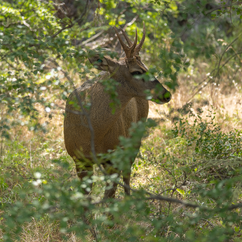
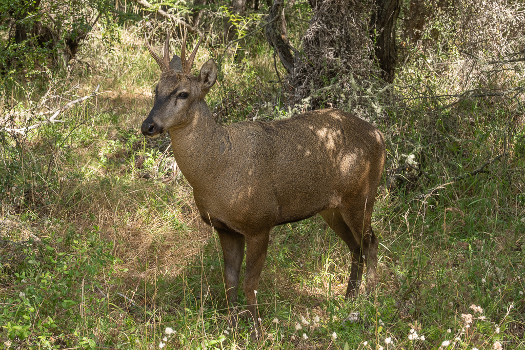
After paying the entrance fee at the park office we started to hike the Sendero Los Carpinteros. The trail leads along the edge of the Lago Cochrane and offers nice views of the lake.

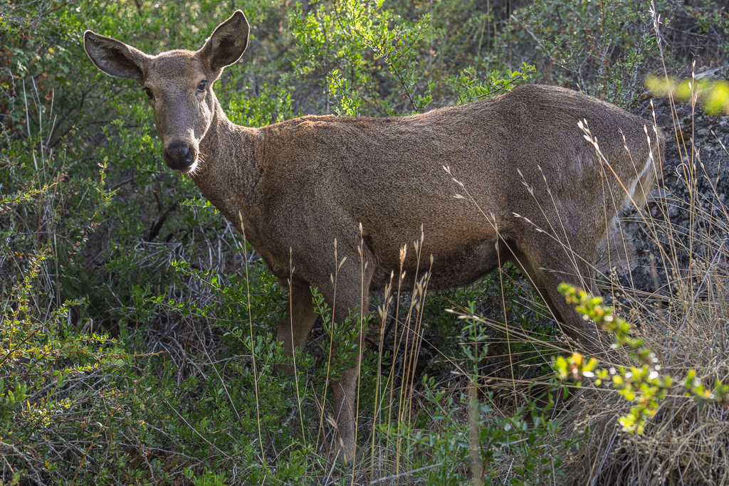
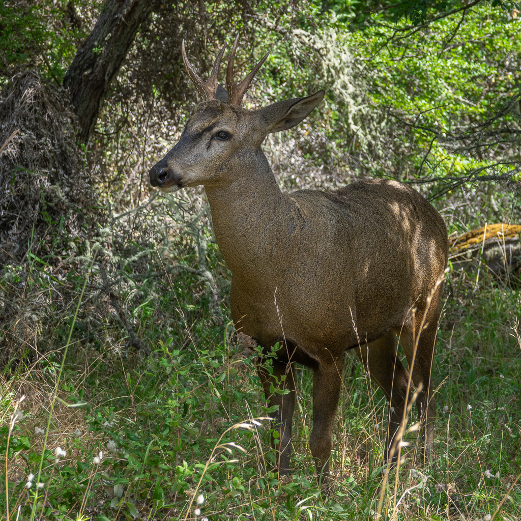
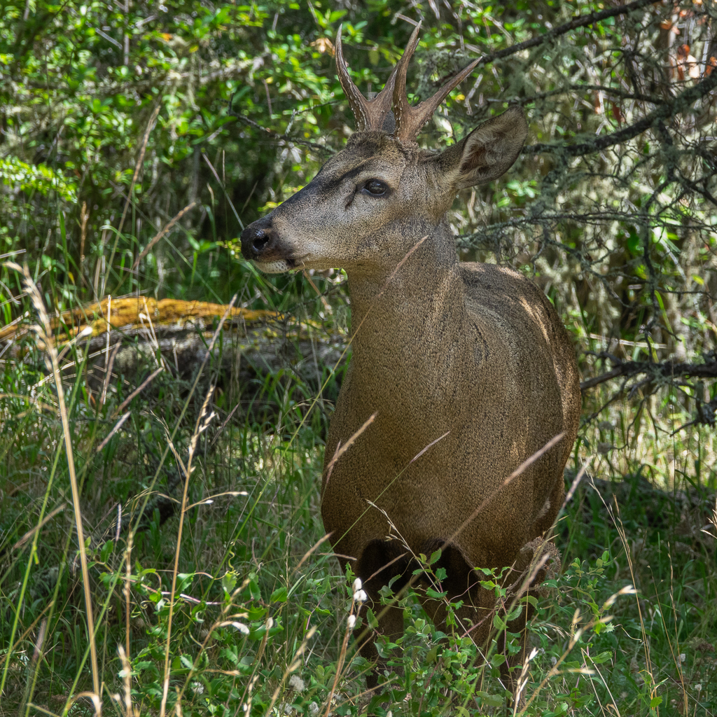
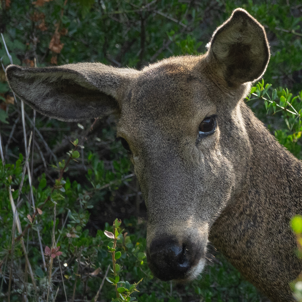
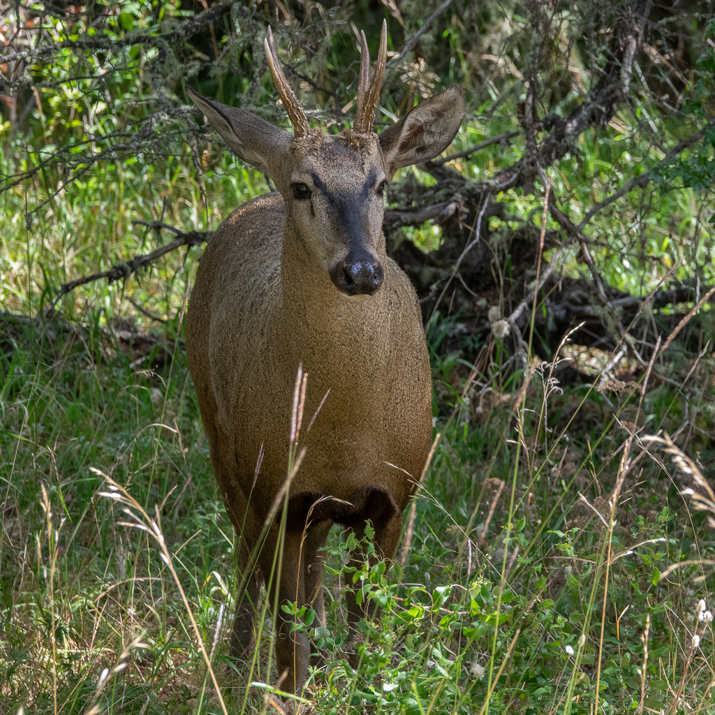
Despite its name, we didn’t see any carpinteros (woodpeckers) on the trail but luckily we saw some huemules instead. A huemul is a medium-sized deer that can only be found in the south of Chile and Argentina. Since we had never seen one before we were super happy to find a couple of different huemules on this trail. We could get very close to them and observe and photograph them for more than an hour. It was a very fascinating experience that we thoroughly enjoyed.


Ruta X-890
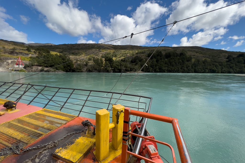
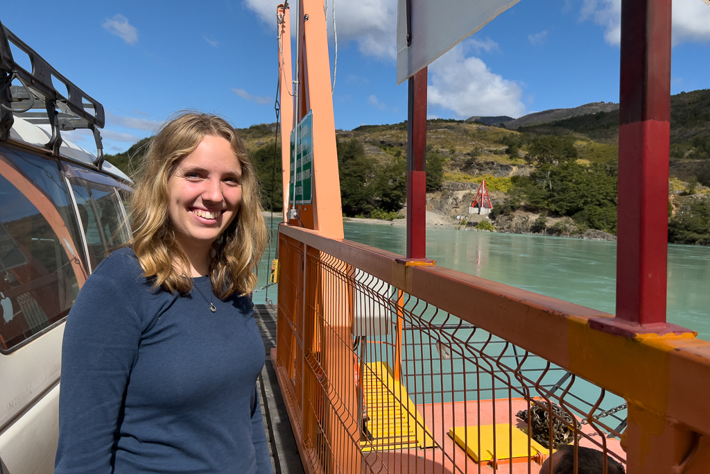
Another interesting exploration from Cochrane was the backroad X-890. You have to take a very small cable ferry across the Rio Baker to get there.
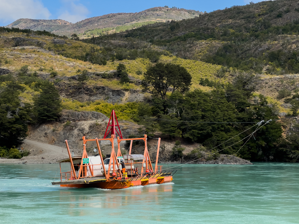

Only two cars fit on the ferry at the same time.

The ferry has no engine. It is moved just by the current of the river.
The X-890 leads through some beautiful remote landscapes.

16 km later, you reach a bridge, that crosses the Rio Baker again and leads you back to the Carretera Austral. In 2019 this bridge was an extremely narrow old suspension bridge that looked like a pedestrian bridge. If you were brave enough you could barely cross it with a small vehicle. But things have changed. Now, there is a wide metal bridge over the Rio Baker. Sadly, no more adventure there. But the side trip is still worth it, especially since the Balsa Baker ferry is fun to use (and it’s free).

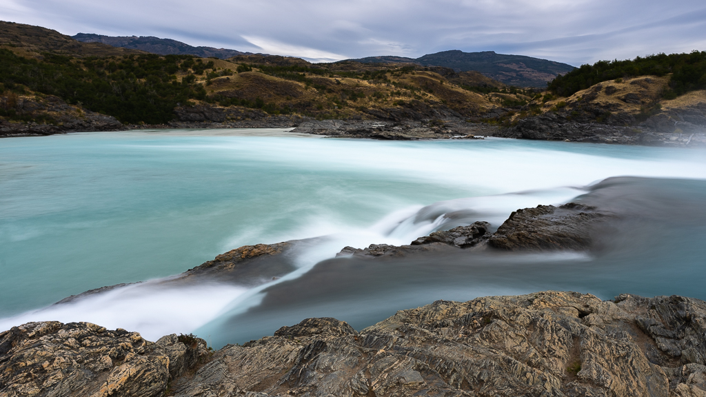
Confluenza Rio Baker / Rio Neff
Soon after this bridge, you get the first view of the confluence of the Rio Baker and Rio Neff from a viewpoint next to the Carretera Austral.

From the parking lot next to the confluenza a short 15-minute hike leads to this stunning place. From above (using my drone) you can clearly see the different colors of the Rio Baker (blue) and Rio Neff (brown).
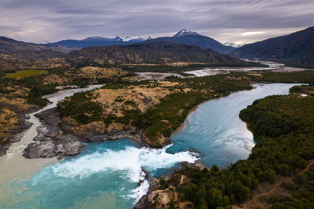

At the confluenza you can also find a beautiful waterfall.

But the Confluenza Rio Baker / Rio Neff is not the only confluence of two rivers in that area.
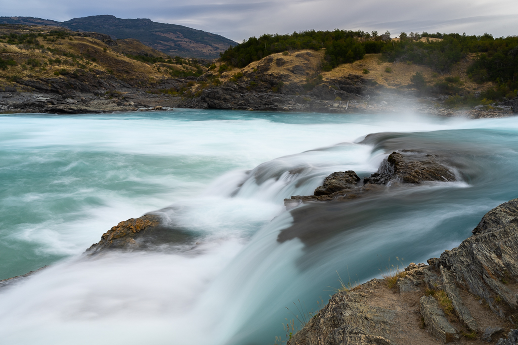
Confluenza Rio Baker / Rio Chacabuco
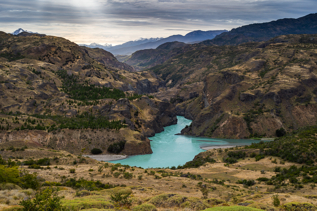
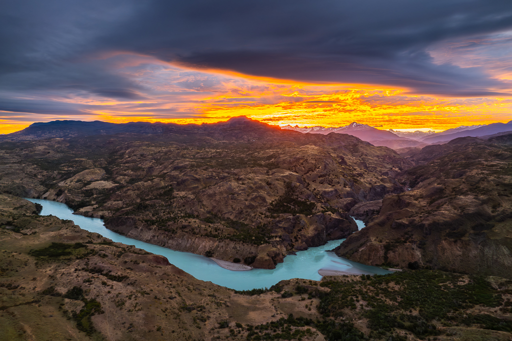
If you take the main road back to Cochrane you will soon reach the confluence of the Rio Baker and the Rio Chacabuco.
But first, we stopped at a nice viewpoint of the Rio Baker to shoot some classical landscape images of this beautiful river.

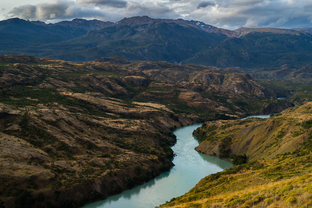
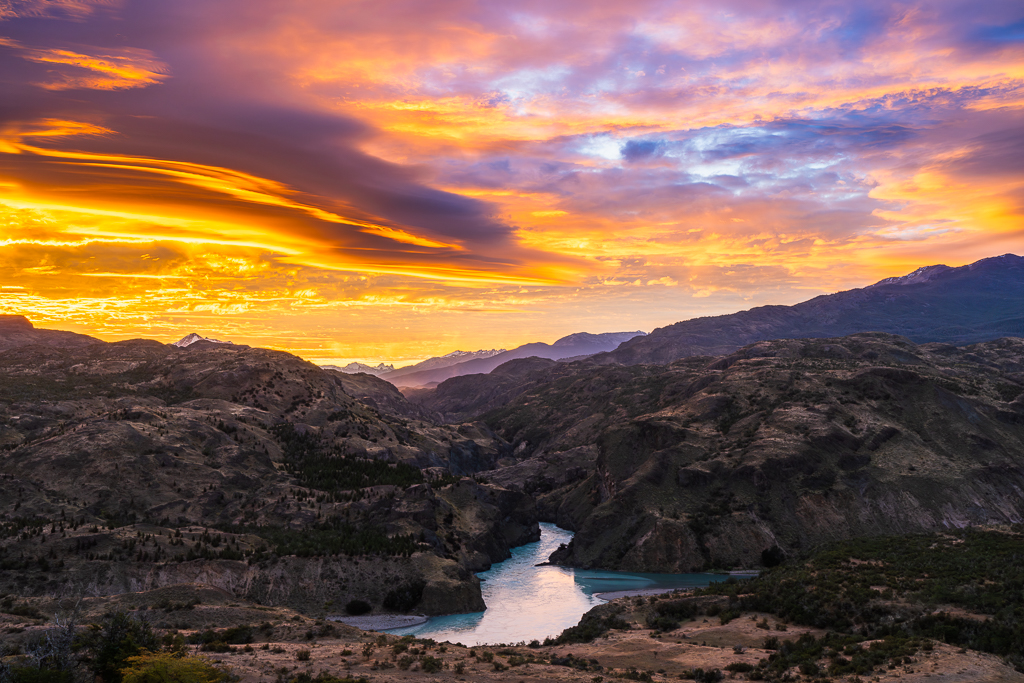
The confluenza Rio Baker / Rio Chacabuco is probably my favorite place in this area. On my previous trips along the Carretera Austral, I’ve already spent many hours at this place and still love it.


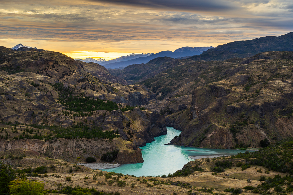
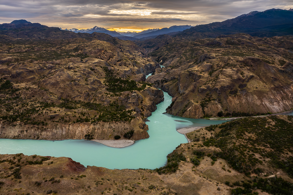
Luckily, we had a spectacular sunset that evening.


Altogether, we had three very interesting days in Cochrane. But now it was time to continue further north along the Carretera Austral.

I didnt expect to see that much (new?) snow on the mountains in February, corresponding to August on the northern countries. Unsually cold in late summer ?
Snow on the higher mountains can always happen in Patagonia, even in mid summer. It happens just more often in March or April compared to January or February. When I was around Cochrane end of March in 2012 all mountains were covered with fresh snow. A beautiful sight and perfect for landscape photography.
When we were there in February, there was a huge fire! I would have preferred the snow 😉
Hi Boris, again beautiful photos! Could you give more details on the loop on Ruta X-890? Where exactly is that cable ferry, and where the new metal bridge? I can’t locate them in Google Maps… Thanks
Hi Malte, if you plan in Google Maps the route from „El Arbolito“ to „El Manzano“ you can see the route, ferry and bridge. I can‘t attach screenshots here but I will send them to you via email.
Thanks, Boris! Does the cable ferry operate every day and all day round, or do they have an itinerary?
Can’t say for sure. I think in the past the ferry was operating all day year round. There are people living on the other side of the Rio Baker and the only way to reach their homes with a large or heavy vehicle was by using this ferry. With the newly built bridge further north they now have another option to get there.
Some statistics: I have been a couple of times at the ferry and I know two other people who used it. Out of 6 days only once the ferry was not operating.
The Calluqueo glacier – retreating glaciers are always a bit depressing, the snow on the mountains gives some hope it will not vanish completely (and looks pretty nice in combination with the dark clouds.)
I drove over the replaced suspension bridge in 2017 with a Suzuki Vitara – one more nice place for photo shots gone….
While the locals usually, for good reason, like improvements … something disappears. I read today that Iceland plans to pave the main mountain roads in the highland.
In 2019 I crossed this bridge with a Toyota 4Runner. You can imagine it was a tight fit.
Regarding Iceland: there are so many interesting highland tracks. They will never ever pave them all. The first one will probably be the Kjölur and the Kaldidalur. Not a big loss. There are already too many tourists there and there are better and more interesting alternatives.
You are really brave! We would never have dared to cross that suspension bridge on the X 901! 😉
Great pictures of the landscapes, the huemules and the two confluenzas!
The confluenza Rio Baker / Rio Chacabuco is also one of my favourite places in that area. Did you hike down?
Thanks Brigitte! No, we didn’t hike down. We were too busy taking pictures from above 😉