Popular Sunshine Coast retirement and holiday resort town.
Historically Caloundra was a typical Sunshine Coast retirement centre with a string of excellent beaches and quiet waters along the Pumicestone Channel (which separates the city from Bribie Island) where fishing and surfing were popular. Since the 1980s this has changed and, as the city has expanded, it has seen an influx of young commuters who combine with holiday makers and the retirees who move north from Brisbane, New South Wales and Victoria.
Today Caloundra city extends north to Buddina and south to Bribie Island. It is known for its string of excellent surf beaches which arc south from Buddina, Warana, Bokarina and Wurtulla across Currimundi Lake, and include the more centrally located Ballinger, Dicky, Moffat, Shelly, Kings, Bulcock and Golden Beaches. With its balmy subtropical climate and easy lifestyle Caloundra is ideal for fishing and water sports. It is recognised as the most southerly resort town on the Sunshine Coast.
Location
Caloundra is located on the coast 94 km north of Brisbane via the Bruce Highway and Caloundra Road.
^ TOPOrigin of Name
It has been claimed that in the language of the local First Nations peoples the word 'caloundra' meant 'the place of beech trees'.
^ TOPThings to See and Do
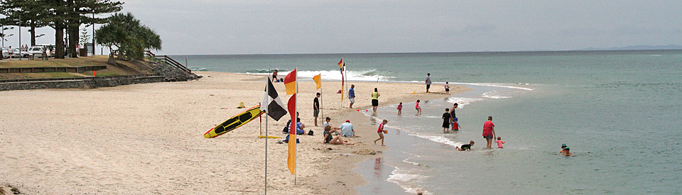
Caloundra's Beaches
Caloundra's primary appeal lies in the run of beautiful beaches, all with their special charm, which start at Golden Beach and, heading north, include Bulcock Beach, Kings Beach (the town's main beach), Shelly Beach, Moffat Beach and Dicky Beach. Those are the town's main beaches but, as the suburban sprawl has moved further north, across Currimundi Lake, they have included the beaches at Wurtulla, Bokarina, Warana and Buddina.
Golden Beach
The city's southernmost beach, located to the south of the CBD, is Golden Beach which is well protected from ocean waves by Bribie Island. The beach offers calm waters for safe swimming, boating, windsurfing, fishing and water skiing with jetties, play facilities, barbecues and picnic tables. There is a sailing boat club at the northern end, a power boat club at the southern end and a jetty in the middle which is ideal for fishing. The Pumicestone Passage, which separates Golden Beach from Bribie Island is shallow. It rarely is more than 2 metres deep.
Bulcock Beach
Located to the south of Caloundra's CBD (and therefore the city's central beach) and west of Deepwater Point, Bulcock Beach, is well protected by Bribie Island. It faces out onto Pumicestone Passage. The local Surf Lifesaving Club patrols the beach daily and the calm waters are ideal for safe family swimming, kayaking, boating, fishing, windsurfing, barbecues and picnics.There is a boat ramp next to the jetty, a lot of good places for fishing, a boardwalk along The Esplanade which is a delightful way to exercise and enjoy the beauty of the Pumicestone Passage, and across from the beach are a number of good restaurants and cafes. It is a typical "centre of town" beach.
Kings Beach
Lying east of Bulcock Beach, just around the Happy Valley Recreation Reserve, lies Kings Beach which was named after Alan King, the proprietor of the Grand Central Guest House (1888). Like Bulcock Beach it offers safe swimming (there is a surf lifesaving club at the eastern end) and surfing because it is exposed to the mild waters of the Coral Sea. There are picnic and barbecue facilities, an ocean pool at the northern end and a boat ramp on Caloundra Head. There is a pleasant walk along the foreshore where joggers and walkers can enjoy the views across the northern entrance to the Pumicestone Passage. Beyond Kings Beach is Caloundra Bar, formed between Deepwater Point and the northern end of Bribie Island.
Shelly Beach
Exposed to the waters of the Coral Sea, Shelly Beach is edged at the south by the rocky Caloundra Head (also known as Wickham Point) and to the north by Moffat Head. A plaque records the loss of 301 men and women, crew and medical staff, on board the Centaur which was torpedoed and sunk by the Japanese 16 km east of Cape Moreton in 1943. It was named because of the large numbers of sea shells on the beach. Unlike the safe beaches in the Pumicestone Passage, the beach is vulnerable to dangerous currents.
Moffat Beach
Moffat Beach lies between Moffat Head and Tooway Creek and is known as the finest surfing beach in the Caloundra area. Moffat Head was named after Brisbane chemist James C. Moffat who built a holiday house in 1883. A plaque on Moffat Headland commemorates the occasion in 1863 when a burial party was washed up on the rocks and marooned. They had been attempting to bury a female passenger who had died on board the Queen of Colonies ship. The WannaSurf website notes: "This wave is easily accessible with a short walk to the headland. When the surf is small it can only be ridden by long boards but when it is big only shortboards or pro mal riders because a large swell makes it break further out on a different ledge which sucks up and offers an awesome bowl section which barrels fast and heavily." Check out http://www.wannasurf.com/spot/Australia_Pacific/Australia/QLD/Sunshine_Coast/moffats.
Dicky Beach
The northernmost beach in the Caloundra CBD area is Dicky Beach, named after the SS Dicky which ran aground there in 1893. One of the more popular of the area's beaches, it is patrolled every day by the local Surf Lifesaving Club. It offers swimming, fishing and surfing, as well as children's play facilities, a skate park and picnic-barbecue facilities. The beach is edged by trees and bushes giving it a pleasant wildness even though the Dicky Beach Family Holiday Park is only a few metres from the surf.
The SS Dicky Propeller
Located in front of the public toilets at Dicky Beach is the propeller from the SS Dicky which ran aground on Dicky Beach on 1 February 1893 with a crew of 11 and 40 tonnes of sand. Attempts to relaunch it proved unsuccessful so it was used for local dances until someone knocked over a kerosene lamp and it was burnt out. The plaque underneath the propellor explains: "The Dicky, an iron screw steam vessel, was built in 1883 by G. Howaldt of Kiel, and her Port of Registration was Hamburg, Germany. Her tonnage was 226 gross and 144 nett; length 96 1/2 feet, beam 21 feet, and depth 14 feet, 9 inches ... The Dicky was on a voyage from Rockhampton to Brisbane with sand and water ballast in February, 1893 when she encountered a very severe gale. This prevented her from rounding Point Wickham (Caloundra Head). She was being driven towards the reef and her master, Captain John Summers Beattie, to save life and property, steered for the shore and stranded her in the vicinity of John Wilson's House on 4th February. No lives were lost. The wind and waves built up a sand bar, and all efforts to refloat the Dicky failed. The propellor ... was salvaged from the wreck."
In 2015 the rusting wreck of the SS Dicky, at the cost of $180,000, was removed from the beach as it was providing problems for surfers and beach swimmers.
Currimundi Beach
North of Dicky Beach, stretching for 8 km as a beautiful, unspoilt strand, is a beach divided into four separate sections: Wurtulla, Bokarina, Warana and Buddina. It is backed by foreshore parkland and extends all the way to Point Cartwright at Mooloolabah.
The Coastal Walks
There is a boardwalk and walking path around the coast from Dicky Beach to the southern end of Golden Beach. It is a delightful, popular walk where visitors and locals can exercise, enjoy the views across the Coral Sea and Pumicestone Passage, stop for coffee at the numerous cafes and just enjoy the relaxed ambience of this balmy and charming holiday and retirement destination.
Walk of Stars
Caloundra has the "Walk of Stars” which was devised by the 1960s pop star Tony Worsley. It is part of the main street (Bulcock Street) and includes an ever-increasing series of bronze stars celebrating members of the Australian and New Zealand music industry including Johnny Young, Jimmy Barnes, Ross Wilson, The Seekers, Phil Manning, Brian Davis and over fifty others. Each year three more names are added. It is associated with the Velvet Waters Rock n Roll Restaurant (Vegas on the Coast) which is located at 97 Bulcock Street. Check out http://www.velvetwaters.com for details. Over the years it has deteriorated and today it is barely a highlight. Still it is worth checking out.
Ben Bennett Bushland Park
Located between Queen Street and Nicklin Way, this luxuriant green space to the west of the city centre includes a patch of vine forest, melaleuca, eucalypts, hakea, casuarinas and a water-lily lagoon. It is a ideal spot for walk through greenery and it offers an excellent opportunity for bird watching. The Sunshine Coast Guide notes: "The reserve is a great place to study the beauty of the wildflowers, bird watch or just sit and enjoy a quiet hour on secluded seating, which is provided throughout the reserve. The Ben Bennett Bushland Park also features walking tracks which guide visitors through the vegetation communities of Melaleuca and Eucalypt forests, coastal heaths and one of the few areas of coastal lowland vine forest. Sugar gliders, possums and owls are just some of the shy creatures that venture out at night." Check out http://www.sunshinecoasteguide.com/Ben-Bennett.php.
Queensland Air Museum
Located at 7 Pathfinder Drive off Caloundra Road to the west of the city centre, the Queensland Air Museum is open to the public from 10.00 am - 4.00 pm every day. Tel: (07) 5492 5930. It started in 1974 and is a 100% volunteer organisation. The collection now has a staggering 89 complete aircraft from Australia's aviation past, a number of other craft in various states of completion, dismantlement and restoration (some on display and some in storage) and plenty of aviation memorabilia. Those on display include fighter planes, sports planes, utility vehicles, transport planes, airliners, executive jets, helicopters, replicas and bombers. For more information check out http://qam.com.au.
Lighthouses
There is a fascinating story which attaches to these two lighthouses which can be seen on Canberra Terrace up the hill from Bulcock Street. The original lighthouse, which was built on the hill in 1896 (because Caloundra and the Pumicestone Passage had become the main access point to Brisbane harbour) was an oil filled wick burner. In 1910 it was upgraded and could be seen 19 miles out to sea. In 1968 the second lighthouse - a signal station, light and radar installation - was built beside the original lighthouse which was duly moved to Golden Beach where, for years, it operated as the clubhouse for the Power Boat Club. In 1999 the old lighthouse was moved back to its original position next to the Signal Station. Today they can both be inspected on the hill. They are open every second and fourth Saturday of the month from 9.00 am - 3.00 pm. There is a plaque with extensive information in front of the two lighthouses. For more information check out http://www.sunshinecoastplaces.com.au/caloundra/kings-beach/canberra-tce/3-canberra-tce---lighthouses/caloundra-lighthouses-website.
Other Attractions in the Area
Aussie World and the Banana Bender Pub
Aussie World is located at 73 Frizzo Road, Palmview and is open daily from 9.00 a.m. to 5.00 p.m., tel: (07) 5494 5444. Once a complex theme park with snake handling and Aboriginal culture exhibitions, today it is a range of over 30 different rides (divided into rides under 100 cm, over 100 cm and over 130 cm) which include a Giant Slide, Ferris Wheel, Dodgems and a Wild Mouse Roller Coaster.
There is also a replica of the amusing and mythical Ettamogah Pub, now known as the Banana Bender Pub, which once featured in cartoons by Ken Maynard. The cartoon pub is an exact replica with outward leaning walls and verandas and an old jalopy on the roof. It is one of the restaurants on the site.
Wild Horse Mountain Lookout
Wild Horse Mountain Lookout is located on one of the volcanic plugs that make up the Glass House Mountains. It not only offers excellent views of the mountains but also has panoramic views east over Pumicestone Channel to Bribie Island. It can be accessed from the Bruce Highway between Donnybrook Road and Roys Road.
History
* Prior to the arrival of Europeans the area was occupied by the Kabi Kabi First Nations group. Every few years they would gather on the banks of Obi Obi Creek to feast on the rich Bunya nuts.
* When Captain James Cook sailed up Australia's east coast he noted and named the Glass House Mountains in May, 1770.
* In 1799 Matthew Flinders sailed into the channel which lies between Caloundra and Bribie Island. He stayed in the area for 16 days. He noticed the pumicestone on the shore and named the channel Pumicestone River. Flinders explored the hinterland and climbed Mount Beerburrum on 26 July, 1799.
* The Caloundra area wasn't settled by Europeans until 1862. The first permanent settler was John Ballinger who selected land for sheep-raising south of Lake Currimundi.
* The town was surveyed in the 1870s.
* In 1875 the Brisbane newspaper proprietor and politician, Robert Bulcock, purchased 277 acres in the district.
* In 1882 the explorer William Landsborough, with a £2000 reward from the Queensland government, purchased 2,372 acres of what is now Golden Beach. Between 1882 and his death in 1886 Landsborough grazed sheep on his property.
* The first land sales in the town occurred in 1883.
* The first hotel in the area was built in 1885 on Shelly Beach.
* By the late 1880s Caloundra was becoming known as a seaside resort.
* The town's first school was opened in 1889.
* In 1896 Caloundra got its first lighthouse.
* By 1905 Wilson's Guest House was offering holidays on Dicky Beach.
* A bakery was built in 1909.
* A general store was opened in 1910.
* In 1917 Robert Bulcock, Jr subdivided part of his land into 404 building blocks.
* The local School of Arts was opened in 1927.
* Golden Beach was subdivided in 1928.
* The Kings Beach surf lifesaving club was formed in 1933.
* During World War II Caloundra became an important defence location with machine gun sites on the beaches and three radar stations.
* The population was 2,800 in 1961.
* The local high school was opened in 1967.
* Kawana Waters Shopping World was opened iin 1979.
* Major commuter belt development occurred during the mid-1980s.
* In 2008 Caloundra City was amalgamated with Maroochy and Noosa Shires to form the Sunshine Coast Regional Council.
^ TOPVisitor Information
Caloundra has two visitor information centres. One in the centre of the city - the Bulcock Street Visitor Centre, 77 Bulcock Street, tel: 1300 847 481 and one at Caloundra Road Visitor Information Centre, 7 Caloundra Road, tel: (07) 5458 8846. Both are open from 9.00 am - 3.00 pm seven days a week.
^ TOPUseful Websites
There is a useful online directory to the city. Check out http://www.caloundracity.com.au and the official website is https://www.visitsunshinecoast.com/What-to-do/Places-to-see/Caloundra-to-Kawana.
^ TOP
The boardwalk from Bulcock beach to King’s beach. I learned to body surf at King’s. Harry Trundle taught me how. He lived at Landsboroug and had a singing group that used to practise in his garage. I remember him singing a popular song from the Boxtops “My baby wrote me a letter”.
The surf life savers were just awesome. I love Caloundra so much.
Ask any body that ever had a holiday there. They keep coming back. There’s just something about the place.
Has Caloundra Bar location always been as it is now? Or has it been further south where the ocean has broken thru recently?
Is the Bar expected to silt up now?
The Ettamogah Pub is now the Banana Bender Pub. It has been renovated by new owner and contains lots of Australian memorabilia. Great place to take overseas visitors. Serves great meals too. Highly recommend.