Major town in Queensland's Granite Belt
Stanthorpe is an attractive rural service centre set in the middle of a rich, mixed farming area where rural activities range from vineyards, wineries and orchards to sheep and cattle grazing. Stanthorpe is unusually cool for Queensland. In winter the night time temperatures in the town often fall below zero - the average minimum temperature for July is 0.3°C. Today the district is known for its cold climate apples, grapes and stone fruit as well as sheep and cattle grazing.
Location
Stanthorpe is located on the New England Highway 217 km south-west from Brisbane via Warwick. It is 57 km north of Tenterfield and 811 m above sea level.
^ TOPOrigin of Name
Stanthorpe grew along Quart Pot Creek. When tin was discovered in the district the name combined Stannum, the Latin word for tin, and "thorp" the Middle English term for village. So it literally means Tin Town or Tin Village.
^ TOPThings to See and Do
Stanthorpe and District Historical Society Museum
Located at 12 High Street, the Stanthorpe and District Historical Society Museum is surrounded by a number of historic buildings including a shearer's hut from Ballandean Station (1876), Ardmore House (1920s), the North Marylands School Residence (1894), the Stanthorpe Shire Council Chambers (1914) and a small gaol from Willsons Downfall (1876). The museum includes some interesting railway artefacts (commemorating the Amiens branch line for the soldier settlement area), and an extensive collection of local memorabilia. Opening times for the museum are Wednesday-Friday 10.00 am - 4.00 pm and on Saturday 1.00 pm - 4.00 pm on Sunday 9.00 am - 1.00 pm. Tel: (07) 4681 1711. For more information check out http://aumuseums.com/qld/stanthorpe-museum.
Public Art Works
Stanthorpe has a number of interesting public art works - huge murals, impressive mosaics and public sculptures. All of them can be seen by walking down Maryland Street from the Stanthorpe Post Office. There is no brochure so you will have to go on a personal treasure hunt. Of particular interest are:
Hidden Cultures - a community mosaic created in 2005 by Teri Welles and Maggie Brockie. "Developed from items donated by members of the local community and items handmade by children and adults in workshops conducted by Maggie and Teri, this work represents many of the different cultures - be they ethnic, historical, family, personal, recreational or symbolic - that make Stanthorpe a diverse and vital place.
"The design is a layered landscape. The lower layers represent the earth, environment, waterways, and animals ... the past. The middle layers represent industry and domestic cultures, family, farming, business and history, while the top layers incorporate multicultural and contemporary elements, youth, music, sport and recreation. The sky - both night and day - represents the passing of time, the dark and light, the balance of light, the balance of life. The big bright sun is made of little suns, our sons and daughters ... the future."
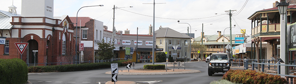
Blue The Divine - located at the roundabout opposite the Post Office, was created by Chris Humphreys out of sandstone and granite.
Angelo Valiante Mural - located on the wall opposite the Post Office is a remarkable, realist image of Angelo Valiante by the great mural artist, Guido van Helten who was the artist responsible for the huge murals on the silos at Brim in Victoria. "The mural depicts Angelo Valiante who turns 100 in November in 2016. Mr Valiante was one of the first Italians to settle in Stanthorpe and the work pays homage to the Italian community that have made the region what it is today. Angelo looks reflectively to the main street of Stanthorpe with a hope in his eyes - and an optimism for the future of the region and what the next 100 years will bring." It is worth noting that Angelo Valiante was a POW from 1941 to 1947 when he was repatriated to Italy. Angelo was sponsored to return to Stanthorpe by his former employer and arrived in 1950 with his wife and son.
Heritage Listed Buildings
El Arish
Located at 94 Greenup Street, this substantial house and garden (it is now a private residence well hidden from the road by a high hedge) were built for Major Allan and Isabella Chauvel in the early 1920s. The Queensland Heritage Register notes of the house: "Characteristic elements of the early market garden survive at El Arish including a rare and early Williams pear tree, Isabella grape vines, sections of dry stone walling and terraced sections of the garden which were incorporated into the later Chauvel garden. These elements are illustrative of the establishment of market gardens in and around Stanthorpe from the 1880s.
El Arish is a characteristic and rare example of a summer residence established in Stanthorpe in the 1920s during a period of intense tourist activity which saw many buildings constructed to support this new industry.
"El Arish consists of a single-storeyed chamferboard residence, with a corrugated iron roof, set amidst a structured garden comprising distinct formal, informal and service areas. El Arish is located on the western slope of Foxton's Hill, adjoining the rugged landscape of the Stanthorpe Soldiers Memorial reserve at the rear, with the highest section of the property affording views over Stanthorpe a short distance to the west.
"The garden at El Arish is an important and rare surviving example of a 1920s Queensland garden influenced by Arts and Crafts gardening ideals. It was designed by Isabella and her son, Charles, to allow a variety of experiences and functions within different areas. Many of the early features remain extant. The cypress hedge along Greenup Street is a marvellous feature of the garden and a rare example of a hedge of this size and extent in Queensland." For more information check out https://environment.ehp.qld.gov.au/heritage-register/detail/?id=601633.
Masel Residence
Located at 98 High Street and listed on the Queensland Heritage Register, Masel Residence (now a private home and not for inspection) is a "substantial two-storeyed brick building, the former Masel Residence was erected in Stanthorpe in 1937-1938 for Dr Harry Masel and Una Masel and their family. Designed in 1936 by Charles William Thomas Fulton of Donoghue and Fulton Architects and constructed by Sydney builders Kell and Rigby, the building with its functionally zoned planning and abstract monumental facades was strongly influenced by European modernist architecture. One of the first examples of these trends in architecture in Queensland, it was the joint winner of Queensland's inaugural awards for meritorious architecture in 1938." They define the importance of the building as "The house demonstrates, through the inclusion of a purpose-built surgery with separate entry, ways in which work and domestic environments were combined in the homes of medical practitioners during the first half of the 20th century. The former Masel Residence is a striking example of a building in what is known as the interwar functionalist style and incorporates typical features of the style such as asymmetrical cubic massing, expanses of undecorated brick walls, steel corner and strip windows, curved brickwork corners, flat cantilevered awnings and a concealed roof." For more information check out https://environment.ehp.qld.gov.au/heritage-register/detail/?id=601552.
Central Hotel
Located at 140 High Street, the Central Hotel was built in 1908 by John Sheahan. An advertisement at the time declared "Everything New and Up-to-date. Tariff: 4s. & 8s per day, Special arrangements re Permanent Boarders. The largest and best appointed Hotel in South-western Queensland, containing 30 Bedrooms and 4 Parlours. Rooms Large and Airy, with twelve foot wide Balcony all round. Table Unexcelled. The comfort of Patrons carefully studied. Hot and Cold Water Baths. The Proprietor guarantees the Purity and Quality of all his stock of Wines and Spirits; only the very best are served. Letters and telegrams receive prompt attention. Cab meets all trains. 'Phone No. 4." It is listed in the Queensland Heritage Register as "one of the largest buildings in Stanthorpe when constructed in 1908 and demonstrates the development of the town in the early twentieth century, when several large masonry buildings, including the nearby post and telegraph office were constructed." For more detailed information check out https://environment.ehp.qld.gov.au/heritage-register/detail/?id=600830.
Post Office
The Post Office was built by the Government Architect in 1901 it has a commanding position on the main street and its front is decorated by the British coat of arms. It is a good example of Edwardian Classical design (sometimes referred to as Arts & Craft style) with arched windows and a very ornamental ceiling. It was one of the first post offices built after Federation and was designed by the Commonwealth Government Architect, John Smith Murdoch.
Stanthorpe Soldiers Memorial
Located on Lock Street, and listed by the Queensland Heritage Register, this unusual memorial was "Built in honour of the soldiers of the district who participated in the Great War, the Stanthorpe Soldiers' Memorial was funded, as with many other such memorials across the state, by public subscription. Stanthorpe's memorial took the form of a park and rest house located on Foxton's Hill described at the time by The Queenslander as one of the lonely hills overlooking Stanthorpe. The rest house was designed by Warwick architects Dornbush and Connolly and built by local contractors NJ Thompson and Sons; inside were seats and on the walls, five rolls of honour, one of which was reserved for the fallen. The Soldiers' Memorial was officially opened on 6 February 1926 by Major General Sir William Glasgow, a commander of campaigns in Gallipoli and also in France, whose battlefields were to be memorialised in Australia by the naming of the towns of the soldier settlement area (Amiens, Pozieres, Bullecourt, and Fleurbaix) established near Stanthorpe soon after the War." For more information check out https://environment.ehp.qld.gov.au/heritage-register/detail/?id=601632.
Other Attractions in the Area
The Granite Belt
Stanthorpe lies at the heart of what has become known as "The Granite Belt", a region which extends for 50 km north from the New South Wales border. The town is surrounded by large granite outcrops. The two most important parks in the area are the Girraween National Park and Sundown National Park.
Girraween National Park
Girraween National Park is located 32 km south of Stanthorpe and is reached by taking the turnoff from the New England Highway at Wyberba. The park is known for its spectacular wildflower displays (Girraween is an Aboriginal word meaning "place of flowers") as well as its impressive granite outcrops which include angular tors and boulders which appear to be precariously balanced. The website https://www.npsr.qld.gov.au/parks/girraween includes a detailed and downloadable map (https://www.npsr.qld.gov.au/parks/girraween/pdf/girraween-map.pdf) which has details of ten bushwalks in the park including the Bald Rock Creek circuit and Wyberba walks. The excellent Girraween and Sundown National Parks brochure (downloadable at https://www.npsr.qld.gov.au/parks/girraween/pdf/girraween-dg.pdf) proudly points out that the visitor can have a range of experiences "From easy Wyberba walk to a challenging full day hike to Mount Norman and back, it takes more than a couple of days to explore Girraween’s 11 800 hectares of rock-strewn ridges, cascading creeks and fascinating forests ... Thrill at seeing The Pyramid or hiking up it for the first time. Stand in awe under Granite Arch. Delight in discovery along the creek or between boulders on the Bald Rock Creek circuit or The Junction track, where enticing rockpools beckon you to dip in your toes or watch reflections in still, chilly waters. Simply disappear! Underground Creek will amaze as water mysteriously vanishes and then resurfaces to continue its journey downstream to Dr Roberts Waterhole. Get your blood pumping on a longer hike to imposing Castle Rock, The Sphinx or Turtle Rock, where you’ll gaze over rugged scenery formed by molten rock that has been uplifted, exposed and eroded by water, wind and ice. Be transported into Girraween’s remote ‘back country’ when you visit Mount Norman day-use area, cycle or walk shared trails, or take on the challenge of an overnight hike."
Soldier Settlements
To the north of the town are the soldier settlements which were established after World War 1. They were named after famous World War 1 battlefields so that, as the old railway signs at the Stanthorpe Museum indicate, there were once railway stations at Amiens, Messines, Bapaume, Passchendaele, Bullecourt, Pozieres and Fleurbaix. Visitors wanting to learn about the old soldier settlements should visit the Amiens Legacy Centre.
Amiens Legacy Centre
Located 17 km north-west of Stanthorpe at 17 Goldfields Road, Amiens, the Amiens Legacy Centre provides a rare glimpse into the Pikedale Soldiers' Settlement Scheme. It includes a Soldier Settlement family sculpture, a Passchendaele Shed and a Bailey Bridge. Tour guides area available on Sundays from 10.00 am - 1.00 pm. Check out https://www.amiensqldhistory.com for more information.
Orchards
The coolness of the surrounding district has meant that apples, pears and various stone fruits including plums, peaches, apricots, cherries and nectarines have all been grown successfully.
Vineyards and Wineries
Stanthorpe is the centre of a thriving wine area. From Cottonvale in the north to Wyberba (south of Ballandean) there are 38 vineyards, cellar doors and wineries. Because of the latitude (it is only a few hundred kilometres south of the Tropic of Capricorn) the area around Stanthorpe boasts the highest altitude vineyards in Australia. This unique microclimate has seen grapes grown in the area since the 1870s. If you want to explore the cellar doors the vineyards are conveniently located along the New England Highway to the north and south of Stanthorpe, with a few on the road to Texas. The best way to access information (apart from discussing your plans at the Visitor Information Centre) is to download the excellent PDF map of the Wineries of the Granite Belt at http://www.aventinewines.com.au/StanthorpeWinery.pdf. There is an excellent brochure Granite Belt Wine Country which has articles on the best wineries in the are and provides details of 30 wineries in the area. It includes a map and encourages wine enthusiasts to explore the websites of the vineyards.
Gem Fossicking
The area is also noted for its gemstones and gem fossicking (for smokey quartz, topaz, zircon, garnet and the occasional sapphire) is common in most of the streams in the area. The best places are Spring Creek, Severn River and Quart Pot Creek. A fossicking permit has to be obtained from the Court House in Stanthorpe. There is a Lapidary Forum which discusses fossicking in the area. Check out http://aussielapidaryforum.com/forum/index.php?topic=3149.0.
History
* Prior to the arrival of Europeans the district was home to Kambuwal Aborigines from the Bundjalung language group.
* The first European to explore the area was Allan Cunningham who passed through the area in 1827.
* Farmers did not move into the area until the 1840s.
* The Stanthorpe district was first settled in the 1850s.
* Grapes were first grown in the area in the 1860s. It was promoted by Father Jerome Davadi, a local priest of Italian descent.
* The discovery of tin on the Quart Pot Creek in 1871 brought an influx of miners to the area. Leases were taken out in 1872.
* The Pioneer Tin Mining Company started mining in 1872.
* A settlement at Stanthorpe started in 1872. A postal service and telegraph office opened that year.
* A local school was built in 1874.
* In 1875 the Border Agricultural, Horticultural and Mining Society was formed.
* By 1876 the price of tin had collapsed.
* The railway arrived in the town in 1881.
* In the 1890s German settlers moved into the area.
* The Post Office was opened in 1901.
* The Central Hotel was opened in 1908.
* After World War I soldier settlements were established to the north of the town.
* In 1920 the branch or spur railway line was completed from Cottonvale to Amiens to enable the Soldier Settlers to send their fruit to the Brisbane markets.
* A jam and preservative Co-op factory was opened in 1922.
* The first Italian migrants arrived in the area in 1924.
* During World War II Italian POWs were sent to the area to work on the farms.
* A local aerodrome was opened in 1954.
* The local secondary school opened in 1961.
* On 23 June, 1961 the temperature reached a record low for Queensland - at -10.6°C.
* By the 1990s the town had a 15 per cent non-Australian born population of which 65 per cent were of Italian descent.
* By 2000 there were nearly 40 wineries in the district.
* By 2011 there were over 5,000 people living in the town.
^ TOPVisitor Information
Stanthorpe Visitor Information Centre, 28 Leslie Parade, tel: (07) 4681 2057, Open 9.00 am - 4.00 pm daily.
^ TOPUseful Websites
There are a number of websites but they tend to provide only general information. Check out http://www.southernqueenslandcountry.com.au/destinations/stanthorpe and http://www.sdrc.qld.gov.au/our-region/region-information/stanthorpe.
^ TOP
Thomas James Moynihan, my grandfather, was born in Stanthorpe January 1 1881.
I wonder if there is any information in your historical society. My mother, his daughter, Elizabeth Jane Moynihan died when I was 21 months old I wonder how his family came to be there and who they were.
Patricia Ann Soltermann
Please email Stanthorpe Museum at stanthorpemuseum@yahoo.com with the information you have, and we will endeavour to add to that
You should be sure to visit the museum https://www.travlar.com/2021/01/the-stanthorpe-heritage-museum-has.html
My family come from that area – fruit growers named Gims. There is a lane named after them. I can remember being there as a kid. I think her name was Mary. There farm backed onto the forest.