2009
NY8540 : The Burtreeford Disturbance
taken 15 years ago, near to Cowshill, County Durham, England
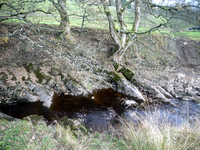
The Burtreeford Disturbance
Although a certain ale house in this area used to be well known for its ill mannered landlord NY8540 : Cowshill Hotel this in fact refers to a geological feature where the rock layers have been tilted by a major fault-line. The fault responsible has been traced through Upper Teesdale, Weardale and Allendale.
 Map © Crown Copyright")
TIP: Click the map for more Large scale mapping
- Grid Square
- NY8540, 182 images (more nearby 🔍)
- Photographer
- Andrew Curtis (more nearby)
- Date Taken
- Friday, 30 October, 2009 (more nearby)
- Submitted
- Saturday, 31 October, 2009
- Subject Location
-
OSGB36:
 NY 8523 4064 [10m precision]
WGS84: 54:45.6286N 2:13.8627W - Camera Location
-
OSGB36: NY 8523 4064
- View Direction
- Northeast (about 45 degrees)