2012
SJ6802 : House in Broseley, Shropshire
taken 12 years ago, near to Broseley, Shropshire, England
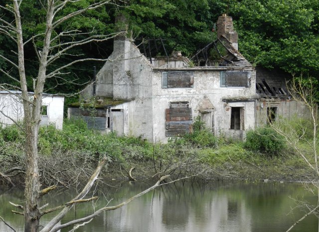
House in Broseley, Shropshire
The house is seen from the Ironbridge to Bridgnorth road looking over a small body of water, which might be only seasonal as it does not show on satellite photos. The house is located in an area between Monewood and The Dunge.
 Map © Crown Copyright")
TIP: Click the map for more Large scale mapping
- Grid Square
- SJ6802, 143 images (more nearby 🔍)
- Photographer
- Ian Slater (more nearby)
- Date Taken
- Sunday, 24 June, 2012 (more nearby)
- Submitted
- Thursday, 28 June, 2012
- Subject Location
-
OSGB36:
 SJ 6816 0228 [10m precision]
WGS84: 52:37.0409N 2:28.3030W - Camera Location
-
OSGB36: SJ 6804 0236
- View Direction
- East-southeast (about 112 degrees)