2007
SO6890 : The Down Inn
taken 17 years ago, near to Chetton, Shropshire, England
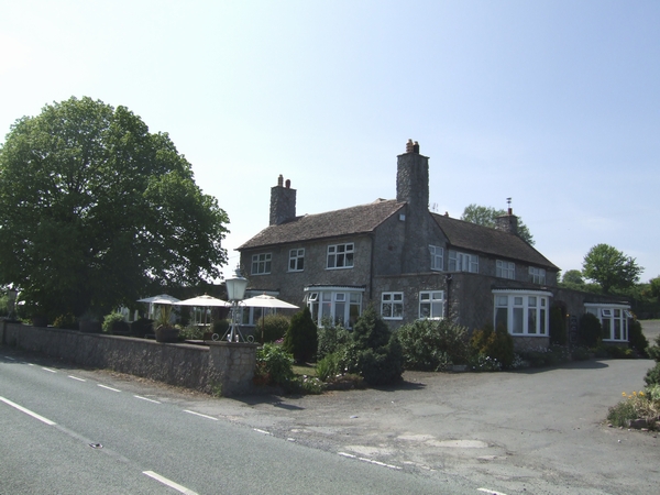
The Down Inn
Traditional roadside inn on the Bridgnorth to Ludlow road. It is also on the Jack Mytton Way, a long distance bridleway and footpath.
 Map © Crown Copyright")
TIP: Click the map for more Large scale mapping
- Grid Square
- SO6890, 15 images (more nearby 🔍)
- Photographer
- John M (more nearby)
- Date Taken
- Saturday, 5 May, 2007 (more nearby)
- Submitted
- Saturday, 5 May, 2007
- Subject Location
-
OSGB36:
 SO 685 904 [100m precision]
WGS84: 52:30.6669N 2:27.8987W - Camera Location
-
OSGB36: SO 685 904
- View Direction
- West-southwest (about 247 degrees)