1994
NY5416 : Lake District scene near Rosgill, between Shap and Bampton
taken 30 years ago, near to Rosgill, Cumbria, England
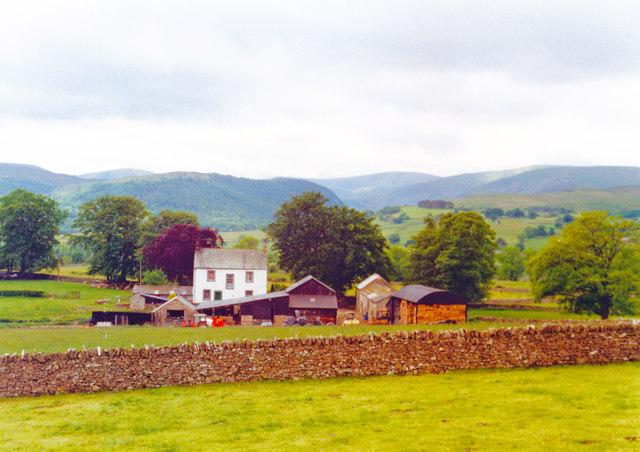
Lake District scene near Rosgill, between Shap and Bampton
View SW near the Ash Farm, across the Lowther valley towards the head of Haweswater, with mountains of Bampton Common beyond - including Low Kop, Load Pot Hill, The Pen and others (all 1,500 - 2,000 ft.).
 Map © Crown Copyright")
TIP: Click the map for more Large scale mapping
- Grid Square
- NY5416, 17 images (more nearby 🔍)
- Photographer
- Ben Brooksbank (more nearby)
- Date Taken
- Sunday, 19 June, 1994 (more nearby)
- Submitted
- Saturday, 28 November, 2015
- Subject Location
-
OSGB36:
 NY 544 167 [100m precision]
WGS84: 54:32.6419N 2:42.3826W - Camera Location
-
OSGB36: NY 544 167
- View Direction
- WEST (about 270 degrees)