2018
SU4569 : Groundwater Outfall Station on the Winterbourne
taken 6 years ago, near to Bagnor, West Berkshire, England
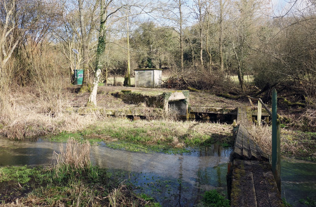
Groundwater Outfall Station on the Winterbourne
The Environment Agency's West Berks Groundwater Scheme is designed to provide augmentation to various rivers in the area from a series of pumped boreholes.
Designed for use in times of low flow, this is the outfall point for water from pump houses further up the valley.
Looks like the bridge needs mending.
Designed for use in times of low flow, this is the outfall point for water from pump houses further up the valley.
Looks like the bridge needs mending.
 Map © Crown Copyright")
TIP: Click the map for more Large scale mapping
- Grid Square
- SU4569, 103 images (more nearby 🔍)
- Photographer
- Des Blenkinsopp (more nearby)
- Date Taken
- Monday, 12 February, 2018 (more nearby)
- Submitted
- Wednesday, 14 February, 2018
- Subject Location
-
OSGB36:
 SU 4527 6950 [10m precision]
WGS84: 51:25.3626N 1:21.0192W - Camera Location
-
OSGB36: SU 4525 6949
- View Direction
- East-northeast (about 67 degrees)