2019
ST5953 : Chewton Mendip school
taken 5 years ago, near to Chewton Mendip, Somerset, England
The Geograph Britain and Ireland project aims to collect geographically representative photographs and information for every square kilometre of Great Britain and Ireland.
Read about the Geograph Project.
Read about the Geograph Project.
We have at least 1 images that match your query [https://www..org.uk//6128938] in the area! View them now
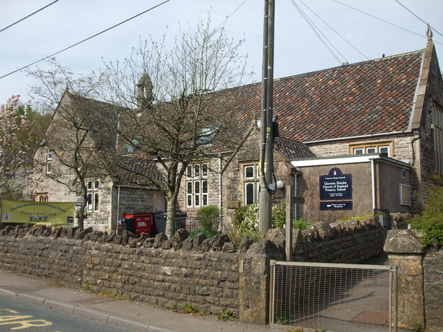
Chewton Mendip school
The earliest part of the school faces onto the A39 Wells Road, with much more space set further up the slope. A flush bracket can be seen on the near corner of shot - see ST5953 : School flush bracket.
 Map © Crown Copyright")
TIP: Click the map for more Large scale mapping
- Grid Square
- ST5953, 60 images (more nearby 🔍)
- Photographer
- Neil Owen (more nearby)
- Date Taken
- Monday, 22 April, 2019 (more nearby)
- Submitted
- Monday, 22 April, 2019
- Subject Location
-
OSGB36:
 ST 5974 5311 [10m precision]
WGS84: 51:16.5423N 2:34.7130W - Camera Location
-
OSGB36: ST 5976 5311
- View Direction
- WEST (about 270 degrees)