2020
SK3612 : The Tie Barn, near Normanton le Heath
taken 4 years ago, near to Normanton le Heath, Leicestershire, England
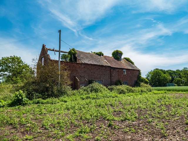
The Tie Barn, near Normanton le Heath
A derelict barn (possibly part-house), located by a public footpath coming off Redburrow Lane and giving access to the end of Babelake Street. The condition of the building has significantly worsened since my previous visit in 2016 SK3612 : An derelict barn near Normanton-le-Heath.
 Map © Crown Copyright")
TIP: Click the map for more Large scale mapping
- Grid Square
- SK3612, 30 images (more nearby 🔍)
- Photographer
- Oliver Mills (more nearby)
- Date Taken
- Monday, 22 June, 2020 (more nearby)
- Submitted
- Monday, 22 June, 2020
- Subject Location
-
OSGB36:
 SK 3649 1267 [10m precision]
WGS84: 52:42.6282N 1:27.6796W - Camera Location
-
OSGB36: SK 3646 1267
- View Direction
- East-southeast (about 112 degrees)