2020
SP4871 : Rugby Road, Dunchurch
taken 3 years ago, near to Dunchurch, Warwickshire, England
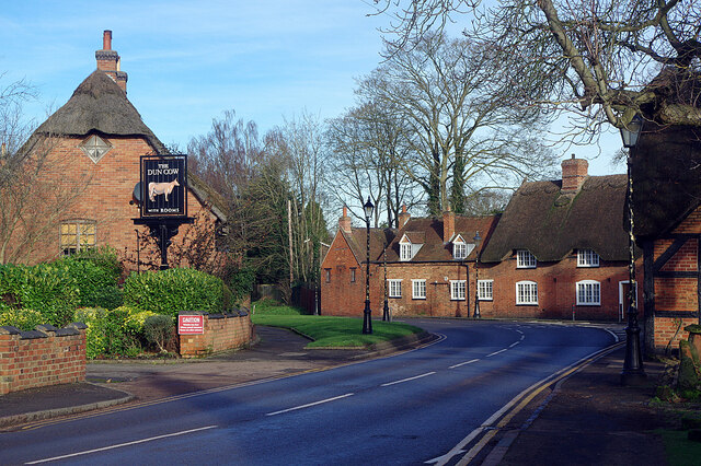
Rugby Road, Dunchurch
Being Christmas Day this road is quieter than usual, but even so it took a while to photograph the scene vehicle-free. On the left is the entrance to the Dun Cow car park, but sadly the old coaching inn had been closed for several weeks due to the Covid-19 pandemic. The building on the immediate right is the Old Forge and beyond that is Phoenix Cottage.
 Map © Crown Copyright")
TIP: Click the map for more Large scale mapping
- Grid Square
- SP4871, 200 images (more nearby 🔍)
- Photographer
- Stephen McKay (more nearby)
- Date Taken
- Friday, 25 December, 2020 (more nearby)
- Submitted
- Sunday, 27 December, 2020
- Subject Location
-
OSGB36:
 SP 4853 7130 [10m precision]
WGS84: 52:20.2586N 1:17.3493W - Camera Location
-
OSGB36: SP 4853 7126
- View Direction
- NORTH (about 0 degrees)