Uphill
110m

Length
6km
Duration
3h
Elev gain
110m
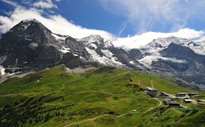
Wonderful hike near the Eiger glacier. This trail starts at the Eigergletscher station, then joins the Alpiglen station during a long descent located at the foot of the north face of the Eiger.

Already more than 200,000 users!
Uphill
110m
Highest point
2332m
Downhill
820m
Lowest point
1617m
Route type
One way
Download the map on your smartphone to save battery and rest assured to always keep access to the route, even without signal.
Includes IGN France and Swisstopo.
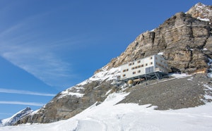
Eigergletscher station at the starting point.
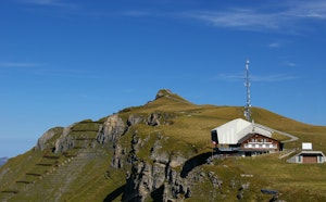
Alpiglen station at the arrival.
I indicate whether dogs are allowed or prohibited on this trail
From May to September
0 ratings
Also enjoy:

Already more than 200,000 users!