Lighthouses of Norway: Vest-Agder (Kristiansand Area)

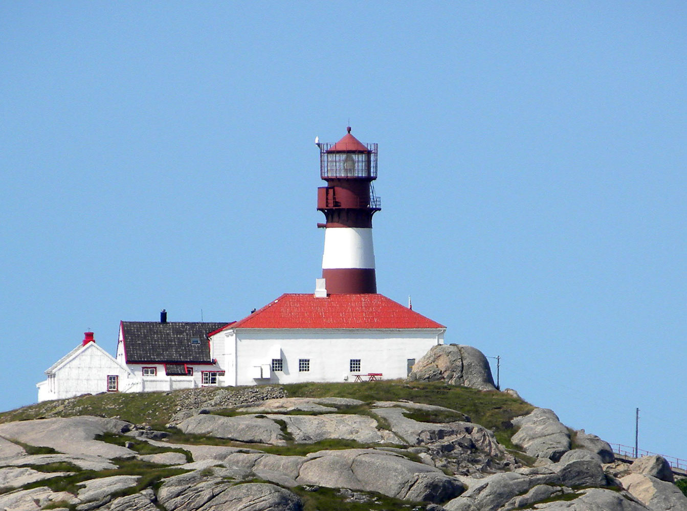
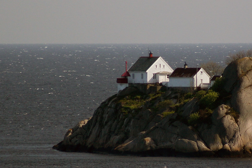
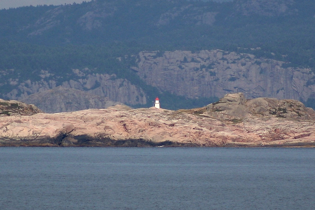
The Kingdom of Norway (Norge in Norwegian) is one of the world's most maritime nations. The country is long and narrow with drowned valleys called fjords that bring the sea far inland in most regions. The mainland coast is estimated to be 2650 km (1650 mi) long and when all the islands and minor indentations are counted the total coastline approaches an astonishing 60,000 km (37,500 mi), long enough the go around the world one and a half times. With such a lengthy and rocky shore it's not surprising that Norway has a large number of lighthouses.

Norway is divided into counties (fylker) and the counties are divided into townships (kommuner). In 2020 mergers decreed by the national government reduced the number of counties from 19 to 11. This page lists lighthouses of the former county of Vest-Agder, at the southern tip of Norway facing the entrance to the Skaggerak from the North Sea. Kristiansand, in the southeastern corner of the county, is the principal port. On 1 January 2020 the counties of Aust-Agder and Vest-Agder were combined to form Agder county.

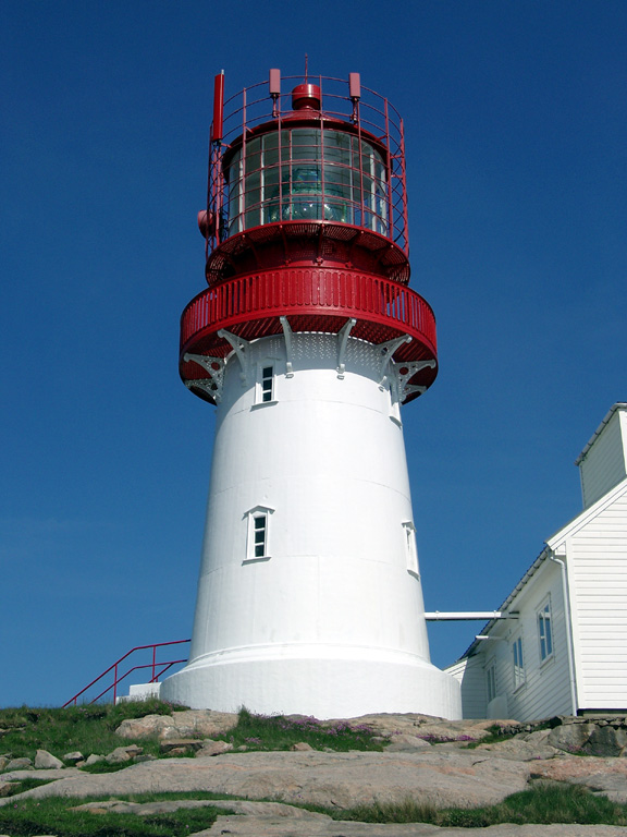
In Norwegian a lighthouse is a fyrtårn (fire tower) or simply a fyr; a fyrlykt is a beacon and a lyktehus is a lantern. Øy is an island, holmen is an islet, skjær is a skerry (a tiny island or rocky reef), sund is a strait (often between an island and the mainland), bukt is a bay, nes is a headland, and havn is a harbor.

Aids to navigation in Norway are maintained by the Kystverket (Coast Directorate), an agency of the Ministry of Transport.

ARLHS numbers are from the ARLHS World List of Lights. NF numbers are from the Norsk Fyrliste. Admiralty numbers are from volume B of the Admiralty List of Lights & Fog Signals. U.S. NGA List numbers are from Publication 115.

General Sources
Online List of Lights - Norway North Sea
Photos by various photographers, posted by Alexander Trabas. Many of these photos were taken by Ronald Wöhrn.
Norwegian Lighthouse Association
News and photos from the Association.
Leuchtturmseiten von Anke und Jens - Südnorwegen
Excellent 2002 photos posted by two German lighthouse fans.
Lighthouses in Agder
Photos by various photographers available from Wikimedia.
World of Lighthouses - Norway
Photos by various photographers available from Lightphotos.net.
Norwegische Leuchttürme auf historischen Postkarten
Historic postcard images posted by Klaus Huelse.
Norsk Fyrliste
Current edition of the Norwegian light list.
Liste over Norske Fyr
From Norwegian Wikipedia, a handy list of Norwegian light stations with their dates of establishment.
GPSNauticalCharts
Navigational chart information for southern Norway.
Navionics Charts
Navigational chart information for the Skaggerak.


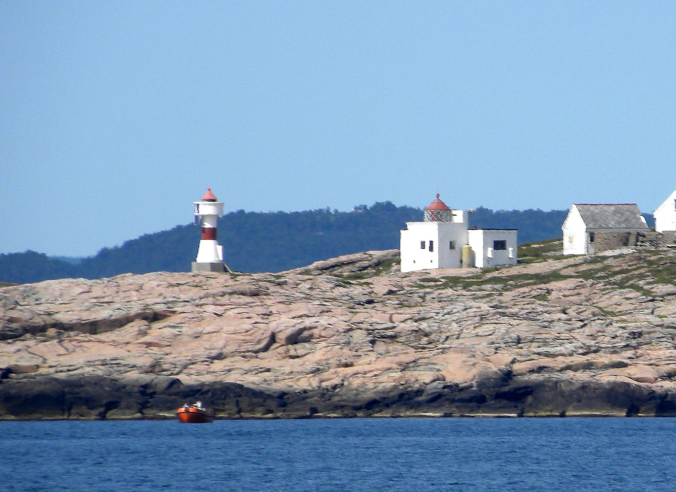
Grønningen Light, Kristiansand, July 2016
Wikimedia Creative Commons photo by Millars

Kristiansand Lighthouses
Torsøya
Date unknown. Inactive. 6 m (20 ft) lantern and gallery mounted on piles. Lantern painted white with a red roof. Hugo Rosano has a photo and Google has an indistinct satellite view. Located on the eastern point of Torsøya, an island east of the entrance to Kristiansand. Accessible only by boat. Site open, tower closed. ARLHS NOR-394; ex-NF-070800; ex-Admiralty B2908; NGA 1360.
Mannevikodden
Date unknown. Inactive since 2020. 4.5 m (15 ft) lantern and gallery mounted on a concrete pedestal. Lantern painted white with a red roof, pedestal black. No photo available but Google has a satellite view. Located on a southern tip of a ridge marking a right-angle turn in the Randøysund. Accessible only by boat. Site open, tower closed. ex-NF-070900; ex-Admiralty B2914; NGA 1364.
Stokken
Date unknown. Inactive. 4 m (13 ft) lantern and gallery mounted on a concrete pedestal. Lantern painted white with a red roof, pedestal black. No photo available but Google has a satellite view. Located on the northwestern point of the island of Stokken. Accessible only by boat. Site open, tower closed. ex-NF-071100; ex-Admiralty B2918; NGA 1372.
Grønningen
1878. Active; focal plane 19 m (62 ft); white, red, or green light depending on direction, occulting once every 6 s. 14 m (46 ft) square cylindrical masonry tower with lantern and gallery, attached to one end of a 1-1/2 story masonry keeper's house. A photo is at the top of this page, Trabas has a photo by Wöhrn, Mark Koenig has a 2018 photo, Wikimedia has several photos, Pål Sollie has a street view, and Google has a satellite view. This lighthouse marks the start of the channel into Kristiansand. During the summer the house is operated as a hostel for overnight stays, first come first served, no private accommodations. Located on a small skerry in the entrance to Kristiansandsfjorden, about 3 km (2 mi) south of Fidje. Accessible only by boat. Site open, tower open during the summer. Site manager: Bragdøya Kystlag (Grønningen Fyr ). ARLHS NOR-030; NF-071600; Admiralty B2922; NGA 1380.
** Odderøya (2)
1874 (station established 1832). Inactive since 1984. 8 m (26 ft) square cylindrical tower with lantern and gallery, attached to one end of a 1-1/2 story keeper's house. Building painted white, lantern red. Fog bell mounted on the front of the tower. Robert Smith's photo is at right, Trabas has posted an excellent photo by Wöhrn, a 2008 photo is available, Anke and Jens have good photos, Wikimedia has several photos, Luděk Sehr has a nice view from the fjord, and Google has a satellite view. The active light stands in front of the lighthouse. The building was transferred first to the city of Kristiansand for use as a center for meetings and cultural events and more recently to Vest-Agder (now Agder) County. The Vest-Agder Museum manages the station. Located at the end of the Odderøya peninsula, which projects into Kristiansandsfjorden and protects the harbor of the city. Accessible by road. Parking is provided; it's a short walk to the lighthouse. Site open, lighthouse and tower open on Sundays. Owner: Agder Fylkeskommune. Site manager: Vest-Agder Museet (Odderøya Fyr ). ARLHS NOR-035.
* Odderøya (3)
1984 (station established 1832). Active; focal plane 12 m (39 ft); white, red, or green light, depending on direction, occulting twice every 8 s. 6 m (20 ft) round cylindrical concrete tower with a small lantern and gallery, painted with red and white horizontal bands. Robert Smith's photo is at right, Trabas has posted an excellent photo by Wöhrn, Petter Emil Wikøren also has a good photo, and Ove Borgersen has a 2022 photo. Located in front of the historic lighthouse. Site open, tower closed. ARLHS NOR-337; NF-072300; Admiralty B2936; NGA 1400.
Jøngeholmskjæret (Gyngeholmen)
1916. Inactive. 4 m (13 ft) octagonal lantern, painted white with a red roof and mounted on a round stone base. John Viste has a photo and Google has a satellite view. Located on a rock just off the northern tip of Flekkerøy. Accessible only by boat. Site open, tower closed. ex-NF-073100; ex-Admiralty B2942; NGA 1416.
Odderøya Light
Odderøya Light, Kristiansand, April 2012
Flickr Creative Commons photo by Robert Smith
Kinn
Date unknown. Inactive. 4 m (13 ft) lantern and gallery mounted on a concrete pad. Trabas has Arno Siering's photo and Google has a satellite view. Located on the northern tip of Kinn, a small island on the west side of the approach to Kristiansand. Accessible only by boat. Site open, tower closed. ex-NF-071800; ex-Admiralty B2930; NGA 1388.
Oksøy (2)
1900 (station established 1832). Active; focal plane 47 m (154 ft); two white flashes every 45 s; also a continuous white passing light (NF-071710) at a focal plane of 24 m (79 ft). 36 m (118 ft) round cast iron tower with lantern and gallery, painted white with two narrow red horizontal bands; original clamshell-style 1st order Fresnel lens in use. Several keeper's houses, boathouse, and other light station buildings. Dubey Suhas has the fine 2020 photo at right, Trabas has a fine photo by Wöhrn, Lars Verket has a 2014 photo, Hugo Rosano has a 2022 closeup, Marcin Kowalski has a street view, Marinas.com has aerial photos, Huelse has an aerial postcard view, Wikimedia has a historic photo, and Google has a satellite view. This historic station, the landfall light for Kristiansand, was staffed until 2004. The Oksøy and Grønningen lights bracket the entrance to the fjord. Located on a small island in the entrance to Kristiansandsfjorden, about 3 km (2 mi) east of Skålevik and the same distance west southwest of Grønningen Fyr. Accessible only by boat. Site open except during the bird nesting season (April 15 through July 15), tower closed. . ARLHS NOR-036; NF-071700; Admiralty B2926; NGA 1384.
#Senskjær (?)
1913. Inactive since 2021 and apparently removed. 5 m (17 ft) octagonal lantern and gallery, painted white with a red roof and mounted on four black piles. John Viste has a photo, and Trabas has a photo by Wöhrn. Google's satellite view does not show the lighthouse. Located on a rock off the eastern tip of Flekkerøy, about 1 km (0.6 mi) west of the Oksøy lighthouse. Accessible only by boat. Site open, tower closed. ex-NF-073300; ex-Admiralty B2948; NGA 1424.
#Blåstholmen (Ytre Blåstholmen)
1907. Inactive since 2021 and possibly removed. 5 m (17 ft) octagonal lantern and gallery, painted white with a red roof and mounted on four black piles. Trabas has a photo by Wöhrn and Bing has a satellite view. Located on a rock just off the southeastern coast of Flekkerøy. Accessible only by boat. Site open, tower closed. ex-NF-073400; ex-Admiralty B2950; NGA 1432.
#Bergenesodden
1919. Inactive since 2021 and apparently removed. 6 m (20 ft) square pyramidal wood tower with lantern and gallery. Lighthouse painted white, lantern roof red. John Viste has a photo and Ivan Mæland has a 2021 photo, but Google's satellite view does not show the lighthouse. Located on a rocky promontory at the southwestern tip of Flekkerøy. Accessible only by boat. Site open, tower closed. ex-NF-073600; ex-Admiralty B2952; NGA 1436.

Oksøy Light, Kristiansand, February 2020
Google Maps photo by Dubey Suhas
#Flekkerøygapet
Date unknown. Inactive since 2019 and probably removed. 6 m (20 ft) square pyramidal wood tower with lantern and gallery. Lighthouse painted white, lantern roof red. No photo available ; Bing has a satellite view but Google's satellite view does not show the lighthouse. Located on a promontory of the mainland opposite Flekkerøy. Site open, tower closed. ex-NF-073200; ex-Admiralty B2944; NGA 1420.

Søgne Lighthouses
#Herøya (1)
Date unknown. Replaced in 2019. This was a 6 m (20 ft) lantern on a platform supported by piles. No photo available and Google's satellite view does not show the lighthouse. The lighthouse was replaced by a light on a post (focal plane 4.5 m (15 ft); red light, 1 s on, 1 s off). Located on the southern point of Herøy, an island just off Langenes. Accessible only by boat. Site open, tower closed. Current light: NF-073924; Admiralty B2956; NGA 1440.
Ny-Hellesund
Date unknown. Active; focal plane 7 m (23 ft); white, red, or green light, depending on direction, occulting once every 6 s. 5 m (17 ft) round metal (cast iron?) tower. The light is shown through a narrow window at the top of the tower. Lighthouse painted white with a red roof. Trabas has a photo by Wöhrn and Google has a satellite view. Located on a skerry off the east coast of Kapelløy, south of Monsøy. Accessible only by boat. Site open, tower closed. ARLHS NOR-021; NF-074100; Admiralty B2960; NGA 1444.
Songvår (2)
1955 (station established 1888). Inactive since 2004. 10 m (33 ft) square cylindrical tower with lantern and gallery, rising from one end of a 1-1/2 story keeper's house. Building painted white, lantern red. Additional 1-1/2 story keeper's house and other light station buildings. A photo is at right, Lars Verket has a portfolio of 2008 photos, Arne Sklett Larsen has a 2018 photo, Trabas has a view of the station by Pauline and Wim de Kleine, a 2003 photo shows the lighthouse shortly before it was decommissioned, and Google has an indistinct satellite view. Foundation ruins of the 1888 lighthouse can be seen nearby. This light station has recently been restored by the town of Søgne and is now available for overnight stays. A support group, Songvår Fyrs Venner, was formed in 2005. Located on a small island about 5 km (3 mi) south of Søgne. Accessible only by boat. Site open, tower closed. Site manager: Songvaar Fyrs Venner . ARLHS NOR-219.
Songvår (3)
2004 (station established 1888). Active; focal plane 24 m (79 ft); white, red, or green light, depending on direction, 2 s on, 2 s off. Approx. 5 m (17 ft) round "Art Deco" hourglass-shaped tower with lantern and gallery, painted white with one red horizontal band. A photo is at right. Located in front of the historic lighthouse. ARLHS NOR-341; NF-074000; Admiralty B2958; NGA 1448.
Nordre Vassøy (?)
Date unknown. Inactive since 2019 and according to an Admiralty Notice to Mariners the light was "to be removed." 4.5 m (15 ft) lantern mounted on a rubblestone base. Lantern painted white. Aleksander Kristoffersen has a 2018 photo, Laci Biksi has a view from the sea and Google has a distant satellite view. Located at the east end of an island on the west side of the Songvårfjord. Accessible only by boat. Site open, tower closed. ex-NF-074300; ex-Admiralty B2966; NGA 1464.

Old and new Songvår Lights, Søgne, June 2014
ex-Panoramio photo copyright olavfin; used by permission

Mandal Lighthouses
Tåneskjær (Tånesskjær)
Date unknown. Active; focal plane 13.5 m (45 ft); white, red, or green light, depending on direction, occulting twice every 8 s. 8 m (26 ft) lantern on a platform supported by piles. Lantern painted white with a red roof, piles black. Marius Salthaug has a drone video view and Bing has an indistinct satellite view. Located on a skerry just off the tip of the Tånes peninsula. Accessible only by boat. Site open, tower closed. NF-074400; Admiralty B2968; NGA 1468.
Skogsøybåen
Date unknown. Active; focal plane 10.5 m (34 ft); white, red, or green light, depending on direction, occulting once every 6 s. 10.5 m (34 ft) lantern on a platform supported by piles. Lantern painted white with a red roof, piles black. No photo available but Google has a satellite view. Located on a reef just off the southeastern tip of Skogsøy, guiding vessels toward Tregde. Accessible only by boat. Site open, tower closed. NF-074900; Admiralty B2972; NGA 1480.
** Ryvingen
1867. Active: focal plane 52 m (171 ft); four white flashes every 40 s. 23 m (75 ft) round cast iron tower with lantern and gallery, attached to a 1-1/2 story crew quarters building. Lighthouse painted red with one white horizontal band. Additional 1-1/2 story wood keeper's house and other light station buildings. Caroline Lund's 2020 closeup photo is at right, Tregde Ferie has a photo is at right, Marco Ruffatti has a closeup photo, Per Arvid Åsen has another photo, Trabas has a photo by Pauline and Wim de Kleine, Erling Løfsnes has a street view, Wikimedia has several photos, and Google has an indistinct satellite view. This is Norway's southernmost light station. It was also the first Norwegian lighthouse to be converted to electricity (1890s). The station was staffed until 2002; then it was transferred to the town of Mandal, which has restored the buildings and made them available for overnight accommodations. Located on an island about 5 km (3 mi) southeast of Mandal. Accessible only by boat; transportation including day trips can be arranged in Mandal. Site open; tower status unknown. Site manager: Ryvingen Fyrstasjon . ARLHS NOR-191; NF-079000; Admiralty B3014; NGA 1572.
Madodden (2)
2019. Active; focal plane 11 m (36 ft); white, red, or green light, depending on direction, occulting twice every 8 s. 6.5 m (21 ft) tower with lantern. No photo available but Google has a satellite view. The earlier light was a lantern and gallery on a platform supported by two piles. A sunset photo of that light is available and Bing has a satellite view. Located on the west side of Skjernøy, marking a narrow passage between that island and Ferøy, southeast of Mandal. Accessible only by boat. Site open, tower closed. NF-077800; Admiralty B3006; NGA 1560.
Havneholmen
Date unknown. Active; focal plane 12.5 m (41 ft); white, red, or green light, depending on direction, occulting once every 4 s. 6.5 m (21 ft) tower with lantern. Lighthouse is white with two black horizontal bands, lantern white with a red roof. Trabas has Andreas Köhler's photo and Google has a satellite view. Located on a small island off the west side of Skjernøy. Accessible only by boat. Site open, tower closed. NF-078000; Admiralty B2997.5.
 

Ryvingen Light, Mandal, June 2020
Google Maps photo by Caroline Lund
* Sjøsanden
1907. Active; focal plane 8 m (26 ft); white, red, or green light, depending on direction, occulting once every 6 s. 6 m (20 ft) square pyramidal wood tower with lantern and gallery. Lighthouse painted white, lantern roof red. Trabas has Arno Siering's closeup photo, Wikimedia also has a closeup, Johannes Klemsdal has a photo, another photo is available, and Google has an indistinct satellite view. Sjøsanden, on the west side of the entrance to the harbor of Mandal, has Norway's only sand beach. Located behind the beach. Site open, tower closed. NF-079200; Admiralty B3020; NGA 1580.
 
Hatholmen (Hattholmen)
1867. Active: focal plane 19 m (62 ft); white, red or green light depending on direction, occulting three times every 10 s. 7 m (23 ft) square cylindrical tower with lantern and gallery. set into one corner of a 1-1/2 story wood keeper's house. Lighthouse painted white with a red roof. Rolf Johansen's 2008 photo is at right, Lars Verket has a portfolio of photos, the tower can be seen in Wöhrn's photo posted by Trabas, and Google has a satellite view of the station. Mandal Kystlag assumed maintenance of the station in 1991. A resident caretaker is present during the summer season. The keeper's house and a 1-1/2 story wood assistant keeper's house are both available for overnight accommodations. Located on an island in Mannefjorden about 1.5 km (1 mi) south of Mandal. Accessible only by boat. Site open; buildings open to paying guests. Site manager: Mandal Kystlag (Hatholmen Fyr ). ARLHS NOR-108; NF-079100; Admiralty B3018; NGA 1576.

Lindesnes Lighthouses
* Åvik
Date unknown. Active; focal plane 10 m (33 ft); white, red, or green light, depending on direction, occulting three times every 10 s. 10 m (33 ft) concrete post with lantern and gallery. Lighthouse painted white, lantern roof red. Trabas has Andreas Köhler's photo, Bernd Römer has a view from the village, and Google has an indistinct satellite view. Located on the waterfront of Åvik. Site open, tower closed. NF-081100; Admiralty B3044; NGA 1632.

Hatholmen Light, Mandal, August 2008
Google Maps photo by Rolf Johansen
Udvåre (Utvåre)
1907. Active: focal plane 25 m (82 ft); white, red or green light depending on direction, occulting once every 6 s. Approx. 7 m (23 ft) round stone tower with lantern. Lighthouse painted white, lantern roof red. Trabas has posted a distant photo by Wöhrn and Bing has an indistinct satellite view. Located on a rocky islet about 7 km (4.5 mi) southeast of Høllen. Accessible only by boat. Site open, tower closed. ARLHS NOR-345; NF-081700; Admiralty B3050; NGA 1648.
**** Lindesnes (5) (Range Rear)
1915 (station established 1656). Active: focal plane 50 m (164 ft); continuous white light with a more intense flash every 20 s. 16 m (52 ft) round cast iron tower with lantern and gallery, adjacent to a 1-story keeper's house. The 1854 1st order Fresnel lens (transferred from an older tower) is in use. Tower and house painted white; lantern and gallery painted red. The keeper's house is now in use as a lighthouse museum. A photo is at right, a lovely 2022 photo is available, Trabas has posted a great closeup by Wöhrn, Wikimedia has numerous photos, Stian Bluth Levik has a street view, and Google has a satellite view. Anke and Jens also have a photo of the hexagonal stone base of the third (1822) lighthouse, which is preserved nearby. For westbound ships the light also serves as the rear light of a range. This is one of Norway's best known and most historic lighthouses, marking the southernmost point of the Norwegian mainland and the entrance to the Skaggerak and the Baltic Sea from the North Sea. The first tower was in use only briefly in 1656. A more permanent lighthouse (one of a pair, Markøy being the twin) was built in 1725, and new towers were built in 1822 and in 1854. A preservation foundation was formed in 1992 and the station was opened to visitors soon thereafter. The station was staffed until 2003; after it was automated the site became a museum and a very popular tourist attraction. There is a visitor center, restaurant, and gift shop in addition to the historic buildings. Two lanterns of unknown origin are on exhibit. Located at the end of a peninsula (the Naze) about 12 km (7.5 mi) southwest of Høllen. Accessible by paved road (highway 460); ample parking provided. Site open; museum and tower open daily April 1 through early October and on Saturdays and Sundays the rest of the year; guided tours are available every Sunday year round and daily in July. Site manager: Lindesnes Fyr . ARLHS NOR-028; NF-082200; Admiralty B3058.1; NGA 1676.
Markøy (2)
1822 (station established 1725). Inactive since 1844. Only the hexagonal stone base survives of this historic lighthouse, the twin to the second Lindesnes Fyr. Harald Storaker has a 2007 closeup photo and Google has a satellite view. In 2019 a friends group, Markøy Fyrs Venner, was formed to manage the site and possibly rebuild the lighthouse. Located on an island in the mouth of the Grønsfjord, about 3.5 km (2 mi) west northwest of Lindesnes Fyr. The island is a bird sanctuary. Accessible only by boat. Site open. . ARLHS NOR-164.

Lindesnes Light, Lindesnes, November 2019
Flickr Creative Commons photo by Schwarzwert Naturfotografie

Lyngdal Lighthouses
Lypskjær
Date unknown. Active; focal plane 9 m (30 ft); white, red or green light depending on direction, 3 s on, 3 s off. 9.5 m (31 ft) lantern and gallery supported by piles. Lantern painted white with a red roof. A distant street view is available and Google has an indistinct satellite view. Located on a skerry in the entrance to the Grønsfjord, just west of the Lindesnes peninsula. Accessible only by boat. Site open, tower closed. NF-082300; Admiralty B3060; NGA 1680.
Rævøysund
1913. Active; focal plane 6 m (20 ft); white, red or green light depending on direction, occulting three times every 10 s. 6 m (20 ft) concrete post with lantern and gallery, painted white; lantern roof painted red. A closeup photo is available and Google has a distant satellite view. Located on the northwest point of Revøy about 800 m (1/2 mi) north of Korshavn. There is a bridge to the island, but the light appears to be accessible only by boat. Site open, tower closed. ARLHS NOR-339; NF-082800; Admiralty B3063; NGA 1692.
Syrhovud
Date unknown. Active; focal plane 4 m (13 ft); white, red or green light depending on direction, 2 s on, 2 s off. 5 m (17 ft) post with lantern and gallery. Lantern painted white with a red roof. No photo available but Google has a distant satellite view. Located on a promontory on the west side of the Rosfjord, about 5 km (3 mi) southwest of Lyngdal. Site open, tower closed. NF-083300; Admiralty B3070; NGA 1712.

Farsund Lighthouses
Bremerodden
Date unknown. Active; focal plane 15 m (49 ft); white, red or green light depending on direction, occulting twice every 8 s. 6 m (20 ft) lantern and gallery supported by piles. Lantern painted white with a red roof. No photo available but Google has an indistinct satellite view. Located on the south coast of Langøy, about 6 km (3.5 mi) southeast of Farsund. Accessible only by boat. Site open, tower closed. NF-083700; Admiralty B3076; NGA 1724.
Langøy
Date unknown. Active; focal plane 11.5 m (37 ft); white, red or green light depending on direction, occulting once every 6 s. 6.5 m (21 ft) square tower with lantern and gallery, painted white; lantern roof is red. No photo available but Google has an indistinct satellite view. Located on the northwest coast of Langøy, about 3 km (2 mi) southeast of Farsund. Accessible only by boat. Site open, tower closed. NF-083900; Admiralty B3078; NGA 1728.
Søndre Katland (Søndre Kattland, Søre Katland)
1878. Active; focal plane 19 m (62 ft); white, red or green light depending on direction, occulting three times every 12 s. 15 m (49 ft) square cylindrical masonry tower with lantern and gallery, rising from one corner of a 2-story masonry keeper's house. A distant photo is at right, another good photo is available, Trabas has posted a photo by Wöhrn, Dag Buch has a 2020 photo, Wikimedia has a photo, and Google has a satellite view. Unoccupied since 1947, the lighthouse was in great need of restoration. A support group was formed in 2000; the group has leased the lighthouse and is working on the restoration. The Kystverket photo at right shows work underway in the summer of 2014. Located on an island in the mouth of the Lyngdfjorden about 4.5 km (3 mi) southeast of Farsund. Accessible only by boat. Site and tower closed. Owner: Kystverket. Site manager: Venner av Søndre Katland Fyr . ARLHS NOR-240; NF-084100; Admiralty B3080; NGA 1736.
Sandøy
Date unknown. Active; focal plane 8 m (26 ft); white, red or green light depending on direction, 3 s on, 3 s off. 6 m (20 ft) lantern and gallery supported by piles. Lantern painted white with a red roof. No photo available but Bing has a satellite view. Located on the southeast coast of Sandøy, marking the westernmost entrance to Farsund. Accessible only by boat. Site open, tower closed. NF-084300; Admiralty B3081; NGA 1740.
Listerrauna
1914. Active; focal plane 14 m (46 ft); two flashes every 5 s, white or red depending on direction (white is shown to the south and red to the north). Approx. 7 m (23 ft) square pyramidal tower with lantern and gallery, painted white; lantern roof is red. Google has a satellite view. Located on an island about 2.5 km (1.5 mi) southeast of Vestbygda. Accessible only by boat. Site open, tower closed. ARLHS NOR-335; NF-085900; Admiralty B3102; NGA 1776.

Søndre Katland Light, Farsund, July 2014
Kystverket photo
* Brekneholmen (Borhaug)
1894. Active; focal plane 9 m (30 ft); white, red or green light depending on direction, 3 s on, 3 s off. 5 m (17 ft) square pyramidal tower with lantern and gallery. Lighthouse painted white, lantern roof red. Trabas has posted Arno Siering's closeup photo, Jarl Gulbrandsen has a 2021 photo, Per Øivind Larsen has a closeup, and Google has a satellite view and a closeup street view. Described in the light lists as a mole, Brekneholmen is actually a rocky ridge that provides a natural breakwater for the harbor of Vestbygda. Located at the south end of the island, just off Vestbygda. Accessible by a road over a causeway connecting the island to the town. Site open, tower closed. ARLHS NOR-327; NF-086000; Admiralty B3106; NGA 1780.
**** Lista (2)
1853 (station established 1836). Active; focal plane 39 m (128 ft); white flash every 4 s. 34 m (112 ft) round granite tower with lantern and gallery. The tower is unpainted dark gray stone; lantern painted white with a red roof. A 1-story fog signal house and 1-story garage and workshop flank the tower; also preserved are a 2-story keeper's house and several other original buildings. An assistant keeper's house is available for overnight accommodations. Stefano Sassu's photo is at right, Trabas has posted a great photo by Wöhrn, Marjolein Vegers has a good 2008 photo, Steinar Sørlie has a 2020 photo, a 2021 drone view of the station is available, Marinas.com has aerial photos, Huelse has a historic postcard view, and Google has a street view and a satellite view. This light station marks a prominent and dangerous cape on the south side of the entrance to the Listafjord; from a mariner's point of view this is the extreme southwestern tip of Norway. The original lighthouse was a granite tower of the same height with a slightly more conical profile. In 1853 the station was tripled; the current tower and an identical tower were built on either side of the 1836 tower. In 1874 the original tower was dismantled and the third tower was taken down for relocation to Halten, near Trondheim. In 2003 the station was automated and turned over to Vest-Agder County for renovation as a museum complex. Located at the end of the Fyrveien (highway 43) about 800 m (1/2 mi) west of Vestbygda; parking provided. Site open; museum and tower open daily May 1 through mid October and on weekends the rest of the year. Owner: Kystverket. Site manager: Lista Fyr . ARLHS NOR-029; NF-086500; Admiralty B3112; NGA 1792.
* Varnes (2)
1950 (station established 1836). Active; focal plane 30 m (98 ft); white, red or green light depending on direction, 2 s on, 8 s off. 6 m (20 ft) square pyramidal tower with lantern and gallery. Lighthouse painted white, lantern roof red. The modern tower stands beside ruins of the original light station. Intars Liepa has a 2019 photo, Cecilie Versland has a 2020 photo, Per Arvid Åsen has a 2008 photo, Trabas has Wöhrn's very distant view from the sea, and Google has a satellite view. This little light, a companion to the Lista Fyr, marks the south side of the entrance to the sheltered waters of the Listafjord. The Lightghouse Association has a historic photo of the original lighthouse, a lantern attached to the front of a keeper's cottage. Located off highway 654 about 10 km (6 mi) north of Lista Fyr; accessible by a narrow and twisting road. Site open, tower closed. ARLHS NOR-269; NF-087300; Admiralty B3118; NGA 1812.
Lista Fyr
Lista Light, Farsund, August 2007
ex-Flickr Creative Commons photo by Stefano Sassu

Kvinesdal Lighthouse
Fedafjord
Date unknown. Active; focal plane 8 m (26 ft); two flashes every 10 s, white, red or green depending on direction. 7 m (23 ft) concrete post with lantern and gallery. Lighthouse painted white with a narrow black horizontal band, lantern roof red. The Fedafjord is a deep, rather strait fjord flanked by spectacular cliffs; since 2006 the Fedafjord Bridge has carried the E39 highway across the gorge. Trabas has Andreas Köhler's photo (also seen at right) and Google has a distant street view taken from the bridge, but the light is not visible in Google's heavily shadowed satellite view. Located on the south side of the fjord a short distance south of the bridge. Accessible only by boat; there's a view from the southbound side of the bridge. Site open but difficult to reach, tower closed. NF-087600; Admiralty B3122; NGA 1820.

Flekkefjord Lighthouses
Kokodden
Date unknown. Active; focal plane 6 m (20 ft); white, red or green light depending on direction, occulting three times every 10 s. 5 m (17 ft) octagonal lantern mounted on a round stone base. Lantern painted white with a red roof. Andrei Akifev has a view from the fjord, Benedicto Lomborgini has a closeup 2020 street view, and Google has a satellite view. Located on a promontory about 800 m (1/2 mi) southwest of Abelnes. Accessible only by boat. Site open, tower closed. NF-087700; Admiralty B3124; NGA 1824.
Rossøy (Rosøy)
Date unknown. Active; focal plane 46 m (151 ft); two flashes every 10 s, white, red or green depending on direction. 6.5 m (21 ft) square pyramidal tower with lantern and gallery. Lighthouse painted white, lantern roof red. This light has a friends group, Rossøyas Venner, and their Facebook page has many photos. Google has a satellite view. Located atop a small island west of Hidra, marking the entrance to the Hidrasund. Accessible only by boat. Site open but difficult to reach, tower closed. . NF-089700; Admiralty B3138; NGA 1872.
#Hidrasund (1)
1894. Replaced in 2011. This was a 4 m (13 ft) wood lantern attached to a small equipment closet. Lighthouse painted white with a red roof. No photo available. According to the Kystverket there were only 3 or 4 wood lanterns of this type surviving in Norway. In September 2011 a helicopter was used to install a new LED post light (focal plane 18 m (59 ft); flash every 5 s, white, red or green depending on direction). Google's satellite view shows the post light. The old lantern was scheduled to be relocated to the lighthouse museum at Lindesnes Light (see above). Located atop a cliff on the north side of the entrance to the Hidrasund. Site open, tower closed. Current light: NF-089400; Admiralty B3136; NGA 1868.

Fedafjord Light, Kvinesdal, June 2019
photo copyright Andreas Köhler; used by permission

Information available on lost lighthouses:

Notable faux lighthouses:

Adjoining pages: East: Aust-Agder (Arendal Area) | West: Southern Rogaland (Eigersund Area)

Return to the Lighthouse Directory index | Ratings key

Posted May 15, 2006. Checked and revised March 29, 2023. Lighthouses: 44. Site copyright 2023 Russ Rowlett and the University of North Carolina at Chapel Hill.