
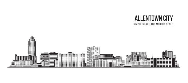
Allentown Pennsylvania Pictures, Images and Stock Photos
Browse 200+ allentown pennsylvania stock photos and images available, or search for allentown pa or lehigh valley to find more great stock photos and pictures.
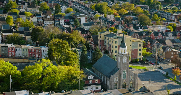
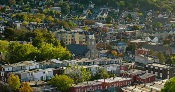
Aerial panorama of Allentown, Pennsylvania skyline on late sunny afternoon. Allentown is Pennsylvania's third most populous city.

Downtown main street of Allentown, Pennsylvania, USA

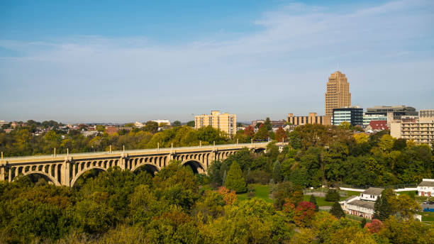
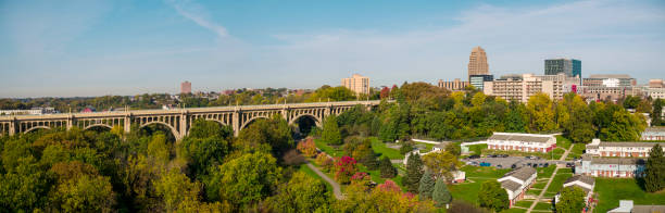
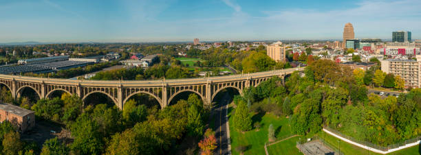
Aerial panorama of Allentown, Pennsylvania skyline and Albertus L. Meyers Bridge (aka Eighth Street Bridge) on late sunny afternoon . Allentown is Pennsylvania's third most populous city.
Allentown is a city located in Lehigh County, Pennsylvania, in the United States. It is Pennsylvania's third most populous city
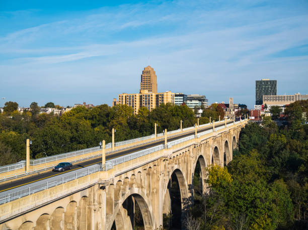
Albertus L. Meyers Bridge, Allentown, Pennsylvania, USA.

Aerial panorama of Allentown, Pennsylvania skyline on late sunny afternoon. Allentown is Pennsylvania's third most populous city.
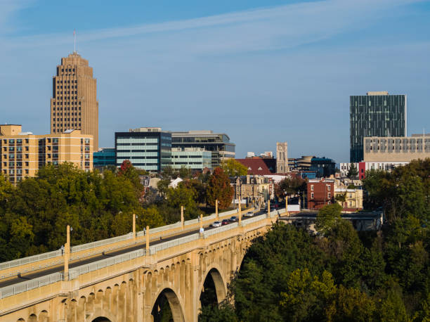
Albertus L. Meyers Bridge, Allentown, Pennsylvania, USA.

Albertus L. Meyers Bridge, Allentown, Pennsylvania, USA.

This photo was taken at early summer afternoon in Rose Garden of Allentown, PA.

Sneakers dangling on the power lines - Allentown, Pennsylvania, USA

Albertus L. Meyers Bridge, Allentown, Pennsylvania, USA.

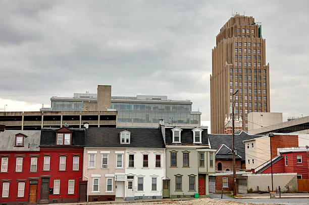
Downtown main street of Allentown, Pennsylvania, USA
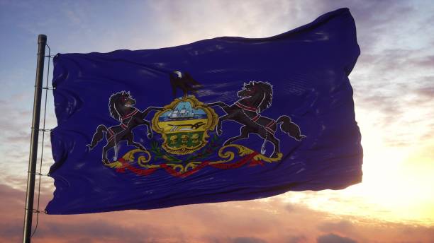
Flag of Pennsylvania waving in the wind against deep beautiful sky. 3d illustration.
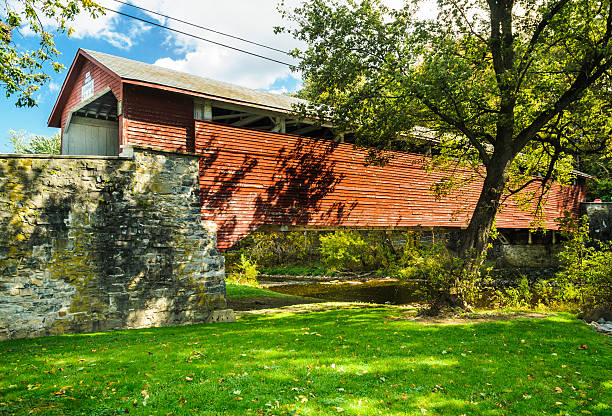
Guth's bridge (1858) was built over Jordan Creek in Allentown, Pennsylvania. It is a 129 foot long single span truss bridge.
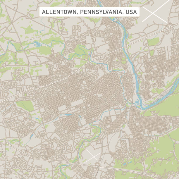
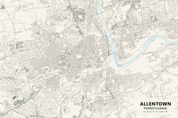
Vector Illustration of a City Street Map of Allentown, Pennsylvania, USA. Scale 1:60,000. All source data is in the public domain. U.S. Geological Survey, US Topo Used Layers: USGS The National Map: National Hydrography Dataset (NHD) USGS The National Map: National Transportation Dataset (NTD)

Albertus L. Meyers Bridge, Allentown, Pennsylvania, USA

http://farm8.staticflickr.com/7189/6818724910_54c206caf8.jpg
Aerial shot of residential streets in Bethlehem, a city in the Lehigh Valley region of eastern Pennsylvania with a rich history tied to the American Industrial Revolution through Bethlehem Steel. Authorization was obtained from the FAA for this operation in restricted airspace.

Street in Allentown residential district, Pennsylvania, USA
Albertus L. Meyers Bridge, Allentown, Pennsylvania, USA.
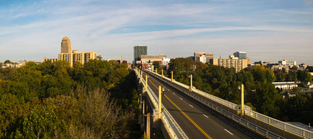
Albertus L. Meyers Bridge, Allentown, Pennsylvania, USA.

Albertus L. Meyers Bridge, Allentown, Pennsylvania, USA
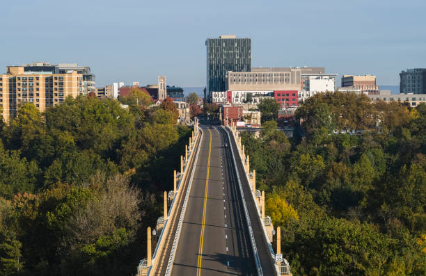
Albertus L. Meyers Bridge, Allentown, Pennsylvania, USA.

A Pennsylvania road sign concept.
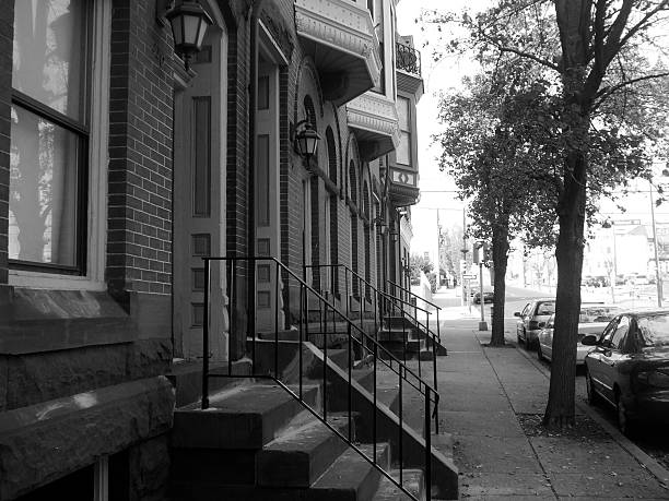
A row of brick apartments line the streets of Allentown, PA.

Inner city streets in winter. Allentown, Pennsylvania, USA

A black and white photo of an architecturally intricate church steeple in Allentown, Pennsylvania

American homes. Allentown, Pennsylvania, USA
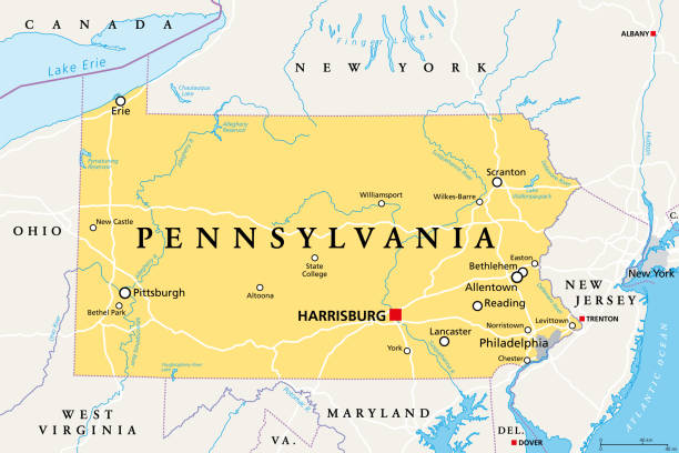
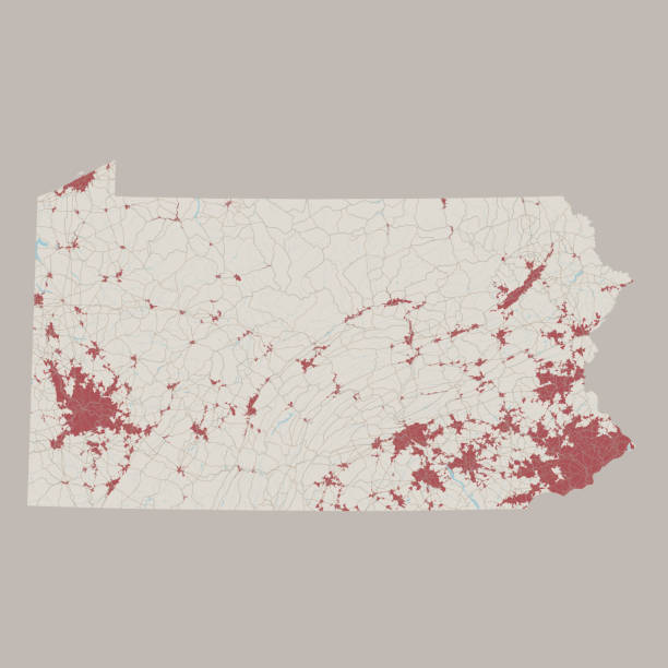
Pennsylvania, PA, political map. Officially the Commonwealth of Pennsylvania. State in the northeastern United States of America. Capital Harrisburg. Keystone State. Quaker State. Illustration. Vector
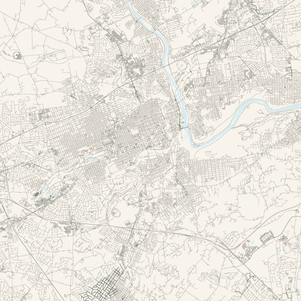
Topographic / Road map of Allentown, PA. Map data is public domain via census.gov. All maps are layered and easy to edit. Roads are editable stroke.
Poster Style Topographic / Road map of Allentown, PA. Map data is public domain via census.gov. All maps are layered and easy to edit. Roads are editable stroke.
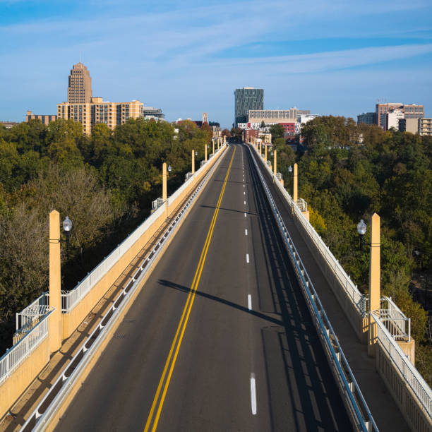
Albertus L. Meyers Bridge, Allentown, Pennsylvania, USA.

The top of an ornate, stone church steeple can be seen from the sidewalk in the city of Allentown, PA
Aerial shot of residential streets in Bethlehem, a city in the Lehigh Valley region of eastern Pennsylvania with a rich history tied to the American Industrial Revolution through Bethlehem Steel. Authorization was obtained from the FAA for this operation in restricted airspace.
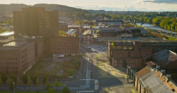
Aerial shot of SteelStacks, a disused steel plant in Bethlehem, a city in Northampton and Lehigh Counties of eastern Pennsylvania, on an overcast day in Fall. Authorization was obtained from the FAA for this operation in restricted airspace.
Albertus L. Meyers Bridge, Allentown, Pennsylvania, USA.
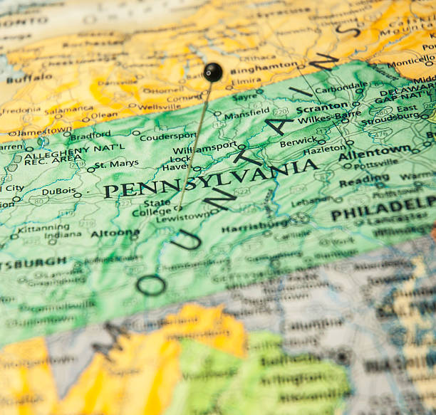
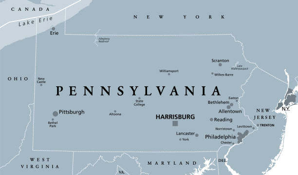
Pennsylvania, PA, gray political map. The Commonwealth of Pennsylvania, a state in the Northeastern United States of America with capital Harrisburg. Keystone State. Quaker State. Illustration. Vector
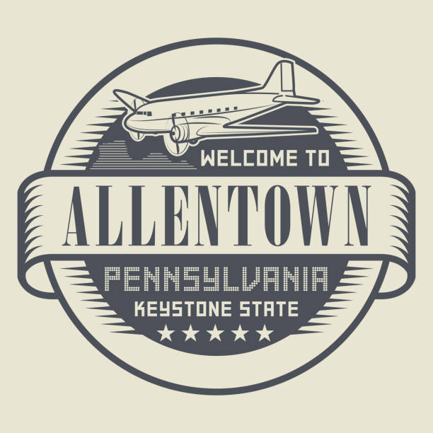
Stamp or tag with text Welcome to Allentown, Pennsylvania, vector illustration

"Detailed vector map of Pennsylvania with administrative divisions. File was created on December 10, 2012. The colors in the .eps-file are ready for print (CMYK). Included files: EPS (v8) and Hi-Res JPG (5600aa aaa 3381 px)."

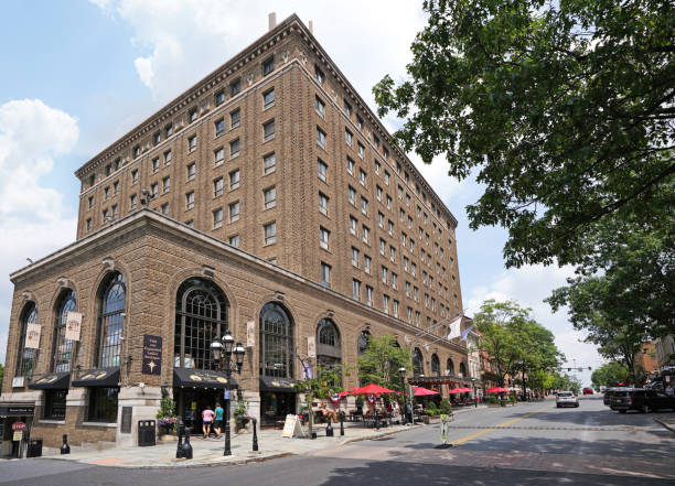
Bethlehem, PA - USA - 07-08-2023: The historic Hotel Bethlehem on Main St in the heart of downtown

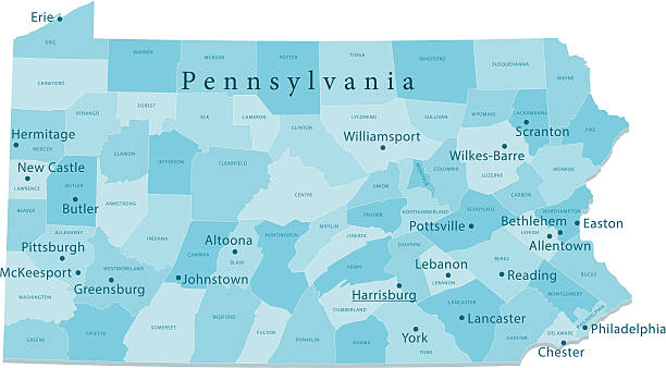
Detailed map of Pennsylvania state,in vector format,with county borders,roads and major cities.
Allentown, Pennsylvania, April 21 2018: The logo of Bank of America. Bank of America is a banking and financial services corporation. Editorial.
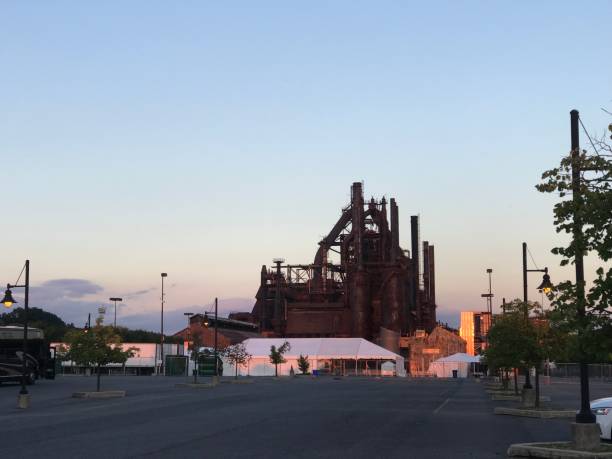
Former site of Bethlehem Steel Corporation.The site of Bethlehem Steel Corporation in Allentown, Pennsylvania. The place used for Billy Joel's lyrics.Steelworks


A vintage-style map of Pennsylvania with freeways, highways and major cities. Shoreline, lakes and rivers are very detailed. Includes an EPS and JPG of the map without roads and cities. Texture, compass, cities, etc. are on separate layers for easy removal or changes.
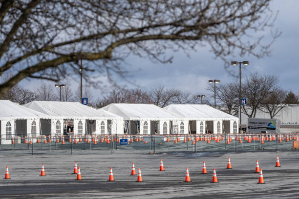
Allentown, Pennsylvania, USA- January 16, 2021: Lehigh Valley Health Network mass coronavirus vaccination site set up on parking lot.
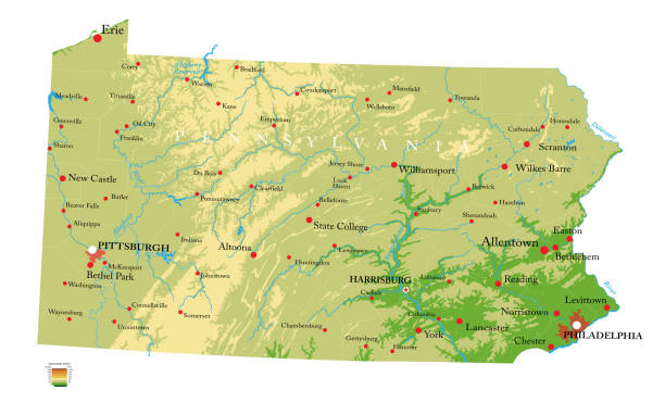
Highly detailed physical map of the Pennsylvania, in vector format,with all the relief forms,regions and big cities.
Albertus L. Meyers Bridge, Allentown, Pennsylvania, USA
Allentown, Pennsylvania, United States, March 18 2018: Allentown downtown street
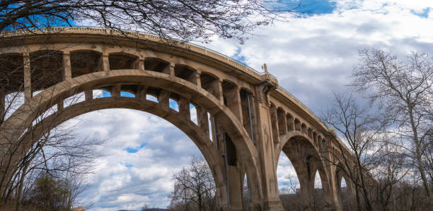
The Eighth Street Bridge or High Bridge over the Little Lehigh Creek in Allentown, Pennsylvania, monumental viaduct of reinforced concrete bridge built in 1913
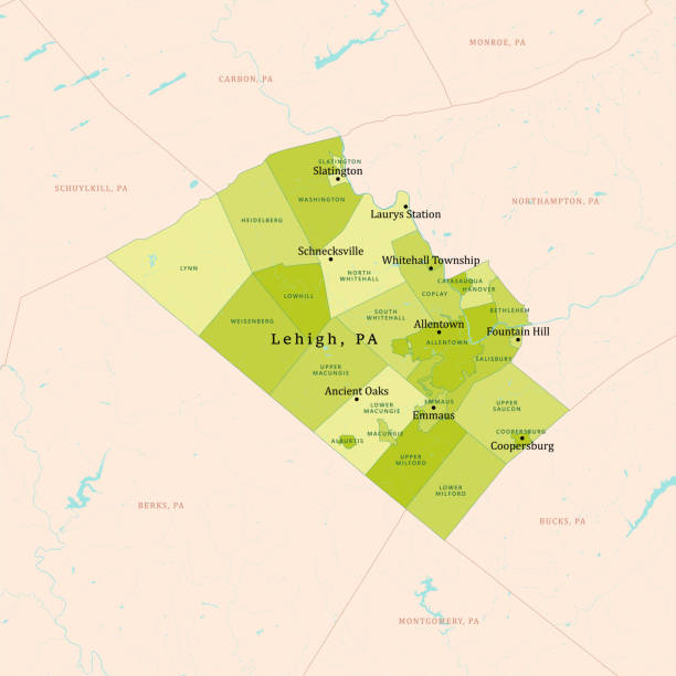
PA Lehigh County Vector Map Green. All source data is in the public domain. U.S. Census Bureau Census Tiger. Used Layers: areawater, linearwater, cousub, pointlm.

Sneakers hanging on the power lines - Allentown, Pennsylvania

Vector Pennsylvania Travel
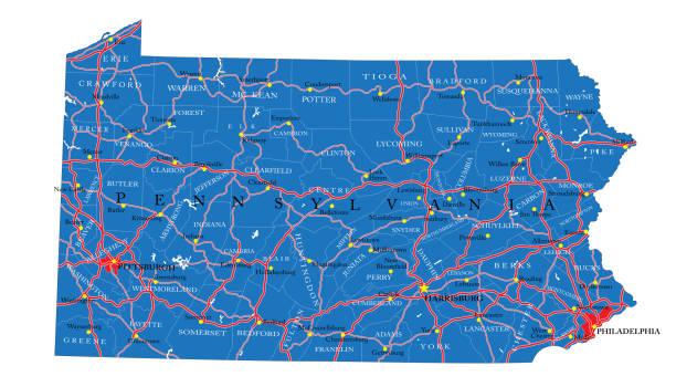
Vector Illustration of a Road Map of Pennsylvania State, USA. All source data is in the public domain. U.S. Geological Survey, US Topo Used Layers: USGS The National Map: National Hydrography Dataset (NHD) USGS The National Map: National Transportation Dataset (NTD)
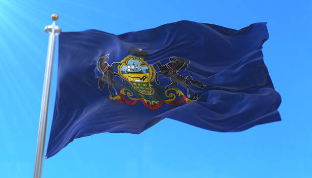
Flag of american state of Pennsylvania, region of the United States, waving at wind