Rio Negro Brazil Pictures, Images and Stock Photos
Browse 1,800+ rio negro brazil stock photos and images available, or start a new search to explore more stock photos and images.
Most popular
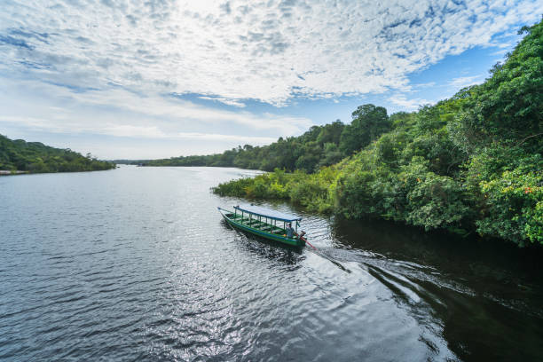
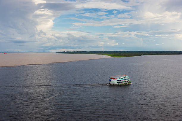
A traditional boat used for transportation purposes on the river Rio Negro
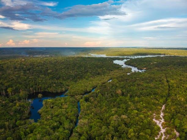
Amazon rainforest. In the photo: Rio Negro, located in the state of Amazonas.
Aerial view of Rio Negro (Black River), in the Brazilian wetlands, know as Pantanal, in Aquidauana, Mato Grosso do Sul, Brazil
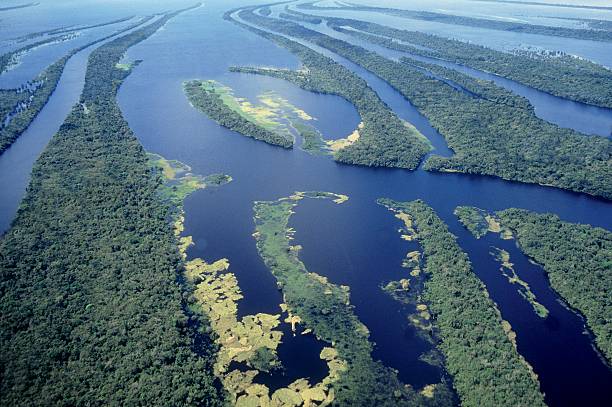
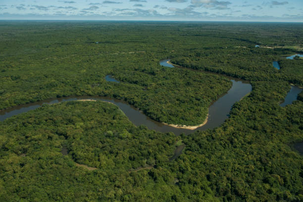
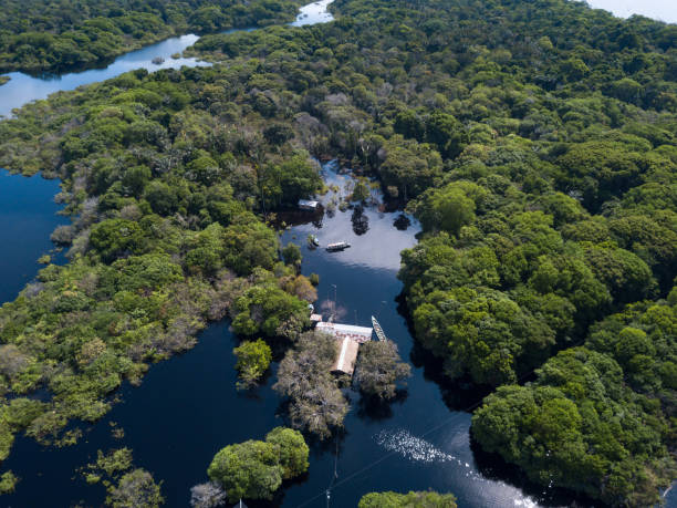
Aerial and partial view of the second largest set of river islands in the world, with about 400 of them forming an archipelago on the Rio Negro, in the state of Amazonas, Brazil.
Bridge over Negro River Manaus (background) is capital of the State of Amazonas
Amazon rainforest. In the photo: Rio Negro, located in the state of Amazonas.
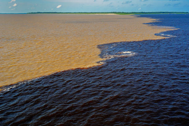
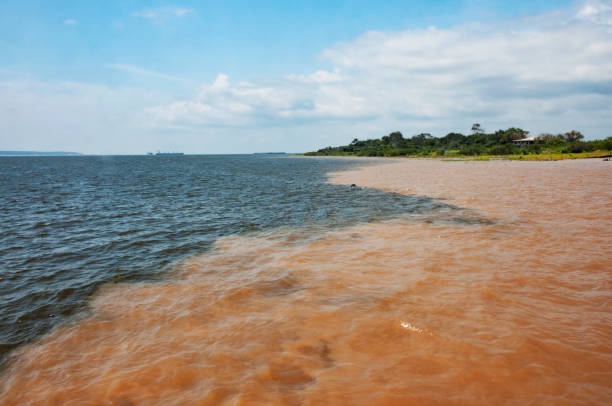
Meeting of the Waters of Rio Negro and the Amazon River or Rio Solimoes near Manaus, Amazonas, Brazil in South America
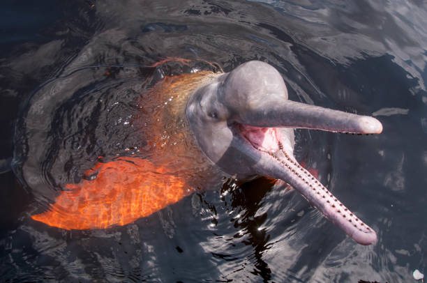
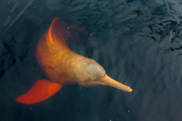
Pink boto found in the Brazilian Amazon region. City of Novo Airão, Amazonas, Brazil
Belem do Para in Brazil
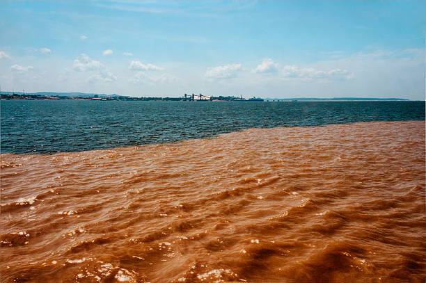
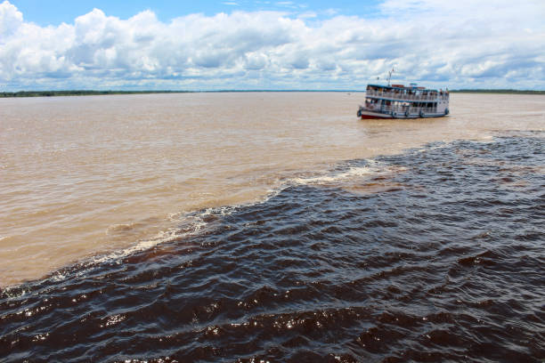
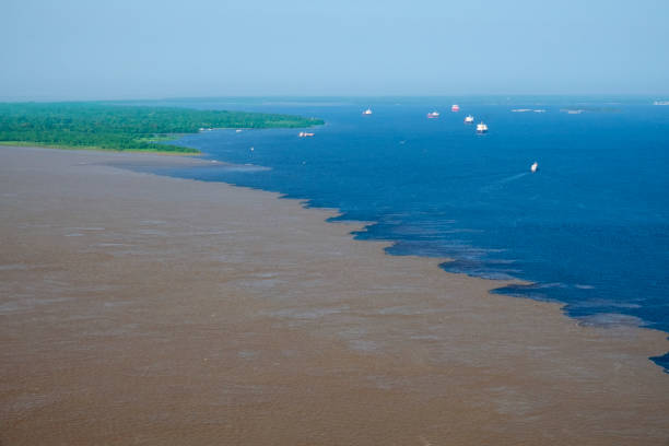
The Meeting of Waters is the confluence between the Rio Negro, a river with dark full of tannins water, and the sandy-colored Amazon River or Rio Solimões, as it is known the upper section of the Amazon in Brazil. For 6 km (3.7 mi) the river's waters run side by side without mixing. The same also happens near Santarém, Pará with the Amazon and Tapajós rivers..This phenomenon is due to the differences in temperature, speed and water density of the two rivers. The Rio Negro flows at near 2 km per hour at a temperature of 28°C, while the Rio Solimões flows between 4 to 6 km per hour a temperature of 22°C.
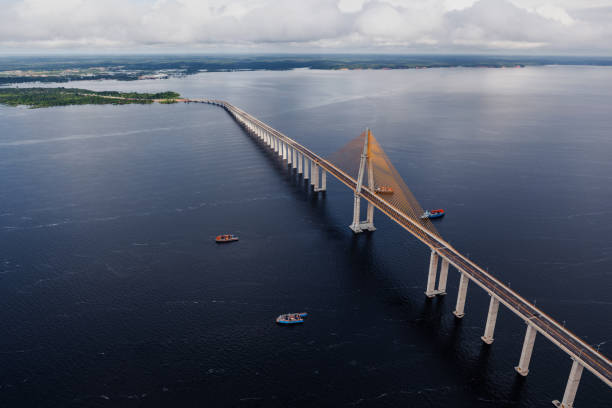
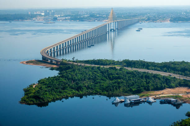
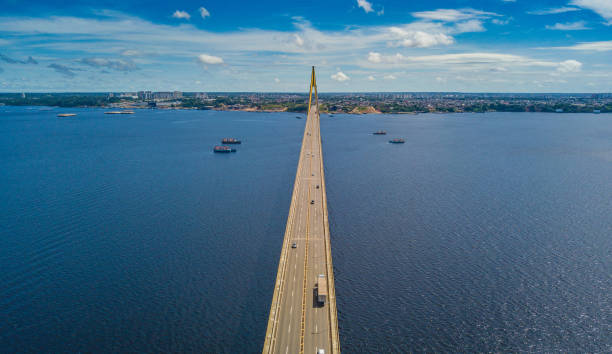
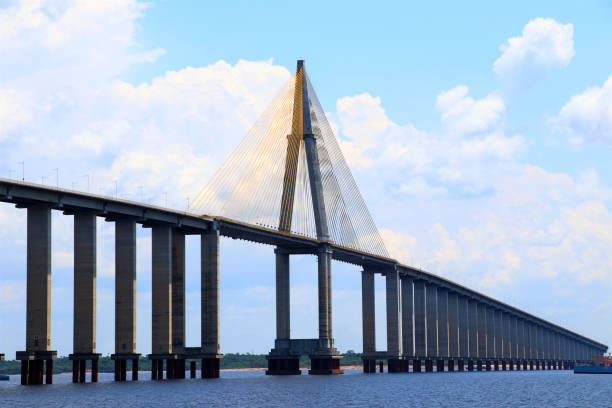
Ponte Jornalista Phelippe Daou, popularly known as Ponte Rio Negro, in the Brazilian state of Amazonas. It connects the municipalities of Manaus and Iranduba, and is also part of the Manoel Urbano Highway.
The phenomenon, known as the Meeting of Waters, occurs because of the difference of composition, acidity and temperature of the two rivers
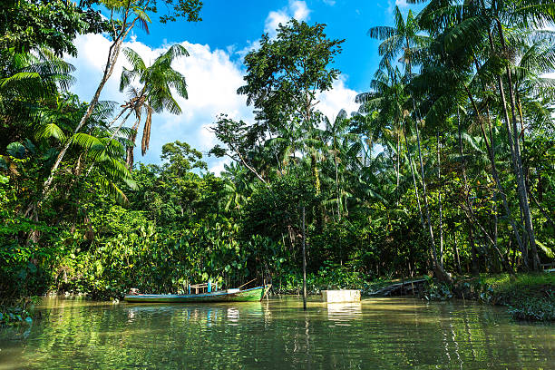
Boat trips through the Amazonian rivers can last for several days.
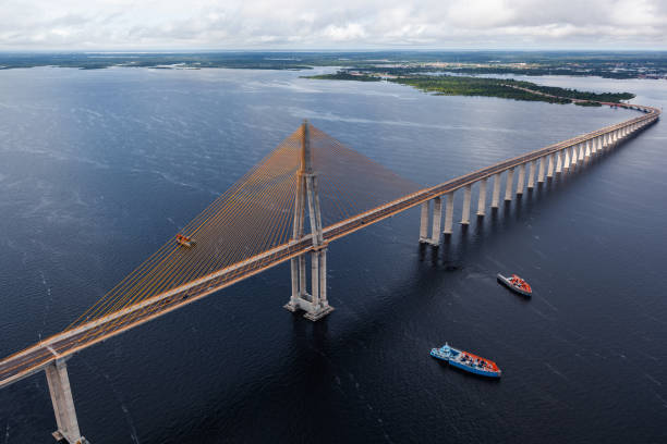
Ponte Jornalista Phelippe Daou, popularly known as Ponte Rio Negro, in the Brazilian state of Amazonas. It connects the municipalities of Manaus and Iranduba, and is also part of the Manoel Urbano Highway.
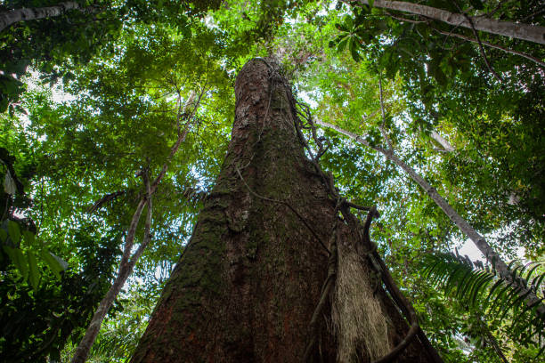
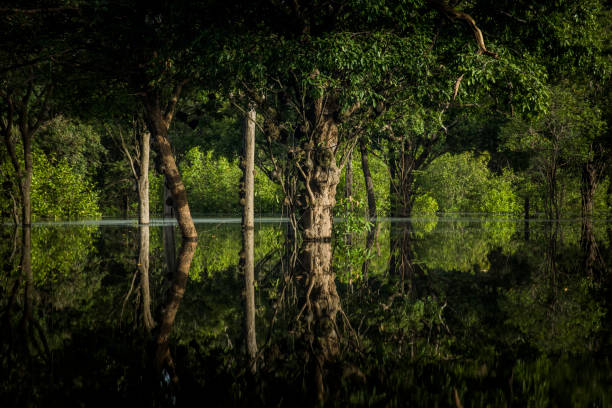
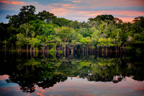
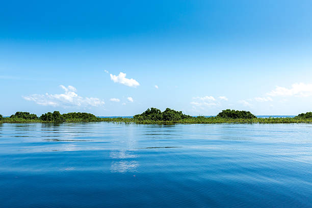
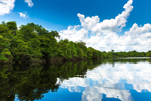
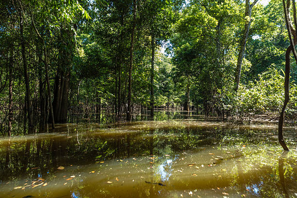
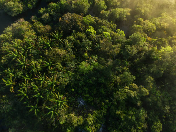
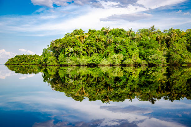
Tree, texture, and landscape from Rio Negro, Amazon
Bridge Journalist Phelippe Daou - Manaus - Amazonas
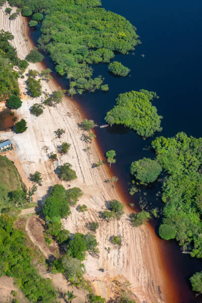
Typical Amazon beach (at the border of a river)
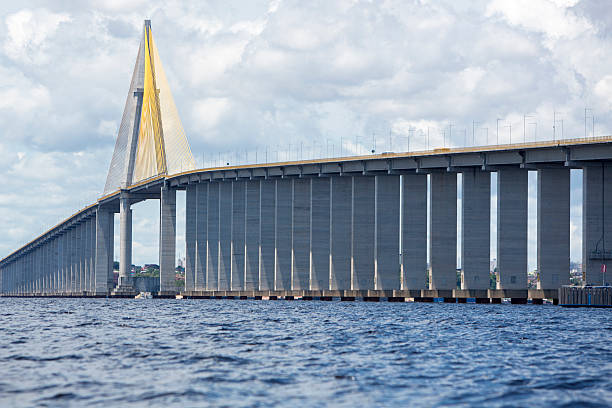
The Manaus-Iranduba Bridge (called Ponte Rio Negro in Brazil) is a bridge over the Rio Negro with 3595 meters of length that links the cities of Manaus and Iranduba. It was opened on Oct 24, 2011
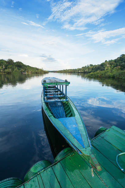
A traditional boat used for transportation purposes on the river Rio Negro
Manaus Center, overlooking the Educandos Bridge, Brewery and Rio Negro Bridge
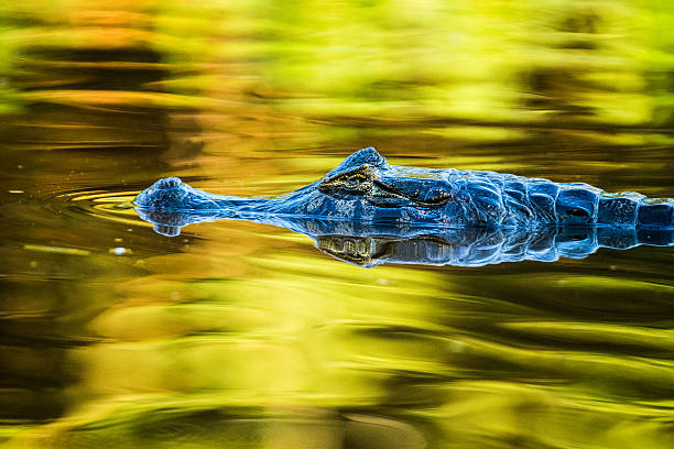
Close up of a wild Kaiman in Pantanal Brazil, swimming in golden colored water, reflection,

"3D rendering and image composing: Topographic Map of Brazil. Including country borders, rivers and accurate longitude/latitude lines. High resolution available! High quality relief structure!Relief texture and satellite images courtesy of NASA. Further data source courtesy of CIA World Data Bank II database.Note: This image is perfectly congruent to the image"
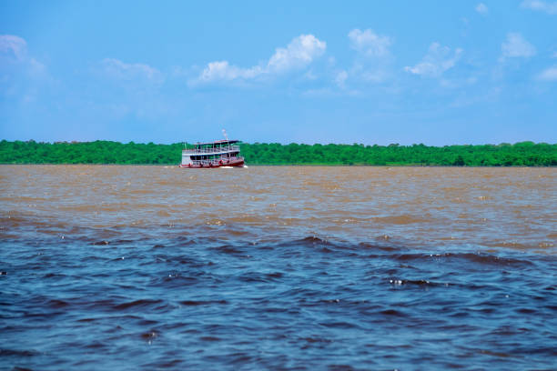
Typical passenger boat from the Amazon region sailing in Manaus, capital of the State of Amazonas The Amazon florest in the background

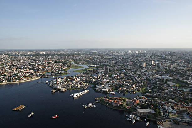
Aerial view of manaus city center, showing the area of modern manaus and the Negro River.
The Rio Negro (Spanish and Portuguese) or Black River (English) ) in Venezuela, is the largest tributary of the Amazon river and the largest blackwater river in the world. Rio Negro is navigable for 715 km from its mouth. A small portion of it forms the international boundary between Colombia and Venezuela. Rio Negro is one of the world's ten largest rivers in average water volume. The Pasimoni river is a tribitary of Rio Negro with vast areas for sport fishing. Bass fishing is a very popular activity, of catch and release, for tourist comming from all over the world.

Amazon River Dolphin on Rio Negro
The Meeting of Waters is the confluence between the Rio Negro, a river with dark full of tannins water, and the sandy-colored Amazon River or Rio Solimões, as it is known the upper section of the Amazon in Brazil. For 6 km (3.7 mi) the river's waters run side by side without mixing. The same also happens near Santarém, Pará with the Amazon and Tapajós rivers.
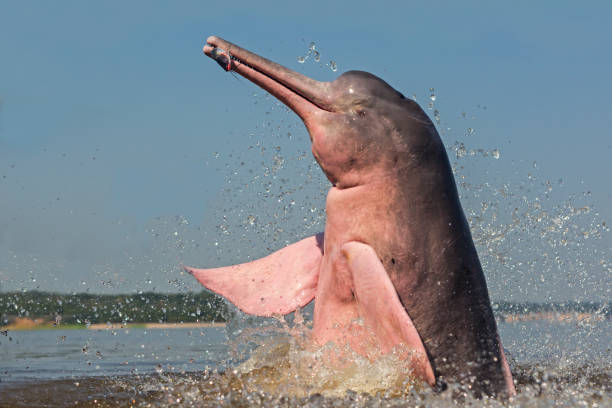
Amazon River Dolphin on Rio Negro
Aerial view of the city of Manaus, central region and Negro river
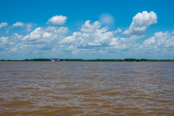
Typical passenger boat from the Amazon region sailing in Manaus, capital of the State of Amazonas The Amazon florest in the background
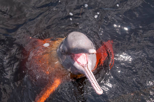
Pink boto found in the Brazilian Amazon region. City of Novo Airão, Amazonas, Brazil
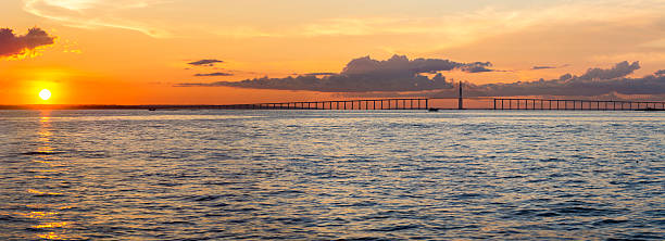
Panorama of the Manaus-Iranduba Bridge (called Ponte Rio Negro in Brazil) during the sunset. Bridge over the Rio Negro with 3595 meters of length that links the cities of Manaus and Iranduba. It was opened on Oct 24, 2011
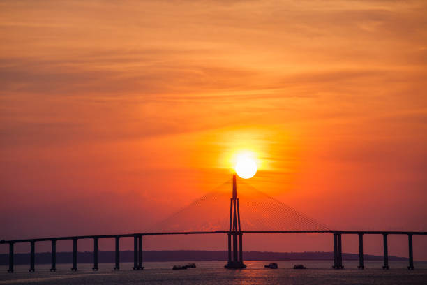
The Journalist Phelippe Daou Bridge or Rio Negro Bridge (Portuguese: Ponte Rio Negro) is a cable-stayed bridge over the Rio Negro with 3,595 metres (11,795 ft) of length that links the cities of Manaus and Iranduba in Brazil.
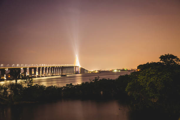
The Journalist Phelippe Daou Bridge or Rio Negro Bridge (Portuguese: Ponte Rio Negro) is a cable-stayed bridge over the Rio Negro with 3,595 metres (11,795 ft) of length that links the cities of Manaus and Iranduba in Brazil.
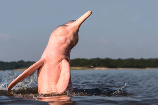
Amazon River Dolphin on Rio Negro
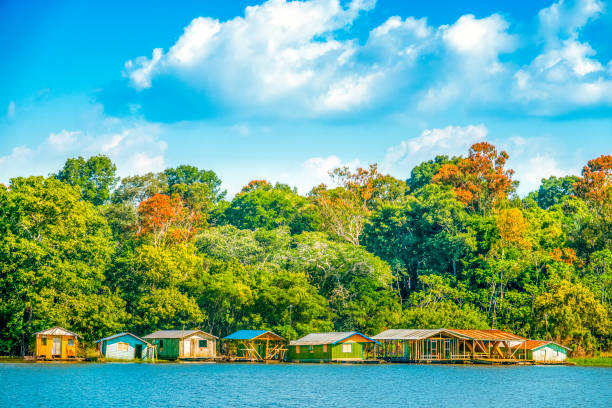
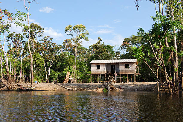
Houses at the border of Negro River, near Manaus, capital of the State of Amazonas
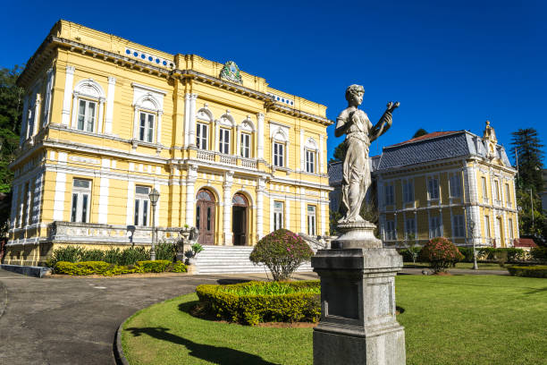
Petropolis, Brazil

Amazon River
Amazon rainforest: Expedition by boat along the Amazon River near Manaus, Brazil
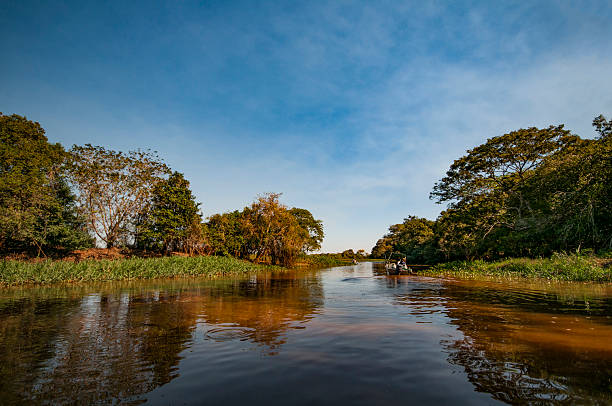
boat drivers on the Rio Negro in the Pantanal in Brazil
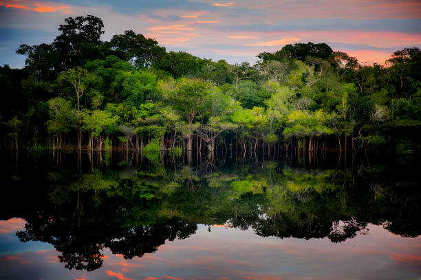
Amazon rainforest. In the photo: Rio Negro, located in the state of Amazonas.
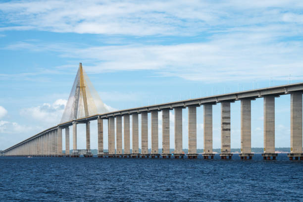
Rio Negro Bridge (Portuguese: Ponte Rio Negro) is a cable-stayed bridge over the Rio Negro of length that links the cities of Manaus and Iranduba in Brazil.
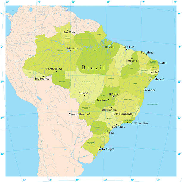
Ultra detailed vector map of Brazil with administrative divisions. Including main rivers and lakes. Each state is grouped separately. You can zoom in well in the vector file. There's more detail visible than you can see in the preview window, because there's a limit of 6000 pixels. You may open the .eps-file in Photoshop at even higher resolutions. Great for super-size usage like trade fair walls. File was created on February 18, 2013. The colors in the .eps-file are ready for print (CMYK). Included files: EPS (v8) and Hi-Res JPG (6000 × 6000 px).
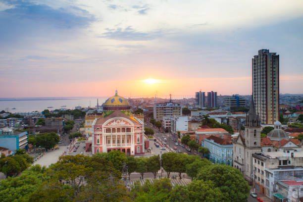
August 27, 2013 - Manaus, Brazil: Sunset over the city of Manaus, showing the front view the Opera house of Manaus, the buildings, streets and the Rio Negro river in the background.
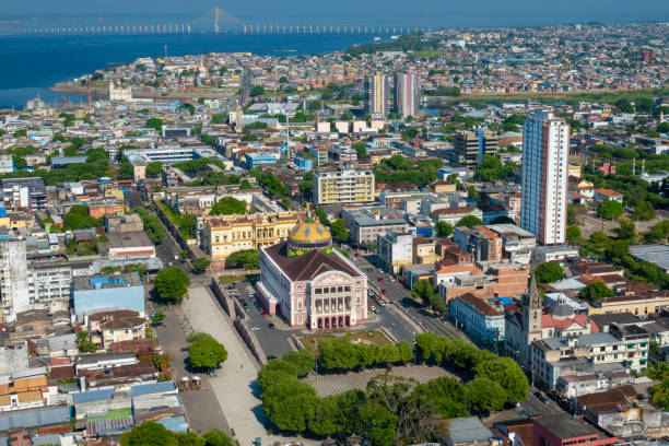
Main urban, financial and industrial center of the Amazon region Located at the border of Rio Negro Bridge Journalist Phelippe Daou (in the background) links Manaus to Iranduba
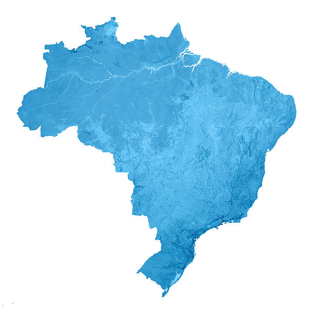
3D render and image composing: Topographic Map of Brazil. Isolated on White. High resolution available!
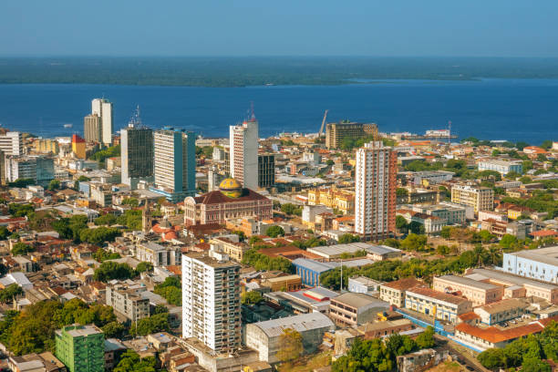
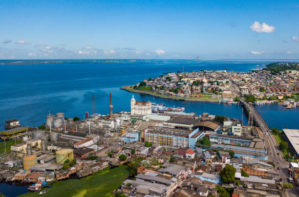
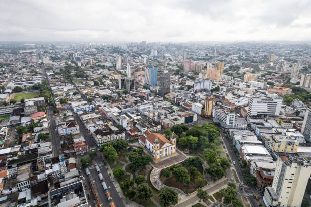
Main urban, financial and industrial center of the Amazon region Located at the border of Negro River Amazonas Theater in the middle of the photo
nature
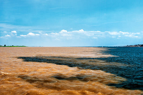
The Meeting of Waters is the confluence between the Rio Negro, a river with dark full of tannins water, and the sandy-colored Amazon River or Rio Solimões, as it is known the upper section of the Amazon in Brazil. For 6 km (3.7 mi) the river's waters run side by side without mixing. The same also happens near Santarém, Pará with the Amazon and Tapajós rivers..This phenomenon is due to the differences in temperature, speed and water density of the two rivers. The Rio Negro flows at near 2 km per hour at a temperature of 28°C, while the Rio Solimões flows between 4 to 6 km per hour a temperature of 22°C.