Buxton circular walks plus route map
Buxton is the highest market town in England and located in the beautiful Peak District National Park, Derbyshire.
Buxton is famous for it’s water and thermal spring but it’s also a great place to walk. We have four walks on the Derbyshire Walks app which explore both the town and surrounding countryside.


Here is a route map for Buxton walk 2.
Search ‘Derbyshire Walks’ on your app store to download the app.
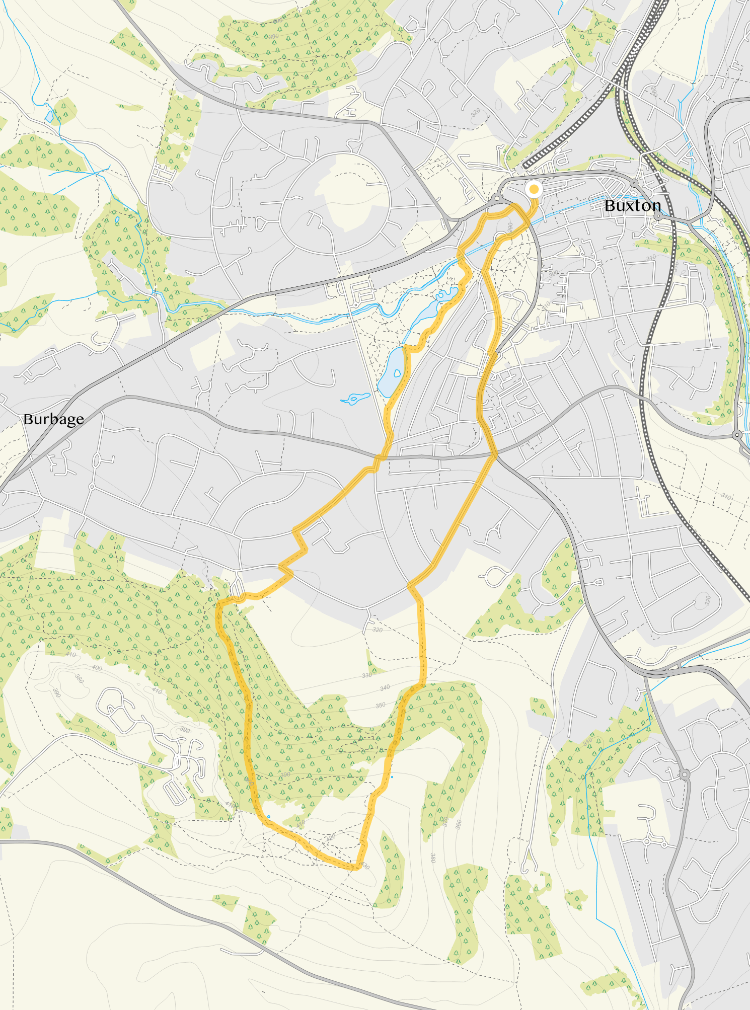
© OpenStreetMap contributors
Contains OS data © Crown copyright and database right 2021
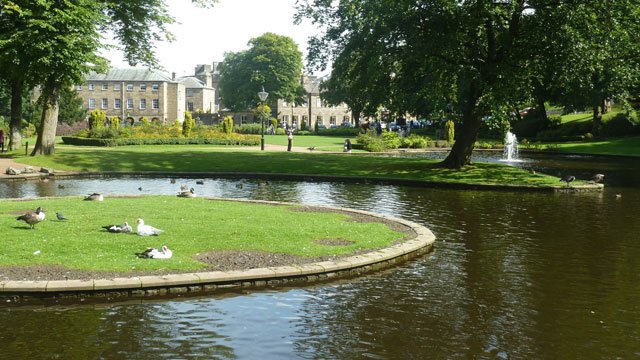
Photo © Ruth Sharville (cc-by-sa/2.0)
These Buxton Walks start at grid reference: 53.260059,-1.913001
Buxton and Pavilion Gardens walk
1.25 miles
This first route is a simple stroll from the spa town of Buxton into and around the pretty Pavilion Gardens. You'll enjoy the victorian gardens themselves with their lovely lakes and the River Wye, as well as visiting the Buxton Crescent, the opera house and a number of pubs and eateries.
Buxton hills and Grin Low walk
3 miles
This second route option is a pleasant walk takes you around the town of Buxton where you can visit the museum and art gallery and then travel up to the surrounding hills. As you leave the town behind you there is a fairly steep climb up to the Grin Low, a Bronze Age barrow where you will find the Grin Low Tower, a distinctive landmark crowning the skyline above Buxton. On a clear day from the top of the tower (take care of the steep steps) you have wonderful views across the town and the nearby heights of the Shivering Mountain at the head of Hope Valley, Kinder Scout and the well known Mam Tor. You can climb up the tower but the steps are quite small, steep and worn so please take care. As you walk back to the town the route will take you through the delightful Pavilion Gardens. If you have time take time to explore the 23 acres of magnificent gardens where you can enjoy some wonderful food and a drink. Once you have finished exploring just follow the route on your map to take you back to the start of the walk.
These Buxton Walks start at grid reference: 53.245104,-1.928487
Grin Woods
1.25 miles
This is a very short, easy walk that takes you through the lovely Grin Woods and up to Grin Low, a Bronze Age barrow where you will find the Grin Low Tower, (known locally as Soloman’s Temple) a distinctive landmark crowning the skyline above Buxton. On a clear day from the top of the tower (take care of the steep steps) you have wonderful views across the town and the nearby heights of the Shivering Mountain at the head of Hope Valley, Kinder Scout and the well known Mam Tor. You can climb up the tower but the steps are quite small, steep and worn so please take care. There are a couple of gentle climbs and the route may be muddy in wet weather.
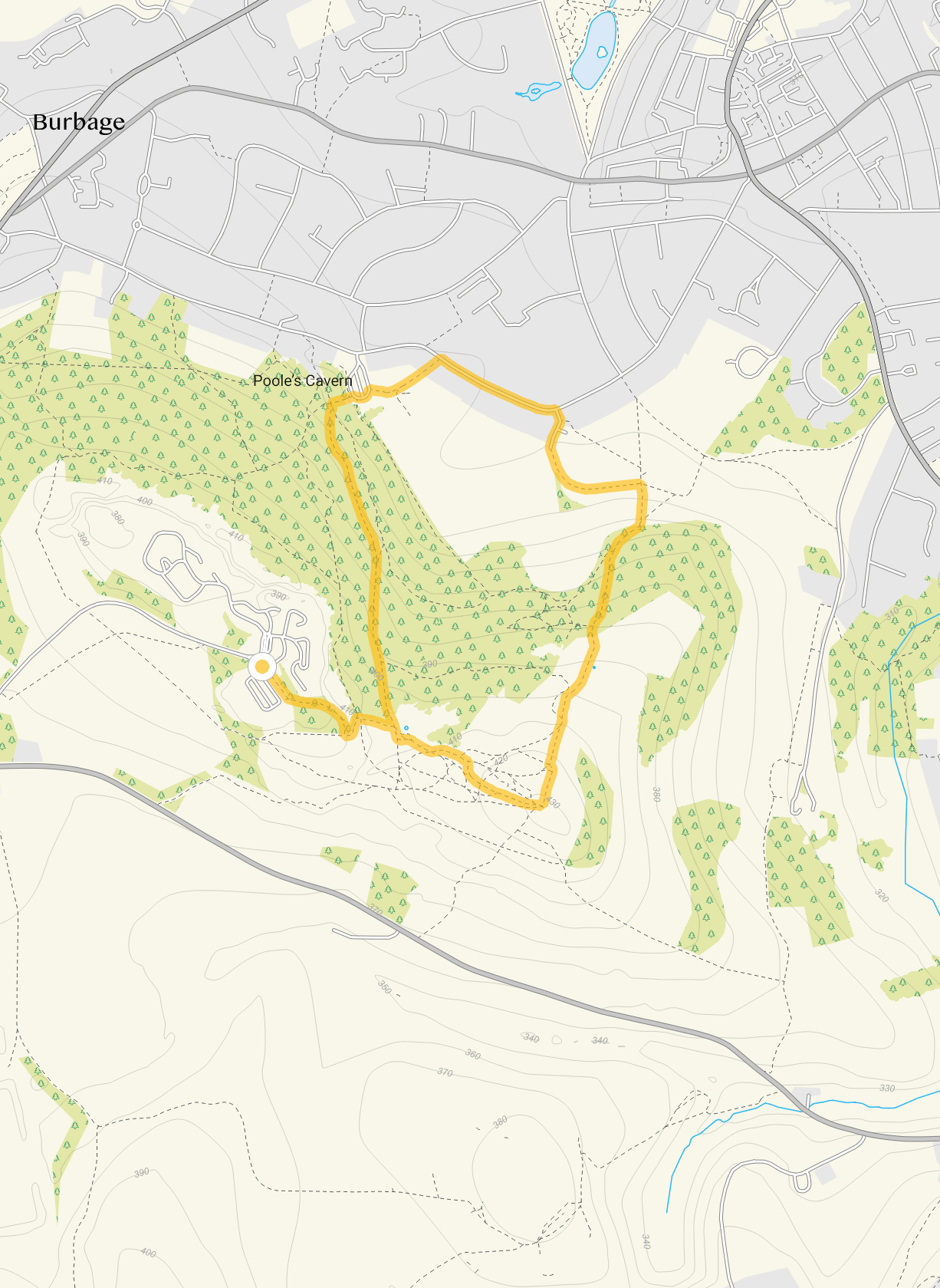
Buxton Country Park
2 miles
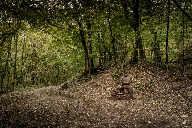
Photo © Brian Deegan (cc-by-sa/2.0)
This is a slightly longer version of the Grin Woods walk which takes you further through Buxton Country Park and Grin Woods (designated as an SSSI). In the summer you can enjoy the woodland glades filled with wild flowers and orchids. As you come out of the wood if you wish you could take a slight detour and visit Poole’s Cavern. The walk then takes you along Green Lane, south of Buxton College, and then quite a steep climb up to Grin Low, a Bronze Age barrow where you will find the Grin Low Tower, (known locally as Soloman’s Temple) a distinctive landmark crowning the skyline above Buxton. (See details as Grin Woods Walk and remember to take care of the steep steps). Refreshments are available at the wonderful Poole’s Cafe at The Cavern. The route could be muddy in wet weather.